Category:Lake Memphremagog
Jump to navigation
Jump to search
glacial lake in Quebec, Canada and Vermont, United States of America  | |||||
| Upload media | |||||
| Instance of | |||||
|---|---|---|---|---|---|
| Location | |||||
| Area |
| ||||
| Elevation above sea level |
| ||||
| Inflows |
| ||||
| Outflows | |||||
| Drainage basin |
| ||||
| Basin country | |||||
 | |||||
Subcategories
This category has the following 3 subcategories, out of 3 total.
B
Media in category "Lake Memphremagog"
The following 36 files are in this category, out of 36 total.
-
 DENT(1881) 1.153 LAKE MEMPHREMAGOG.jpg 2,001 × 1,325; 1.92 MB
-
 1901 Lake Memphremagog map.png 3,500 × 5,402; 25.54 MB
-
 Allan Edson - The Coming Storm, Lake Memphremagog (1880).jpg 350 × 198; 28 KB
-
 Bord du Lac Memphrémagog - panoramio (1).jpg 4,912 × 3,264; 5.28 MB
-
 Bord du Lac Memphrémagog - panoramio (2).jpg 4,912 × 3,264; 2.8 MB
-
 Bord du Lac Memphrémagog - panoramio.jpg 4,912 × 3,264; 3.34 MB
-
 Boston Whaler 110 Sport.jpg 4,000 × 3,000; 3.1 MB
-
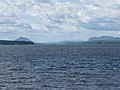
 Canada and Lake Memphremagog from Newport, Vt. (2381917148).jpg 1,200 × 761; 341 KB
-
 City of Magog.JPG 2,923 × 1,410; 4.78 MB
-
 Gaétan IGP8118-19-20 (12792917654).jpg 4,622 × 2,656; 3.14 MB
-
 Georgeville.jpg 3,942 × 3,173; 1.04 MB
-
 Harry Fenn - Lake Memphremagog - 1976.115 - Cleveland Museum of Art.tif 4,910 × 3,621; 50.88 MB
-
 Lac Memphremagog from Owls Head.JPG 2,816 × 2,112; 2.58 MB
-
 Lac Memphremagog pano.jpg 4,000 × 1,430; 3.07 MB
-
 Lac Memphremagog.JPG 2,853 × 2,161; 2.77 MB
-
 Lac Memphrémagog - panoramio.jpg 4,912 × 3,264; 2.45 MB
-
 Lac memphrémagog.jpg 4,032 × 3,024; 3.27 MB
-
 Lac Memphrémagog.png 390 × 769; 276 KB
-
 Lake Memphremagog showing Newport, Vt. (2381918026).jpg 1,200 × 768; 361 KB
-
 Lake Memphremagog.JPG 4,000 × 3,000; 5.55 MB
-
 LakeMemphremagog.jpg 2,496 × 1,872; 3.13 MB
-
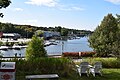 Magog, Quebec - marina.jpg 6,000 × 4,000; 5.82 MB
-
 MagogPagebanner.jpg 1,565 × 224; 105 KB
-
 Memphremagog Lake and Abbey.jpg 4,157 × 2,338; 2.67 MB
-
 Memphremagog Panorama.jpg 6,735 × 2,912; 4.22 MB
-
 New England; a human interest geographical reader (1917) (14767287722).jpg 1,832 × 2,124; 645 KB
-
 Newport VT 1.JPG 2,590 × 1,727; 1.44 MB
-
 Newport VT 2.JPG 2,592 × 1,944; 1.87 MB
-
 Newport VT banner Lake Memphremagog.JPG 2,590 × 370; 334 KB
-
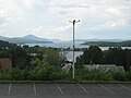
 Newport, Vermont and Lake Memphremagog.jpg 1,023 × 653; 161 KB
-
 Pano Magog.JPG 3,587 × 1,606; 1.73 MB
-
 Photo of the Week - Eagle Point Wildlife Management Area, Vermont (5251298545).jpg 3,296 × 2,472; 1.05 MB
-
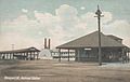 Railroad Station, Newport, VT.jpg 815 × 516; 58 KB
-
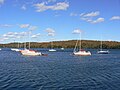 Sailboats Lac Memphrémagog.JPG 2,816 × 2,112; 2.76 MB
-
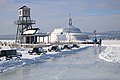 Sentier glacé de Magog.jpg 6,000 × 4,000; 7.25 MB
-

_1.153_LAKE_MEMPHREMAGOG.jpg)

.jpg)
.jpg)
.jpg)


.jpg)

.jpg)


.jpg)


_(14767287722).jpg)


.jpg)


_(1897)_(19994396834).jpg)