Category:Lake Mead National Recreation Area
Jump to navigation
Jump to search
English: Lake Mead National Recreation Area — in and around Lake Mead.
- Located in the Mojave Desert - in Arizona and Nevada.
protected area in Clark County, Nevada and Mohave County, Arizona in the United States  | |||||
| Upload media | |||||
| Instance of | |||||
|---|---|---|---|---|---|
| Named after | |||||
| Location |
| ||||
| Visitor center | |||||
| Operator | |||||
| IUCN protected areas category | |||||
| Inception |
| ||||
| Area |
| ||||
| Elevation above sea level |
| ||||
| official website | |||||
 | |||||
- More public domain images of Lake Mead can be found at: Category: Lake Mead;
and the United States Geological Survey website: [1].
- More public domain images of Lake Mead can be found at: Category: Lake Mead;
Subcategories
This category has the following 30 subcategories, out of 30 total.
*
A
- Anniversary Narrows (10 F)
B
- Bitter Spring Valley (3 F)
- Bonelli Bay (5 F)
C
D
E
G
- Grand Wash, Lake Mead (empty)
- Grapevine Mesa (13 F)
H
- Hiller Mountains (1 F)
I
L
M
- Elwood Mead (6 F)
P
- Pearce Ferry, Lake Mead (10 F)
R
S
T
- Temple Bar Marina (9 F)
- Temple Bar, Lake Mead (4 F)
W
Pages in category "Lake Mead National Recreation Area"
This category contains only the following page.
Media in category "Lake Mead National Recreation Area"
The following 200 files are in this category, out of 245 total.
(previous page) (next page)-

-
 Alan Bible Botanical Garden.jpg 4,032 × 3,024; 5.34 MB
-
 An elevated view of Callville Bay Marina (634ad444-b419-46d9-b4a9-5d2cb6a9b3cb).jpg 4,434 × 2,955; 3.72 MB
-
 At-lake-mead-recreation-area-nevada 25674523003 o.jpg 1,280 × 960; 676 KB
-
 Beach Area at Willow Beach (0f5a7668-c962-4515-a260-8f8d67de631f).jpg 5,173 × 3,451; 17.53 MB
-
 Beach at Cottonwood Cove (55d1b7f3-2c9f-4e09-a73a-f1e1699b5385).jpg 4,288 × 2,848; 2.3 MB
-
 Blue Point Spring (e0b7cb4f-1190-40c8-81b8-fabc56240a43).jpg 3,888 × 5,184; 7.91 MB
-
 Boaters using Hemenway Harbor launch ramp (b05ae97d-f988-49d5-bbb5-2c3b76c61314).jpg 5,323 × 3,591; 2.17 MB
-
 Bonelli Bay, Lake Mead National Recreation Area, East of Las Vegas, Nevada (15830857829).jpg 4,000 × 3,000; 3.03 MB
-
 Bonelli Bay, Lake Mead National Recreation Area, East of Las Vegas, Nevada (16014931741).jpg 4,000 × 2,190; 1.37 MB
-
 Bonelli Bay, Near Eastern Terminus of Lake Mead, Arizona (6780622383).jpg 3,960 × 2,855; 5.34 MB
-
 Boulder Beach Lake Mead NV.jpg 1,920 × 1,080; 2.13 MB
-
 Lake Mead from Boulder City Nevada.jpg 800 × 600; 116 KB
-
 Boulder City, View of Lake Mead.jpg 1,600 × 1,200; 695 KB
-
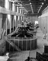
 Boulder Dam 3 Millionth Cubic Yard of Concrete (cb36737e-6f94-4352-883c-0083cc042c56).jpg 9,269 × 6,397; 12.49 MB
-
 Boulder Habor Launch Ramp (f30ae860-a896-4b07-aa92-33e1a05810a1).jpg 5,964 × 3,976; 2.69 MB
-
 Bowl of Fire in the Muddy Mountains Wilderness Area (8982443342).jpg 1,600 × 1,066; 2.38 MB
-
 Callville Bay Marina (cac8f27d-b591-49ca-896f-d028880c0830).jpg 5,184 × 3,456; 6.48 MB
-

-
 Close up of flowing water (5b3af23d-d520-43a5-a972-e1a8e892f0ac).jpg 5,184 × 3,888; 5.47 MB
-
 Close up of water flowing over rocks (95b5fb73-7d0b-42bd-a9bb-e46b2391dae9).jpg 3,888 × 5,184; 5.88 MB
-
 Comet Neowise over Lake Mead (1a4d5876-0177-40ca-8536-ea69d5ac132b).jpg 8,241 × 5,169; 8.82 MB
-
 Comet Neowise over Lake Mead (6c9acdcf-320e-47de-a8c3-1fcb5ab88b86).jpg 5,351 × 7,200; 10.94 MB
-
 Cottonwood Cove (d12ecd1c-0672-4c89-87fc-57a435e2cb91).jpg 4,288 × 2,464; 1.28 MB
-
 Cottonwood Cove Cafe (05d1281b-74d5-42b7-aa83-230ef4012ed9).jpg 1,509 × 2,000; 511 KB
-
 Cottonwood Cove Marina (32794a94-ccb0-47b6-92cb-3676d1bedf44).jpg 5,184 × 3,456; 6.93 MB
-
 Cottonwood Cove Marina (c50ab623-d4af-4b89-8083-5f51beca343c).jpg 5,184 × 3,456; 10.64 MB
-

-
 Cottonwood Cove Motel at sunrise (d57f112c-3d91-425a-a66b-b9a6ae4ff68c).jpg 3,886 × 2,559; 1.35 MB
-
 Cottonwood Cove on Lake Mohave at Lake Mead NRA.jpg 4,288 × 2,848; 9.55 MB
-
 Cottonwood Cove Swim Beach (64b9171b-8d4a-43ee-93d8-60bfee03d8b9).jpg 4,960 × 3,016; 3.24 MB
-
 Cove and trees at South Cove (b684b12d-ca0c-4a24-b08c-f864c7390056).jpg 5,184 × 3,456; 7.02 MB
-
 Cove at Echo Bay (640b344f-67d1-4607-a74b-f892189daff9).jpg 5,184 × 3,456; 5.41 MB
-
 Cove at South Cove (77817c46-1008-4def-b824-371f4216a32f).jpg 5,184 × 3,456; 7.67 MB
-

-
 Day of the Dead (8142856053) (2).jpg 4,288 × 2,848; 4.94 MB
-
 Day of the Dead (8142856825).jpg 4,288 × 2,848; 4.11 MB
-
 Day of the Dead (8142859673).jpg 4,288 × 2,848; 5.29 MB
-
 Day of the Dead (8142863745).jpg 4,288 × 2,848; 5.06 MB
-
 Death Valley, CA 2 015 - Flickr - GregTheBusker.jpg 1,600 × 1,200; 239 KB
-
 Death Valley, CA 2 018 - Flickr - GregTheBusker.jpg 1,600 × 1,200; 285 KB
-
 Desierto en California colorado y nevada.jpg 2,592 × 1,936; 2.11 MB
-
 Downstream Face of Dam (214c06cd-56a3-4893-85ad-4dadcdb036f8).jpg 1,600 × 1,280; 751 KB
-
 Dry Cracked Mud (4957b8b2-f52c-43b0-acc2-ead42cf6f03b).jpg 5,472 × 3,648; 10.94 MB
-
 Echo Bay Launch Ramp (97955924-c912-40e9-bc81-04223a6034e2).jpg 5,184 × 3,456; 9.23 MB
-
 Elevated view of Blue Point Spring (2dd6e4d0-570f-47ad-b2dc-2c1c314d46a5).jpg 5,184 × 3,888; 8.88 MB
-
 Elevated view of Blue Point Spring (40f5fc8f-c538-4847-acc3-8ade3192882e).jpg 5,184 × 3,888; 10.59 MB
-
 Elevated view of Blue Point Spring (d2ed481f-92e0-491b-a760-f9765320191c).jpg 5,184 × 3,888; 9.73 MB
-
 Elevated view of Blue Point Spring (de059f1e-d7d1-4497-b68f-423c3fb78a64).jpg 5,184 × 3,888; 9.63 MB
-

-

-
 Fishing (8982522738).jpg 4,288 × 2,848; 7.44 MB
-
 Fishing at Government Point Cove (f1866a68-2ed8-4e6d-80ba-7e09ad716160).jpg 5,184 × 3,888; 6.54 MB
-

-
 Geology of Muddy Mountains Wilderness (a7116112-1717-4fc2-b181-e385c77f3ec8).jpg 4,953 × 3,715; 9.56 MB
-
 Government Point Cove (10a6520b-4866-44d7-9c4c-e923f3d4d536).jpg 5,184 × 3,888; 9.22 MB
-
 Government Point Cove (32822b60-298e-41c6-af4b-e9ca32857933).jpg 5,184 × 3,888; 8.32 MB
-
 Government Point Cove (6fe6ff38-947a-4aaa-a677-f5d3b7923260).jpg 5,184 × 3,888; 8.03 MB
-
 Government Point Cove (f2e0c914-225d-4c3b-a846-8b0f38a31d87).jpg 5,184 × 3,888; 9.18 MB
-
 Government Point Cove (fc52a385-7dd0-43ac-9eea-6e089eb1ebf5).jpg 5,184 × 3,888; 8.08 MB
-
 Grand Canyon area of Arizona by Sally Ride EarthKAM.jpg 4,312 × 2,868; 6.62 MB
-
 Grand Canyon, United States (Unsplash 05nPKZbBArI).jpg 6,000 × 4,000; 8.75 MB
-
 Grapevine Canyon (15023728224).jpg 4,992 × 3,328; 2.69 MB
-
 Grapevine Canyon (15023733774).jpg 1,664 × 2,496; 4.31 MB
-
 Gypsum Wash 1.jpg 2,400 × 1,600; 774 KB
-
 Gypsum Wash 2.jpg 2,400 × 1,600; 719 KB
-
 Gypsum Wash from Northshore Drive 1.jpg 2,400 × 1,600; 668 KB
-
 Hamblin-Cleopatra Volc sat image.gif 828 × 1,044; 661 KB
-
 Hazy Sunrise at Lake Mead (aa59e2e8-94b1-485a-9e13-8a5f2c89463c).jpg 24,353 × 4,257; 10.62 MB
-
 Hazy Sunrise at Lake Mead (d81cf2b5-1769-499d-a1ab-841e7ed8283e).jpg 5,184 × 3,605; 5.6 MB
-
 Hemenway Harbor Fishing Pier (b9f80144-a5cc-440a-8f48-ea3809ab63eb).jpg 4,728 × 2,848; 2.91 MB
-
 Hemenway Harbor Fishing Pier (f8e380fe-5911-44ff-9a94-11e6f8857148).jpg 3,864 × 2,464; 2.34 MB
-
 HFCA 1607 NPS Employees, Search And Rescue 166 U.jpg (401954f709404697b1625c248286c05b).jpg 7,736 × 5,128; 2.66 MB
-
 Hiking (8982521338).jpg 2,496 × 1,664; 4.51 MB
-
 Homestake Nevada mine shafts.JPG 2,048 × 1,536; 708 KB
-
 Inside Lake Mead National Park (3467671705).jpg 2,784 × 1,856; 1,009 KB
-
 Inside Lake Mead National Park (3468495262).jpg 2,784 × 1,856; 748 KB
-
 Kayakin' on Colorado River.jpg 2,272 × 1,704; 1.29 MB
-
 Kayaking Near Boulder Harbor (1979f5a6-9fd5-47f9-9393-7d560e79dcc6).jpg 5,184 × 3,888; 7.23 MB
-
 Kayaking Near Boulder Harbor (5ef81582-9e7e-462a-ac19-55983c1e05db).jpg 5,184 × 3,888; 5.56 MB
-
 Kayaking through the Black Canyon Wilderness Area (8981324889).jpg 1,500 × 996; 1.68 MB
-
 Kayaks at Hoover Dam (108e42ac-37e6-4de1-a889-dcef5ecd048a).jpg 5,184 × 3,888; 7.1 MB
-
 Kayaks at Hoover Dam (2936ab0c-95d8-44a5-9667-170cbe8da469).jpg 6,000 × 4,004; 7.66 MB
-
 Kayaks at Hoover Dam (4d7d9a75-bca0-4ee2-8eef-646a049eb704).jpg 6,000 × 4,004; 8.7 MB
-
 Kayaks at Hoover Dam (90b6198e-4bb7-44c3-8ea0-b85762043fdc).jpg 5,184 × 3,888; 6.59 MB
-
 Kayaks at Hoover Dam (9221bed3-3569-4fe7-bb54-204092805164).jpg 4,238 × 3,178; 4.71 MB
-
 Kayaks at Hoover Dam (bb3e350a-a77b-4ab8-8646-436b411cef03).jpg 6,000 × 4,500; 8.15 MB
-
 Kayaks at Hoover Dam (f3e80ee7-a4b5-452a-83d4-be25adbe8fae).jpg 6,000 × 4,500; 9.68 MB
-
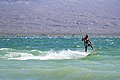 Kiteboarding at Six Mile Cove (a1b71ed4-c11e-420d-a410-f76f90646ba0).jpg 5,185 × 3,457; 6.17 MB
-
 Kiteboarding at Six Mile Cove (ba6e1809-c0d3-4492-acba-9b8c9900726b).jpg 3,424 × 5,136; 5.25 MB
-
 Kiteboarding at Six Mile Cove (ce4c94dc-d414-4c55-b7c3-a4c851a66de5).jpg 5,265 × 3,510; 13.18 MB
-
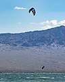 Kiteboarding on Lake Mohave (26498700-39ad-4590-bcb4-3fa469ebb344).jpg 2,904 × 3,632; 5.58 MB
-
 Kiteboarding on Lake Mohave (bd1204c1-ad43-4ed9-9ddb-a818a9f09d7d).jpg 5,068 × 3,269; 5.02 MB
-
 Lake Mead & Boulder City.jpg 4,368 × 2,912; 8.46 MB
-
 Lake Mead 0059.jpg 600 × 442; 31 KB
-
 Lake Mead 0068.jpg 600 × 408; 44 KB
-
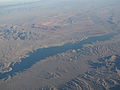
 Lake Mead 3 July 2022.jpg 5,505 × 4,588; 4.78 MB
-
 Lake Mead 6 July 2000.jpg 5,505 × 4,588; 4.31 MB
-
 Lake Mead and Valley of Fire State Park.jpg 2,466 × 1,272; 497 KB
-
 Lake Mead behind Hoover Dam in Sugarloaf Mnt1.jpg 310 × 121; 7 KB
-
 Lake Mead Bitter Spring Valley 1.jpg 2,400 × 1,600; 784 KB
-
 Lake Mead boaters.jpg 600 × 433; 29 KB
-
 Lake Mead City, Lake Mead National Recreation Area, Nevada-Arizona (15991111166).jpg 4,000 × 3,000; 2.31 MB
-
 Lake Mead forticationhill.jpg 1,181 × 549; 148 KB
-
 Lake Mead from Gypsum Wash 1.jpg 2,000 × 1,333; 509 KB
-
 Lake Mead from Virgin Peak 1.jpg 1,800 × 1,200; 369 KB
-
 Lake Mead from Virgin Peak 2.jpg 2,400 × 1,600; 671 KB
-
 Lake Mead July 2007.jpg 3,072 × 2,304; 1.08 MB
-
 Lake Mead Las Vegas Bay 1.jpg 2,400 × 1,600; 523 KB
-
 Lake Mead Nat. Recreation Area, S of the Hoover Dam, Ariz….Pano 1 (7334038726).jpg 2,121 × 1,414; 2.91 MB
-
 Lake Mead Nat. Recreation Area, S of the Hoover Dam, Ariz….Panorama-3 (7334039824).jpg 2,121 × 1,414; 2.1 MB
-
 Lake Mead National Recreation Area - panoramio.jpg 1,600 × 407; 122 KB
-
 Lake Mead National Recreation Area Headquarters (1a372c55-219e-44ca-a3d6-fc093b495069).jpg 4,723 × 3,149; 4.05 MB
-
 Lake Mead National Recreation Area Headquarters (4a3bd409-833a-4bbf-ae74-ceca908de021).jpg 4,488 × 3,366; 3.42 MB
-
 Lake Mead National Recreation Area Headquarters (6fe07a05-0686-4bf3-af2f-b64ea8a964e9).jpg 4,962 × 3,722; 5.02 MB
-
 Lake Mead National Recreation Area Headquarters (7813a4e9-29e4-4246-b077-cc045d853955).jpg 4,687 × 3,515; 4.64 MB
-
 Lake Mead National Recreation Area Headquarters (e0872f27-dc63-4f5e-97f7-abb71be2ddfd).jpg 5,066 × 3,800; 4.74 MB
-
 Lake Mead National Recreation Area Headquarters (fb295df9-f689-445d-8798-afaaa7ce2bd9).jpg 4,675 × 3,506; 3.83 MB
-
 Lake Mead National Recreation Area January 2011.jpg 1,600 × 424; 111 KB
-
 Lake Mead National Recreation Area LAME3544.jpg 3,072 × 2,048; 4.33 MB
-
 Lake Mead National Recreation Area LAME3644.jpg 2,048 × 3,072; 3.63 MB
-
 Lake Mead National Recreation Area, East of Las Vegas, Nevada (15394631774).jpg 4,000 × 3,000; 2.1 MB
-
 Lake Mead National Recreation Area, East of Las Vegas, Nevada (15394632154).jpg 4,000 × 3,000; 2.09 MB
-
 Lake Mead National Recreation Area, East of Las Vegas, Nevada (15829476178).jpg 4,000 × 3,000; 2.72 MB
-
 Lake Mead National Recreation Area, East of Las Vegas, Nevada (15829633620).jpg 4,000 × 3,000; 2.24 MB
-
 Lake Mead National Recreation Area, East of Las Vegas, Nevada (15830855459).jpg 4,000 × 3,000; 2.04 MB
-
 Lake Mead National Recreation Area, East of Las Vegas, Nevada (15991107646).jpg 4,000 × 3,000; 2.12 MB
-
 Lake Mead National Recreation Area, East of Las Vegas, Nevada (16014931331).jpg 4,000 × 3,000; 2.17 MB
-
 Lake Mead National Recreation Area, East of Las Vegas, Nevada (16016883805).jpg 4,000 × 3,000; 2.83 MB
-
 Lake Mead National Recreation Area, Nevada-Arizona (14311740309).jpg 4,000 × 3,000; 1.93 MB
-
 Lake Mead National Recreation Area, Nevada-Arizona (14311744428).jpg 4,000 × 3,000; 2.27 MB
-
 Lake Mead National Recreation Area, Nevada-Arizona (14311892737).jpg 4,000 × 3,000; 2.41 MB
-
 Lake Mead National Recreation Area, Nevada-Arizona (14494959671).jpg 4,000 × 3,000; 2.24 MB
-
 Lake Mead National Recreation Area, Nevada-Arizona (14497042734).jpg 4,000 × 3,000; 2.42 MB
-
 Lake Mead National Recreation Area, Nevada-Arizona (14498353805).jpg 3,000 × 4,000; 2.22 MB
-
 Lake Mead National Recreation Area, Nevada-Arizona (14518456953).jpg 4,000 × 3,000; 2.15 MB
-
 Lake Mead National Recreation Area, Nevada-Arizona (18193469642).jpg 4,000 × 3,000; 2.57 MB
-
 Lake Mead National Recreation Area, Nevada-Arizona (90024839).jpg 1,280 × 960; 72 KB
-
 Lake Mead National Recreation Area, Nevada-Arizona (90024858).jpg 1,280 × 960; 75 KB
-
 Lake Mead National Recreation Area, Nevada-Arizona (90024874).jpg 1,280 × 960; 77 KB
-
 Lake Mead National Recreation Area, Nevada-Arizona (90024897).jpg 1,280 × 960; 95 KB
-
 Lake Mead Nevada1.jpg 1,024 × 454; 160 KB
-
 Lake Mead Nevada10.jpg 1,024 × 768; 309 KB
-
 Lake Mead Recreation Area - panoramio.jpg 4,224 × 2,376; 3.8 MB
-
 Lake Mead Recreation Area dyeclan.com - panoramio.jpg 3,264 × 2,448; 3.47 MB
-
 Lake Mead Recreation Park - panoramio.jpg 4,224 × 2,376; 3.11 MB
-
 Lake mead satellite image.jpg 584 × 852; 87 KB
-
 Lake Mead virgincanyon.jpg 600 × 404; 81 KB
-
 Lake Mead, Arizona.jpg 3,456 × 5,184; 2.28 MB
-
 Lake Mead, NV, October 2008, Doris Hyeoma, Photographer - panoramio.jpg 3,008 × 2,000; 2.63 MB
-
 Lake mead.jpg 634 × 639; 160 KB
-
 LAKE wa262 (27473661801).jpg 482 × 336; 60 KB
-
 LAKE wa266 (27511331646).jpg 480 × 330; 68 KB
-
 LAKE wa269 (27511331666).jpg 478 × 335; 80 KB
-
 LakeMead-redstone.jpg 3,591 × 1,568; 643 KB
-
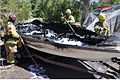 LakeMeadBoatFire.jpg 689 × 457; 516 KB
-

-

-
 Launch Ramp at Cottonwood Cove (0b16931c-03f5-49c7-94fa-66a04bbd05d2).jpg 5,154 × 3,865; 4.34 MB
-
 Lava Butte from east 1.jpg 2,400 × 1,600; 633 KB
-
 Lava Butte from southeast 1.jpg 2,400 × 1,600; 656 KB
-
 Lava Butte from southeast 2.jpg 2,400 × 1,600; 644 KB
-
 Marinas at Hemenway Harbor (413e4ee4-cfa9-4a15-88f1-2b3d3e03b487).jpg 5,711 × 3,192; 2.54 MB
-
 Meadandcoloradoriver.jpg 720 × 480; 147 KB
-
 Mount Wilson AZ looking northeast 1.jpg 2,400 × 1,600; 520 KB
-
 Mountains near St. Thomas at sunset (9db129c7-000e-41d6-9d6c-f15983e3445e).jpg 5,472 × 3,648; 3.19 MB
-
 Muddy Mountains Wilderness Area (8981247941).jpg 1,600 × 990; 1.91 MB
-
 Muddy Peak from Northshore Drive 1.jpg 2,400 × 1,600; 753 KB
-
 Muddy Peak from Northshore Drive 2.jpg 2,560 × 1,707; 1.05 MB
-
 Muddy River Near St. Thomas (042d8b36-f51a-4b7e-891b-320b4224c3b4).jpg 3,648 × 5,472; 8.34 MB
-
 Muddy River Near St. Thomas (11562d45-b928-405b-8e38-57f42d62ecf7).jpg 3,648 × 5,472; 11.2 MB
-
 Muddy River Near St. Thomas (5d53675a-621b-4210-a892-b3b91255a0f3).jpg 3,648 × 5,472; 7.39 MB
-
 Muddy River Near St. Thomas (8ac273ee-e7fb-46a3-92f8-ef869975b072).jpg 5,472 × 3,648; 8.76 MB
-
 Muddy River Near St. Thomas (ec4b4d64-6b91-49c4-94b5-d09c212e430a).jpg 3,648 × 5,472; 8.4 MB
-
 Natural Texture in Mud (bd3ac059-64ed-4387-bab7-0b6030c0c314).jpg 5,472 × 3,648; 7.4 MB
-
 Natural Texture in Mud (f4420e90-b757-4b6a-afdb-71398a608c3f).jpg 3,648 × 5,472; 6.81 MB
-
 Natural Texture in Sand (deac132c-eadb-42c4-91c4-a06cbd3872b5).jpg 5,472 × 3,648; 10.11 MB
-
 Northshore Drive in Bitter Spring Valley 1.jpg 2,560 × 1,707; 933 KB
-
-
 Overton Arm of Lake Mead at Beginning of Moapa Valley, Nevada (98447005).jpg 1,600 × 1,200; 843 KB
-
 Overton Arm of Lake Mead with Valley of Fire State Park, Nevada (9179230255).jpg 4,000 × 3,000; 5.69 MB
-
 Overton Arm of Lake Mead with Valley of Fire State Park, Nevada (9181445484).jpg 4,000 × 3,000; 2.27 MB
-
 Pearce Ferry & upper Lake Mead.jpg 4,368 × 2,456; 8.23 MB
-

-
 PWC on Lake Mead (7c66668e-f777-471f-a1ce-5a38cedf6e96).jpg 4,348 × 2,899; 5.09 MB
-
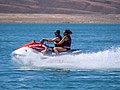 PWC on Lake Mead (df6f6f62-037b-4e6f-ab59-4b969025d1ac).jpg 5,003 × 3,752; 6.15 MB
-
 PWC Rider Near Boulder Harbor (64d9c1d4-3419-4a60-80fd-5d6c76aad3ad).jpg 3,619 × 2,413; 2.94 MB
-
 PWC Rider Near Boulder Harbor (9320e25e-d7f6-4e9b-80f9-c01c6a71e8ee).jpg 4,215 × 3,161; 4.2 MB
-
 PWC Riders Near Boulder Harbor (07f1ad10-2c01-4521-aeb7-0fec50d9d2be).jpg 5,184 × 3,888; 8.84 MB
-
 PWC Riders Near Boulder Harbor (d5393025-9a22-4e6b-85d7-82970f199751).jpg 5,128 × 3,846; 6.61 MB
-
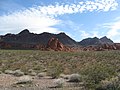
 Red Rock Outcroppings Near Lake Mead National Recreation Area, Nevada (9179229627).jpg 4,000 × 3,000; 7.35 MB
-
 Redrocks in Lake Mead Recreation Area dyeclan.com - panoramio.jpg 3,264 × 2,448; 3.81 MB
-
 Remains of large tree at St. Thomas (7c092141-f9e7-4384-b879-6c6f1b4946ea).jpg 3,648 × 5,472; 5.96 MB
-
 Ripples in Calm Water at Lake Mead (e082fea3-1c90-4bf1-b543-00d8348e5c69).jpg 3,888 × 5,184; 5.27 MB
-
-
 Rogers Spring - Hot Spring in Clark County Nevada.jpg 750 × 1,000; 399 KB
-
 Running (8982516896).jpg 4,288 × 2,848; 2.31 MB
-
 Slalom Skiing on Lake Mead (3680f638-2eb1-4d2f-af3c-7b7f271b67a5).jpg 5,184 × 3,888; 7.93 MB
-
 Slalom Skiing on Lake Mead (78253add-cfaa-4665-8fd1-ffabc161d56c).jpg 4,289 × 2,859; 4.62 MB
-
 Slalom Skiing on Lake Mead (837174ec-2b9a-49d4-9d8b-2e7a3245e296).jpg 4,446 × 3,335; 5.84 MB


.jpg)

.jpg)
.jpg)
.jpg)
.jpg)
.jpg)
.jpg)
.jpg)


.jpg)
.jpg)
.jpg)
.jpg)
.jpg)
.jpg)
.jpg)
.jpg)
.jpg)
.jpg)
.jpg)
.jpg)
.jpg)
.jpg)
.jpg)
.jpg)
.jpg)
.jpg)
.jpg)
.jpg)
_(2).jpg)
.jpg)
.jpg)
.jpg)


.jpg)
.jpg)
.jpg)
.jpg)
.jpg)
.jpg)
.jpg)
.jpg)
.jpg)
.jpg)
.jpg)
.jpg)
.jpg)
.jpg)
.jpg)
.jpg)
.jpg)
.jpg)

.jpg)
.jpg)
.jpg)


.jpg)
.jpg)
.jpg)
.jpg)
.jpg)

.jpg)
.jpg)

.jpg)
.jpg)
.jpg)
.jpg)
.jpg)
.jpg)
.jpg)
.jpg)
.jpg)
.jpg)
.jpg)
.jpg)
.jpg)
.jpg)
.jpg)


.jpg)


.jpg)
.jpg)
.jpg)
.jpg)
.jpg)
.jpg)
.jpg)
.jpg)


.jpg)
.jpg)
.jpg)
.jpg)
.jpg)
.jpg)
.jpg)
.jpg)
.jpg)
.jpg)
.jpg)
.jpg)
.jpg)
.jpg)
.jpg)
.jpg)
.jpg)
.jpg)
.jpg)
.jpg)


.jpg)
.jpg)
.jpg)


.jpg)
.jpg)
.jpg)


.jpg)


.jpg)
.jpg)


.jpg)
.jpg)
.jpg)
.jpg)
.jpg)
.jpg)
.jpg)
.jpg)

.jpg)
.jpg)
.jpg)
.jpg)

.jpg)
.jpg)
.jpg)
.jpg)
.jpg)
.jpg)
.jpg)
.jpg)

.jpg)
.jpg)


.jpg)
.jpg)
.jpg)
.jpg)
.jpg)
Categories:
- Parks in Arizona
- Parks in Clark County, Nevada
- National recreation areas of the United States
- Arizona Strip
- Visitor attractions in Clark County, Nevada
- Locations along U.S. Route 93 in Nevada
- National Park Service in Nevada
- 1936 establishments in the United States
- Protected areas established in 1936
- IUCN Category V
- IUCN Protected areas of the United States
- Lakes of the Mojave Desert