Category:Ladybank
Jump to navigation
Jump to search
town in Fife, Scotland, UK  | |||||
| Upload media | |||||
| Instance of | |||||
|---|---|---|---|---|---|
| Location |
| ||||
| Population |
| ||||
| Elevation above sea level |
| ||||
 | |||||
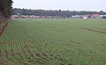
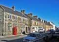
English: Ladybank is a town and former burgh of Fife, Scotland, 8 kilometres (5 miles) southwest of Cupar, and a mile from the River Eden. Its population was estimated in 2005 to be 1,540.
Media in category "Ladybank"
The following 26 files are in this category, out of 26 total.
-
 A man with a Penny-farthing bicycle - Ladybank, Scotland c.1880.jpg 444 × 690; 275 KB
-
 Access road near the Ladybank tip. - geograph.org.uk - 786951.jpg 426 × 640; 117 KB
-
 By Sunnybraes - geograph.org.uk - 208369.jpg 640 × 424; 90 KB
-
 By the eastern edge of Ladybank tip - geograph.org.uk - 786974.jpg 640 × 418; 105 KB
-
 Cairnfield - geograph.org.uk - 787186.jpg 640 × 395; 74 KB
-
 Commercial Street Ladybank.jpg 1,024 × 732; 689 KB
-
 Cottages in Ladybank, Fife - geograph.org.uk - 127323.jpg 640 × 480; 107 KB
-
 Eastern pond - geograph.org.uk - 787882.jpg 640 × 498; 108 KB
-
 Edens Muir - geograph.org.uk - 1456872.jpg 480 × 640; 165 KB
-
 Edge of the pit - geograph.org.uk - 787003.jpg 541 × 640; 145 KB
-
 Farmland near Cairnfield - geograph.org.uk - 787185.jpg 640 × 426; 85 KB
-
 Gravel Pit - geograph.org.uk - 954210.jpg 640 × 470; 100 KB
-
 In The New Nature Reserve - geograph.org.uk - 954197.jpg 640 × 474; 81 KB
-
 Kilwiss - geograph.org.uk - 7226.jpg 640 × 520; 56 KB
-
 Ladybank Post Office - geograph.org.uk - 1248758.jpg 640 × 426; 52 KB
-
 Ladybank, Fife - geograph.org.uk - 127327.jpg 640 × 480; 102 KB
-
Ladybank.ogg 1.7 s; 37 KB
-
 Level Crossing, Jennystown, Fife - geograph.org.uk - 783575.jpg 640 × 426; 85 KB
-
 Melville junction - geograph.org.uk - 787024.jpg 640 × 426; 100 KB
-
 Muirside Wood and fields - geograph.org.uk - 208234.jpg 640 × 424; 72 KB
-
 Near Ladybank Station - geograph.org.uk - 208225.jpg 640 × 424; 59 KB
-
 New Nature Reserve - geograph.org.uk - 954191.jpg 640 × 480; 86 KB
-
 Polythene covered crops, Shiells - geograph.org.uk - 121800.jpg 640 × 444; 54 KB
-
 Road near Rossie - geograph.org.uk - 190631.jpg 640 × 424; 52 KB
-
 Towards Heatherinch - geograph.org.uk - 208365.jpg 640 × 424; 70 KB
-
 War memorial, Ladybank - geograph.org.uk - 1439838.jpg 640 × 480; 144 KB


