Category:La Côte-de-Gaspé Regional County Municipality
Jump to navigation
Jump to search

Français : La Côte-de-Gaspé est une municipalité régionale de comté (MRC) du Québec (Canada) dans la région de Gaspésie–Îles-de-la-Madeleine. Le chef-lieu de la MRC de La Côte-de-Gaspé est Gaspé. Ces MRC voisins sont Le Rocher-Percé et La Haute-Gaspésie.
English: La Côte-de-Gaspé is a regional county municipality on the Gaspé peninsula in eastern Quebec, Canada. The regional county municipality seat is Gaspé. The municipality has a land area of 4,097.13 km² (1,581.91 sq mi) and a 2006 census population of 17,888 inhabitants. Its largest community is the city of Gaspé.
Deutsch: La Côte-de-Gaspé ist eine regionale Grafschaftsgemeinde (frz. municipalité régionale du comté, MRC) in der kanadischen Provinz Québec. Sie liegt in der Region Gaspésie–Îles-de-la-Madeleine und besteht aus sieben untergeordneten Verwaltungseinheiten (zwei Städte, zwei Gemeinden, eine Kantonsgemeinde und zwei gemeindefreie Gebiete). Die MRC wurde am 8. Januar 1982 gegründet, der Hauptort ist Gaspé. Die Einwohnerzahl beträgt 18.281 und die Fläche 4402,33 km², was einer Bevölkerungsdichte von 4,2 Einwohnern je km² entspricht.
regional county municipality in Quebec, Canada | |||||
| Upload media | |||||
| Pronunciation audio | |||||
|---|---|---|---|---|---|
| Instance of | |||||
| Location | Gaspésie–Îles-de-la-Madeleine, Quebec, Canada | ||||
| Capital | |||||
| Population |
| ||||
| Area |
| ||||
| official website | |||||
 | |||||
Subcategories
This category has the following 9 subcategories, out of 9 total.
C
- Cloridorme (7 F)
- Collines-du-Basque (1 F)
G
L
- Lakes of La Côte-de-Gaspé (1 F)
M
- Murdochville (3 F)
P
Media in category "La Côte-de-Gaspé Regional County Municipality"
The following 23 files are in this category, out of 23 total.
-
 - panoramio (4974).jpg 7,056 × 1,600; 2.57 MB
-
 - panoramio (5006).jpg 8,544 × 1,520; 2.36 MB
-
 Entrée des visiteurs, au phare de Cap-des-Rosiers, le plus haut au Canada - panoramio.jpg 3,648 × 2,736; 2.06 MB
-
 Gaspé 09.jpg 4,288 × 2,848; 10.69 MB
-
 Gaspé 10.jpg 4,020 × 2,532; 8.5 MB
-
 Gaspé 13.jpg 4,288 × 2,848; 9.03 MB
-
 Gaspé 14.jpg 3,992 × 2,696; 5.35 MB
-
 Phare de Gaspé - panoramio.jpg 573 × 800; 139 KB
-
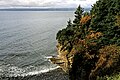
 Photography on a rocky cliff - panoramio.jpg 2,048 × 1,365; 890 KB
-
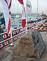
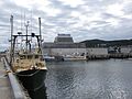
 Port de Pêche à Rivière-au-Renard, Bas Saint-Laurent, Qc - panoramio (1).jpg 3,648 × 2,736; 2.9 MB
-
 Port de Pêche à Rivière-au-Renard, Bas Saint-Laurent, Qc - panoramio (2).jpg 3,648 × 2,736; 2.47 MB
-
 Port de Pêche à Rivière-au-Renard, Bas Saint-Laurent, Qc - panoramio (3).jpg 3,648 × 2,736; 2.22 MB
-
 Port de Pêche à Rivière-au-Renard, Bas Saint-Laurent, Qc - panoramio.jpg 3,648 × 2,736; 2.71 MB
-
 Quebec MRC La Côte-de-Gaspé location map.svg 1,630 × 2,000; 500 KB
-
 Saint Aubîn Paspédgia Jèrri Gaspé Septembre 2009 c.jpg 2,827 × 3,762; 7.52 MB
-
 Saint Aubîn Paspédgia Jèrri Gaspé Septembre 2009 d.jpg 2,946 × 3,835; 9.54 MB
-
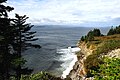
 Sunlight passing through the clouds over the sea - panoramio.jpg 2,126 × 1,875; 687 KB
-
 Unlimitedly large ocean - panoramio.jpg 1,994 × 1,460; 577 KB
-
-

-
-

-


.jpg)
.jpg)
.jpg)


.jpg)
.jpg)


.jpg)
.jpg)