Category:Kraftwerk Werdohl-Elverlingsen
Jump to navigation
Jump to search
| Object location | | View all coordinates using: OpenStreetMap |
|---|
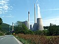
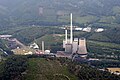
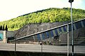
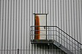
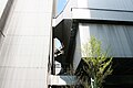
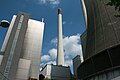
coal power plant  | |||||
| Upload media | |||||
| Instance of | |||||
|---|---|---|---|---|---|
| Location | Werdohl, Märkischer Kreis, Arnsberg Government Region, North Rhine-Westphalia, Germany | ||||
| Owned by | |||||
| Nominal power capacity |
| ||||
 | |||||
Media in category "Kraftwerk Werdohl-Elverlingsen"
The following 59 files are in this category, out of 59 total.
-
 Ballonfahrt 2017-042 (38327320952).jpg 6,225 × 4,150; 14.29 MB
-
 Coal-fired power station Werdohl Elverlingsen Germany-2.jpg 2,336 × 1,552; 3.76 MB
-
 Coal-fired power station Werdohl Elverlingsen Germany.jpg 4,672 × 3,104; 5.69 MB
-
 Kraftwerk Werdohl-Elverlingsen - panoramio.jpg 4,000 × 3,000; 3.61 MB
-
 Kraftwerk Werdohl-Elverlingsen FFSN-4827.jpg 4,672 × 3,107; 15.98 MB
-
 Kraftwerk Werdohl-Elverlingsen FFSN-4831.jpg 3,125 × 4,699; 15.68 MB
-
 Kraftwerk Werdohl-Elverlingsen FFSW PK 5120.jpg 6,958 × 4,643; 9.45 MB
-
 Kraftwerk Werdohl-Elverlingsen FFSW PK 5148.jpg 6,586 × 4,395; 8.75 MB
-
 Kraftwerk Werdohl-Elverlingsen FFSW PK 5314.jpg 7,360 × 4,912; 40.55 MB
-
 Kraftwerk Werdohl-Elverlingsen.jpg 1,600 × 1,200; 451 KB
-

-
 Werdohl - Kraftwerk Elverlingsen 01 ies.jpg 3,888 × 2,592; 1.61 MB
-
 Werdohl - Kraftwerk Elverlingsen 02 ies.jpg 3,888 × 2,592; 1.74 MB
-
 Werdohl - Kraftwerk Elverlingsen 03 ies.jpg 3,888 × 2,592; 2.06 MB
-
 Werdohl - Kraftwerk Elverlingsen 04 ies.jpg 3,888 × 2,592; 2.22 MB
-
 Werdohl - Kraftwerk Elverlingsen 05 ies.jpg 3,888 × 2,592; 2.69 MB
-
 Werdohl - Kraftwerk Elverlingsen 06 ies.jpg 3,888 × 2,592; 2.41 MB
-
 Werdohl - Kraftwerk Elverlingsen 07 ies.jpg 3,888 × 2,592; 2.85 MB
-
 Werdohl - Kraftwerk Elverlingsen 08 ies.jpg 3,888 × 2,592; 1.94 MB
-
 Werdohl - Kraftwerk Elverlingsen 09 ies.jpg 3,888 × 2,592; 3.41 MB
-
 Werdohl - Kraftwerk Elverlingsen 10 ies.jpg 3,888 × 2,592; 1.89 MB
-
 Werdohl - Kraftwerk Elverlingsen 11 ies.jpg 3,888 × 2,592; 2.14 MB
-
 Werdohl - Kraftwerk Elverlingsen 12 ies.jpg 3,888 × 2,592; 2.35 MB
-
 Werdohl - Kraftwerk Elverlingsen 13 ies.jpg 3,888 × 2,592; 2.3 MB
-
 Werdohl - Kraftwerk Elverlingsen 14 ies.jpg 3,888 × 2,592; 2.53 MB
-
 Werdohl - Kraftwerk Elverlingsen 15 ies.jpg 3,888 × 2,592; 2.83 MB
-
 Werdohl - Kraftwerk Elverlingsen 16 ies.jpg 3,888 × 2,592; 2.82 MB
-
 Werdohl - Kraftwerk Elverlingsen 17 ies.jpg 3,888 × 2,592; 2.72 MB
-
 Werdohl - Kraftwerk Elverlingsen 18 ies.jpg 3,888 × 2,592; 2.69 MB
-
 Werdohl - Kraftwerk Elverlingsen 19 ies.jpg 3,888 × 2,592; 1.41 MB
-
 Werdohl - Kraftwerk Elverlingsen 20 ies.jpg 3,888 × 2,592; 1.91 MB
-
 Werdohl - Kraftwerk Elverlingsen 21 ies.jpg 3,888 × 2,592; 2.3 MB
-
 Werdohl - Kraftwerk Elverlingsen 22 ies.jpg 3,888 × 2,592; 1.55 MB
-
 Werdohl - Kraftwerk Elverlingsen 23 ies.jpg 3,888 × 2,592; 2.17 MB
-
 Werdohl - Kraftwerk Elverlingsen 24 ies.jpg 3,888 × 2,592; 2.47 MB
-
 Werdohl - Kraftwerk Elverlingsen 25 ies.jpg 3,888 × 2,592; 2.28 MB
-
 Werdohl - Kraftwerk Elverlingsen 26 ies.jpg 3,888 × 2,592; 2.53 MB
-
 Werdohl - Kraftwerk Elverlingsen 27 ies.jpg 3,888 × 2,592; 2.32 MB
-
 Werdohl - Kraftwerk Elverlingsen 28 ies.jpg 3,888 × 2,592; 2.36 MB
-
 Werdohl - Kraftwerk Elverlingsen 29 ies.jpg 3,888 × 2,592; 2.34 MB
-
 Werdohl - Kraftwerk Elverlingsen 30 ies.jpg 3,888 × 2,592; 1.65 MB
-
 Werdohl - Kraftwerk Elverlingsen 31 ies.jpg 3,888 × 2,592; 2.11 MB
-
 Werdohl - Kraftwerk Elverlingsen 32 ies.jpg 3,888 × 2,592; 1.54 MB
-
 Werdohl - Kraftwerk Elverlingsen 33 ies.jpg 3,888 × 2,592; 1.41 MB
-
 Werdohl - Kraftwerk Elverlingsen 34 ies.jpg 3,888 × 2,592; 2.06 MB
-
 Werdohl - Kraftwerk Elverlingsen 35 ies.jpg 3,888 × 2,592; 2.63 MB
-
 Werdohl - Kraftwerk Elverlingsen 36 ies.jpg 3,888 × 2,592; 2.78 MB
-
 Werdohl - Kraftwerk Elverlingsen 37 ies.jpg 3,888 × 2,592; 2.08 MB
-
 Werdohl - Kraftwerk Elverlingsen 38 ies.jpg 3,888 × 2,592; 2.08 MB
-
 Werdohl - Kraftwerk Elverlingsen 39 ies.jpg 3,888 × 2,592; 2.07 MB
-
 Werdohl - Kraftwerk Elverlingsen 40 ies.jpg 3,888 × 2,592; 1.6 MB
-
 Werdohl - Kraftwerk Elverlingsen 41 ies.jpg 3,888 × 2,592; 2.33 MB
-
 Werdohl - Kraftwerk Elverlingsen 42 ies.jpg 3,888 × 2,592; 2.38 MB
-
 Werdohl - Kraftwerk Elverlingsen 43 ies.jpg 3,888 × 2,592; 1.87 MB
-
 Werdohl Kraftwerk Werdohl-Elverlingsen FFSN-5759.jpg 1,175 × 1,771; 2.08 MB
-
 Werdohl Kraftwerk Werdohl-Elverlingsen FFSN-5775.jpg 1,175 × 1,771; 2.36 MB
-
 Werdohl-Dresel FFSW PK 5449.jpg 6,463 × 4,313; 35.61 MB
-
 Werdohl-Elverlingsen FFSW PK 5067.jpg 6,424 × 4,286; 9.2 MB
-
 Werdohl-Elverlingsen Kraftwerk FFSW PK 5883.jpg 7,025 × 4,688; 35.94 MB
.jpg)


