Category:Kosterstraat 36, Doesburg
Jump to navigation
Jump to search
| Object location | | View all coordinates using: OpenStreetMap |
|---|
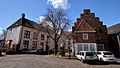
house in Doesburg, Netherlands  | |||||
| Upload media | |||||
| Instance of | |||||
|---|---|---|---|---|---|
| Location | Doesburg, Gelderland, Netherlands | ||||
| Street address |
| ||||
| Located on street | |||||
| Heritage designation |
| ||||
 | |||||
|
This is a category about rijksmonument number 13025
|
| Address |
|
Media in category "Kosterstraat 36, Doesburg"
The following 10 files are in this category, out of 10 total.
-
 Doesburg - Kosterstraat 36-38.jpg 1,536 × 2,048; 1,020 KB
-
 Doesburg, Netherlands - panoramio (141).jpg 2,048 × 1,155; 633 KB
-
 Doesburg, Netherlands - panoramio (142).jpg 2,048 × 1,155; 614 KB
-
 Doesburg, Netherlands - panoramio (79).jpg 4,896 × 3,264; 1.97 MB
-
 Huis - Doesburg - 20058264 - RCE.jpg 1,200 × 930; 256 KB
-
 Markt west-zijde vanuit Kosterstr., overzicht - Doesburg - 20057876 - RCE.jpg 1,200 × 816; 213 KB
-
 Markt west-zijde, overzicht - Doesburg - 20057877 - RCE.jpg 1,200 × 820; 216 KB
-
 Overzicht - Doesburg - 20058265 - RCE.jpg 1,190 × 1,200; 367 KB
-
 RM13025 Doesburg - Kosterstraat 36-38.jpg 2,592 × 1,944; 1.19 MB
-
 Voorgevels - Doesburg - 20058266 - RCE.jpg 1,200 × 1,197; 406 KB
.jpg)
.jpg)
.jpg)


