Category:Kopet Dag
Jump to navigation
Jump to search
mountain range in Iran and Turkmenistan  | |||||
| Upload media | |||||
| Instance of | |||||
|---|---|---|---|---|---|
| Part of | |||||
| Location |
| ||||
| Length |
| ||||
| Highest point | |||||
| Elevation above sea level |
| ||||
 | |||||
Subcategories
This category has the following 3 subcategories, out of 3 total.
Media in category "Kopet Dag"
The following 20 files are in this category, out of 20 total.
-
 Ahal.jpg 3,264 × 2,448; 2.84 MB
-
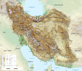
 Iran-geographic map-es.svg 3,013 × 2,600; 14.13 MB
-
 Iran-geographic map.svg 3,013 × 2,600; 12.7 MB
-
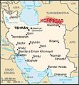 Kopet dag iran map.jpg 328 × 355; 54 KB
-
 Kopet Dag mountains (1) (45442857461).jpg 3,505 × 2,188; 4.65 MB
-
 Kopet Dag mountains (1) (46194532591).jpg 3,638 × 2,513; 5.32 MB
-
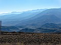 Kopet Dag mountains (2) (45442857081).jpg 3,740 × 2,805; 6.85 MB
-
 Kopet Dag mountains (2) (46194532221).jpg 3,705 × 2,624; 6.8 MB
-
 Kopet Dag mountains (3) (45442856411).jpg 3,833 × 2,462; 7.14 MB
-
 Kopet Dag mountains (4) (45442855581).jpg 3,740 × 2,265; 6.16 MB
-
 Kopet Dag mountains (46194531771).jpg 3,573 × 2,463; 5 MB
-
 Kopet Dag mountains (5) (45442854971).jpg 3,720 × 2,523; 6.06 MB
-
 Kopetdag mountains in early spring, a view from Bereket city.jpg 2,288 × 1,712; 595 KB
-
 Kopetdag-mountains.jpg 782 × 519; 180 KB
-
 Macrovipera lebetina turanica.tif 1,331 × 866; 6.6 MB
-
 Map of Persia, Afghanistan and Baluchistan - 1898.tif 2,715 × 1,024; 7.95 MB
-
 Naja oxiana juv.tif 865 × 1,336; 6.61 MB
-
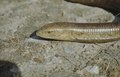 Scheltopusik Turkmenistan.tif 1,335 × 858; 6.55 MB
-
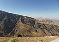
 The foothills of the Kopet Dag mountains (46194531021).jpg 3,530 × 2,446; 5.99 MB
-
 Wilde Tulpen in Turkmenistan.tif 865 × 1,340; 6.63 MB


_(45442857461).jpg)
_(46194532591).jpg)
_(45442857081).jpg)
_(46194532221).jpg)
_(45442856411).jpg)
_(45442855581).jpg)
.jpg)
_(45442854971).jpg)


.jpg)