Category:Koninklijk Nederlands Aardrijkskundig Genootschap
organization of geographers and those interested in geography in The Netherlands | |||||
| Upload media | |||||
| Instance of |
| ||||
|---|---|---|---|---|---|
| Location |
| ||||
| Headquarters location | |||||
| Legal form |
| ||||
| Inception |
| ||||
| official website | |||||
| |||||

The Royal Dutch Geographical Society, or Koninklijk Nederlands Aardrijkskundig Genootschap (KNAG) in Dutch, was founded in 1873 in the Netherlands. The aim of the institute was to increase interest in geography among a general audience. Part of their programme was to gather more geographical knowledge. In 1873 they started building a collection among which were a library and collection of maps and atlases. In those early years the institute had a reputation for organizing expeditions into unknown territories. Part of the map collection focuses on these expeditions. Since 1880, the library and map collection is accommodated by the University of Amsterdam. The collection covers all aspects of geography and cartography with a focus on Dutch territories, including the overseas areas.
History of the KNAG collection[edit]

The library and map collection of the KNAG increased rapidly in size since the founding of the organisation in 1873. Within one year the organisation had already collected about 300 books, atlases and maps. At first, the collection was accommodated at the Handelsschool in Amsterdam which was situated at the Keizersgracht 123. This accommodation was arranged by dr. H.F.R. Hubrecht. He was co-founder of the KNAG, board member of the organisation and headmaster of the Handelsschool. The librarian at the time was A. Van Otterloo. He worked for the organisation from 1873 until 1877. In 1877 dr. I. Dornseiffen became the new librarian at the institute.
Maps of the Netherlands were kept separately and used for research concerning the geography of the Netherlands. This part of the collection was accommodated in The Hague by Jacob Kuyper (1821-1908) who was also co-founder of the organisation. There was even a special research group of which Kuyper was chairman. However, the biggest part of the collection and research focused on the exploration and study of the overseas areas. It is unclear when the collection of maps that was situated in The Hague became part of the collection in Amsterdam.
In 1880 the KNAG was forced to move its collection because the storage space had become too small. Particularly the maps needed to be preserved carefully. The collection was moved to the University Library. Hundreds of books, almost 2000 maps and dozens of atlases were moved to the library at the Handboogdoelen, situated at Singel 421. This is still the location of the current library.
Map collection Frederik Muller & Co.[edit]

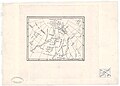
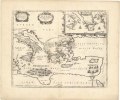
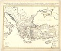
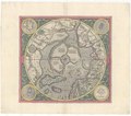
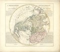
In 1910, the KNAG bought a large part of the map collection from the famous antiquarian Frederik Muller & Co. The collection contains about 10,000 objects. Most of the maps of this collection are taken from well-known Dutch atlases from the sixteenth, seventeenth, and eighteenth century. The collection includes for example maps from the Amsterdam printers Jodocus Hondius and Frederik de Wit. Apart from the Dutch maps there are also a lot of maps of foreign origin. In 1960 the doublets were removed from the collection because of financial issues and from the 14.371 maps c. 8700 remained part of the collection.[1][2]
The collection from Frederik Muller & Co is often used for research, since it contains many editions of maps with various text and imprints. This rich collection is therefore of great importance for carto-bibliographical research (the analysis of variant in maps printed from copperplates).
The map collection of Frederik Muller & Co. is made available to Wikimedia Commons by the Special Collections of the University of Amsterdam.
References[edit]
organization of geographers and those interested in geography in The Netherlands | |||||
| Upload media | |||||
| Instance of |
| ||||
|---|---|---|---|---|---|
| Location |
| ||||
| Headquarters location | |||||
| Legal form |
| ||||
| Inception |
| ||||
| official website | |||||
| |||||
Subcategories
This category has the following 14 subcategories, out of 14 total.
C
E
- Europe (Map collection KNAG) (25 F)
F
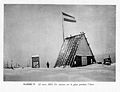
- First Karakoram Expedition (72 F)
- Fourth Karakoram Expedition (38 F)
I
- Italy (Map collection KNAG) (38 F)
J
- Japan (Map collection KNAG) (1 F)
L
M
- Malta (Map collection KNAG) (4 F)
P
S
- Spain (Map collection KNAG) (29 F)
T
- Third Karakoram Expedition (65 F)
W
- World (Map collection KNAG) (27 F)
Media in category "Koninklijk Nederlands Aardrijkskundig Genootschap"
The following 200 files are in this category, out of 1,111 total.
(previous page) (next page)-
 Aardrijkskundig Genootschap Koninklijk - te Amsterdam, objectnr PA 2550.jpg 3,200 × 1,600; 1.17 MB
-

-
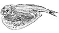 Chiasmodon braueri.jpg 996 × 560; 263 KB
-

-
 De conferentiezaal met prins Claus, Bestanddeelnr 919-8039.jpg 3,684 × 2,469; 1.66 MB
-
 De zeeën van Nederlandsch Oost-Indië (IA dezeenvanneder00koni).pdf 1,085 × 1,629, 602 pages; 30.69 MB
-
 Frederick de Wit, Insula Malta 1680 - OTM- HB-KZL 32.35.04.tif 2,931 × 1,468; 12.31 MB
-

-

-
-
 Ipy-karasea 5.jpg 2,412 × 1,859; 457 KB
-
 Koningin en prins worden door prof. dr. P.J. Bakker ontvangen, Bestanddeelnr 919-8037.jpg 3,699 × 2,457; 1.53 MB
-
 Koningin Juliana krijgt bloemen aangeboden, Bestanddeelnr 919-8038.jpg 3,696 × 2,469; 1.5 MB
-

-

-
 Map - Special Collections University of Amsterdam - OTM- HB-KZL 31-01-14.tif 7,144 × 6,007; 122.78 MB
-
 Map - Special Collections University of Amsterdam - OTM- HB-KZL 31-01-15.tif 7,272 × 5,991; 124.65 MB
-
 Map - Special Collections University of Amsterdam - OTM- HB-KZL 31-01-16.tif 6,480 × 5,084; 94.25 MB
-
 Map - Special Collections University of Amsterdam - OTM- HB-KZL 31-01-17.tif 6,984 × 5,464; 109.18 MB
-
 Map - Special Collections University of Amsterdam - OTM- HB-KZL 31-01-18.tif 6,776 × 5,507; 106.76 MB
-
 Map - Special Collections University of Amsterdam - OTM- HB-KZL 31-01-32.tif 7,224 × 6,035; 124.73 MB
-
 Map - Special Collections University of Amsterdam - OTM- HB-KZL 31-01-33.tif 6,920 × 5,332; 105.56 MB
-
 Map - Special Collections University of Amsterdam - OTM- HB-KZL 31-01-34.tif 6,728 × 5,134; 98.82 MB
-
 Map - Special Collections University of Amsterdam - OTM- HB-KZL 31-01-35.tif 7,256 × 6,016; 124.89 MB
-
 Map - Special Collections University of Amsterdam - OTM- HB-KZL 31-01-41.tif 6,848 × 5,494; 107.64 MB
-
 Map - Special Collections University of Amsterdam - OTM- HB-KZL 31-01-42.tif 6,808 × 5,497; 107.07 MB
-
 Map - Special Collections University of Amsterdam - OTM- HB-KZL 31-01-43.tif 7,272 × 5,624; 117.01 MB
-
 Map - Special Collections University of Amsterdam - OTM- HB-KZL 31-01-44.tif 6,856 × 5,440; 106.71 MB
-
 Map - Special Collections University of Amsterdam - OTM- HB-KZL 31-01-45.tif 7,344 × 6,078; 127.71 MB
-
 Map - Special Collections University of Amsterdam - OTM- HB-KZL 31-01-46.tif 6,808 × 5,498; 107.09 MB
-
 Map - Special Collections University of Amsterdam - OTM- HB-KZL 31-01-47.tif 6,840 × 5,457; 106.79 MB
-
 Map - Special Collections University of Amsterdam - OTM- HB-KZL 31-01-48.tif 6,592 × 5,432; 102.45 MB
-
 Map - Special Collections University of Amsterdam - OTM- HB-KZL 31-01-49.tif 7,192 × 5,632; 115.89 MB
-
 Map - Special Collections University of Amsterdam - OTM- HB-KZL 31-01-50.tif 7,352 × 6,142; 129.19 MB
-
 Map - Special Collections University of Amsterdam - OTM- HB-KZL 31-01-51.tif 6,832 × 5,502; 107.55 MB
-
 Map - Special Collections University of Amsterdam - OTM- HB-KZL 31-01-52.tif 7,200 × 5,627; 115.91 MB
-
 Map - Special Collections University of Amsterdam - OTM- HB-KZL 31-01-53.tif 6,816 × 5,444; 106.16 MB
-
 Map - Special Collections University of Amsterdam - OTM- HB-KZL 31-01-54.tif 7,272 × 6,079; 126.48 MB
-
 Map - Special Collections University of Amsterdam - OTM- HB-KZL 31-01-55.tif 6,472 × 5,080; 94.06 MB
-
 Map - Special Collections University of Amsterdam - OTM- HB-KZL 31-01-60.tif 6,803 × 4,753; 92.51 MB
-
 Map - Special Collections University of Amsterdam - OTM- HB-KZL 31-01-67.tif 6,706 × 5,466; 104.87 MB
-
 Map - Special Collections University of Amsterdam - OTM- HB-KZL 31-01-68.tif 6,386 × 4,607; 84.17 MB
-
 Map - Special Collections University of Amsterdam - OTM- HB-KZL 31-02-12.tif 7,720 × 6,508; 143.74 MB
-
 Map - Special Collections University of Amsterdam - OTM- HB-KZL 31-02-13.tif 7,876 × 6,482; 146.06 MB
-
 Map - Special Collections University of Amsterdam - OTM- HB-KZL 31-02-27.tif 6,611 × 5,808; 109.85 MB
-
 Map - Special Collections University of Amsterdam - OTM- HB-KZL 31-02-32.tif 7,384 × 6,352; 134.19 MB
-
 Map - Special Collections University of Amsterdam - OTM- HB-KZL 31-02-39.tif 7,568 × 6,525; 141.28 MB
-
 Map - Special Collections University of Amsterdam - OTM- HB-KZL 31-02-40.tif 7,088 × 6,012; 121.92 MB
-
 Map - Special Collections University of Amsterdam - OTM- HB-KZL 31-02-41.tif 7,343 × 6,247; 131.24 MB
-
 Map - Special Collections University of Amsterdam - OTM- HB-KZL 31-02-43.tif 7,303 × 6,277; 131.15 MB
-
 Map - Special Collections University of Amsterdam - OTM- HB-KZL 31-02-44.tif 7,320 × 6,659; 139.46 MB
-
 Map - Special Collections University of Amsterdam - OTM- HB-KZL 31-02-45.tif 7,730 × 6,687; 147.89 MB
-
 Map - Special Collections University of Amsterdam - OTM- HB-KZL 31-02-46.tif 7,653 × 6,633; 145.23 MB
-
 Map - Special Collections University of Amsterdam - OTM- HB-KZL 31-02-47.tif 7,503 × 6,259; 134.36 MB
-
 Map - Special Collections University of Amsterdam - OTM- HB-KZL 31-02-48.tif 7,779 × 6,621; 147.36 MB
-
 Map - Special Collections University of Amsterdam - OTM- HB-KZL 31-02-61.tif 7,608 × 6,316; 137.5 MB
-
 Map - Special Collections University of Amsterdam - OTM- HB-KZL 31-02-64.tif 7,320 × 6,281; 131.54 MB
-
 Map - Special Collections University of Amsterdam - OTM- HB-KZL 31-02-67.tif 7,192 × 5,924; 121.9 MB
-
 Map - Special Collections University of Amsterdam - OTM- HB-KZL 31-03-12.tif 6,360 × 4,854; 88.35 MB
-
 Map - Special Collections University of Amsterdam - OTM- HB-KZL 31-03-26.tif 8,144 × 6,703; 156.18 MB
-
 Map - Special Collections University of Amsterdam - OTM- HB-KZL 31-03-29.tif 7,856 × 6,645; 149.36 MB
-
 Map - Special Collections University of Amsterdam - OTM- HB-KZL 31-03-46.tif 6,648 × 5,363; 102.01 MB
-
 Map - Special Collections University of Amsterdam - OTM- HB-KZL 31-03-50.tif 7,304 × 6,232; 130.23 MB
-
 Map - Special Collections University of Amsterdam - OTM- HB-KZL 31-03-55.tif 5,430 × 4,355; 67.66 MB
-
 Map - Special Collections University of Amsterdam - OTM- HB-KZL 31-04-50.tif 14,472 × 11,050; 457.52 MB
-
 Map - Special Collections University of Amsterdam - OTM- HB-KZL 31-05-24.tif 7,792 × 6,501; 144.93 MB
-
 Map - Special Collections University of Amsterdam - OTM- HB-KZL 31-05-25.tif 7,560 × 6,048; 130.81 MB
-
 Map - Special Collections University of Amsterdam - OTM- HB-KZL 31-05-26.tif 7,601 × 6,387; 138.9 MB
-
 Map - Special Collections University of Amsterdam - OTM- HB-KZL 31-05-27.tif 7,480 × 6,360; 136.11 MB
-
 Map - Special Collections University of Amsterdam - OTM- HB-KZL 31-05-30.tif 7,353 × 6,264; 131.78 MB
-
 Map - Special Collections University of Amsterdam - OTM- HB-KZL 31-05-50.tif 7,584 × 6,451; 139.97 MB
-
 Map - Special Collections University of Amsterdam - OTM- HB-KZL 31-05-54.tif 7,610 × 6,255; 136.19 MB
-
 Map - Special Collections University of Amsterdam - OTM- HB-KZL 31-05-55.tif 7,804 × 6,569; 146.67 MB
-
 Map - Special Collections University of Amsterdam - OTM- HB-KZL 31-05-56.tif 7,640 × 6,275; 137.16 MB
-
 Map - Special Collections University of Amsterdam - OTM- HB-KZL 31-05-57.tif 7,551 × 6,264; 135.33 MB
-
 Map - Special Collections University of Amsterdam - OTM- HB-KZL 31-05-58.tif 7,549 × 6,747; 145.72 MB
-
 Map - Special Collections University of Amsterdam - OTM- HB-KZL 31-05-59.tif 7,660 × 6,423; 140.76 MB
-
 Map - Special Collections University of Amsterdam - OTM- HB-KZL 31-05-60.tif 7,292 × 6,309; 131.62 MB
-
 Map - Special Collections University of Amsterdam - OTM- HB-KZL 31-05-63.tif 7,200 × 6,173; 127.16 MB
-
 Map - Special Collections University of Amsterdam - OTM- HB-KZL 31-05-65.tif 6,840 × 5,115; 100.1 MB
-
 Map - Special Collections University of Amsterdam - OTM- HB-KZL 31-05-67.tif 6,440 × 5,058; 93.19 MB
-
 Map - Special Collections University of Amsterdam - OTM- HB-KZL 31-06-01.tif 6,488 × 5,110; 94.85 MB
-
 Map - Special Collections University of Amsterdam - OTM- HB-KZL 31-06-03.tif 7,504 × 6,433; 138.11 MB
-
 Map - Special Collections University of Amsterdam - OTM- HB-KZL 31-06-04.tif 7,132 × 6,167; 125.84 MB
-
 Map - Special Collections University of Amsterdam - OTM- HB-KZL 31-06-05.tif 7,080 × 6,142; 124.41 MB
-
 Map - Special Collections University of Amsterdam - OTM- HB-KZL 31-06-08.tif 7,488 × 6,346; 135.95 MB
-
 Map - Special Collections University of Amsterdam - OTM- HB-KZL 31-06-09.tif 7,520 × 6,350; 136.62 MB
-
 Map - Special Collections University of Amsterdam - OTM- HB-KZL 31-06-13.tif 7,147 × 6,216; 127.1 MB
-
 Map - Special Collections University of Amsterdam - OTM- HB-KZL 31-06-14.tif 6,872 × 6,177; 121.45 MB
-
 Map - Special Collections University of Amsterdam - OTM- HB-KZL 31-06-15.tif 7,239 × 6,104; 126.42 MB
-
 Map - Special Collections University of Amsterdam - OTM- HB-KZL 31-06-25.tif 7,000 × 5,911; 118.38 MB
-
 Map - Special Collections University of Amsterdam - OTM- HB-KZL 31-06-34.tif 6,826 × 5,882; 114.87 MB
-
 Map - Special Collections University of Amsterdam - OTM- HB-KZL 31-06-35.tif 6,653 × 5,553; 105.7 MB
-
 Map - Special Collections University of Amsterdam - OTM- HB-KZL 31-06-39.tif 6,480 × 4,930; 91.4 MB
-
 Map - Special Collections University of Amsterdam - OTM- HB-KZL 31-06-41.tif 7,480 × 6,373; 136.39 MB
-
 Map - Special Collections University of Amsterdam - OTM- HB-KZL 31-06-64.tif 8,120 × 6,696; 155.56 MB
-
 Map - Special Collections University of Amsterdam - OTM- HB-KZL 31-06-70.tif 7,536 × 6,375; 137.45 MB
-
 Map - Special Collections University of Amsterdam - OTM- HB-KZL 31-07-01.tif 7,440 × 6,360; 135.38 MB
-
 Map - Special Collections University of Amsterdam - OTM- HB-KZL 31-07-02.tif 7,592 × 6,318; 137.23 MB
-
 Map - Special Collections University of Amsterdam - OTM- HB-KZL 31-07-04.tif 7,705 × 6,696; 147.61 MB
-
 Map - Special Collections University of Amsterdam - OTM- HB-KZL 31-07-05.tif 7,039 × 5,686; 114.51 MB
-
 Map - Special Collections University of Amsterdam - OTM- HB-KZL 31-07-15.tif 7,336 × 6,343; 133.13 MB
-
 Map - Special Collections University of Amsterdam - OTM- HB-KZL 31-07-16.tif 7,184 × 5,932; 121.92 MB
-
 Map - Special Collections University of Amsterdam - OTM- HB-KZL 31-07-17.tif 6,074 × 4,755; 82.63 MB
-
 Map - Special Collections University of Amsterdam - OTM- HB-KZL 31-07-18.tif 7,576 × 6,492; 140.72 MB
-
 Map - Special Collections University of Amsterdam - OTM- HB-KZL 31-07-19.tif 7,482 × 6,358; 136.1 MB
-
 Map - Special Collections University of Amsterdam - OTM- HB-KZL 31-07-20.tif 7,080 × 6,044; 122.43 MB
-
 Map - Special Collections University of Amsterdam - OTM- HB-KZL 31-07-21.tif 7,125 × 6,131; 124.98 MB
-
 Map - Special Collections University of Amsterdam - OTM- HB-KZL 31-07-22.tif 7,081 × 5,978; 121.11 MB
-
 Map - Special Collections University of Amsterdam - OTM- HB-KZL 31-07-24.tif 7,912 × 6,575; 148.83 MB
-
 Map - Special Collections University of Amsterdam - OTM- HB-KZL 31-07-26.tif 7,304 × 6,247; 130.54 MB
-
 Map - Special Collections University of Amsterdam - OTM- HB-KZL 31-07-27.tif 7,716 × 6,284; 138.72 MB
-
 Map - Special Collections University of Amsterdam - OTM- HB-KZL 31-07-28.tif 7,808 × 6,504; 145.29 MB
-
 Map - Special Collections University of Amsterdam - OTM- HB-KZL 31-07-29.tif 7,885 × 6,739; 152.03 MB
-
 Map - Special Collections University of Amsterdam - OTM- HB-KZL 31-07-30.tif 7,636 × 6,440; 140.69 MB
-
 Map - Special Collections University of Amsterdam - OTM- HB-KZL 31-07-39.tif 7,516 × 6,368; 136.93 MB
-
 Map - Special Collections University of Amsterdam - OTM- HB-KZL 31-07-40.tif 7,499 × 6,389; 137.08 MB
-
 Map - Special Collections University of Amsterdam - OTM- HB-KZL 31-07-41.tif 7,640 × 6,340; 138.58 MB
-
 Map - Special Collections University of Amsterdam - OTM- HB-KZL 31-07-42.tif 7,304 × 5,788; 120.95 MB
-
 Map - Special Collections University of Amsterdam - OTM- HB-KZL 31-07-43.tif 7,672 × 6,401; 140.5 MB
-
 Map - Special Collections University of Amsterdam - OTM- HB-KZL 31-07-46.tif 7,024 × 5,638; 113.3 MB
-
 Map - Special Collections University of Amsterdam - OTM- HB-KZL 31-08-03.tif 7,591 × 6,234; 135.39 MB
-
 Map - Special Collections University of Amsterdam - OTM- HB-KZL 31-08-06.tif 7,336 × 6,000; 125.93 MB
-
 Map - Special Collections University of Amsterdam - OTM- HB-KZL 31-08-08.tif 7,828 × 6,501; 145.6 MB
-
 Map - Special Collections University of Amsterdam - OTM- HB-KZL 31-08-09.tif 8,280 × 6,359; 150.64 MB
-
 Map - Special Collections University of Amsterdam - OTM- HB-KZL 31-08-19.tif 7,817 × 6,437; 143.96 MB
-
 Map - Special Collections University of Amsterdam - OTM- HB-KZL 31-08-20.tif 7,424 × 6,388; 135.68 MB
-
 Map - Special Collections University of Amsterdam - OTM- HB-KZL 31-08-25.tif 7,584 × 6,382; 138.48 MB
-
 Map - Special Collections University of Amsterdam - OTM- HB-KZL 31-08-26.tif 7,522 × 6,352; 136.7 MB
-
 Map - Special Collections University of Amsterdam - OTM- HB-KZL 31-08-27.tif 7,472 × 6,140; 131.26 MB
-
 Map - Special Collections University of Amsterdam - OTM- HB-KZL 31-08-28.tif 7,908 × 6,665; 150.8 MB
-
 Map - Special Collections University of Amsterdam - OTM- HB-KZL 31-08-29.tif 7,530 × 6,377; 137.38 MB
-
 Map - Special Collections University of Amsterdam - OTM- HB-KZL 31-08-30.tif 5,116 × 6,720; 98.36 MB
-
 Map - Special Collections University of Amsterdam - OTM- HB-KZL 31-08-32.tif 7,948 × 6,519; 148.24 MB
-
 Map - Special Collections University of Amsterdam - OTM- HB-KZL 31-08-35.tif 3,106 × 4,234; 37.63 MB
-
 Map - Special Collections University of Amsterdam - OTM- HB-KZL 31-08-41.tif 6,528 × 5,110; 95.44 MB
-
 Map - Special Collections University of Amsterdam - OTM- HB-KZL 31-08-64.tif 7,216 × 6,057; 125.05 MB
-
 Map - Special Collections University of Amsterdam - OTM- HB-KZL 31-08-67.tif 7,392 × 6,195; 131.02 MB
-
 Map - Special Collections University of Amsterdam - OTM- HB-KZL 31-09-02.tif 7,428 × 6,356; 135.08 MB
-
 Map - Special Collections University of Amsterdam - OTM- HB-KZL 31-09-04.tif 7,008 × 6,207; 124.45 MB
-
 Map - Special Collections University of Amsterdam - OTM- HB-KZL 31-09-07.tif 7,383 × 5,956; 125.81 MB
-
 Map - Special Collections University of Amsterdam - OTM- HB-KZL 31-09-08.tif 7,784 × 6,815; 151.77 MB
-
 Map - Special Collections University of Amsterdam - OTM- HB-KZL 31-09-10.tif 8,690 × 6,343; 157.7 MB
-
 Map - Special Collections University of Amsterdam - OTM- HB-KZL 31-09-11.tif 7,976 × 6,795; 155.06 MB
-
 Map - Special Collections University of Amsterdam - OTM- HB-KZL 31-09-12.tif 7,760 × 6,294; 139.74 MB
-
 Map - Special Collections University of Amsterdam - OTM- HB-KZL 31-09-15.tif 7,608 × 6,384; 138.96 MB
-
 Map - Special Collections University of Amsterdam - OTM- HB-KZL 31-09-16.tif 7,640 × 6,279; 137.25 MB
-
 Map - Special Collections University of Amsterdam - OTM- HB-KZL 31-09-17.tif 7,043 × 6,165; 124.23 MB
-
 Map - Special Collections University of Amsterdam - OTM- HB-KZL 31-09-18.tif 8,088 × 6,934; 160.45 MB
-
 Map - Special Collections University of Amsterdam - OTM- HB-KZL 31-09-19.tif 7,596 × 6,376; 138.57 MB
-
 Map - Special Collections University of Amsterdam - OTM- HB-KZL 31-09-20.tif 6,917 × 6,307; 124.81 MB
-
 Map - Special Collections University of Amsterdam - OTM- HB-KZL 31-09-21.tif 6,555 × 5,320; 99.77 MB
-
 Map - Special Collections University of Amsterdam - OTM- HB-KZL 31-09-25.tif 7,048 × 5,997; 120.93 MB
-
 Map - Special Collections University of Amsterdam - OTM- HB-KZL 31-09-27.tif 7,244 × 6,083; 126.07 MB
-
 Map - Special Collections University of Amsterdam - OTM- HB-KZL 31-09-33.tif 7,496 × 6,264; 134.34 MB
-
 Map - Special Collections University of Amsterdam - OTM- HB-KZL 31-09-63.tif 7,280 × 6,053; 126.07 MB
-
 Map - Special Collections University of Amsterdam - OTM- HB-KZL 31-09-69.tif 7,680 × 6,556; 144.05 MB
-
 Map - Special Collections University of Amsterdam - OTM- HB-KZL 31-10-05.tif 7,009 × 6,243; 125.19 MB
-
 Map - Special Collections University of Amsterdam - OTM- HB-KZL 31-10-20.tif 8,228 × 6,103; 143.67 MB
-
 Map - Special Collections University of Amsterdam - OTM- HB-KZL 31-10-22.tif 7,796 × 6,479; 144.51 MB
-
 Map - Special Collections University of Amsterdam - OTM- HB-KZL 31-10-24.tif 6,884 × 5,743; 113.11 MB
-
 Map - Special Collections University of Amsterdam - OTM- HB-KZL 31-10-25.tif 6,722 × 5,800; 111.55 MB
-
 Map - Special Collections University of Amsterdam - OTM- HB-KZL 31-10-27.tif 7,555 × 6,513; 140.78 MB
-
 Map - Special Collections University of Amsterdam - OTM- HB-KZL 31-10-32.tif 6,219 × 7,336; 153.68 MB
-
 Map - Special Collections University of Amsterdam - OTM- HB-KZL 31-11-12.tif 7,056 × 5,946; 120.03 MB
-
 Map - Special Collections University of Amsterdam - OTM- HB-KZL 31-11-16.tif 6,688 × 5,487; 104.99 MB
-
 Map - Special Collections University of Amsterdam - OTM- HB-KZL 31-11-19.tif 7,992 × 6,724; 153.75 MB
-
 Map - Special Collections University of Amsterdam - OTM- HB-KZL 31-11-29A.tif 7,552 × 6,523; 140.94 MB
-
 Map - Special Collections University of Amsterdam - OTM- HB-KZL 31-11-53.tif 7,657 × 6,385; 139.88 MB
-
 Map - Special Collections University of Amsterdam - OTM- HB-KZL 31-11-55.tif 7,848 × 6,463; 145.12 MB
-
 Map - Special Collections University of Amsterdam - OTM- HB-KZL 31-11-57.tif 7,844 × 5,937; 133.24 MB
-
 Map - Special Collections University of Amsterdam - OTM- HB-KZL 31-11-60.tif 7,136 × 5,976; 122.01 MB
-
 Map - Special Collections University of Amsterdam - OTM- HB-KZL 31-11-64.tif 6,975 × 5,975; 119.24 MB
-
 Map - Special Collections University of Amsterdam - OTM- HB-KZL 31-11-66.tif 7,400 × 6,119; 129.55 MB
-
 Map - Special Collections University of Amsterdam - OTM- HB-KZL 31-11-69.tif 7,216 × 6,065; 125.21 MB
-
 Map - Special Collections University of Amsterdam - OTM- HB-KZL 31-12-13.tif 6,864 × 5,265; 103.39 MB
-
 Map - Special Collections University of Amsterdam - OTM- HB-KZL 31-12-24.tif 6,316 × 7,252; 131.05 MB
-
 Map - Special Collections University of Amsterdam - OTM- HB-KZL 31-12-26.tif 7,718 × 6,685; 147.61 MB
-
 Map - Special Collections University of Amsterdam - OTM- HB-KZL 31-12-45.tif 7,064 × 5,646; 114.11 MB
-
 Map - Special Collections University of Amsterdam - OTM- HB-KZL 31-12-66.tif 7,704 × 6,357; 140.12 MB
-
 Map - Special Collections University of Amsterdam - OTM- HB-KZL 31-13-10.tif 7,434 × 6,114; 130.04 MB
-
 Map - Special Collections University of Amsterdam - OTM- HB-KZL 31-13-12.tif 7,520 × 6,331; 136.21 MB
-
 Map - Special Collections University of Amsterdam - OTM- HB-KZL 31-13-14.tif 7,584 × 6,426; 139.43 MB
-
 Map - Special Collections University of Amsterdam - OTM- HB-KZL 31-13-18.tif 7,520 × 6,420; 138.13 MB
-
 Map - Special Collections University of Amsterdam - OTM- HB-KZL 31-13-19.tif 7,543 × 6,392; 137.94 MB
-
 Map - Special Collections University of Amsterdam - OTM- HB-KZL 31-13-20.tif 6,972 × 5,902; 117.73 MB
-
 Map - Special Collections University of Amsterdam - OTM- HB-KZL 31-13-22.tif 7,376 × 6,114; 129.02 MB
-
 Map - Special Collections University of Amsterdam - OTM- HB-KZL 31-13-26.tif 7,320 × 5,913; 123.83 MB
-
 Map - Special Collections University of Amsterdam - OTM- HB-KZL 31-13-35.tif 7,760 × 6,443; 143.04 MB
-
 Map - Special Collections University of Amsterdam - OTM- HB-KZL 31-13-41.tif 7,296 × 6,308; 131.67 MB
-
 Map - Special Collections University of Amsterdam - OTM- HB-KZL 31-13-42.tif 7,640 × 6,491; 141.88 MB
-
 Map - Special Collections University of Amsterdam - OTM- HB-KZL 31-13-44.tif 7,720 × 6,488; 143.3 MB
-
 Map - Special Collections University of Amsterdam - OTM- HB-KZL 31-13-46.tif 7,552 × 6,358; 137.37 MB
-
 Map - Special Collections University of Amsterdam - OTM- HB-KZL 31-13-57.tif 7,624 × 6,332; 138.12 MB
-
 Map - Special Collections University of Amsterdam - OTM- HB-KZL 31-14-02.tif 7,624 × 6,555; 142.98 MB
-
 Map - Special Collections University of Amsterdam - OTM- HB-KZL 31-14-03.tif 6,504 × 7,512; 139.78 MB
-
 Map - Special Collections University of Amsterdam - OTM- HB-KZL 31-14-04.tif 6,270 × 7,472; 134.04 MB
-
 Map - Special Collections University of Amsterdam - OTM- HB-KZL 31-14-06.tif 7,440 × 6,320; 134.53 MB
-
 Map - Special Collections University of Amsterdam - OTM- HB-KZL 31-14-29.tif 7,672 × 6,367; 139.75 MB
-
 Map - Special Collections University of Amsterdam - OTM- HB-KZL 31-14-39.tif 7,680 × 6,732; 147.92 MB


.jpg)


