Category:Koepoortstraat 28, Doesburg
Jump to navigation
Jump to search
| Object location | | View all coordinates using: OpenStreetMap |
|---|
 | |||||
| Upload media | |||||
| Instance of |
| ||||
|---|---|---|---|---|---|
| Location | Doesburg, Gelderland, Netherlands | ||||
| Street address |
| ||||
| Located on street | |||||
| Heritage designation |
| ||||
 | |||||
|
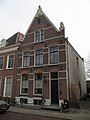
This is a category about rijksmonument number 13008
|
| Address |
|
Media in category "Koepoortstraat 28, Doesburg"
The following 7 files are in this category, out of 7 total.
-
 Doesburg, Netherlands - panoramio (114).jpg 4,896 × 3,264; 3.76 MB
-
 Doesburg, Netherlands - panoramio (186).jpg 4,896 × 3,264; 6.27 MB
-
 Doesburg, Netherlands - panoramio (46).jpg 2,048 × 1,148; 557 KB
-
 Doesburg, Netherlands - panoramio (57).jpg 1,148 × 2,048; 449 KB
-
 Koepoortstr. naar het noorden, overzicht - Doesburg - 20057866 - RCE.jpg 1,200 × 816; 243 KB
-
 RM13008 Doesburg - Koepoortstraat 28.jpg 1,944 × 2,592; 1.12 MB
-
 Voorgevels - Doesburg - 20058206 - RCE.jpg 803 × 1,200; 154 KB
.jpg)
.jpg)
.jpg)
.jpg)

