Category:Kita-ku, Kumamoto
Jump to navigation
Jump to search

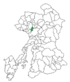
English: Kita-ku is one of the five wards of Kumamoto City, Japan.
日本語: 熊本市北区に関するカテゴリ
| Object location | | View all coordinates using: OpenStreetMap |
|---|
one of the five wards of the City of Kumamoto, Japan  | |||||
| Upload media | |||||
| Instance of | |||||
|---|---|---|---|---|---|
| Location | |||||
| Population |
| ||||
| Area |
| ||||
| official website | |||||
 | |||||
Subcategories
This category has the following 10 subcategories, out of 10 total.
B
J
- Jakushin-san no Kusu (3 F)
K
- Kita Ward Office (Kumamoto) (4 F)
- Kitakumamoto Service Area (7 F)
P
S
T
U
Media in category "Kita-ku, Kumamoto"
The following 85 files are in this category, out of 85 total.
-
 2016 Kumamoto earthquake Best Denki Kitakumamoto.JPG 3,264 × 2,448; 1.52 MB
-
 Aerial photographs of Ueki interchange.jpg 1,500 × 1,800; 1.68 MB
-
 Asahino Hospital.JPG 2,560 × 1,920; 961 KB
-
 Fukuoka pref road and Kumamoto pref road 3-1.JPG 3,264 × 2,448; 2.46 MB
-
 Fukuoka pref road and Kumamoto pref road 3-2.JPG 3,264 × 2,448; 1.89 MB
-
 Hakenomiya fountainhead 1.jpg 800 × 600; 231 KB
-
 Hayabusa-Full1.JPG 640 × 370; 134 KB
-
 Hokubu Kumamoto map.png 341 × 401; 11 KB
-
 Hokubu-Kumamoto memolial.JPG 3,264 × 2,448; 2.93 MB
-
 Japan National Route 3 near Kita-Kumamoto Station 2.jpg 3,956 × 2,967; 2.49 MB
-
 Japan National Route 3 near Kita-Kumamoto Station 3.jpg 3,942 × 2,957; 2.26 MB
-
 Japan National Route 3 near Kita-Kumamoto Station.jpg 3,996 × 2,997; 2.61 MB
-
 JOZH-TV Kumamoto 2011.JPG 1,664 × 1,248; 513 KB
-
 Kaketsuken.JPG 3,264 × 2,448; 1.43 MB
-
 Kitakumamoto-kamei.jpg 800 × 600; 192 KB
-
 KM Biologics.JPG 2,546 × 1,804; 492 KB
-
 Kumamoto Chuo Fire Station Hokubu branch.JPG 3,264 × 2,448; 1.81 MB
-
 Kumamoto health science univercity building 2.jpg 800 × 450; 238 KB
-
 Kumamoto International Folk Craft Museum.jpg 2,000 × 1,252; 719 KB
-
 Kumamoto Kita By-pass Shinsuya.jpg 2,000 × 1,329; 375 KB
-
 Kumamoto Kita Fire Station Kusunoki Branch.JPG 3,264 × 2,448; 1.76 MB
-
 Kumamoto Kita Fire Station Shimizu Branch.JPG 3,264 × 2,448; 1.86 MB
-
 Kumamoto Kita Fire Station.JPG 2,816 × 2,112; 1.29 MB
-
 Kumamoto Konyusha.JPG 3,264 × 2,448; 1.82 MB
-
 Kumamoto pref road 207.JPG 2,448 × 3,264; 2.49 MB
-
 Kumamoto pref road 231-2.JPG 3,264 × 2,448; 2.11 MB
-
 Kumamoto pref road 231-3.JPG 2,448 × 3,264; 1.62 MB
-
 Kumamoto pref road 231-4.JPG 3,264 × 2,448; 2.5 MB
-
 Kumamoto pref road 231.JPG 3,264 × 2,448; 1.92 MB
-
 Kumamoto pref road 329-1.JPG 3,264 × 2,448; 1.77 MB
-
 Kumamoto pref road 337-2.JPG 3,264 × 2,448; 1.84 MB
-
 Kumamoto pref road 337.JPG 3,264 × 2,448; 2.2 MB
-
 Kumamoto prefectural roads 207 Kikuyo-Kumamoto border.JPG 3,264 × 2,448; 1.64 MB
-
 Kumamoto prefectural roads 207 Kumamoto-Kikuyo border.JPG 3,264 × 2,448; 2.05 MB
-
 Kumamoto prefectural roads 329 Kikuchi-Kumamoto border.JPG 3,264 × 2,448; 1.97 MB
-
 Kumamoto prefectural roads 337 Kikuyo-Kumamoto border.JPG 2,448 × 3,264; 2.37 MB
-
 Kumamoto prefectural roads 337 Kumamoto-Kikuyo border.JPG 2,448 × 3,264; 1.55 MB
-
 Kumamoto Seijo Hospital 2021.jpg 2,280 × 1,479; 679 KB
-
 Kumamoto Seijo Hospital.JPG 2,560 × 1,850; 518 KB
-
 Kumamotodentetsu 5101A 1.jpg 800 × 450; 154 KB
-
 Kumamotodentetsu 5101A 2.jpg 800 × 600; 182 KB
-
 Kumamotodentetsu 5102A 1.jpg 800 × 450; 158 KB
-
 Kumamotodentetsu 5102A 2.jpg 800 × 600; 153 KB
-
 Kumamotodentetsu 6231A.jpg 800 × 600; 202 KB
-
 Kumamotodentetsu type6000.jpg 800 × 450; 183 KB
-
 Kusunoki housing development.jpg 2,000 × 1,256; 425 KB
-
 Kyushu EXP Kumamoto Shirakawa.jpg 2,312 × 1,244; 966 KB
-
 Kyushu Expressway Kita Kumamoto SIC.JPG 2,560 × 1,920; 739 KB
-
 Kyushu Expressway near Kita-Kumamoto Service Area.jpg 3,888 × 2,916; 1.88 MB
-
 Manhole cover of Hokubu, Kumamoto 2.JPG 3,264 × 2,448; 3.64 MB
-
 Manhole cover of Hokubu, Kumamoto.JPG 3,264 × 2,448; 2.99 MB
-
 Mimagenoumagoya 1.JPG 3,264 × 2,448; 1.74 MB
-
 Mimagenoumagoya 2.JPG 3,264 × 2,448; 2.43 MB
-
 Mimagenoumagoya 3.JPG 3,264 × 2,448; 1.6 MB
-
 Musashiduka.jpg 407 × 336; 47 KB
-
 Musashigaoka basstop.jpg 640 × 480; 113 KB
-
 Musashigaoka Bus Stop to Fukuoka.jpg 2,000 × 1,276; 488 KB
-
 Musashigaoka Bus Stop to Kagoshim,a.jpg 2,000 × 1,306; 469 KB
-
 MusashigaokaChurch.jpg 2,048 × 1,528; 600 KB
-
 Musashizuka park.JPG 375 × 500; 61 KB
-
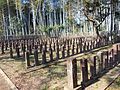 Nanamoto Imperial Army Cemetery.jpg 2,592 × 1,944; 1.12 MB
-
 Nanamoto Kakinokidaiba Cemetery for Satsuma Soldiers 01.jpg 2,592 × 1,764; 954 KB
-
 Nanamoto Kakinokidaiba Cemetery for Satsuma Soldiers 02.jpg 2,452 × 1,712; 624 KB
-
 National road Route3 kumamoto-Kita By-Pass tatsuda-jinnai kumamoto 1.jpg 800 × 600; 220 KB
-
 Nishisato Station front 2.JPG 800 × 450; 132 KB
-
 Route 387 Koshi-Kumamoto border.JPG 3,264 × 2,448; 1.59 MB
-
 Route 57 Kikuyo-Kumamoto border.JPG 3,264 × 2,448; 1.37 MB
-
 Route 57 Kumamoto-Kikuyo border.JPG 3,264 × 2,448; 1.62 MB
-
 Route 57 Yuge Intersection.JPG 3,264 × 2,448; 1.59 MB
-
 Route57 ja Kumamoto Yuge.JPG 2,121 × 1,591; 943 KB
-
 Sojo Univ2.JPG 3,264 × 2,448; 1.67 MB
-
 Sugihon.jpg 1,046 × 557; 410 KB
-
 Sunlive Shimizu 2020.JPG 2,222 × 1,433; 558 KB
-
 Tatsutaguchi Station front 1.JPG 800 × 600; 284 KB
-
 Tsuboigawa-river Green Space.JPG 800 × 600; 196 KB
-
 Ueki Hospital.JPG 3,264 × 2,448; 1.93 MB
-
 UekiBS.jpg 2,560 × 1,920; 3.33 MB
-
 Yugejinjya.jpg 448 × 312; 94 KB
-
 ショッピングプラザウエッキー.jpg 2,816 × 2,112; 1.26 MB
-
 ニッセイ熊本の森 - panoramio.jpg 3,664 × 2,748; 2.19 MB
-
 夕焼け - panoramio (5).jpg 3,264 × 2,448; 4.28 MB
-
 小萩 - panoramio.jpg 3,664 × 2,748; 2.82 MB
-
 龍田公園2.JPG 350 × 263; 61 KB
-
 龍田公園3.JPG 350 × 263; 51 KB
-
 龍田公園5.JPG 256 × 350; 65 KB


.jpg)


