Category:Kirchnerschule
Jump to navigation
Jump to search
| Object location | | View all coordinates using: OpenStreetMap |
|---|
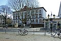
This is the category of the Hessian Kulturdenkmal (cultural monument) with the ID 154679 (Wikidata)
|
| Upload media | |||||
| Instance of | |||||
|---|---|---|---|---|---|
| Location | Frankfurt, Darmstadt Government Region, Hesse, Germany | ||||
| Heritage designation | |||||
 | |||||
Media in category "Kirchnerschule"
The following 3 files are in this category, out of 3 total.
-
 Frankfurt, Berger Straße, Kirchnerschule.jpg 7,019 × 3,200; 17.97 MB
-
 Frankfurt, Löwengasse, Kirchnerschule.JPG 4,920 × 3,256; 9.21 MB
-
 Kirchner-schule-ffm001.jpg 2,855 × 1,952; 1.47 MB


