Category:Kingsland, Herefordshire
Jump to navigation
Jump to search
village in Herefordshire, England, UK  | |||||
| Upload media | |||||
| Instance of | |||||
|---|---|---|---|---|---|
| Location | Herefordshire, West Midlands, England | ||||
 | |||||
Cymraeg: Pentref yn Swydd Henffordd, Gorllewin Canolbarth Lloegr, Lloegr ydy Kingsland, Herefordshire.
English: Kingsland is a small village and civil parish in the English county of Herefordshire. It is located north-west of Leominster. The population of the civil parish at the 2011 census was 986.
Français : Kingsland est un village anglaise situeé dans le comté d' Herefordshire, à 5 km au nord-ouest de Leominster. Derrière de l'eglise, il y a les vestiges d'une motte castrale.
Polski: Kingsland – wieś i civil parish w Anglii, w hrabstwie Herefordshire. W 2011 roku civil parish liczyła 986 mieszkańców. Kingsland jest wspomniana w Domesday Book (1086) jako Lene.

Subcategories
This category has the following 6 subcategories, out of 6 total.
Media in category "Kingsland, Herefordshire"
The following 200 files are in this category, out of 276 total.
(previous page) (next page)-
 "There is a lot of water about" - geograph.org.uk - 3273856.jpg 640 × 480; 282 KB
-
 'Hazeldene' - Shirl Heath, Herefordshire - geograph.org.uk - 365904.jpg 640 × 480; 127 KB
-

-

-
 A winding English road - geograph.org.uk - 1814763.jpg 640 × 480; 165 KB
-
 A4110 by Arrow Mill - geograph.org.uk - 5606227.jpg 1,600 × 1,000; 759 KB
-
 A4110 east of Longmoor - geograph.org.uk - 3738843.jpg 3,423 × 2,495; 1.06 MB
-
 A4110 enters Shirl Heath - geograph.org.uk - 3738217.jpg 3,760 × 2,281; 1.05 MB
-
 A4110 junction with Hereford Lane - geograph.org.uk - 3739429.jpg 3,484 × 2,414; 836 KB
-
 A4110 junction with Hereford Lane - geograph.org.uk - 4276360.jpg 1,024 × 767; 117 KB
-
 A4110 junction with un-named lane to Cobnash - geograph.org.uk - 3738853.jpg 3,417 × 2,435; 1.42 MB
-
 A4110 north of Kingsland - geograph.org.uk - 2144379.jpg 640 × 480; 32 KB
-
 A4110 north of Kingsland - geograph.org.uk - 2555711.jpg 640 × 480; 106 KB
-
 A4110 passes entrance to Mortimer Park - geograph.org.uk - 3739437.jpg 3,473 × 2,517; 980 KB
-
 A4110 passes Showers Cottage - geograph.org.uk - 3738874.jpg 3,366 × 2,491; 1.16 MB
-
 A4110, Lawton Cross - geograph.org.uk - 4423877.jpg 800 × 533; 406 KB
-
 Access Track To Club Hall - geograph.org.uk - 1758968.jpg 640 × 480; 181 KB
-
 Angel House (Kingsland) - geograph.org.uk - 5689950.jpg 3,264 × 2,448; 1.72 MB
-
 Angel House (Viewed from Millennium Green ^ Kingsland) - geograph.org.uk - 5689952.jpg 3,264 × 2,448; 2.47 MB
-
 Angel House, Kingsland - geograph.org.uk - 2183945.jpg 3,896 × 2,181; 5.09 MB
-
 Apple orchard - geograph.org.uk - 5050071.jpg 800 × 531; 164 KB
-
 Apple orchard in early May near Ledicot - geograph.org.uk - 2932941.jpg 4,752 × 3,168; 4.43 MB
-
 Approaching Basket's Gate Crossroads - geograph.org.uk - 1758957.jpg 640 × 480; 127 KB
-
 Approaching the Kingsland crossroads - geograph.org.uk - 5629039.jpg 1,600 × 901; 654 KB
-
 Approaching Whitehouse Aston - geograph.org.uk - 5158650.jpg 800 × 600; 156 KB
-
 Arrow Bridge - geograph.org.uk - 4423886.jpg 800 × 533; 463 KB
-
 Arrow Bridge over the River Arrow in Arrow Green - geograph.org.uk - 4276403.jpg 1,024 × 768; 156 KB
-
 Arrow Bridge, Arrow Green - geograph.org.uk - 3381727.jpg 4,320 × 3,240; 3.02 MB
-
 Aston Lane - geograph.org.uk - 1758973.jpg 640 × 480; 138 KB
-
 B4360 at Cobnash - geograph.org.uk - 2144238.jpg 640 × 480; 61 KB
-
 B4360 at Cobnash - geograph.org.uk - 2555677.jpg 640 × 480; 164 KB
-
 B4360 at the Wesleyan Chapel - geograph.org.uk - 2555704.jpg 640 × 480; 148 KB
-
 B4360 junction west of Mousenatch Farm - geograph.org.uk - 3812592.jpg 3,648 × 2,736; 1.7 MB
-
 B4360 Langford - geograph.org.uk - 1248532.jpg 640 × 480; 89 KB
-
 B4360 near Holgate Farm - geograph.org.uk - 2555691.jpg 640 × 480; 111 KB
-
 B4360 passes The Poor House - geograph.org.uk - 3812582.jpg 3,648 × 2,736; 1.72 MB
-
 B4360 towards Kingsland - geograph.org.uk - 5679430.jpg 1,600 × 901; 669 KB
-
 B4360, Cobnash - geograph.org.uk - 2144260.jpg 640 × 480; 77 KB
-
 B4360, Kingsland - geograph.org.uk - 2144320.jpg 640 × 480; 38 KB
-
 B4529 looking towards Lawton - geograph.org.uk - 4276399.jpg 1,600 × 1,200; 1.4 MB
-
 B4529 northeast of Lawton Marsh - geograph.org.uk - 3738049.jpg 3,224 × 2,289; 1.13 MB
-
 Bell Inn (Kingsland) - geograph.org.uk - 5689886.jpg 3,264 × 2,448; 1.56 MB
-
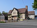
 Black and white buildings in Kingsland - geograph.org.uk - 4276374.jpg 1,024 × 768; 129 KB
-
 Blackthorn - geograph.org.uk - 5210127.jpg 1,024 × 683; 492 KB
-
 Blocked off gate - geograph.org.uk - 4413550.jpg 800 × 533; 447 KB
-
 Border Oak Designs Offices (Kingsland) - geograph.org.uk - 5689870.jpg 3,264 × 2,448; 2.26 MB
-

-
 Brick and timber house in Kingsland - geograph.org.uk - 4276365.jpg 1,024 × 769; 125 KB
-
 Bridge parapet - geograph.org.uk - 4909825.jpg 2,048 × 1,536; 1.6 MB
-
 Bridge parapet for Pinsley Brook - geograph.org.uk - 4276380.jpg 1,024 × 769; 185 KB
-
 Brook Bridge - geograph.org.uk - 388281.jpg 640 × 480; 151 KB
-
 Brook Bridge - geograph.org.uk - 6210837.jpg 1,024 × 683; 189 KB
-
 Brook Bridge near Kingsland - geograph.org.uk - 2932932.jpg 4,752 × 3,168; 3.47 MB
-
 Bungalows along the B4360, Kingsland - geograph.org.uk - 2555707.jpg 640 × 480; 141 KB
-
 Calves near Basket's Gate - geograph.org.uk - 2382102.jpg 640 × 480; 282 KB
-
 Cattle, Shirl Heath - geograph.org.uk - 2691859.jpg 640 × 480; 96 KB
-
 Cereal crop - geograph.org.uk - 802676.jpg 640 × 480; 94 KB
-
 Cider apple orchard - geograph.org.uk - 5631530.jpg 1,600 × 901; 708 KB
-
 Cobnash Industrial Estate - geograph.org.uk - 5632232.jpg 1,600 × 901; 701 KB
-
 Cobnash Mill - geograph.org.uk - 5679428.jpg 1,600 × 901; 672 KB
-
 Concrete farm track - geograph.org.uk - 5632178.jpg 1,600 × 901; 642 KB
-
 Corners Inn, Kingsland - geograph.org.uk - 3277076.jpg 640 × 480; 259 KB
-
 Corners Inn, Kingsland - geograph.org.uk - 5629037.jpg 1,600 × 901; 708 KB
-
 Country Lane near Cobnash - geograph.org.uk - 2144304.jpg 640 × 480; 114 KB
-
 Country Track near Cobnash - geograph.org.uk - 2144293.jpg 640 × 480; 90 KB
-
 Course of old railway, Kingsland - geograph.org.uk - 4028181.jpg 3,872 × 2,592; 4.78 MB
-
 Cultivated field north of the Lugg - geograph.org.uk - 5632163.jpg 1,600 × 901; 686 KB
-
 Drive to Arrow Mill - geograph.org.uk - 5637560.jpg 1,600 × 901; 702 KB
-
 Drumlin near Yarpole - geograph.org.uk - 2382109.jpg 640 × 480; 269 KB
-
 Eardisland, that way - geograph.org.uk - 1814765.jpg 640 × 480; 80 KB
-
 Entrance to Kingsland - geograph.org.uk - 3240538.jpg 640 × 453; 60 KB
-
 Farm Buildings at Lawton - geograph.org.uk - 1814766.jpg 640 × 480; 157 KB
-
 Farm buildings in Cobnash - geograph.org.uk - 2555680.jpg 640 × 480; 188 KB
-
 Farm track - geograph.org.uk - 944636.jpg 640 × 480; 99 KB
-
 Field at Cobnash - geograph.org.uk - 2144252.jpg 640 × 480; 56 KB
-
 Field off the track to Mousenatch - geograph.org.uk - 2555689.jpg 640 × 480; 174 KB
-
 Field out of use - geograph.org.uk - 3273866.jpg 640 × 480; 317 KB
-
 Fields at Cobnash - geograph.org.uk - 2144282.jpg 640 × 480; 40 KB
-
 Fields near Cobnash - geograph.org.uk - 2144310.jpg 640 × 480; 66 KB
-
 Finger post at Brook Bridge - geograph.org.uk - 5631540.jpg 1,600 × 901; 653 KB
-
 Flooded gateway - geograph.org.uk - 3273848.jpg 640 × 480; 287 KB
-
 Former Bell Inn, Kingsland - geograph.org.uk - 1957779.jpg 4,197 × 2,160; 5.49 MB
-
 Former Bell Inn, Kingsland - geograph.org.uk - 1957782.jpg 3,231 × 2,407; 5.8 MB
-
 Formerly pollarded tree in Shirl Heath - geograph.org.uk - 4276389.jpg 1,024 × 769; 178 KB
-
 Gathering pens, Aston (Eyton) - geograph.org.uk - 2381158.jpg 640 × 480; 287 KB
-
 Give Way^ - geograph.org.uk - 1814764.jpg 640 × 480; 197 KB
-
 Grassland on the Lugg floodplain. - geograph.org.uk - 5631532.jpg 1,600 × 901; 629 KB
-
 Hereford Lane at Lower Cross Farm - geograph.org.uk - 2931252.jpg 4,752 × 3,168; 3.69 MB
-
 Hereford Lane, near Kingsland - geograph.org.uk - 2144358.jpg 640 × 480; 45 KB
-
 In the footsteps of the Romans - geograph.org.uk - 2555762.jpg 640 × 480; 186 KB
-
 Inlet sluice at Arrow Mill - geograph.org.uk - 2953080.jpg 640 × 480; 83 KB
-
 Kingsland Castle (Kingsland) - geograph.org.uk - 5689834.jpg 3,264 × 2,448; 3.14 MB
-
 Kingsland Castle (Kingsland) - geograph.org.uk - 5689847.jpg 3,264 × 2,448; 2.72 MB
-
 Kingsland Castle (Kingsland) - geograph.org.uk - 5689851.jpg 3,264 × 2,448; 1.95 MB
-
 Kingsland Church of England Primary School - geograph.org.uk - 5689931.jpg 3,264 × 2,448; 1.76 MB
-
 Kingsland Farm - panoramio.jpg 800 × 533; 54 KB
-
 Kingsland fire station - geograph.org.uk - 266844.jpg 640 × 426; 253 KB
-
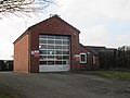 Kingsland Fire Station - geograph.org.uk - 5689858.jpg 3,264 × 2,448; 1.79 MB
-
 Kingsland Fire Station - geograph.org.uk - 5689863.jpg 3,264 × 2,448; 1.91 MB
-
 Kingsland Methodist Church (Wesleyan Chapel) - geograph.org.uk - 5689917.jpg 3,264 × 2,448; 2.17 MB
-
 Kingsland Post Office (Viewed from Millennium Green) - geograph.org.uk - 5689959.jpg 3,264 × 2,448; 1.76 MB
-
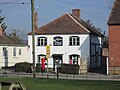
 Kingsland post office - geograph.org.uk - 2555697.jpg 640 × 480; 162 KB
-
 Kingsland Post Office - geograph.org.uk - 5689947.jpg 3,264 × 2,448; 1.88 MB
-
 Kingsland Post Office ^ Angel House (Kingsland) - geograph.org.uk - 5689982.jpg 3,264 × 2,448; 1.88 MB
-
 Kingsland Railway Station - geograph.org.uk - 5689867.jpg 3,264 × 2,448; 1.86 MB
-
 Kingsland Railway Station - geograph.org.uk - 5770631.jpg 1,920 × 1,080; 1.02 MB
-
 Kingsland Sawmills, near Leonminster - geograph.org.uk - 2747636.jpg 640 × 480; 68 KB
-
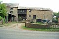
 Kingsland stables and Border Oak sawmills - geograph.org.uk - 4909837.jpg 2,048 × 1,536; 1.59 MB
-
 Kingsland Village Hall (Viewed from Kingsland Castle) - geograph.org.uk - 5689854.jpg 3,264 × 2,448; 2.34 MB
-
 Kingsland, Crossroads - geograph.org.uk - 4560148.jpg 4,608 × 3,456; 6.26 MB
-

-

-

-

-

-

-

-

-

-

-

-

-

-
-

-

-
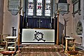 Kingsland, St. Michael and All Angels Church, The altar - geograph.org.uk - 6159951.jpg 6,995 × 4,663; 6.78 MB
-

-
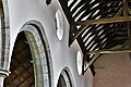
 Kingsland, St. Michael and All Angels Church, The nave - geograph.org.uk - 6159943.jpg 5,807 × 3,871; 4.15 MB
-
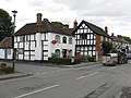
 Kingsland, The 'Corners Inn' - geograph.org.uk - 4560140.jpg 4,608 × 3,456; 6.35 MB
-
 Kingsland, The 'Corners Inn' - geograph.org.uk - 4560143.jpg 4,608 × 3,456; 6.4 MB
-
 Kingsland, village store-post office - geograph.org.uk - 2201167.jpg 640 × 480; 69 KB
-
 Knapp Farm, Aston - geograph.org.uk - 1758980.jpg 640 × 480; 143 KB
-
 Lambs, Street - geograph.org.uk - 5210124.jpg 1,024 × 683; 381 KB
-
 Lane at Cobnash - geograph.org.uk - 2144272.jpg 640 × 480; 75 KB
-
 Lane from Street Court - geograph.org.uk - 2581009.jpg 2,048 × 1,536; 1.99 MB
-
 Lane from Street court - geograph.org.uk - 944640.jpg 640 × 480; 102 KB
-
 Lane junction near Vernalls Cottage - geograph.org.uk - 2555758.jpg 640 × 480; 138 KB
-
 Lane Junction South Of Aston - geograph.org.uk - 1758986.jpg 640 × 480; 148 KB
-
 Lane near Becknell House - geograph.org.uk - 5632243.jpg 1,600 × 901; 675 KB
-
 Lane To Bicton Near Croft Castle - geograph.org.uk - 1759059.jpg 640 × 480; 205 KB
-
 Lane to Eyton - geograph.org.uk - 5632182.jpg 1,600 × 901; 623 KB
-
 Lane to Lugg Green - geograph.org.uk - 5632177.jpg 1,600 × 901; 720 KB
-
 Lawton Cross - geograph.org.uk - 4413561.jpg 800 × 533; 327 KB
-
 Lawton Cross - geograph.org.uk - 4423865.jpg 800 × 533; 390 KB
-
 Lawton Summit - geograph.org.uk - 1814767.jpg 640 × 480; 172 KB
-
 Lawton's Cross - geograph.org.uk - 3273863.jpg 640 × 480; 235 KB
-
 Longford, Kingsland - geograph.org.uk - 3628620.jpg 640 × 480; 316 KB
-
 Looking east from Hazeldene - geograph.org.uk - 2581010.jpg 2,048 × 1,536; 1.93 MB
-

-
 Luctonians club house - geograph.org.uk - 5632118.jpg 1,600 × 902; 599 KB
-
 Luctonians RFC - geograph.org.uk - 3573759.jpg 640 × 480; 199 KB
-
 Luctonians rugby ground - geograph.org.uk - 5632115.jpg 1,600 × 901; 626 KB
-
 Lugg flood plain - geograph.org.uk - 2459303.jpg 640 × 359; 202 KB
-
 Lugg flood plain - geograph.org.uk - 3277069.jpg 640 × 480; 273 KB
-
 Lugg flood plain - geograph.org.uk - 4413391.jpg 800 × 533; 311 KB
-
 Lugg Green Road - geograph.org.uk - 3273401.jpg 640 × 480; 287 KB
-
 Lugg Valley Fieldscape - geograph.org.uk - 1759004.jpg 640 × 480; 182 KB
-
 Main access to Street Court - geograph.org.uk - 2581006.jpg 2,048 × 1,536; 2.41 MB
-
 Markhams Garage Ltd. (Kingsland) - geograph.org.uk - 5689937.jpg 3,264 × 2,448; 1.96 MB
-
 Middle Barns - geograph.org.uk - 5210117.jpg 1,024 × 683; 309 KB
-
 Millennium Green (Kingsland) (geograph 5689967).jpg 3,264 × 2,448; 2.23 MB
-
-
 Modern farm track - geograph.org.uk - 5632242.jpg 1,600 × 901; 664 KB
-
 Molehills, Kingsland - geograph.org.uk - 3273829.jpg 640 × 480; 337 KB
-
 Morris minor at Shirl Heath - geograph.org.uk - 5637543.jpg 1,600 × 901; 723 KB
-
 Motte and Bailey, Kingsland - geograph.org.uk - 61969.jpg 640 × 480; 86 KB
-
 Motte in the village of Kingsland - geograph.org.uk - 363638.jpg 640 × 426; 138 KB
-
 New Housing Completed (Kingsland) - geograph.org.uk - 5784352.jpg 4,096 × 2,160; 3.58 MB
-
 New Housing Completed (Kingsland) - geograph.org.uk - 5784358.jpg 4,096 × 2,835; 4.71 MB
-
 New Housing Completed (Kingsland) - geograph.org.uk - 5796561.jpg 4,096 × 3,072; 5.27 MB
-
 New Housing Development (Kingsland) - geograph.org.uk - 5689922.jpg 3,264 × 2,448; 2.72 MB
-
 New Housing Development (Kingsland) - geograph.org.uk - 5689925.jpg 3,264 × 2,448; 1.84 MB
-
 New Housing Development (Kingsland) - geograph.org.uk - 5689928.jpg 3,264 × 2,448; 2.21 MB
-
 No More Phone Box - geograph.org.uk - 1758977.jpg 640 × 480; 209 KB
-
 Oak tree - geograph.org.uk - 5632173.jpg 1,600 × 901; 588 KB
-
 Oak tree at a lane junction - geograph.org.uk - 5631525.jpg 1,600 × 901; 699 KB
-
 Oak tree in pasture - geograph.org.uk - 5632168.jpg 1,600 × 901; 680 KB
-
 Oaker Wood - geograph.org.uk - 2382118.jpg 640 × 480; 386 KB
-
 Oaker Wood - geograph.org.uk - 2382127.jpg 640 × 480; 335 KB
-
 Oaks, early November morning - geograph.org.uk - 5606223.jpg 1,600 × 735; 683 KB
-
 Oilseed rape crop - geograph.org.uk - 2691865.jpg 640 × 480; 76 KB
-
 One week after the super moon (geograph 5679426).jpg 1,600 × 901; 680 KB
-
 Orchard near Kingsland - geograph.org.uk - 3273397.jpg 640 × 480; 269 KB
-
 Orchard trees - geograph.org.uk - 802662.jpg 640 × 480; 125 KB
-
 Orchard, Cobnash - geograph.org.uk - 3628630.jpg 640 × 480; 328 KB
-
 Orchard, Lime - geograph.org.uk - 5210107.jpg 1,024 × 683; 431 KB
-
 Orchard, Street - geograph.org.uk - 5210109.jpg 1,024 × 683; 353 KB
-
 Park House (Kingsland) - geograph.org.uk - 5689878.jpg 3,264 × 2,448; 2.18 MB
-
 Pasture near Halford Hall - geograph.org.uk - 2382093.jpg 640 × 480; 275 KB
-
 Path through a tree - geograph.org.uk - 3628625.jpg 480 × 640; 115 KB
-
 Peaceful pastures, 2017 - geograph.org.uk - 5631509.jpg 1,600 × 901; 647 KB
-
 Pinsley Brook - geograph.org.uk - 4413387.jpg 800 × 533; 430 KB
-
 Pinsley Brook from Brook Bridge near Kingsland - geograph.org.uk - 2932136.jpg 4,752 × 3,168; 4.85 MB
-
 Plant stall - geograph.org.uk - 2381145.jpg 640 × 480; 378 KB
-
 Ploughed field opposite Knapp Farm - geograph.org.uk - 5158656.jpg 800 × 600; 158 KB
-

-
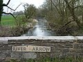
 River Arrow - geograph.org.uk - 4413574.jpg 800 × 533; 428 KB
-
 River Arrow - geograph.org.uk - 4423893.jpg 800 × 533; 407 KB
-
 River Arrow - geograph.org.uk - 4909834.jpg 2,048 × 1,536; 1 MB


_-_geograph.org.uk_-_5689950.jpg)
_-_geograph.org.uk_-_5689952.jpg)


_-_geograph.org.uk_-_5689886.jpg)


_-_geograph.org.uk_-_5689870.jpg)


_-_geograph.org.uk_-_2381158.jpg)


_-_geograph.org.uk_-_5689834.jpg)
_-_geograph.org.uk_-_5689847.jpg)
_-_geograph.org.uk_-_5689851.jpg)


_-_geograph.org.uk_-_5689917.jpg)
_-_geograph.org.uk_-_5689959.jpg)


_-_geograph.org.uk_-_5689982.jpg)


_-_geograph.org.uk_-_5689854.jpg)


_-_geograph.org.uk_-_5689937.jpg)

_(geograph_5689967).jpg)
_-_geograph.org.uk_-_5689988.jpg)


_-_geograph.org.uk_-_5784352.jpg)
_-_geograph.org.uk_-_5784358.jpg)
_-_geograph.org.uk_-_5796561.jpg)
_-_geograph.org.uk_-_5689922.jpg)
_-_geograph.org.uk_-_5689925.jpg)
_-_geograph.org.uk_-_5689928.jpg)


.jpg)


_-_geograph.org.uk_-_5689878.jpg)


