Category:Kings Park Road
Jump to navigation
Jump to search
road in Perth, Western Australia | |||||
| Upload media | |||||
| Instance of | |||||
|---|---|---|---|---|---|
| Location |
| ||||
 | |||||
Kings Park Road is a street in West Perth, Western Australia, spanning the suburb's southern boundary. It continues westward onto Bagot Road, Subiaco, and eastward onto Malcolm Street and St Georges Terrace, Perth.
Subcategories
This category has the following 2 subcategories, out of 2 total.
D
- Dumas House (5 F)
N
Media in category "Kings Park Road"
The following 6 files are in this category, out of 6 total.
-
 CoP ticket machine Kings Park Rd.jpg 4,624 × 3,468; 9.29 MB
-
 Kings Park Rd building cnr Colin.jpg 4,624 × 3,468; 5.97 MB
-
 Kings Park Rd E from Colin.jpg 4,624 × 3,462; 4.15 MB
-
 Kings Park Rd W from Colin.jpg 4,624 × 3,468; 7.7 MB
-
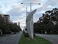 Perth welcome - Kings Park Road 1.jpg 1,600 × 1,200; 479 KB
-
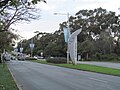 Perth welcome - Kings Park Road 2.jpg 1,600 × 1,200; 691 KB


