Category:Kinfauns (civil parish)
Jump to navigation
Jump to search
Scottish parish in Perth and Kinross, Scotland, UK | |||||
| Upload media | |||||
| Instance of | |||||
|---|---|---|---|---|---|
| Part of |
| ||||
| Location |
| ||||
| Population |
| ||||
| Area |
| ||||
 | |||||
Subcategories
This category has the following 5 subcategories, out of 5 total.
Media in category "Kinfauns (civil parish)"
The following 200 files are in this category, out of 243 total.
(previous page) (next page)-
 A lot of hedge to trim - geograph.org.uk - 3239735.jpg 1,933 × 1,351; 1.14 MB
-
 A view from the road past 'Tay View' - geograph.org.uk - 5018654.jpg 4,599 × 3,449; 3.55 MB
-
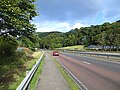
 A90 and Kinnoull Hill - geograph.org.uk - 2821167.jpg 1,920 × 2,252; 1.37 MB
-
 A90 approaching Kinfauns Junction - geograph.org.uk - 6134687.jpg 800 × 533; 681 KB
-
 A90 approaching Kinfauns Junction - geograph.org.uk - 6134797.jpg 800 × 533; 576 KB
-
 A90 approaching Layby near Kinfauns - geograph.org.uk - 6134672.jpg 800 × 533; 659 KB
-
 A90 by the turning for Kinfauns Castle - geograph.org.uk - 2280229.jpg 1,024 × 763; 140 KB
-
 A90 from Kinnoull Hill - geograph.org.uk - 5492444.jpg 5,184 × 3,888; 4.54 MB
-
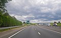
 A90 near Perth - geograph.org.uk - 6134178.jpg 800 × 600; 784 KB
-
 A90 Southbound - geograph.org.uk - 6134808.jpg 800 × 533; 506 KB
-
 A90, approaching Kinfauns - geograph.org.uk - 4149958.jpg 800 × 450; 281 KB
-
 A90, Kinfauns - geograph.org.uk - 4149942.jpg 800 × 600; 389 KB
-
 A90, Kinfauns - geograph.org.uk - 4505526.jpg 800 × 600; 481 KB
-
 A90, Tofthill - geograph.org.uk - 4507370.jpg 800 × 600; 462 KB
-
 Agricultural Tayside by Kinfauns - geograph.org.uk - 1990590.jpg 2,560 × 1,920; 1.86 MB
-
 Anchor on the gatepost - geograph.org.uk - 4058120.jpg 1,536 × 2,048; 1.13 MB
-
 Approaching access to Tofthill Farm - geograph.org.uk - 2761935.jpg 2,018 × 1,078; 251 KB
-
 Approaching Burnfoot - geograph.org.uk - 4428533.jpg 4,601 × 2,763; 2.26 MB
-
-
 Arable land beside the Kinfauns junction on the A90 - geograph.org.uk - 3548260.jpg 1,600 × 1,105; 337 KB
-
 Arable land, Seggieden - geograph.org.uk - 4149955.jpg 800 × 450; 322 KB
-
 Barley, Glencarse - geograph.org.uk - 2206758.jpg 640 × 480; 118 KB
-
 Beech Woods on Binn Hill - geograph.org.uk - 5611325.jpg 640 × 427; 529 KB
-
 Between the fields - geograph.org.uk - 1976184.jpg 640 × 480; 91 KB
-
 Binn Hill - geograph.org.uk - 2211966.jpg 640 × 480; 109 KB
-
 Binn Hill from Deuchny Hill - geograph.org.uk - 2181416.jpg 1,600 × 1,200; 506 KB
-
 Bridge over the A90 at Kinfauns Junction - geograph.org.uk - 6134691.jpg 800 × 533; 631 KB
-
 Bucky Braes - geograph.org.uk - 2611194.jpg 480 × 640; 65 KB
-

-
 Buildings beside the Tay at Seggieden - geograph.org.uk - 4427613.jpg 1,024 × 681; 234 KB
-
 Burnfoot, Kinfauns - geograph.org.uk - 3517554.jpg 1,024 × 526; 156 KB
-
 Bus Stop on the A90 near Inchyra - geograph.org.uk - 6134812.jpg 800 × 600; 601 KB
-
 Bus stop, Inchyra - geograph.org.uk - 4150125.jpg 800 × 600; 431 KB
-
 C404 at Tayview - geograph.org.uk - 6306683.jpg 5,184 × 3,888; 5.03 MB
-
 Castle Farm - geograph.org.uk - 4056505.jpg 1,960 × 1,423; 485 KB
-
-
 Close-up of Ordnance Survey Bench Mark - geograph.org.uk - 5611314.jpg 640 × 427; 501 KB
-
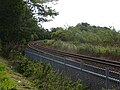
 Closed level crossing - geograph.org.uk - 4507579.jpg 800 × 600; 477 KB
-
 Commonbank Farm - geograph.org.uk - 5612825.jpg 640 × 427; 319 KB
-
 Commonbank Farm - geograph.org.uk - 6306661.jpg 5,184 × 3,888; 6.48 MB
-
 Coronation Path - geograph.org.uk - 5612811.jpg 640 × 427; 415 KB
-
 Coronation Road Footpath at Kinfauns - geograph.org.uk - 6189323.jpg 4,000 × 3,000; 4.35 MB
-
 Cottages near Goukton - geograph.org.uk - 5612814.jpg 640 × 427; 379 KB
-
 Country road at Craignorth - geograph.org.uk - 5701107.jpg 1,024 × 682; 192 KB
-
 Crags of Kinnoull Hill above the A90 - geograph.org.uk - 4529664.jpg 1,024 × 401; 124 KB
-
 Crags, Kinnoull Hill - geograph.org.uk - 2078464.jpg 640 × 480; 139 KB
-
 Crags, Pawns Hill - geograph.org.uk - 2206769.jpg 640 × 359; 106 KB
-
 Crossing point, A90 - geograph.org.uk - 4150136.jpg 800 × 600; 380 KB
-
 Crossing The A85 - geograph.org.uk - 5986821.jpg 640 × 411; 70 KB
-
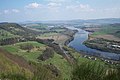
 Deuchny Hill and the River Tay - geograph.org.uk - 3366808.jpg 2,048 × 1,536; 511 KB
-
 Driveway to Glencarse House - geograph.org.uk - 2090693.jpg 640 × 480; 148 KB
-
 Edrington, West Kinfauns - geograph.org.uk - 4530391.jpg 800 × 450; 331 KB
-
 Entrance to Glencarse House - geograph.org.uk - 2090689.jpg 640 × 480; 166 KB
-
 Entry gates and stunning lodge house - geograph.org.uk - 1899474.jpg 640 × 443; 74 KB
-
 Ewes Looking at Me - geograph.org.uk - 5612836.jpg 640 × 427; 363 KB
-
 Farm Buildings at Pepperknowes - geograph.org.uk - 3636434.jpg 640 × 480; 71 KB
-
 Farm track to Hole o' Clean - geograph.org.uk - 5309376.jpg 640 × 480; 81 KB
-
 Farming near Goukton - geograph.org.uk - 1990655.jpg 2,560 × 1,920; 1.84 MB
-

-
 Farmland near Commonbank - geograph.org.uk - 3289453.jpg 1,200 × 797; 463 KB
-

-

-
 Farmland, Inchyra - geograph.org.uk - 4150152.jpg 800 × 600; 422 KB
-
 Field at Burnfoot, Kinfauns - geograph.org.uk - 4876291.jpg 640 × 480; 37 KB
-
 Field at Kinfauns - geograph.org.uk - 3637188.jpg 640 × 480; 43 KB
-
 Field at Sandyhall, Glendoick - geograph.org.uk - 4365355.jpg 640 × 480; 56 KB
-
 Fields at Seggieden - geograph.org.uk - 5636671.jpg 800 × 435; 63 KB
-
 Fields at Seggieden - geograph.org.uk - 5701117.jpg 1,024 × 682; 183 KB
-
 Fields near Glencarse - geograph.org.uk - 5422392.jpg 1,024 × 683; 176 KB
-
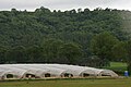
 Fields of plastic - geograph.org.uk - 3239730.jpg 2,034 × 1,310; 1,008 KB
-
 Flowers beside Glendoick House - geograph.org.uk - 3936345.jpg 681 × 1,024; 114 KB
-
 Footbridge in the woods - geograph.org.uk - 3366804.jpg 2,048 × 1,536; 1.28 MB
-
 Forestry Commission Management sign - geograph.org.uk - 4418931.jpg 1,836 × 3,264; 1.12 MB
-
 Friarton Bridge - geograph.org.uk - 2611136.jpg 1,143 × 1,600; 585 KB
-
 Friarton Bridge - geograph.org.uk - 3366104.jpg 2,048 × 1,536; 839 KB
-
 Friarton Bridge - geograph.org.uk - 6368226.jpg 1,024 × 683; 130 KB
-
 From Friarton Bridge - geograph.org.uk - 5986815.jpg 640 × 378; 70 KB
-
 Fundamental benchmark - geograph.org.uk - 2211971.jpg 640 × 480; 110 KB
-
 Glen Carse - geograph.org.uk - 1899327.jpg 640 × 480; 72 KB
-
 Glen Carse - geograph.org.uk - 2206762.jpg 640 × 480; 92 KB
-
 Glen Carse - geograph.org.uk - 2206764.jpg 640 × 359; 77 KB
-

-
-
 Glencarse Hill - geograph.org.uk - 2206766.jpg 640 × 359; 86 KB
-
 Glencarse Hill - geograph.org.uk - 6306531.jpg 5,184 × 3,888; 6.41 MB
-
 Glencarse Hill trig - geograph.org.uk - 1057942.jpg 640 × 480; 123 KB
-
 Glencarse polytunnels - geograph.org.uk - 4017493.jpg 4,608 × 3,456; 3.27 MB
-
 Glencarse Wood on Glencarse Hill - geograph.org.uk - 3636442.jpg 640 × 480; 86 KB
-
 Glendoick - geograph.org.uk - 3511063.jpg 1,024 × 681; 132 KB
-
 Glendoick Gardens - geograph.org.uk - 3936329.jpg 681 × 1,024; 394 KB
-
 Glendoick House - geograph.org.uk - 3936328.jpg 1,024 × 681; 205 KB
-
 Goukton Cottages, Glencarse - geograph.org.uk - 2541102.jpg 800 × 533; 216 KB
-
 Grange of Elcho - geograph.org.uk - 2079977.jpg 480 × 640; 92 KB
-
 Grassland near Pitlowie - geograph.org.uk - 5309637.jpg 640 × 480; 57 KB
-
 Grassland, The Binn - geograph.org.uk - 2211960.jpg 640 × 480; 87 KB
-
 Grazing Near Deuchny Burn - geograph.org.uk - 1446909.jpg 640 × 384; 84 KB
-
 Gun emplacement in the garden - geograph.org.uk - 4056480.jpg 2,048 × 1,536; 1.52 MB
-
 Hairpin bend near Glendoick House - geograph.org.uk - 3289464.jpg 1,200 × 797; 682 KB
-
 Harvesting done in Glencarse - geograph.org.uk - 3636445.jpg 640 × 480; 84 KB
-
 Heading to Perth - geograph.org.uk - 3063335.jpg 640 × 480; 73 KB
-
 Horse drawn ploughing - geograph.org.uk - 1871495.jpg 640 × 423; 53 KB
-
 Horses and traffic - geograph.org.uk - 4056497.jpg 2,048 × 1,536; 1.57 MB
-
 House below Binn Hill, Kinfauns - geograph.org.uk - 5422361.jpg 1,024 × 684; 161 KB
-
 Icehouse at Seggieden - geograph.org.uk - 2369701.jpg 800 × 536; 185 KB
-
 Junction 11, M90 - geograph.org.uk - 2078474.jpg 640 × 480; 127 KB
-
 Junction 11, M90 motorway - geograph.org.uk - 4819948.jpg 2,336 × 3,504; 3.61 MB
-
 Kinfauns Junction - geograph.org.uk - 1990577.jpg 2,560 × 1,920; 1.72 MB
-
 Kinfauns junction overpass - geograph.org.uk - 4445802.jpg 3,210 × 2,068; 1.2 MB
-
 Kinnoul cliffs from A90 - geograph.org.uk - 1509133.jpg 640 × 480; 74 KB
-
 Kinnoull Hill - cloudy view - geograph.org.uk - 4418925.jpg 3,264 × 1,836; 1.3 MB
-
 Kinnoull Hill - geograph.org.uk - 2078434.jpg 640 × 480; 167 KB
-
 Kinnoull Hill - geograph.org.uk - 2078436.jpg 480 × 640; 159 KB
-
 Kinnoull Hill - geograph.org.uk - 2078444.jpg 640 × 480; 156 KB
-
 Kinnoull Hill - geograph.org.uk - 2078451.jpg 640 × 480; 162 KB
-
 Kinnoull Hill - geograph.org.uk - 2078456.jpg 640 × 480; 178 KB
-
 Kinnoull Hill - geograph.org.uk - 2080019.jpg 640 × 480; 157 KB
-
 Kinnoull Hill - geograph.org.uk - 2084415.jpg 640 × 480; 176 KB
-
 Kinnoull Hill - geograph.org.uk - 2611165.jpg 2,736 × 3,648; 2.48 MB
-
 Kinnoull Hill - geograph.org.uk - 4144947.jpg 3,600 × 2,400; 3.89 MB
-
 Kinnoull Hill cliffs - geograph.org.uk - 2876748.jpg 640 × 480; 100 KB
-
 Kinnoull Hill clifftop - geograph.org.uk - 2749713.jpg 640 × 480; 102 KB
-
 Kinnoull Hill from Kinfauns - geograph.org.uk - 1990620.jpg 2,560 × 1,920; 1.67 MB
-

-
 Kinnoull Hill path - geograph.org.uk - 2180301.jpg 480 × 640; 105 KB
-
 Kinnoull Tower, Perth - geograph.org.uk - 5422351.jpg 1,024 × 684; 139 KB
-
 Kirkstyle Cottage - geograph.org.uk - 4056487.jpg 2,048 × 1,536; 1.57 MB
-
 Level crossing, Tofthill - geograph.org.uk - 4150095.jpg 800 × 450; 345 KB
-
 Looking to Kinfauns Castle - geograph.org.uk - 1943180.jpg 640 × 480; 50 KB
-
 Looking towards Broompark - geograph.org.uk - 5612826.jpg 640 × 427; 384 KB
-
-
 Low cloud over Pawns Hill, Glencarse - geograph.org.uk - 2541078.jpg 800 × 534; 187 KB
-
 Magnificent Tay - geograph.org.uk - 1899446.jpg 640 × 480; 60 KB
-
 Many Shades of Green - geograph.org.uk - 5611348.jpg 640 × 427; 364 KB
-
 Mecanopsis at Glendoick - geograph.org.uk - 1871671.jpg 640 × 640; 79 KB
-
-
 Minor road near Commonbank - geograph.org.uk - 3289454.jpg 1,200 × 797; 514 KB
-
 Minor road near Pitlowie Cottages - geograph.org.uk - 3289461.jpg 1,200 × 797; 517 KB
-
 Minor road near Pitlowie Cottages - geograph.org.uk - 3289463.jpg 1,200 × 797; 656 KB
-
 Minor road near to Goukton - geograph.org.uk - 6190379.jpg 4,000 × 3,000; 3.73 MB
-
 Nameless Burn - geograph.org.uk - 5611349.jpg 640 × 427; 483 KB
-
 Nearing the end of the road from Glendoick - geograph.org.uk - 6306653.jpg 5,184 × 3,888; 7.35 MB
-
 New building under Kinnoull Hill - geograph.org.uk - 2212014.jpg 640 × 480; 122 KB
-
 New building, Walnut Grove - geograph.org.uk - 2078470.jpg 640 × 480; 120 KB
-
 Old building under Kinnoull Hill - geograph.org.uk - 2212295.jpg 640 × 424; 118 KB
-

-
 Ordnance Survey Bench Mark - geograph.org.uk - 5611310.jpg 640 × 427; 451 KB
-
 Ornamental lake near Perth - geograph.org.uk - 1296879.jpg 640 × 426; 75 KB
-
 Overlooking Taymount - geograph.org.uk - 1448930.jpg 640 × 427; 58 KB
-
 Pasture Land - geograph.org.uk - 5612831.jpg 640 × 427; 342 KB
-
 Path into Deuchny Wood - geograph.org.uk - 5611322.jpg 480 × 640; 619 KB
-
 Path, Kinnoull Hill - geograph.org.uk - 2084420.jpg 640 × 480; 160 KB
-
 Pawns Hill - geograph.org.uk - 5611354.jpg 640 × 427; 393 KB
-
-
 Perth sewage works - geograph.org.uk - 3366137.jpg 2,048 × 1,536; 567 KB
-
 Pillbox at The Binn - geograph.org.uk - 2694488.jpg 640 × 480; 114 KB
-
 Polythene fields, Tofthill, near St Madoes - geograph.org.uk - 5422370.jpg 1,024 × 682; 175 KB
-
 Polythene fields, Tofthills, Kinfauns - geograph.org.uk - 5425518.jpg 1,024 × 682; 92 KB
-
 Polytunnels near Kinfauns - geograph.org.uk - 1851527.jpg 640 × 481; 114 KB
-
 Polytunnels, Glencarse - geograph.org.uk - 3511071.jpg 1,024 × 681; 112 KB
-
 Polytunnels, Glencarse - geograph.org.uk - 3517571.jpg 1,024 × 680; 173 KB
-
 Private road, Kinfauns - geograph.org.uk - 4149953.jpg 800 × 600; 422 KB
-
 Railway passing Insherrit Island - geograph.org.uk - 4149950.jpg 800 × 600; 435 KB
-

-
 Ramshackle Fence - geograph.org.uk - 5611341.jpg 640 × 427; 432 KB
-
 Reed beds at Insherrit - geograph.org.uk - 2369750.jpg 800 × 536; 152 KB
-
 Referendum poster - geograph.org.uk - 4150116.jpg 800 × 600; 484 KB
-
 Rhododendron buds, Glendoick House - geograph.org.uk - 3936347.jpg 1,024 × 681; 88 KB
-
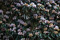
 Rhododendron flower, Glendoick Gardens - geograph.org.uk - 3936333.jpg 1,024 × 681; 120 KB
-
 Rhododendron, Glendoick Gardens - geograph.org.uk - 3936336.jpg 1,024 × 682; 303 KB
-
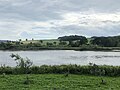
 River Tay at Kinfauns - geograph.org.uk - 1294498.jpg 640 × 426; 64 KB
-
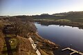
 River Tay at Seggieden - geograph.org.uk - 6230900.jpg 1,024 × 767; 145 KB
-
 River Tay from Friarton Bridge - geograph.org.uk - 5636676.jpg 1,024 × 686; 101 KB
-
-
 River Tay, downstream of Perth - geograph.org.uk - 2079973.jpg 640 × 480; 83 KB
-
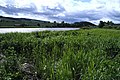 Riverside Reed Bed at Seggieden - geograph.org.uk - 869901.jpg 640 × 429; 104 KB
-
 Road to Pepperknowes Farm - geograph.org.uk - 2090683.jpg 640 × 480; 143 KB
-
 Roadside woodland - geograph.org.uk - 4324787.jpg 427 × 640; 609 KB
-
 Rocky Burn, Glendoick Gardens - geograph.org.uk - 3936339.jpg 681 × 1,024; 465 KB
-
 Rosewood in Glen Carse - geograph.org.uk - 1899336.jpg 640 × 480; 86 KB
-
 Round bales by Sandyhall - geograph.org.uk - 2213174.jpg 640 × 359; 71 KB
-
 Ruins with Trees - geograph.org.uk - 5612840.jpg 640 × 427; 444 KB
-
 Sandyhall, Glendoick - geograph.org.uk - 3517588.jpg 1,024 × 682; 147 KB
-
 Sandyhall, Glendoick - geograph.org.uk - 4365353.jpg 640 × 480; 60 KB
-
 Seggieden by the Tay - geograph.org.uk - 1336397.jpg 640 × 427; 92 KB
-
 Sewage Works - geograph.org.uk - 2079983.jpg 640 × 480; 98 KB
-
 Sheep Grazing at Kinfauns - geograph.org.uk - 1990628.jpg 2,560 × 1,920; 1.85 MB
-
 Sheep Pasture Near The Binn - geograph.org.uk - 1448771.jpg 640 × 427; 57 KB
-
 Slip road onto the A90 at Kinfauns heading for Dundee - geograph.org.uk - 3548265.jpg 1,600 × 1,200; 304 KB
-
 Small wood and farmland near Durdie - geograph.org.uk - 3289459.jpg 1,200 × 797; 456 KB
-
 Snowdrops - geograph.org.uk - 4324790.jpg 640 × 471; 531 KB
-

-
 Southbound A90 near Kinfauns Castle - geograph.org.uk - 6134677.jpg 800 × 533; 701 KB
-
 Southbound A90, approaching the M90 - geograph.org.uk - 2679825.jpg 640 × 480; 188 KB
-
 Southbound A90, Kinfauns Exit - geograph.org.uk - 2679815.jpg 640 × 480; 202 KB
-
 Steadings at Pepperknowes Farm - geograph.org.uk - 2090676.jpg 640 × 480; 79 KB
-
 Steep incline in the road near Glendoick House - geograph.org.uk - 3289466.jpg 1,200 × 797; 644 KB
-

-
 Strawberry Fields by Tofthill - geograph.org.uk - 1990601.jpg 2,560 × 1,920; 1.82 MB
-
 Strawberry polytunnels at Tofthill - geograph.org.uk - 2821225.jpg 1,600 × 1,178; 230 KB
-
 Tarsappie (Moncreiffe) Hill - geograph.org.uk - 2079957.jpg 640 × 480; 79 KB


,_Glendoick_Gardens_-_geograph.org.uk_-_3936342.jpg)


_Hill_-_geograph.org.uk_-_2079957.jpg)
&filefrom=Tay+valley+at+dusk+-+geograph.org.uk+-+1090366.jpg#mw-category-media)