Category:Kerkweg 107, Schiedam
Jump to navigation
Jump to search
| Object location | | View all coordinates using: OpenStreetMap |
|---|
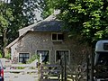
farmhouse in Schiedam, Netherlands  | |||||
| Upload media | |||||
| Instance of | |||||
|---|---|---|---|---|---|
| Location | Schiedam, South Holland, Netherlands | ||||
| Street address |
| ||||
| Located on street |
| ||||
| Heritage designation |
| ||||
 | |||||
|
This is a category about rijksmonument number 33298
|
| Address |
|
Media in category "Kerkweg 107, Schiedam"
The following 32 files are in this category, out of 32 total.
-
 Aanzicht - Schiedam - 20125071 - RCE.jpg 1,200 × 803; 266 KB
-
 Achtergevel - Schiedam - 20125077 - RCE.jpg 1,200 × 1,195; 472 KB
-
 Achtergevel schuur - Schiedam - 20125084 - RCE.jpg 1,200 × 1,197; 393 KB
-
 Detail opkamer - Schiedam - 20125078 - RCE.jpg 1,195 × 1,200; 221 KB
-
 Gedeelte opkamer - Schiedam - 20125079 - RCE.jpg 1,190 × 1,200; 194 KB
-
 Kelderraam in de voorgevel - Schiedam - 20474788 - RCE.jpg 896 × 1,200; 209 KB
-
 Kelderraam in de voorgevel - Schiedam - 20474789 - RCE.jpg 896 × 1,200; 215 KB
-
 Kelderramen in de zijgevel - Schiedam - 20474769 - RCE.jpg 1,200 × 900; 243 KB
-
 Keuken - Schiedam - 20125082 - RCE.jpg 1,198 × 1,200; 222 KB
-
 Linkerzijgevel - Schiedam - 20125074 - RCE.jpg 1,190 × 1,200; 413 KB
-
 Linkerzijgevel - Schiedam - 20125075 - RCE.jpg 1,197 × 1,200; 392 KB
-
 Overzicht voor- en zijgevel - Schiedam - 20125072 - RCE.jpg 1,200 × 1,200; 452 KB
-
 Rechterzijgevel - Schiedam - 20125076 - RCE.jpg 1,190 × 1,200; 454 KB
-
 Schiedam-Kethel - Kerkweg 105.jpg 2,592 × 1,944; 1.69 MB
-
 Schoorsteen en tegeltableau's in opkamer - Schiedam - 20125080 - RCE.jpg 1,200 × 1,200; 251 KB
-
 Schuur - Schiedam - 20125085 - RCE.jpg 1,188 × 1,200; 400 KB
-
 Stal - Schiedam - 20125086 - RCE.jpg 1,193 × 1,200; 335 KB
-
 Tegeltableau - Schiedam - 20125081 - RCE.jpg 1,188 × 1,200; 316 KB
-
 Voor- en zijgevel schuur - Schiedam - 20125083 - RCE.jpg 1,195 × 1,200; 459 KB
-
 Voorgevel - Schiedam - 20125073 - RCE.jpg 1,200 × 1,200; 379 KB
-
 Voorgevel - Schiedam - 20474770 - RCE.jpg 1,200 × 900; 234 KB
-
 Voorgevel - Schiedam - 20474771 - RCE.jpg 1,200 × 900; 232 KB
-
 Voorgevel - Schiedam - 20474790 - RCE.jpg 1,200 × 900; 287 KB
-
 Zij- en voorgevel - Schiedam - 20474775 - RCE.jpg 1,200 × 900; 214 KB
-
 Zij- en voorgevel - Schiedam - 20474786 - RCE.jpg 1,200 × 900; 255 KB
-
 Zij- en voorgevel - Schiedam - 20474787 - RCE.jpg 896 × 1,200; 219 KB
-
 Zijgevel - Schiedam - 20474768 - RCE.jpg 896 × 1,200; 309 KB
-
 Zijgevel - Schiedam - 20474776 - RCE.jpg 896 × 1,200; 282 KB
-
 Zijgevel - Schiedam - 20474783 - RCE.jpg 896 × 1,200; 291 KB
-
 Zijgevel - Schiedam - 20474784 - RCE.jpg 1,200 × 900; 256 KB
-
 Zijgevel - Schiedam - 20474785 - RCE.jpg 896 × 1,200; 273 KB
-
 Zijgevels - Schiedam - 20474791 - RCE.jpg 1,200 × 900; 253 KB


