Category:Kerkplein 26, Abcoude
Jump to navigation
Jump to search
| Object location | | View all coordinates using: OpenStreetMap |
|---|
building in the Netherlands  | |||||
| Upload media | |||||
| Instance of | |||||
|---|---|---|---|---|---|
| Location |
| ||||
| Street address |
| ||||
| Located on street |
| ||||
| Heritage designation |
| ||||
 | |||||
|
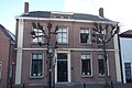
This is a category about rijksmonument number 6974
|
| Address |
|
Subcategories
This category has only the following subcategory.
T
Media in category "Kerkplein 26, Abcoude"
The following 4 files are in this category, out of 4 total.
-
 Abcoude Kerkplein 26.jpg 2,680 × 2,364; 2.97 MB
-
 Kerkplein 26, Abcoude 01.jpg 3,888 × 2,592; 4.1 MB
-
 Kerkplein 26, Abcoude 02.jpg 3,888 × 2,592; 4.32 MB
-
 Voorgevel - Abcoude - 20004300 - RCE.jpg 1,195 × 1,200; 328 KB


