Category:Kerkboog (Nijmegen)
Jump to navigation
Jump to search
| Object location | | View all coordinates using: OpenStreetMap |
|---|
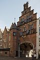
Archway to St Stephens Church, Nijmegen (listed building)  | |||||
| Upload media | |||||
| Instance of | |||||
|---|---|---|---|---|---|
| Location | Nijmegen, Gelderland, Netherlands | ||||
| Architectural style | |||||
| Heritage designation |
| ||||
| Inception |
| ||||
 | |||||
Nederlands: Kerkboog, Nijmegen
|
This is a category about rijksmonument number 31129
|
| Address |
|
Subcategories
This category has the following 2 subcategories, out of 2 total.
A
- Afsluitpaal Grote Markt (4 F)
Media in category "Kerkboog (Nijmegen)"
The following 84 files are in this category, out of 84 total.
-
 2013.05.30.163910 Facades Grote Markt Nijmegen NL.jpg 1,920 × 1,280; 1.12 MB
-
 2013.05.30.163924 Facade Grote Markt Nijmegen NL.jpg 1,920 × 1,280; 1.12 MB
-
 2013.05.30.164054 Sint Stevenskerk Grote Markt Nijmegen NL.jpg 1,920 × 1,280; 887 KB
-
 2013.05.30.164225 Facade Grote Markt Nijmegen NL.jpg 1,920 × 1,280; 1.11 MB
-
 2013.05.30.164444 Gate Sint Stevenskerkhof Nijmegen NL.jpg 1,920 × 1,280; 1.27 MB
-
 2013.05.31.090409 St. Stevenskerk Nijmegen.jpg 1,920 × 1,280; 1.13 MB
-
 Aanzicht - Nijmegen - 20167802 - RCE.jpg 890 × 1,200; 200 KB
-
 Aanzicht - Nijmegen - 20167803 - RCE.jpg 870 × 1,200; 179 KB
-
 Aanzicht - Nijmegen - 20167804 - RCE.jpg 877 × 1,200; 209 KB
-
 Achterkant Kerkboog Nijmegen P1420739.jpg 2,672 × 4,000; 5.59 MB
-
 Benedenstad 1.jpg 2,272 × 1,704; 1 MB
-
 Benedenstad vanaf Toren - Nijmegen - 20166840 - RCE.jpg 1,157 × 1,200; 409 KB
-
 Benedenstad, Nijmegen, Netherlands - panoramio (13).jpg 1,375 × 2,048; 342 KB
-
 Benedenstad, Nijmegen, Netherlands - panoramio (20).jpg 2,048 × 1,375; 409 KB
-
 Benedenstad, Nijmegen, Netherlands - panoramio (26).jpg 2,048 × 1,375; 416 KB
-
 Benedenstad, Nijmegen, Netherlands - panoramio (31).jpg 2,048 × 1,375; 365 KB
-
 Benedenstad, Nijmegen, Netherlands - panoramio (32).jpg 2,048 × 1,375; 418 KB
-
 Benedenstad, Nijmegen, Netherlands - panoramio (44).jpg 1,375 × 2,048; 454 KB
-
 Benedenstad, Nijmegen, Netherlands - panoramio (56).jpg 2,048 × 1,375; 561 KB
-
 Benedenstad, Nijmegen, Netherlands - panoramio (57).jpg 2,048 × 1,375; 444 KB
-
 Church Archway Nijmegen.jpg 2,993 × 4,694; 3.27 MB
-

-
 Gevel doorgang naar de grote Kerk; PBK - Nijmegen - 20509622 - RCE.jpg 582 × 885; 112 KB
-
 Gevels Grote Markt Nijmegen P1420721.jpg 4,000 × 2,672; 5.31 MB
-
 Gezicht op Kerkboog - Nijmegen - 20168042 - RCE.jpg 887 × 1,200; 210 KB
-
 Gezicht op Waag - Nijmegen - 20167805 - RCE.jpg 889 × 1,200; 164 KB
-
 Gezicht op Waag - Nijmegen - 20167806 - RCE.jpg 893 × 1,200; 163 KB
-
 Grote Markt (Nijmegen) P1060343.JPG 3,264 × 2,448; 3.73 MB
-
-
 Grote Markt en Kerkboog Nijmegen (cropped).JPG 639 × 1,338; 222 KB
-
 Grote Markt en Kerkboog Nijmegen.JPG 1,952 × 2,576; 1.25 MB
-
 Grote Markt Nijmegen Benedenstad, Café Daen - panoramio.jpg 4,604 × 3,450; 4.84 MB
-
 Interieur trap - Nijmegen - 20167812 - RCE.jpg 764 × 1,200; 179 KB
-
 Interieur trap en schoorsteen - Nijmegen - 20167810 - RCE.jpg 788 × 1,200; 226 KB
-
 Interieur trap en schoorsteen - Nijmegen - 20167811 - RCE.jpg 788 × 1,200; 220 KB
-
 Jibea Nijmegen 2016 04.jpg 4,000 × 3,000; 4.54 MB
-
 Kerkboog - Nijmegen - 20167794 - RCE.jpg 931 × 1,200; 243 KB
-
 Kerkboog - Nijmegen - 20167795 - RCE.jpg 1,200 × 938; 259 KB
-
 Kerkboog - Nijmegen - 20167796 - RCE.jpg 936 × 1,200; 271 KB
-
 Kerkboog in Nijmegen (1).jpg 1,895 × 3,532; 6.14 MB
-
 Kerkboog in Nijmegen (2).jpg 2,195 × 3,987; 8.05 MB
-
 Kerkboog in Nijmegen (3).jpg 3,170 × 4,289; 12.15 MB
-
 Kerkboog Stevenspoortje P1420717.jpg 2,672 × 4,000; 5.14 MB
-
 Kerkboog Stevenspoortje P1420718.jpg 4,000 × 2,672; 5.52 MB
-
 Kerkboog Stevenspoortje P1420719.jpg 4,000 × 2,672; 5.31 MB
-
 Kerkboog Stevenspoortje P1420720.jpg 2,672 × 4,000; 5.05 MB
-
 Kerkboog vanaf Grote Markt.JPG 3,072 × 2,304; 1.62 MB
-
 Kerkboog.JPG 2,736 × 3,648; 2.52 MB
-
 Kerkhofzijde van de poortdoorgang met traptoren - Nijmegen - 20167798 - RCE.jpg 894 × 1,200; 189 KB
-
Lakenhal en In De Blaauwe Hand -- Rondje Regio.webm 2 min 52 s, 1,920 × 1,080; 83.52 MB
-
 Met achtergevels Grote Markt - Nijmegen - 20167799 - RCE.jpg 879 × 1,200; 218 KB
-
 Met achtergevels Grote Markt - Nijmegen - 20167800 - RCE.jpg 886 × 1,200; 190 KB
-
 Met achtergevels Grote Markt - Nijmegen - 20167801 - RCE.jpg 881 × 1,200; 178 KB
-
 Nijmegen (4274162825).jpg 3,000 × 1,542; 3.03 MB
-
 Nijmegen - Houses at Grote Markt.jpg 3,456 × 4,608; 4.63 MB
-
 Nijmegen - Kerkboog - Stadswapen Nijmegen.jpg 4,000 × 3,000; 3.26 MB
-
 Nijmegen - Kerkboog gezien vanaf de Grote Markt - Wapen van Nijmegen.jpg 4,000 × 3,000; 3.7 MB
-
 Nijmegen - panoramio (6).jpg 2,848 × 4,288; 3.11 MB
-
 Nijmegen Grote Markt,Kerkboog met Stevenstoren.JPG 2,960 × 3,946; 3.07 MB
-
 Nijmegen Kerkboog R01.jpg 2,262 × 3,810; 4.93 MB
-
 Nijmegen, Holland - panoramio.jpg 1,400 × 820; 822 KB
-
 Nijmegen, monumentale panden voor Sint Stevenskerk foto6 2010-06-06 11.04.JPG 3,456 × 2,592; 1.08 MB
-
 Nimweege stadhoes.jpg 400 × 300; 112 KB
-
 NIMWEGEN NIJMEGEN – Niederlande NL (25697002863).jpg 1,400 × 933; 1.4 MB
-
 NIMWEGEN NIJMEGEN – Niederlande NL (25697010543).jpg 1,400 × 933; 1.61 MB
-
 NIMWEGEN NIJMEGEN – Niederlande NL (25697011153).jpg 1,400 × 933; 1.48 MB
-
 NIMWEGEN NIJMEGEN – Niederlande NL (26026899470).jpg 1,400 × 2,100; 3.47 MB
-
 NIMWEGEN NIJMEGEN – Niederlande NL (26273806086).jpg 1,400 × 2,100; 3 MB
-
 NIMWEGEN NIJMEGEN – Niederlande NL (26299753195).jpg 1,400 × 2,100; 3 MB
-
 NIMWEGEN NIJMEGEN – Niederlande NL (26299761445).jpg 1,400 × 933; 1.58 MB
-

-

-

-
 Poortgebouw in gevelwand - Nijmegen - 20325788 - RCE.jpg 974 × 1,200; 193 KB
-
 Reproductie van foto - Nijmegen - 20167793 - RCE.jpg 956 × 1,200; 253 KB
-
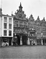
 Restauratie van de Kerkboog in januari 1967 F21404.jpeg 1,161 × 1,956; 496 KB
-
 Spiltrap in traptorentje - Nijmegen - 20167807 - RCE.jpg 1,197 × 1,200; 224 KB
-
 Spiltrap in traptorentje - Nijmegen - 20167808 - RCE.jpg 1,195 × 1,200; 168 KB
-
 Spiltrap in traptorentje - Nijmegen - 20167809 - RCE.jpg 1,190 × 1,200; 167 KB
-
 Stevenspoortje P1060341.JPG 2,448 × 3,264; 3.76 MB
-

-

-

-


.jpg)
.jpg)
.jpg)
.jpg)
.jpg)
.jpg)
.jpg)
.jpg)


_P1060343.JPG)

.JPG)


.jpg)
.jpg)
.jpg)


.jpg)


.jpg)


.jpg)
.jpg)
.jpg)
.jpg)
.jpg)
.jpg)
.jpg)


