Category:Kerk, Tjerkgaast
Jump to navigation
Jump to search
| Object location | | View all coordinates using: OpenStreetMap |
|---|
church building in Skarsterlân, Netherlands  | |||||
| Upload media | |||||
| Instance of | |||||
|---|---|---|---|---|---|
| Location | Tjerkgaast, De Fryske Marren, Friesland, Netherlands | ||||
| Street address |
| ||||
| Located on street |
| ||||
| Heritage designation |
| ||||
| Inception |
| ||||
| Significant event |
| ||||
| official website | |||||
 | |||||
|
This is a category about rijksmonument number 13258
|
| Address |
|
Media in category "Kerk, Tjerkgaast"
The following 21 files are in this category, out of 21 total.
-
 Ingang - Tjerkgaast - 20209678 - RCE.jpg 813 × 1,200; 309 KB
-
 INTERIEUR, OVERZICHT NAAR HET OOSTEN - Tjerkgaast - 20281720 - RCE.jpg 1,200 × 960; 134 KB
-
 INTERIEUR, OVERZICHT NAAR HET WESTEN - Tjerkgaast - 20281721 - RCE.jpg 1,200 × 960; 138 KB
-
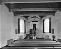
 INTERIEUR, PREEKSTOEL - Tjerkgaast - 20281722 - RCE.jpg 954 × 1,200; 164 KB
-
 Noord-west gevel - Tjerkgaast - 20209677 - RCE.jpg 1,200 × 813; 296 KB
-
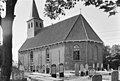
 Tjerkgaast N.H. Kerk.jpg 4,000 × 3,000; 860 KB
-
 Tjerkgaast, kerk RM13258 IMG 2671 2018-04-19 14.53.jpg 5,161 × 3,441; 15 MB
-
 Tjerkgaast. Kerk van Tjerkgaast Gaestdyk 37 (Rijksmonument) 001.jpg 4,513 × 3,155; 11.16 MB
-
 Tjerkgaast. Kerk van Tjerkgaast Gaestdyk 37 (Rijksmonument) 002.jpg 4,838 × 3,337; 12.49 MB
-
 Tjerkgaast. Kerk van Tjerkgaast Gaestdyk 37 (Rijksmonument) 003.jpg 5,010 × 3,340; 12.41 MB
-
 Tjerkgaast. Kerk van Tjerkgaast Gaestdyk 37 (Rijksmonument) 004.jpg 2,735 × 3,375; 6.24 MB
-
 Tjerkgaast. Kerk van Tjerkgaast Gaestdyk 37 (Rijksmonument) 005.jpg 2,652 × 2,508; 5.99 MB
-
 Tjerkgaast. Kerk van Tjerkgaast Gaestdyk 37 (Rijksmonument) 006.jpg 3,429 × 3,427; 12.08 MB
-
 Tjerkgaast. Kerk van Tjerkgaast Gaestdyk 37 (Rijksmonument) 007.jpg 4,615 × 2,958; 13.48 MB
-
 Tjerkgaast. Kerk van Tjerkgaast Gaestdyk 37 (Rijksmonument) 008.jpg 5,012 × 2,854; 12.34 MB
-
 Tsjerke fan Tsjerkgaast.jpg 1,920 × 1,199; 1.4 MB
-
 Tsjerkgaast kerkje in de bomen.jpg 833 × 596; 119 KB
-
 West-gevel - Tjerkgaast - 20209679 - RCE.jpg 815 × 1,200; 198 KB
-
 Wollegaast Tjerkgaast Kerkhof bij kerk, Bestanddeelnr 170-2603.jpg 2,446 × 3,671; 2.46 MB
-
 Zuid-oost gevel - Tjerkgaast - 20209676 - RCE.jpg 1,200 × 811; 257 KB
-
 Zuid-oost gevel - Tjerkgaast - 20209680 - RCE.jpg 1,200 × 804; 303 KB


_001.jpg)
_002.jpg)
_003.jpg)
_004.jpg)
_005.jpg)
_006.jpg)
_007.jpg)
_008.jpg)


