Category:Kenn, Devon
Jump to navigation
Jump to search
English: Kenn is a village situated in Devon, England, several miles to the south of Exeter, in one of the country's main tourist areas.
village and civil parish in Devon, UK  | |||||
| Upload media | |||||
| Instance of | |||||
|---|---|---|---|---|---|
| Location | Teignbridge, Devon, South West England, England | ||||
 | |||||
Subcategories
This category has the following 7 subcategories, out of 7 total.
Media in category "Kenn, Devon"
The following 200 files are in this category, out of 519 total.
(previous page) (next page)-
 "Forest dreaming, motherhood revisited" - geograph.org.uk - 239565.jpg 480 × 640; 165 KB
-

-
 A trio of copses - geograph.org.uk - 581622.jpg 640 × 379; 82 KB
-
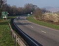
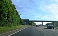
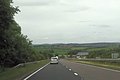 A30 approaching A380 junction - geograph.org.uk - 4035234.jpg 640 × 425; 50 KB
-
 A38 - A380 junction - geograph.org.uk - 3096446.jpg 640 × 430; 40 KB
-
 A38 and A380 part company - geograph.org.uk - 3879122.jpg 3,646 × 2,399; 1.25 MB
-
 A38 at Exeter racecourse - geograph.org.uk - 3355816.jpg 640 × 480; 77 KB
-
 A38 Below Telegraph Hill - geograph.org.uk - 1368494.jpg 640 × 455; 81 KB
-
 A38 Below Telegraph Hill - geograph.org.uk - 1368502.jpg 640 × 455; 85 KB
-
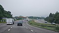
 A38 Devon Expressway near to Kennford - geograph.org.uk - 6108733.jpg 800 × 533; 568 KB
-

-
 A38 Haldon Hill, Exeter side - geograph.org.uk - 91481.jpg 640 × 427; 175 KB
-
 A38 Near Gorsey Cliff - geograph.org.uk - 1368505.jpg 640 × 455; 91 KB
-
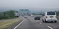
 A38 near Kennford - geograph.org.uk - 4765409.jpg 640 × 426; 67 KB
-
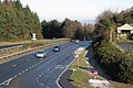
 A38 southbound near Kennford - geograph.org.uk - 3096435.jpg 640 × 361; 37 KB
-
 A38 west of Trehill Farm - geograph.org.uk - 3879109.jpg 3,530 × 2,519; 1.17 MB
-
 A38, A379 Turnoff - geograph.org.uk - 1368552.jpg 640 × 455; 92 KB
-
 A38, Approaching A380 - geograph.org.uk - 1368492.jpg 640 × 455; 88 KB
-
 A38, approaching the A380 junction - geograph.org.uk - 3096439.jpg 640 × 321; 34 KB
-

-
 A38, descending Telegraph Hill - geograph.org.uk - 3016692.jpg 640 × 430; 50 KB
-
 A38, Devon Expressway - geograph.org.uk - 3096437.jpg 640 × 430; 36 KB
-
 A38, Exeter Race Course turn off - geograph.org.uk - 3016695.jpg 640 × 394; 36 KB
-
 A38, Great Haldon - geograph.org.uk - 1368448.jpg 640 × 455; 77 KB
-
 A38, Great Haldon - geograph.org.uk - 1368451.jpg 640 × 455; 61 KB
-
 A38, Great Haldon - geograph.org.uk - 1368469.jpg 640 × 455; 60 KB
-
 A38, Great Haldon - geograph.org.uk - 1368473.jpg 640 × 455; 79 KB
-
 A38, Great Haldon - geograph.org.uk - 1368478.jpg 640 × 455; 101 KB
-
 A38, Great Haldon - geograph.org.uk - 1368481.jpg 640 × 455; 97 KB
-
 A38, Kennford turning - geograph.org.uk - 4765412.jpg 640 × 347; 40 KB
-
 A38, southbound - geograph.org.uk - 4761665.jpg 640 × 408; 44 KB
-
 A380 - A38 junction - geograph.org.uk - 3096448.jpg 640 × 430; 34 KB
-
 A380 at the top of Telegraph Hill - geograph.org.uk - 1651531.jpg 640 × 426; 391 KB
-
 A380 at the top of Telegraph Hill - geograph.org.uk - 2291847.jpg 800 × 600; 343 KB
-
 A380 below Telegraph Hill - geograph.org.uk - 1219082.jpg 640 × 496; 77 KB
-
 A380 carriageways diverge - geograph.org.uk - 3096465.jpg 640 × 396; 30 KB
-
 A380 climbing Telegraph Hill - geograph.org.uk - 3096451.jpg 640 × 430; 69 KB
-
 A380 crosses the A38, Telegraph Hill - geograph.org.uk - 3016691.jpg 640 × 430; 49 KB
-
 A380 east of Round Plantation - geograph.org.uk - 3879134.jpg 3,187 × 2,291; 1.17 MB
-
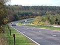
 A380 in the Haldon Forest - geograph.org.uk - 3096462.jpg 640 × 430; 36 KB
-
 A380 near to Kennford - geograph.org.uk - 6108674.jpg 800 × 533; 693 KB
-
 A380 on Haldon - geograph.org.uk - 3263944.jpg 640 × 480; 101 KB
-
 A380 on Haldon - geograph.org.uk - 6052642.jpg 2,432 × 3,753; 1.24 MB
-
 A380 on Haldon.jpg 640 × 480; 93 KB
-
 A380 overbridge, A38 - geograph.org.uk - 4761666.jpg 640 × 350; 49 KB
-

-
 A380 south of Telegraph Hill - geograph.org.uk - 3879139.jpg 3,423 × 2,403; 1.32 MB
-
 A380 Telegraph Hill - geograph.org.uk - 6108647.jpg 800 × 533; 749 KB
-
 A380, A38 junction - geograph.org.uk - 5321649.jpg 640 × 426; 58 KB
-
 A380, Telegraph Hill - geograph.org.uk - 3096456.jpg 640 × 430; 60 KB
-
 Almost out of the woods - geograph.org.uk - 5688041.jpg 2,048 × 1,368; 1.24 MB
-

-
 Animal Paradise, Clapham - geograph.org.uk - 155248.jpg 640 × 480; 120 KB
-
 Approaching the A380 - geograph.org.uk - 2547048.jpg 640 × 480; 59 KB
-
 Ashton, Haldon Gate - geograph.org.uk - 686995.jpg 640 × 427; 163 KB
-
 Bank, Round O Plantation - geograph.org.uk - 5564104.jpg 1,536 × 2,048; 643 KB
-
 Bare trees at Underdown Cross - geograph.org.uk - 2776167.jpg 600 × 800; 510 KB
-
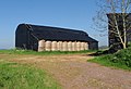
 Barn, at Yeo's Farm - geograph.org.uk - 1458007.jpg 640 × 480; 99 KB
-
 Barn, on Two Stone Lane - geograph.org.uk - 1458143.jpg 640 × 480; 100 KB
-
 Barns near Clapham - geograph.org.uk - 797924.jpg 640 × 438; 76 KB
-
 Below the Round O on Telegraph Hill - geograph.org.uk - 144880.jpg 640 × 480; 155 KB
-
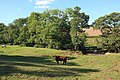
 Belvedere and cow - geograph.org.uk - 689376.jpg 640 × 594; 56 KB
-
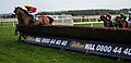
 Best Mate - His Last Race - geograph.org.uk - 1292602.jpg 640 × 480; 102 KB
-
 Big Wood, Kenton - geograph.org.uk - 683032.jpg 640 × 427; 256 KB
-
 Bird of Prey viewpoint, Haldon - geograph.org.uk - 238843.jpg 480 × 640; 126 KB
-

-
 Bridge over River Kenn in Clapham - geograph.org.uk - 2774880.jpg 800 × 600; 435 KB
-
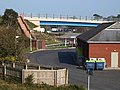
 Bridge over the A38 - geograph.org.uk - 571711.jpg 640 × 480; 108 KB
-
 Bridge over the A380, Telegraph Hill - geograph.org.uk - 3096458.jpg 640 × 430; 25 KB
-
 Bridleway passing Cumberland Wood - geograph.org.uk - 2814873.jpg 600 × 800; 526 KB
-

-
 Bridleway to Exeter Lodge, Mamhead - geograph.org.uk - 4669198.jpg 1,024 × 768; 223 KB
-
 Bridleway, Clapham - geograph.org.uk - 5559856.jpg 3,072 × 2,048; 1.33 MB
-
 Brooke Lodge, Kenn - geograph.org.uk - 3798747.jpg 800 × 600; 150 KB
-
 Brown's farm, near Kenn - geograph.org.uk - 1458138.jpg 640 × 480; 90 KB
-
 Buildings at Exeter Racecourse (geograph 3355810).jpg 640 × 480; 83 KB
-
 Buildings on Old Haldon Hill - geograph.org.uk - 1218971.jpg 640 × 480; 77 KB
-
 Buller's Cross looking southeast - geograph.org.uk - 2663509.jpg 1,024 × 768; 140 KB
-
 Buller's Hill - geograph.org.uk - 239571.jpg 640 × 480; 120 KB
-
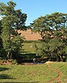
 By the Kenn - geograph.org.uk - 1219160.jpg 640 × 422; 68 KB
-

-
 Car park for Taverner's Farm - geograph.org.uk - 2009836.jpg 640 × 480; 234 KB
-
 Cattle by Two Stone Lane - geograph.org.uk - 5922768.jpg 4,278 × 2,653; 2.36 MB
-
 Cattle in the Kenn valley - geograph.org.uk - 5922856.jpg 1,828 × 2,267; 688 KB
-
 Cattle in the Kenn valley - geograph.org.uk - 5922860.jpg 4,288 × 2,848; 2.35 MB
-
 Cattle in the Kenn valley - geograph.org.uk - 5923019.jpg 4,288 × 2,848; 2.12 MB
-
 Cattle pasture above Clapham - geograph.org.uk - 5559866.jpg 2,988 × 1,866; 1.17 MB
-
 Chalet site, Great Haldon - geograph.org.uk - 1651545.jpg 640 × 427; 372 KB
-

-
 Collapsing bank near Kenn - geograph.org.uk - 3846748.jpg 1,920 × 1,252; 769 KB
-
 Coniferous woodland - geograph.org.uk - 1129748.jpg 640 × 480; 220 KB
-
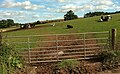
 Contented sheep, Kenn - geograph.org.uk - 1045287.jpg 640 × 568; 161 KB
-
 Cottage beside Kenn Footpath 2 - geograph.org.uk - 571683.jpg 640 × 480; 100 KB
-
 Country north of Kenn - geograph.org.uk - 581685.jpg 640 × 480; 118 KB
-
 Countryside from Holloway Barton - geograph.org.uk - 798299.jpg 640 × 480; 81 KB
-
 Countryside near Brown's Farm - geograph.org.uk - 5918843.jpg 4,288 × 2,848; 2.32 MB
-
 Countryside near Brown's Farm - geograph.org.uk - 5922088.jpg 4,279 × 2,523; 1.81 MB
-
 Crossroads at Buller's Hill Cross - geograph.org.uk - 2654442.jpg 800 × 600; 422 KB
-
 Cumberland Lane - geograph.org.uk - 158548.jpg 640 × 480; 110 KB
-
 Cyclamen at Kenn - geograph.org.uk - 581535.jpg 640 × 487; 72 KB
-
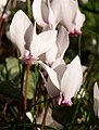 Cyclamen at Kenn - geograph.org.uk - 581570.jpg 486 × 640; 61 KB
-
 Cycle path, Great Haldon - geograph.org.uk - 1218937.jpg 480 × 640; 102 KB
-
 Cycle path, Haldon - geograph.org.uk - 6052698.jpg 4,008 × 2,718; 2.33 MB
-
 Cycle trail crossing road, Haldon - geograph.org.uk - 238832.jpg 640 × 480; 89 KB
-
 Dawlish turning A38 - geograph.org.uk - 2428039.jpg 640 × 400; 58 KB
-
 Deers Hill - geograph.org.uk - 6042350.jpg 4,191 × 2,625; 1.35 MB
-

-
 Derelict petrol station, on the A380, near Kenn - geograph.org.uk - 1716320.jpg 1,024 × 768; 169 KB
-

-
-

-
 Disused main road on Haldon - geograph.org.uk - 160419.jpg 640 × 480; 139 KB
-
 Dragonfly, Haldon Forest - geograph.org.uk - 4588295.jpg 1,920 × 1,510; 493 KB
-
 Ducks on Lake at Bickam House - geograph.org.uk - 801114.jpg 640 × 427; 78 KB
-
 Dunchideock - geograph.org.uk - 164755.jpg 640 × 480; 92 KB
-
 Dunchideock, view near Lawrence Castle - geograph.org.uk - 404156.jpg 640 × 427; 164 KB
-
 Edge of an encampment - geograph.org.uk - 1129751.jpg 640 × 480; 244 KB
-
 Emergency escape lane, A380 Telegraph Hill - geograph.org.uk - 6186549.jpg 1,600 × 1,199; 859 KB
-
 Entering Clapham - geograph.org.uk - 1565580.jpg 640 × 480; 175 KB
-
-
 Entrance to Kenn village - geograph.org.uk - 581602.jpg 640 × 460; 124 KB
-

-
-
 Estate lodge, Lord Haldon Hotel, Clapham - geograph.org.uk - 1458123.jpg 640 × 466; 110 KB
-

-

-
 Exeter A38 , The A38 Trunk Road - geograph.org.uk - 1196427.jpg 640 × 480; 47 KB
-
 Exeter Racecourse - geograph.org.uk - 1129752.jpg 640 × 480; 210 KB
-
 Exeter racecourse - geograph.org.uk - 1537152.jpg 640 × 480; 172 KB
-
 Exeter Racecourse - geograph.org.uk - 18185.jpg 636 × 309; 84 KB
-
 Exeter Racecourse - geograph.org.uk - 5356105.jpg 640 × 393; 37 KB
-
 Exeter Racecourse - geograph.org.uk - 5356106.jpg 640 × 426; 33 KB
-
 Exeter Racecourse turning, A38 - geograph.org.uk - 5321655.jpg 640 × 264; 40 KB
-
 Exeter Road Bridge, A38 - geograph.org.uk - 3096430.jpg 640 × 430; 32 KB
-
 Farm buildings at Brenton - geograph.org.uk - 1565968.jpg 640 × 480; 145 KB
-
 Farm buildings at Holloway Barton - geograph.org.uk - 2774903.jpg 800 × 600; 251 KB
-
 Farm diversification - geograph.org.uk - 1834394.jpg 2,560 × 1,920; 1.04 MB
-
 Farm entrance and fields - geograph.org.uk - 1565980.jpg 640 × 480; 170 KB
-
 Farm Ford at Kennford - geograph.org.uk - 3690019.jpg 3,872 × 2,592; 1.27 MB
-
 Farm road to Brown's Farm - geograph.org.uk - 2654485.jpg 800 × 600; 415 KB
-
 Farmland east of Clapham - geograph.org.uk - 5919186.jpg 4,288 × 2,848; 1.64 MB
-
 Farmland near Clapham - geograph.org.uk - 5922766.jpg 3,474 × 1,895; 851 KB
-
 Field above A38 - geograph.org.uk - 572807.jpg 640 × 480; 97 KB
-
 Field beside Kenn Footpath 2 - geograph.org.uk - 572830.jpg 640 × 480; 142 KB
-
 Field by the River Kenn - geograph.org.uk - 581373.jpg 640 × 480; 142 KB
-
 Field by Two Stone Lane - geograph.org.uk - 5922344.jpg 3,813 × 2,221; 1.82 MB
-
 Field near Kenn - geograph.org.uk - 581652.jpg 640 × 480; 112 KB
-
 Field with bath - geograph.org.uk - 572897.jpg 640 × 480; 127 KB
-
 Field, Splatford - geograph.org.uk - 3581695.jpg 511 × 640; 88 KB
-
 Field, Splatford - geograph.org.uk - 5921863.jpg 4,288 × 2,848; 2.31 MB
-
 Field, Splatford - geograph.org.uk - 5922079.jpg 4,288 × 2,848; 2.18 MB
-
 Fields below Haldon Gate - geograph.org.uk - 3414146.jpg 800 × 600; 138 KB
-
 Fields south of Clapham and Haldon hills - geograph.org.uk - 2774888.jpg 800 × 600; 286 KB
-
 Fields, near Trehill - geograph.org.uk - 1059065.jpg 640 × 480; 78 KB
-
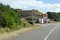
 Filling station by the A38 - geograph.org.uk - 5321663.jpg 640 × 426; 61 KB
-
 Final fence - geograph.org.uk - 663997.jpg 640 × 307; 61 KB
-
 Finger-post, Haldon Gate - geograph.org.uk - 2001900.jpg 480 × 640; 168 KB
-

-
 Foot of Old Haldon Hill - geograph.org.uk - 1218992.jpg 640 × 450; 57 KB
-
 Footpath from Haldon Gate - geograph.org.uk - 6053651.jpg 2,848 × 4,288; 2.29 MB
-

-
 Ford at Yeo's Farm - geograph.org.uk - 3690029.jpg 3,872 × 2,592; 1.26 MB
-
 Ford on a farm track at Yeo's Farm - geograph.org.uk - 4354041.jpg 640 × 480; 54 KB
-

-
 Forest track to Veitch's Plantation - geograph.org.uk - 6053614.jpg 4,288 × 2,848; 1.44 MB
-
 Forestry by A380, Great Haldon turn - geograph.org.uk - 1651328.jpg 640 × 426; 364 KB
-
 Forestry Commission HQ Bullers Hill Devon - geograph.org.uk - 19414.jpg 640 × 480; 164 KB
-
 Forestry, on Haldon Hills - geograph.org.uk - 1993613.jpg 1,024 × 768; 298 KB
-
 Formal entrance to Trehill House - geograph.org.uk - 1059027.jpg 640 × 480; 149 KB
-
 Former car park, Haldon Forest Park - geograph.org.uk - 1652124.jpg 640 × 480; 626 KB
-
 Former road, Haldon - geograph.org.uk - 3263660.jpg 640 × 480; 133 KB
-
 Former road, Haldon - geograph.org.uk - 3263969.jpg 640 × 480; 146 KB
-
 Gate and field at Clapham - geograph.org.uk - 1565570.jpg 640 × 480; 197 KB
-
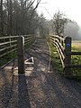
 Gate into woods near Kenn - geograph.org.uk - 950982.jpg 640 × 480; 159 KB
-
 GeereArms.png 813 × 934; 61 KB
-
 Goosemoor Barn - geograph.org.uk - 798294.jpg 640 × 480; 77 KB
-
-
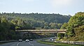
 Great Haldon Bridge, Telegraph Hill - geograph.org.uk - 1218899.jpg 640 × 426; 82 KB
-
 Great Haldon Forest - geograph.org.uk - 1458357.jpg 640 × 480; 100 KB
-
 Gypsy caravans, Haldon Forest - geograph.org.uk - 1458681.jpg 640 × 480; 125 KB
-
 Gypsy encampment, in Haldon Forest - geograph.org.uk - 1458669.jpg 640 × 480; 109 KB
-
 Haldon Chalets Cafe - geograph.org.uk - 1458707.jpg 640 × 480; 62 KB
-
 Haldon Chalets café by the A380 - geograph.org.uk - 1651374.jpg 640 × 427; 383 KB
-
 Haldon Forest - geograph.org.uk - 5185162.jpg 3,072 × 2,048; 2.13 MB
-
 Haldon Forest - geograph.org.uk - 5187341.jpg 2,048 × 2,869; 1.07 MB
-
 Haldon Forest - geograph.org.uk - 5187358.jpg 2,048 × 3,072; 1.77 MB
-
 Haldon Forest and road along the hilltop - geograph.org.uk - 2654438.jpg 800 × 600; 448 KB
-
 Haldon Forest Park, Rangers Centre - geograph.org.uk - 1429267.jpg 640 × 480; 69 KB
-
 Haldon Forest Trail - geograph.org.uk - 1429445.jpg 640 × 480; 118 KB
-
 Haldon Gate - geograph.org.uk - 1226273.jpg 640 × 480; 119 KB
-
 Haldon Gate - geograph.org.uk - 6042377.jpg 4,186 × 2,732; 2.35 MB
-
 Haldon Gate - geograph.org.uk - 687905.jpg 640 × 480; 83 KB
-
 Haldon Quarry - geograph.org.uk - 144881.jpg 640 × 480; 93 KB
-
 Haldon racecourse - geograph.org.uk - 166401.jpg 640 × 480; 128 KB
-
 Haldon View - geograph.org.uk - 572863.jpg 480 × 640; 83 KB
-

-
 Heathland at Exeter Racecourse - geograph.org.uk - 1813645.jpg 640 × 480; 55 KB
-
 Heathland on Haldon - geograph.org.uk - 2977759.jpg 640 × 480; 72 KB
-
 Higher Thornton Farm from bridleway - geograph.org.uk - 2814865.jpg 800 × 600; 436 KB
-
 Holloway Barton - geograph.org.uk - 1458319.jpg 640 × 480; 62 KB


.jpg)


