Category:Kemsing
Jump to navigation
Jump to search
English: Kemsing is a village and civil parish in the Sevenoaks District of Kent, England. The parish lies on the scarp face of the North Downs, to the south. The population of the civil parish in 2001 was 4014 persons.
village and civil parish in Kent, United Kingdom  | |||||
| Upload media | |||||
| Instance of | |||||
|---|---|---|---|---|---|
| Location | Sevenoaks, Kent, South East England, England | ||||
| Said to be the same as | Kemsing (Wikimedia duplicated page, civil parish) | ||||
 | |||||
Subcategories
This category has the following 8 subcategories, out of 8 total.
H
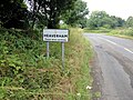
- Heaverham (9 F)
K
- Kemsing Down Nature Reserve (14 F)
- Kemsing railway station (4 F)
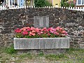
- Kemsing War Memorial (9 F)
M
O
- Oasts in Kemsing (11 F)
S
- Saint Edith's Well, Kemsing (9 F)
- St Clere, Kent (9 F)
Media in category "Kemsing"
The following 200 files are in this category, out of 330 total.
(previous page) (next page)-
 A mystery near Kemsing, Kent - geograph.org.uk - 41978.jpg 640 × 427; 117 KB
-
 An unexpected clock in Kemsing - geograph.org.uk - 4660524.jpg 1,536 × 2,048; 857 KB
-
 Bali Hai Farm - geograph.org.uk - 2174073.jpg 640 × 430; 133 KB
-
 Barn, Highfield Farm - geograph.org.uk - 2174008.jpg 640 × 430; 110 KB
-
 Barnfield Crescent, Kemsing - geograph.org.uk - 4322270.jpg 4,000 × 3,000; 4.19 MB
-
 Beechy Lees Rd, Kemsing (2) - geograph.org.uk - 940040.jpg 640 × 430; 72 KB
-
 Beechy Lees Road - geograph.org.uk - 4322260.jpg 4,000 × 3,000; 3.93 MB
-
 Beechy Lees Road, Kemsing - geograph.org.uk - 3156976.jpg 2,048 × 1,536; 1.42 MB
-
 Beechy Lees Road, Kemsing - geograph.org.uk - 5034120.jpg 3,264 × 2,448; 2.29 MB
-
 Birchin Cross Rd - geograph.org.uk - 2189545.jpg 640 × 430; 190 KB
-
 Birchin Cross Rd - geograph.org.uk - 2190331.jpg 640 × 430; 169 KB
-
 Birchin Cross Rd - geograph.org.uk - 2190335.jpg 640 × 430; 178 KB
-
 Birchin Cross Road - geograph.org.uk - 1706209.jpg 2,048 × 1,536; 1.25 MB
-
 Birchin Cross Road - geograph.org.uk - 1706212.jpg 2,048 × 1,536; 1.26 MB
-
 Birchin Cross Road - geograph.org.uk - 940125.jpg 640 × 430; 71 KB
-
 Birchin Cross Road, junction with Clarke's Green Road - geograph.org.uk - 1706208.jpg 2,048 × 1,536; 1.19 MB
-
 Birchins Cross - geograph.org.uk - 940105.jpg 640 × 430; 96 KB
-
 Blackberries on the North Downs - geograph.org.uk - 6255402.jpg 4,000 × 3,000; 4.96 MB
-
 Bridge over railway - Kemsing - geograph.org.uk - 256200.jpg 640 × 480; 122 KB
-
 Bridge over the M26 - geograph.org.uk - 3934630.jpg 1,600 × 1,241; 493 KB
-
 Castle Bank, Rose Cottage, and the George V Memorial in Kemsing.jpg 4,198 × 2,996; 11.74 MB
-
 Castle Drive, Kemsing - geograph.org.uk - 5034387.jpg 2,417 × 1,551; 819 KB
-
 Castle Drive, Kemsing - geograph.org.uk - 5034391.jpg 3,264 × 2,448; 1.58 MB
-
 Caution forestry, Summeryards Wood - geograph.org.uk - 2171760.jpg 640 × 430; 168 KB
-
 Chalk Grassland - geograph.org.uk - 4309422.jpg 640 × 480; 58 KB
-
 Chequers Inn - geograph.org.uk - 5067601.jpg 4,000 × 3,000; 4.36 MB
-
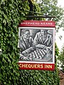 Chequers Inn sign - geograph.org.uk - 5067604.jpg 3,000 × 4,000; 3.66 MB
-
 Chequers Inn, Heaverham - geograph.org.uk - 5034017.jpg 3,264 × 2,448; 2.38 MB
-
 Childsbridge Lane road bridge - geograph.org.uk - 1451535.jpg 640 × 480; 49 KB
-
 Childsbridge Lane, Kemsing - geograph.org.uk - 5034087.jpg 3,264 × 2,448; 1.53 MB
-
 Childsbridge Lane, Kemsing - geograph.org.uk - 5034407.jpg 3,125 × 2,345; 1.33 MB
-
 Clarkes Green Rd, west - geograph.org.uk - 2174135.jpg 640 × 430; 162 KB
-
 Clock and statue on St Edith's Hall, Kemsing - geograph.org.uk - 4660502.jpg 1,536 × 2,048; 788 KB
-
 Cockneys foot crossing - geograph.org.uk - 4346431.jpg 640 × 480; 223 KB
-
 Cockneys foot crossing - geograph.org.uk - 4346438.jpg 640 × 480; 170 KB
-
 Collet Road, Kemsing - geograph.org.uk - 5034373.jpg 3,055 × 2,291; 1.23 MB
-
 Coppiced fencing along Birchin Cross Rd - geograph.org.uk - 2190334.jpg 640 × 430; 203 KB
-
 Coppiced fencing, Birchin Cross Rd - geograph.org.uk - 2190330.jpg 640 × 430; 220 KB
-
 Coppiced trees, Birches Wood - geograph.org.uk - 2171738.jpg 640 × 430; 176 KB
-
 Coppiced trees, Birches Wood - geograph.org.uk - 2171740.jpg 640 × 430; 186 KB
-
 Coppiced Wood - geograph.org.uk - 1256102.jpg 640 × 480; 159 KB
-

-
 Cotman's Ash Lane - geograph.org.uk - 1396683.jpg 640 × 480; 114 KB
-
 Cotman's Ash Lane - geograph.org.uk - 1396692.jpg 640 × 480; 146 KB
-
 Cotman's Ash Lane - geograph.org.uk - 2174101.jpg 640 × 430; 153 KB
-
 Cotman's Ash Lane - geograph.org.uk - 4321994.jpg 4,000 × 3,000; 4.19 MB
-
 Cotman's Ash Lane - geograph.org.uk - 4323272.jpg 4,000 × 3,000; 3.81 MB
-
 Cotman's Ash Lane - Steep Hill 1-7 - geograph.org.uk - 1479221.jpg 640 × 400; 118 KB
-
 Cotman's Ash Lane - Steep Hill 14^ - geograph.org.uk - 1479230.jpg 640 × 400; 135 KB
-
 Cotman's Ash Lane and Crowdleham - geograph.org.uk - 1396672.jpg 640 × 480; 148 KB
-
 Cotman's Ash Lane at the junction of Pilgrim's Way - geograph.org.uk - 3156939.jpg 2,048 × 1,536; 1.39 MB
-
 Cotman's Ash Lane at the junction of Pilgrim's Way - geograph.org.uk - 3156968.jpg 2,048 × 1,536; 1.42 MB
-
 Cotman's Ash Lane, near Kemsing - geograph.org.uk - 5034053.jpg 3,264 × 2,448; 3.5 MB
-
 Cotman's Ash Lane, near Kemsing - geograph.org.uk - 5034058.jpg 3,264 × 2,448; 2.08 MB
-
 Cotmans Ash Lane - geograph.org.uk - 2174011.jpg 640 × 430; 174 KB
-
 Cotmans Ash Lane - geograph.org.uk - 2174047.jpg 640 × 430; 155 KB
-
 Cotmans Ash Lane - geograph.org.uk - 2174057.jpg 640 × 430; 167 KB
-
 Cotmans Ash Lane - geograph.org.uk - 2174064.jpg 640 × 430; 179 KB
-
 Cotmans Ash Lane, northwards - geograph.org.uk - 2174012.jpg 640 × 430; 171 KB
-
 Cotmans Ash Lane, westward - geograph.org.uk - 2174056.jpg 640 × 430; 163 KB
-

-
 Crinkle-crankle churchyard wall, Kemsing - geograph.org.uk - 4660534.jpg 2,048 × 1,536; 1,015 KB
-
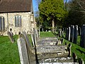
 Crinkle-Crankle Wall in Kemsing Churchyard - geograph.org.uk - 2207095.jpg 1,058 × 738; 369 KB
-
 Cross roads on the North Downs - geograph.org.uk - 940793.jpg 640 × 430; 112 KB
-
 Cross roads on the North Downs - geograph.org.uk - 940840.jpg 640 × 430; 93 KB
-
 Dippers Close, Kemsing - geograph.org.uk - 1363326.jpg 640 × 480; 78 KB
-

-
 Down the line towards Maidstone East - geograph.org.uk - 3440683.jpg 4,000 × 3,000; 3.99 MB
-
 Dry valley on the North Downs - geograph.org.uk - 940805.jpg 640 × 430; 68 KB
-
 Duck house in pond at Noah's Ark - geograph.org.uk - 5741820.jpg 640 × 427; 96 KB
-
 Dyers Barn North - geograph.org.uk - 1256006.jpg 640 × 480; 96 KB
-
 Dynes Road, Kemsing - geograph.org.uk - 5034117.jpg 3,264 × 2,448; 1.88 MB
-
 Dynes Road, Kemsing - geograph.org.uk - 5034374.jpg 3,264 × 2,448; 1.94 MB
-
 Dynes Road, Kemsing - geograph.org.uk - 5034378.jpg 3,069 × 2,301; 1.71 MB
-
 Entrance to Pepperland, Birchin Cross Rd - geograph.org.uk - 2190329.jpg 640 × 430; 208 KB
-
 Entry to the St Clere Estate - geograph.org.uk - 4323211.jpg 4,000 × 3,000; 4.07 MB
-
 Exit from Summeryard Woods - geograph.org.uk - 4309419.jpg 640 × 480; 99 KB
-

-
 Flint building at Cotman's Ash - geograph.org.uk - 940836.jpg 640 × 430; 93 KB
-
 Footbridge over the M26 near Heaverham - geograph.org.uk - 3688548.jpg 640 × 480; 235 KB
-
 Footbridge over the M26, Westbound - geograph.org.uk - 3688520.jpg 640 × 480; 250 KB
-
 Footpath into Great Wood - geograph.org.uk - 2189548.jpg 640 × 430; 209 KB
-
 Footpath off Cotman's Ash Lane - geograph.org.uk - 2174063.jpg 640 × 430; 158 KB
-
 Footpath off Cotman's Ash Lane - geograph.org.uk - 2174103.jpg 640 × 430; 153 KB
-
 Fox Farm, Cotmans Ash Lane - geograph.org.uk - 2174131.jpg 640 × 430; 186 KB
-
 Gateway to the North Downs - geograph.org.uk - 2728810.jpg 640 × 480; 106 KB
-
 George V Coronation Memorial, Kemsing (01).jpg 4,592 × 3,448; 8.24 MB
-
 George V Coronation Memorial, Kemsing (02).jpg 4,592 × 3,448; 8.47 MB
-
 Glen Cottage and Gwen Cottage, Kemsing.jpg 3,605 × 2,836; 8.67 MB
-
 Great Wood - geograph.org.uk - 2190327.jpg 640 × 430; 220 KB
-
 Great Wood - geograph.org.uk - 2190336.jpg 640 × 430; 200 KB
-
 Great Wood - geograph.org.uk - 2190392.jpg 640 × 430; 209 KB
-
 Greenlands Road, Kemsing - geograph.org.uk - 5034428.jpg 3,264 × 2,448; 1.68 MB
-
 Greystones Close, Kemsing - geograph.org.uk - 5034409.jpg 3,262 × 2,029; 1.41 MB
-
 Heaverham Road, Heaverham - geograph.org.uk - 5034019.jpg 3,264 × 2,448; 1.57 MB
-
 Heaverham Road, Heaverham - geograph.org.uk - 5034023.jpg 3,264 × 2,448; 1.83 MB
-
 Heaverham Road, Heaverham - geograph.org.uk - 5034030.jpg 3,264 × 2,448; 1.73 MB
-
 Heaverham Road, near Heaverham - geograph.org.uk - 5034036.jpg 3,264 × 2,448; 1.88 MB
-
 Heaverham Village Sign - geograph.org.uk - 5033998.jpg 3,264 × 2,448; 2.63 MB
-
 Hedges, Cotmans Ash Lane - geograph.org.uk - 2174071.jpg 640 × 430; 122 KB
-
 High hedges, Cotmans Ash Lane - geograph.org.uk - 2174014.jpg 640 × 430; 143 KB
-
 High Street, Kemsing - geograph.org.uk - 1303135.jpg 640 × 480; 63 KB
-
 High Street, Kemsing - geograph.org.uk - 5034420.jpg 3,264 × 2,448; 2.54 MB
-
 Highfield Road, Kemsing - geograph.org.uk - 5034129.jpg 3,264 × 2,448; 2 MB
-
 Highfield Road, Kemsing - geograph.org.uk - 5034132.jpg 3,264 × 2,448; 1.77 MB
-
 Honeypot Lane, Kemsing - geograph.org.uk - 5033963.jpg 3,264 × 2,448; 1.8 MB
-
 Honeypot Lane, Kemsing - geograph.org.uk - 5034432.jpg 3,264 × 2,448; 1.69 MB
-

-
 Horses grazing on the North Downs - geograph.org.uk - 940808.jpg 640 × 430; 105 KB
-
 Horses in a field - geograph.org.uk - 940791.jpg 640 × 430; 83 KB
-
 Horses in front of Fernbank Farm - geograph.org.uk - 940153.jpg 640 × 430; 81 KB
-
 Horses in the mist - geograph.org.uk - 2171766.jpg 640 × 430; 91 KB
-
 Houses on Greenland Rd, Noah's Ark - geograph.org.uk - 2154789.jpg 640 × 326; 56 KB
-
 Houses on Pilgrims Way - geograph.org.uk - 1917187.jpg 1,024 × 768; 202 KB
-
 Houses on St Edith's Road - geograph.org.uk - 1267226.jpg 640 × 480; 85 KB
-
 In the grounds of St Clere - geograph.org.uk - 4323230.jpg 4,000 × 3,000; 3.96 MB
-

-
 Junction of Rowdow and Birchin Cross Rd - geograph.org.uk - 2190397.jpg 640 × 430; 172 KB
-
 K6 Telephone Kiosk in Saint Edith's Road, Kemsing.jpg 4,348 × 3,306; 15.71 MB
-
 Kemsing Church - geograph.org.uk - 2207089.jpg 1,150 × 761; 523 KB
-
 Kemsing railway station, Kent - geograph.org.uk - 3827556.jpg 1,024 × 768; 241 KB
-
 Kemsing View - geograph.org.uk - 4021448.jpg 1,856 × 704; 615 KB
-
 Kemsing Village Sign - geograph.org.uk - 1256015.jpg 480 × 640; 67 KB
-
 Kemsing Well Dressing 2014.jpg 2,619 × 3,555; 5.88 MB
-
 Kemsing Youth Hostel, Kemsing, Kent - geograph.org.uk - 3275293.jpg 800 × 530; 54 KB
-
 Kemsing, St. Mary's Church - geograph.org.uk - 5875817.jpg 7,360 × 4,912; 7.15 MB
-
 Kemsing, St. Mary's Church - geograph.org.uk - 5875826.jpg 5,832 × 3,892; 5.52 MB
-
 Kemsing, St. Mary's Church and its lych gate - geograph.org.uk - 5875902.jpg 4,614 × 6,914; 4.85 MB
-
 Kemsing, St. Mary's Church, c13th stained glass roundel - geograph.org.uk - 5875887.jpg 2,518 × 3,773; 1.79 MB
-

-

-

-

-

-

-

-

-

-

-
 Kemsing, St. Mary's Church, Screen carving - geograph.org.uk - 5875851.jpg 6,060 × 4,044; 4.36 MB
-

-
 Kemsing, St. Mary's Church, Stained glass window (detail) - geograph.org.uk - 5875882.jpg 6,162 × 4,113; 4.94 MB
-
 Kemsing, St. Mary's Church, Stained glass window (detail) - geograph.org.uk - 5875894.jpg 6,931 × 4,625; 4.92 MB
-
 Kemsing, St. Mary's Church, Stained glass window - geograph.org.uk - 5875880.jpg 4,215 × 6,316; 5.02 MB
-
 Kemsing, St. Mary's Church, Stained glass window - geograph.org.uk - 5875892.jpg 4,300 × 6,444; 4.29 MB
-

-

-

-
 Kemsing, St. Mary's Church, The graveyard - geograph.org.uk - 5875824.jpg 5,855 × 3,907; 7.02 MB
-
 Kemsing, St. Mary's Church, The lych gate - geograph.org.uk - 5875897.jpg 7,174 × 4,787; 6.19 MB
-
 Kemsing, St. Mary's Church, The nave - geograph.org.uk - 5875832.jpg 7,174 × 4,787; 5.9 MB
-

-
 Kemsing, St. Mary's Church, The nave from the chancel - geograph.org.uk - 5875838.jpg 7,016 × 4,681; 4.25 MB
-
 Kemsing, St. Mary's Church, The path to the lych gate - geograph.org.uk - 5875820.jpg 6,926 × 4,622; 6.6 MB
-
 Kemsing, St. Mary's Church, The west door - geograph.org.uk - 5875831.jpg 6,138 × 4,096; 7.16 MB
-
 Knave Wood Road, Kemsing - geograph.org.uk - 5034382.jpg 3,264 × 2,448; 2.03 MB
-
 Knave Wood Road, Kemsing - geograph.org.uk - 5034386.jpg 2,448 × 2,448; 1.77 MB
-
 Landscape from M26, east of Kemsing - geograph.org.uk - 4021717.jpg 640 × 480; 78 KB
-
 Large barn, Highfield Farm - geograph.org.uk - 2174009.jpg 640 × 430; 107 KB
-
 Large house on top of the North Downs - geograph.org.uk - 940842.jpg 640 × 430; 75 KB
-
 Little Cotman's Ash - geograph.org.uk - 2174048.jpg 640 × 430; 157 KB
-
 Localised flooding, Cotmans Ash Lane - geograph.org.uk - 2174017.jpg 640 × 430; 146 KB
-
 Looking along Watery Lane - geograph.org.uk - 4323311.jpg 4,000 × 3,000; 4.11 MB
-
 Looking east from Kemsing Station - geograph.org.uk - 5741816.jpg 640 × 427; 105 KB
-
 Looking northh from Pilgrims Way - geograph.org.uk - 1396666.jpg 640 × 480; 129 KB
-

-
 Looking towards Crowdleham - geograph.org.uk - 1405384.jpg 640 × 480; 148 KB
-
 Looking up Cotman's Ash Lane - geograph.org.uk - 4321988.jpg 4,000 × 3,000; 4.4 MB
-
 Lower St Clere - geograph.org.uk - 5070079.jpg 5,184 × 3,456; 4.8 MB
-
 Lozenge graves in St Mary's Churchyard, Kemsing - geograph.org.uk - 4322099.jpg 4,000 × 3,000; 4.37 MB
-
 Lozenge graves in St Mary's Churchyard, Kemsing - geograph.org.uk - 4322103.jpg 4,000 × 3,000; 3.99 MB
-
 M26 - bridge over - geograph.org.uk - 2728666.jpg 640 × 428; 63 KB
-
 M26 - footbridge over - geograph.org.uk - 2728644.jpg 640 × 428; 56 KB
-
 M26 bridge carries Childsbridge Lane - geograph.org.uk - 2576985.jpg 3,479 × 2,395; 987 KB
-
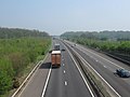 M26 Motorway to Maidstone - geograph.org.uk - 1255995.jpg 640 × 480; 58 KB
-
 M26 north of Kemsing railway station - geograph.org.uk - 3827557.jpg 1,024 × 768; 210 KB
-
 M26, Footbridge near Kemsing - geograph.org.uk - 3688374.jpg 640 × 480; 229 KB
-
 M26, Noah's Ark Bridge, Kemsing - geograph.org.uk - 3688378.jpg 640 × 480; 233 KB
-
 Manure, Teias Farm - geograph.org.uk - 2174061.jpg 640 × 396; 99 KB
-
 Montford Road, Kemsing - geograph.org.uk - 5034395.jpg 2,353 × 2,353; 1.14 MB
-
 Motorway Bridge over Watery Lane, Heaverham - geograph.org.uk - 5033992.jpg 3,264 × 2,448; 1.63 MB
-
 New cottage on Pilgrims Way, Kemsing - geograph.org.uk - 4453258.jpg 2,048 × 1,536; 1.49 MB
-
 Noah's Ark (geograph 6837732).jpg 1,024 × 684; 247 KB
-
 Noah's Ark Cottage - geograph.org.uk - 1255987.jpg 640 × 480; 113 KB
-
 Noah's Ark, Kemsing - geograph.org.uk - 5034430.jpg 3,097 × 2,323; 1.1 MB
-
 Noah's Ark, Kemsing - geograph.org.uk - 5034431.jpg 3,264 × 2,448; 2.02 MB
-
 North Downs Way - geograph.org.uk - 1407804.jpg 640 × 480; 154 KB
-
 North Downs Way - geograph.org.uk - 1407812.jpg 640 × 480; 174 KB
-
 North Downs Way - geograph.org.uk - 1407822.jpg 640 × 480; 179 KB
-
 North Downs Way - geograph.org.uk - 1407835.jpg 640 × 480; 150 KB
-
 North Downs Way - geograph.org.uk - 1407842.jpg 640 × 480; 158 KB
-
 North Downs Way - geograph.org.uk - 1407888.jpg 640 × 480; 159 KB
-
 North Downs Way - geograph.org.uk - 1407898.jpg 640 × 480; 138 KB
-
 North Downs Way - geograph.org.uk - 1407910.jpg 640 × 480; 202 KB
-
 North Downs Way - geograph.org.uk - 1407924.jpg 640 × 480; 155 KB
-
 North Downs Way - geograph.org.uk - 1424826.jpg 640 × 480; 181 KB
-
 North Downs Way - geograph.org.uk - 1424831.jpg 640 × 480; 184 KB
-
 North Downs Way enters Summeryards Wood - geograph.org.uk - 1254177.jpg 640 × 480; 145 KB
-
 North Downs Way enters Summeryards Wood - geograph.org.uk - 2171754.jpg 640 × 430; 201 KB
-
 North Downs Way in the mist - geograph.org.uk - 2171751.jpg 640 × 430; 143 KB


_-_geograph.org.uk_-_940040.jpg)


.jpg)
.jpg)


_1_-_geograph.org.uk_-_5875868.jpg)
_2_-_geograph.org.uk_-_5875872.jpg)

_-_geograph.org.uk_-_5875876.jpg)


_-_geograph.org.uk_-_5875858.jpg)
_1_-_geograph.org.uk_-_5875841.jpg)
_2_-_geograph.org.uk_-_5875844.jpg)


_-_geograph.org.uk_-_5875882.jpg)
_-_geograph.org.uk_-_5875894.jpg)


_-_geograph.org.uk_-_5875846.jpg)
_-_geograph.org.uk_-_5875837.jpg)


.jpg)


