Category:Kempston Rural
Jump to navigation
Jump to search
human settlement in England _-_geograph.org.uk_-_363338.jpg) | |||||
| Upload media | |||||
| Instance of | |||||
|---|---|---|---|---|---|
| Location | Bedford, Bedfordshire, East of England, England | ||||
 | |||||
Subcategories
This category has the following 3 subcategories, out of 3 total.
Media in category "Kempston Rural"
The following 200 files are in this category, out of 314 total.
(previous page) (next page)-
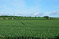
 A sea of green - geograph.org.uk - 5571250.jpg 640 × 426; 49 KB
-
 A sea of wheat - geograph.org.uk - 5570993.jpg 640 × 426; 71 KB
-
 A young crop - geograph.org.uk - 5570972.jpg 640 × 426; 76 KB
-
 A young crop - geograph.org.uk - 5570979.jpg 640 × 426; 72 KB
-
 A young crop - geograph.org.uk - 5571261.jpg 640 × 426; 80 KB
-
 A421 northbound - geograph.org.uk - 4431351.jpg 640 × 467; 48 KB
-
 A421 northbound, footbridge - geograph.org.uk - 4431332.jpg 640 × 480; 46 KB
-
 A421 towards Bedford - geograph.org.uk - 5624228.jpg 640 × 428; 68 KB
-
 A428 - geograph.org.uk - 5005176.jpg 640 × 426; 48 KB
-
 A428 - geograph.org.uk - 5005177.jpg 640 × 426; 49 KB
-
 A428 bridge - geograph.org.uk - 4971781.jpg 640 × 426; 113 KB
-

-

-
 Abandoned scooter LN14 CUH - geograph.org.uk - 5537336.jpg 4,032 × 3,024; 5.89 MB
-
 All Saints Church - geograph.org.uk - 4666304.jpg 2,000 × 1,500; 314 KB
-
 All Saints Church Hall, Kempston - geograph.org.uk - 4971883.jpg 640 × 421; 60 KB
-
 Approaching West End Rd - geograph.org.uk - 5586642.jpg 640 × 426; 104 KB
-
 Arable field - geograph.org.uk - 5577124.jpg 640 × 426; 52 KB
-
 Arable field - geograph.org.uk - 5592991.jpg 640 × 426; 62 KB
-
 Arable land by the B560 - geograph.org.uk - 4971761.jpg 640 × 426; 52 KB
-
 Arable land by the B560 - geograph.org.uk - 4971762.jpg 640 × 426; 60 KB
-
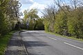
 B560 - geograph.org.uk - 4971719.jpg 640 × 391; 81 KB
-
 B560 - geograph.org.uk - 4971765.jpg 640 × 426; 101 KB
-
 B560 - geograph.org.uk - 5570952.jpg 640 × 426; 89 KB
-
 B560 - geograph.org.uk - 5570957.jpg 640 × 425; 89 KB
-
 B560 - geograph.org.uk - 5570963.jpg 640 × 426; 80 KB
-
 B560 - geograph.org.uk - 5571027.jpg 640 × 426; 57 KB
-
 B560 - geograph.org.uk - 5571249.jpg 640 × 426; 50 KB
-
 B560 - geograph.org.uk - 5571252.jpg 640 × 426; 59 KB
-
 B560 - geograph.org.uk - 5592983.jpg 640 × 426; 87 KB
-
 B560 - geograph.org.uk - 5592987.jpg 640 × 426; 54 KB
-
 B560 - geograph.org.uk - 5592989.jpg 640 × 426; 76 KB
-
 B560 - geograph.org.uk - 5592992.jpg 640 × 426; 59 KB
-
 B560 - geograph.org.uk - 5592993.jpg 640 × 426; 79 KB
-
 B560 - geograph.org.uk - 5592995.jpg 640 × 426; 105 KB
-
 B560 at West End Farm - geograph.org.uk - 5592955.jpg 640 × 426; 63 KB
-
 Bare field - geograph.org.uk - 5577263.jpg 640 × 426; 79 KB
-
 Bare tree in the meadow - geograph.org.uk - 3770276.jpg 1,200 × 1,600; 301 KB
-
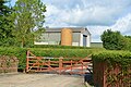 Barn, Top Farm - geograph.org.uk - 5571274.jpg 640 × 426; 103 KB
-
 Barn, Vicarage Farm - geograph.org.uk - 4971703.jpg 640 × 426; 67 KB
-
 Barn, Vicarage Farm - geograph.org.uk - 5570944.jpg 640 × 426; 79 KB
-
 Barn, West End Farm - geograph.org.uk - 5592963.jpg 640 × 426; 65 KB
-
 Barn, West End Farm - geograph.org.uk - 5592965.jpg 640 × 426; 82 KB
-
 Bedfordshire farmland - geograph.org.uk - 5577114.jpg 640 × 426; 61 KB
-
 Bedfordshire farmland - geograph.org.uk - 5577118.jpg 640 × 426; 53 KB
-
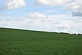 Bedfordshire field - geograph.org.uk - 5571285.jpg 640 × 426; 42 KB
-
 Bend, B560 - geograph.org.uk - 5592994.jpg 640 × 426; 93 KB
-
 Box End Park - geograph.org.uk - 5005764.jpg 640 × 426; 64 KB
-
 Box End Park - geograph.org.uk - 5570924.jpg 640 × 426; 80 KB
-
 Box End Park - geograph.org.uk - 5570928.jpg 640 × 426; 76 KB
-
 Box End Park - geograph.org.uk - 5593025.jpg 640 × 425; 70 KB
-
 Box End Rd - geograph.org.uk - 4971698.jpg 640 × 426; 72 KB
-
 Box End Rd - geograph.org.uk - 5002569.jpg 640 × 426; 88 KB
-
 Box End Rd - geograph.org.uk - 5002614.jpg 640 × 426; 125 KB
-
 Box End Rd - geograph.org.uk - 5005727.jpg 640 × 426; 101 KB
-
 Box End Rd - geograph.org.uk - 5005729.jpg 640 × 426; 107 KB
-
 Box End Rd - geograph.org.uk - 5005735.jpg 640 × 426; 84 KB
-
 Box End Rd - geograph.org.uk - 5005736.jpg 640 × 426; 86 KB
-
 Box End Rd - geograph.org.uk - 5005742.jpg 640 × 426; 79 KB
-
 Box End Rd - geograph.org.uk - 5005750.jpg 640 × 426; 87 KB
-
 Box End Rd - geograph.org.uk - 5005751.jpg 640 × 426; 65 KB
-
 Box End Rd - geograph.org.uk - 5005753.jpg 640 × 426; 75 KB
-
 Box End Rd - geograph.org.uk - 5005755.jpg 640 × 426; 63 KB
-
 Box End Rd - geograph.org.uk - 5005756.jpg 640 × 426; 69 KB
-
 Box End Rd - geograph.org.uk - 5005760.jpg 640 × 426; 67 KB
-
 Box End Rd - geograph.org.uk - 5570930.jpg 640 × 426; 88 KB
-
 Box End Rd, B560 - geograph.org.uk - 5005173.jpg 640 × 426; 56 KB
-
 Box End Road - geograph.org.uk - 2708191.jpg 640 × 480; 64 KB
-
 Box End Road - geograph.org.uk - 5005763.jpg 640 × 378; 49 KB
-
 Brewers Fayre pub at the Premier Inn - geograph.org.uk - 5259311.jpg 640 × 480; 45 KB
-
 Bridleway, Hanger Wood - geograph.org.uk - 5577182.jpg 640 × 426; 101 KB
-
 Bridleway, Hanger Wood - geograph.org.uk - 5577188.jpg 640 × 426; 120 KB
-
 Building site off Ridge Road - geograph.org.uk - 3116875.jpg 640 × 480; 94 KB
-
 Buttons Ramsey Wood - geograph.org.uk - 2745934.jpg 1,024 × 681; 154 KB
-
 Car park, Box End Park - geograph.org.uk - 5593026.jpg 640 × 426; 70 KB
-
 Church End Cottages, Kempston - geograph.org.uk - 4549202.jpg 3,669 × 2,786; 3.59 MB
-
 Church Hall, Kempston Church End.jpg 3,813 × 2,145; 1.52 MB
-
 Church Rd - geograph.org.uk - 4971813.jpg 640 × 426; 126 KB
-
 Circle C - geograph.org.uk - 5586668.jpg 640 × 426; 52 KB
-
 Clay pit leisure lake - geograph.org.uk - 3676945.jpg 1,600 × 1,068; 319 KB
-
 Clay Way - geograph.org.uk - 5577237.jpg 640 × 426; 101 KB
-

-

-
 Corrugated barn, Box End Rd - geograph.org.uk - 5002574.jpg 640 × 426; 69 KB
-
 Corrugated building - geograph.org.uk - 5592948.jpg 640 × 426; 75 KB
-
 Cottage, West End Rd - geograph.org.uk - 5571273.jpg 640 × 425; 58 KB
-
 Cottages at the edge of the churchyard - geograph.org.uk - 3676916.jpg 1,600 × 1,068; 454 KB
-
 Cowslips on the verge, Box End Park - geograph.org.uk - 4971694.jpg 640 × 426; 107 KB
-
 Crossland Fosse gates - geograph.org.uk - 5005739.jpg 640 × 426; 102 KB
-
 Dead tree - geograph.org.uk - 5592944.jpg 640 × 426; 56 KB
-
 Entering Box End, Box End Rd - geograph.org.uk - 5005737.jpg 640 × 426; 108 KB
-
 Entrance to Kempston Cemetery - geograph.org.uk - 4549180.jpg 4,320 × 3,240; 2.92 MB
-
 Entrance to Three Ways Farm - geograph.org.uk - 3770237.jpg 1,600 × 1,068; 556 KB
-
 Entrance, Box End Farm - geograph.org.uk - 5005762.jpg 640 × 426; 81 KB
-
 Entrance, Box End Park - geograph.org.uk - 4971678.jpg 640 × 426; 66 KB
-
 Fair View - geograph.org.uk - 5571276.jpg 640 × 426; 91 KB
-
 Farm buildings at West End Farm - geograph.org.uk - 3770247.jpg 1,600 × 1,069; 413 KB
-
 Farmhouse, Vicarage Farm - geograph.org.uk - 5570945.jpg 640 × 425; 85 KB
-
 Farmland looking towards Kempston - geograph.org.uk - 3770241.jpg 1,600 × 1,068; 353 KB
-
 Farmland near Green End - geograph.org.uk - 2708211.jpg 640 × 480; 68 KB
-
 Farmland near Green End - geograph.org.uk - 2882097.jpg 640 × 480; 82 KB
-
 Farmland near Green End - geograph.org.uk - 2882106.jpg 640 × 480; 80 KB
-
 Farmland near Green End - geograph.org.uk - 2882108.jpg 640 × 480; 82 KB
-
 Farmland near Green End - geograph.org.uk - 2882116.jpg 640 × 480; 78 KB
-
 Field by Box End Rd - geograph.org.uk - 5005734.jpg 640 × 426; 79 KB
-
 Field by Box End Rd - geograph.org.uk - 5005761.jpg 640 × 426; 62 KB
-
 Field by John Bunyan Trail - geograph.org.uk - 5571290.jpg 640 × 426; 61 KB
-
 Flat grassland - geograph.org.uk - 5592950.jpg 640 × 426; 51 KB
-
 Footbridge over A421 - geograph.org.uk - 4873405.jpg 640 × 480; 37 KB
-
 Footbridge over the A421 - geograph.org.uk - 3676947.jpg 1,600 × 1,068; 396 KB
-

-
 Footbridge, A421 - geograph.org.uk - 5448697.jpg 640 × 426; 33 KB
-
 Footpath across the field to Green End - geograph.org.uk - 3676932.jpg 1,600 × 1,066; 415 KB
-
 Footpath by Astey Wood - geograph.org.uk - 3770270.jpg 1,200 × 1,600; 614 KB
-
 Footpath by the River Great Ouse - geograph.org.uk - 4971776.jpg 640 × 426; 130 KB
-
 Footpath by the River Great Ouse - geograph.org.uk - 4971787.jpg 640 × 426; 140 KB
-
 Footpath by the stream - geograph.org.uk - 3770274.jpg 1,200 × 1,600; 712 KB
-
 Footpath from Kempston Church End - geograph.org.uk - 4971779.jpg 640 × 426; 135 KB
-
 Footpath from Tithe Road - geograph.org.uk - 3770243.jpg 1,600 × 1,068; 522 KB
-
 Footpath into Kempston - geograph.org.uk - 3676891.jpg 1,600 × 1,068; 833 KB
-
 Footpath off B560 - geograph.org.uk - 5592990.jpg 640 × 426; 78 KB
-
 Footpath off West End Rd - geograph.org.uk - 5586666.jpg 640 × 426; 129 KB
-
 Footpath to Kempston Wood - geograph.org.uk - 3770273.jpg 1,600 × 1,067; 509 KB
-
 Footpath to new housing estate - geograph.org.uk - 3676953.jpg 1,600 × 1,068; 287 KB
-
 Footpath to Tithe Road - geograph.org.uk - 3770249.jpg 1,600 × 1,070; 389 KB
-
 Footpath to Top Farm - geograph.org.uk - 4424585.jpg 1,600 × 1,066; 697 KB
-
 Footpath to West End Farm - geograph.org.uk - 3770239.jpg 1,200 × 1,600; 419 KB
-
 Footpath under the A428 - geograph.org.uk - 3676902.jpg 1,600 × 1,068; 559 KB
-
 Gate, John Bunyan Trail - geograph.org.uk - 5571265.jpg 640 × 425; 132 KB
-
 Gibraltar Corner, near Wootton - geograph.org.uk - 3188171.jpg 640 × 480; 61 KB
-

-
 Grassy slope - geograph.org.uk - 5571279.jpg 640 × 426; 58 KB
-
 Green End Rd - geograph.org.uk - 4971811.jpg 640 × 426; 104 KB
-
 Hanger Wood - geograph.org.uk - 5577187.jpg 640 × 426; 119 KB
-
 Hanger Wood - geograph.org.uk - 5577193.jpg 640 × 425; 139 KB
-
 Horseshoe Cottage - geograph.org.uk - 5592953.jpg 640 × 426; 78 KB
-
 House on Wood End Road - geograph.org.uk - 5312084.jpg 1,906 × 1,427; 815 KB
-
 Houses being built in Kempston - geograph.org.uk - 5537333.jpg 640 × 480; 75 KB
-
 Houses by The Branston Way, Kempston - geograph.org.uk - 6293047.jpg 1,846 × 1,156; 1.4 MB
-
 Houses on West End Rd - geograph.org.uk - 5571260.jpg 640 × 425; 50 KB
-
 Houses on Wood End Road - geograph.org.uk - 5312082.jpg 2,014 × 1,490; 666 KB
-
 Houses on Wood End Road - geograph.org.uk - 5312083.jpg 2,048 × 1,536; 1.48 MB
-
 Houses on Wood End Road - geograph.org.uk - 5312085.jpg 2,048 × 1,536; 927 KB
-
 Houses, Box End Rd - geograph.org.uk - 5002612.jpg 640 × 426; 78 KB
-
 John Bunyan Trail - geograph.org.uk - 2882089.jpg 640 × 480; 114 KB
-
 John Bunyan Trail - geograph.org.uk - 2882101.jpg 640 × 480; 129 KB
-
 John Bunyan Trail - geograph.org.uk - 4424565.jpg 1,600 × 1,066; 691 KB
-
 John Bunyan Trail - geograph.org.uk - 5571254.jpg 640 × 426; 68 KB
-
 John Bunyan Trail - geograph.org.uk - 5571255.jpg 640 × 426; 77 KB
-
 John Bunyan Trail - geograph.org.uk - 5571281.jpg 640 × 426; 91 KB
-
 John Bunyan Trail - geograph.org.uk - 5571283.jpg 640 × 426; 58 KB
-
 John Bunyan Trail - geograph.org.uk - 5571287.jpg 640 × 426; 72 KB
-
 John Bunyan Trail - geograph.org.uk - 5577127.jpg 640 × 426; 112 KB
-
 John Bunyan Trail by Hangar Wood - geograph.org.uk - 4424586.jpg 1,600 × 1,066; 629 KB
-
 John Bunyan Trail by The Thorns - geograph.org.uk - 5577137.jpg 640 × 426; 127 KB
-
 John Bunyan Trail from West End Road - geograph.org.uk - 3770227.jpg 1,600 × 1,068; 685 KB
-
 John Bunyan Trail through hedge - geograph.org.uk - 5571282.jpg 640 × 426; 135 KB
-
 John Bunyan Trail towards Hanger Wood - geograph.org.uk - 3770230.jpg 1,600 × 1,069; 621 KB
-
 John Bunyan Trail towards Kempston Church End - geograph.org.uk - 3770231.jpg 1,200 × 1,600; 445 KB
-
 John Bunyan Trail, Hanger Wood - geograph.org.uk - 5577165.jpg 640 × 426; 134 KB
-
 Kempston Cemetery - geograph.org.uk - 4971768.jpg 640 × 586; 141 KB
-
 Kempston Cemetery - geograph.org.uk - 4971801.jpg 640 × 426; 95 KB
-
 Kempston Cemetery - geograph.org.uk - 4971806.jpg 640 × 426; 113 KB
-
 Kempston Cemetery - geograph.org.uk - 4971809.jpg 640 × 426; 143 KB
-
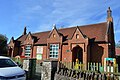
 Kempston Church End (2) - geograph.org.uk - 363338.jpg 640 × 480; 116 KB
-
 Kempston Church End - geograph.org.uk - 4971773.jpg 640 × 426; 86 KB
-
 Kempston Church End - geograph.org.uk - 4971858.jpg 426 × 640; 85 KB
-
 Kempston Church End - geograph.org.uk - 4971861.jpg 640 × 426; 85 KB
-
 Kempston Church End.jpg 4,080 × 3,060; 8 MB
-
 Kempston rural lower school - geograph.org.uk - 3676920.jpg 1,600 × 1,067; 396 KB
-
 Kempston School - geograph.org.uk - 4971866.jpg 640 × 426; 79 KB
-
 Kempston West End - geograph.org.uk - 5586660.jpg 640 × 426; 96 KB
-
 Kempston Wood - geograph.org.uk - 5586653.jpg 640 × 426; 61 KB
-
 Kempston Wood - geograph.org.uk - 5586661.jpg 640 × 426; 58 KB
-
 Lake by the Woburn Road - geograph.org.uk - 3676950.jpg 1,600 × 1,066; 492 KB
-
 Lake, Box End Park - geograph.org.uk - 5005775.jpg 640 × 426; 66 KB
-
 Lake, Box End Park - geograph.org.uk - 5005779.jpg 640 × 426; 69 KB
-
 Lake, Box End Park - geograph.org.uk - 5005793.jpg 640 × 426; 63 KB
-
 Lake, Box End Park - geograph.org.uk - 5005800.jpg 640 × 426; 68 KB
-
 Large arable field - geograph.org.uk - 5002573.jpg 640 × 426; 45 KB
-
 Latin Inscription, Kempston School - geograph.org.uk - 4971870.jpg 640 × 426; 83 KB
-
 Layby on The Branston Way, Kempston - geograph.org.uk - 5428735.jpg 1,958 × 1,408; 854 KB
-
 Layby on The Branston Way, Kempston - geograph.org.uk - 6293042.jpg 1,906 × 1,260; 1.06 MB
-
 Layby on The Branston Way, Kempston - geograph.org.uk - 6293053.jpg 1,920 × 1,280; 740 KB
-
 Lewis Close, Bedford - geograph.org.uk - 3188106.jpg 640 × 480; 51 KB
-
 Lodge, Crossland Fosse - geograph.org.uk - 5005740.jpg 640 × 426; 72 KB
-
 Moorland - geograph.org.uk - 5005724.jpg 640 × 415; 110 KB
-
 Moorland - geograph.org.uk - 5005726.jpg 640 × 426; 129 KB
-
 Near Kempston West End - geograph.org.uk - 5586656.jpg 640 × 426; 67 KB
-
 Near Old Farm - geograph.org.uk - 5586644.jpg 640 × 426; 69 KB
-
 New A428 bridge over the Great Ouse - geograph.org.uk - 3676926.jpg 1,600 × 1,068; 334 KB
-
 New houses by The Branston Way, Kempston - geograph.org.uk - 5428733.jpg 2,048 × 1,536; 1.5 MB
-
 New housing estate - geograph.org.uk - 4547894.jpg 4,320 × 3,240; 2.88 MB
-
 New housing, Bedford - geograph.org.uk - 3188104.jpg 640 × 480; 55 KB
-
 New pub and housing estate - geograph.org.uk - 4547881.jpg 4,320 × 3,240; 2.98 MB
-
 Obstacle course - geograph.org.uk - 5593035.jpg 640 × 426; 59 KB
-
 Obstacle Course, Box End Park - geograph.org.uk - 5005767.jpg 640 × 409; 66 KB
-
 Old Farm Cottage - geograph.org.uk - 5586640.jpg 640 × 426; 89 KB
-
 On the West Bedfordshire Ridge - geograph.org.uk - 5577268.jpg 640 × 426; 73 KB
-
 Openwater swimmer rounding a buoy - geograph.org.uk - 5593064.jpg 640 × 426; 69 KB


