Category:Keizersgracht 71, Amsterdam
Jump to navigation
Jump to search
| Object location | | View all coordinates using: OpenStreetMap |
|---|
house in Amsterdam, Netherlands  | |||||
| Upload media | |||||
| Instance of | |||||
|---|---|---|---|---|---|
| Location | Amsterdam, North Holland, Netherlands | ||||
| Street address |
| ||||
| Located on street | |||||
| Heritage designation |
| ||||
 | |||||
|
This is a category about rijksmonument number 2231
|
| Address |
|
Media in category "Keizersgracht 71, Amsterdam"
The following 17 files are in this category, out of 17 total.
-
 Amsterdam - Keizersgracht 71.JPG 3,056 × 4,592; 4.79 MB
-
 Amsterdam, keizersgracht 71 - WLM 2011 - andrevanb (1).jpg 1,200 × 900; 478 KB
-
 Amsterdam, keizersgracht 71 - WLM 2011 - andrevanb (2).jpg 900 × 1,200; 481 KB
-
 Amsterdam, keizersgracht 71 - WLM 2011 - andrevanb.jpg 958 × 1,200; 381 KB
-
 Interieur, "vulcanus" - Amsterdam - 20352940 - RCE.jpg 1,200 × 573; 103 KB
-
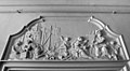 Interieur, bovendeurstuk "bouwkunst" of "aarde" - Amsterdam - 20352939 - RCE.jpg 1,200 × 660; 139 KB
-
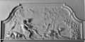 Interieur, bovendeurstuk "gouden tijd" - Amsterdam - 20352179 - RCE.jpg 1,200 × 587; 131 KB
-
 Interieur, bovendeurstuk - Amsterdam - 20352180 - RCE.jpg 1,200 × 692; 141 KB
-
 Interieur, bovendeurstuk in gang, Afrika - Amsterdam - 20352175 - RCE.jpg 1,200 × 813; 154 KB
-
 Interieur, bovendeurstuk in gang, Amerika - Amsterdam - 20352177 - RCE.jpg 1,200 × 870; 157 KB
-
 Interieur, bovendeurstuk in gang, Azië - Amsterdam - 20352174 - RCE.jpg 1,200 × 818; 141 KB
-
 Interieur, bovendeurstuk in gang, Europa - Amsterdam - 20352176 - RCE.jpg 1,200 × 842; 163 KB
-
 Interieur, bovendeurstuk in hal, Neptunus - Amsterdam - 20352173 - RCE.jpg 1,200 × 701; 119 KB
-
 Interieur, plafond gang "Mercurius" - Amsterdam - 20352937 - RCE.jpg 861 × 1,200; 159 KB
-
 Interieur, plafond trappenhuis, Aurora - Amsterdam - 20352172 - RCE.jpg 1,169 × 1,200; 196 KB
-
 Interieur, stucwerk in gang - Amsterdam - 20352178 - RCE.jpg 787 × 1,200; 143 KB
-
 Voorgevels - Amsterdam - 20018035 - RCE.jpg 1,200 × 1,174; 378 KB
.jpg)
.jpg)


