Category:Kehl
Jump to navigation
Jump to search
town in southwest Germany    | |||||
| Upload media | |||||
| Instance of |
| ||||
|---|---|---|---|---|---|
| Location | Ortenau, Freiburg Government Region, Baden-Württemberg, Germany | ||||
| Located in or next to body of water | |||||
| Head of government |
| ||||
| Significant event |
| ||||
| Population |
| ||||
| Area |
| ||||
| Elevation above sea level |
| ||||
| Different from | |||||
| official website | |||||
 | |||||
Subcategories
This category has the following 28 subcategories, out of 28 total.
*
E
F
- Festung Kehl (16 F)
- Fountains in Kehl (1 F)
H
- Heuwenderin (7 F)
J
K
- Kehler Zeitung (3 F)
- Khatchkar (Kehl) (4 F)
- Kriegerdenkmal 1914/18 Kehl (1 F)
- Kriegerdenkmal 39-45 in Kehl (1 F)
- Kriegsgräberstätte in Kehl (12 F)
M
- Myriameterstein 12 (Kehl) (6 F)
- Myriameterstein 13 (Kehl) (4 F)
N
P
- Public bookcases in Kehl (3 F)
R
- Rheinseitenkanal (Ortenau) (7 F)
S
- Stolpersteine in Kehl (74 F)
T
V
- Views of Kehl (24 F)
Media in category "Kehl"
The following 111 files are in this category, out of 111 total.
-
 DEU Kehl COA.svg 701 × 742; 10 KB
-
 Wappen Kehl.png 575 × 603; 154 KB
-
 2006 January walk around Kehl 10.jpg 1,280 × 960; 526 KB
-
 2006 January walk around Kehl 11.jpg 1,280 × 960; 492 KB
-
 2006 January walk around Kehl 12.jpg 1,280 × 960; 474 KB
-
 2006 January walk around Kehl 13.jpg 1,280 × 960; 268 KB
-
 2006 January walk around Kehl 2.jpg 1,280 × 960; 331 KB
-
 2006 January walk around Kehl 3.jpg 1,280 × 960; 358 KB
-
 2006 January walk around Kehl 4.jpg 1,280 × 960; 444 KB
-
 2006 January walk around Kehl 5.jpg 1,280 × 960; 429 KB
-
 2006 January walk around Kehl 6.jpg 1,280 × 960; 331 KB
-
 2006 January walk around Kehl 7.jpg 1,280 × 960; 332 KB
-
 2006 January walk around Kehl 8.jpg 1,280 × 960; 419 KB
-
 2006 January walk around Kehl 9.jpg 1,280 × 960; 451 KB
-
 2006 January walk around Kehl.jpg 1,280 × 960; 342 KB
-
 A frozen kingdom (Unsplash).jpg 5,184 × 3,456; 2.49 MB
-
 April 2013 Feuerwache Kehl.JPG 3,648 × 2,736; 4.04 MB
-
 Badisches Pionier-Bataillon Nr. 14.JPG 1,712 × 2,288; 900 KB
-
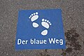
 Kehl, der blaue Weg, 1.jpeg 2,660 × 2,448; 1.3 MB
-
 Blick über den Rhein nach Straßburg - panoramio.jpg 1,029 × 1,280; 854 KB
-
 Borne aux armes de Strasbourg-1698.jpg 2,736 × 3,648; 2.6 MB
-
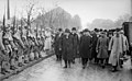 Clemenceau Millerand Kehl 1919.jpg 1,221 × 756; 229 KB
-
 D-OG-Kehl1.JPG 1,600 × 1,200; 502 KB
-
De-Kehl.ogg 1.6 s; 16 KB
-
 DropsAstronaut.jpg 1,254 × 1,866; 368 KB
-
 DropsCultureBeat.jpg 1,004 × 708; 147 KB
-
 Einsatzzentrale Feuerwehr Kehl 2013.JPG 3,648 × 2,736; 4.41 MB
-
 Einwohnerentwicklung von Kehl - ab 1871.svg 800 × 400; 48 KB
-
 Einwohnerentwicklung von Kehl.svg 800 × 400; 48 KB
-
 Fahrplan Kehl Seelbach.jpg 1,042 × 1,285; 171 KB
-
 Flagge Kehl.svg 600 × 1,500; 16 KB
-
 GemeinderatKehl.jpg 905 × 583; 41 KB
-
 GRDKehl0914.JPG 949 × 545; 28 KB
-
 Grenzfluss - Deutschland - Frankreich - panoramio.jpg 1,280 × 932; 808 KB
-
 Iced ballad (Unsplash).jpg 5,184 × 3,456; 5.1 MB
-
 Jean-Michel Moreau illustration Candide Voltaire édition de Kehl 1787.jpg 918 × 1,273; 718 KB
-
 July 2007, cycling from Strasbourg to Kehl 10.jpg 3,072 × 2,304; 1.58 MB
-
 July 2007, cycling from Strasbourg to Kehl 2.jpg 3,072 × 2,304; 2.59 MB
-
 July 2007, cycling from Strasbourg to Kehl 3.jpg 3,072 × 2,304; 1.35 MB
-
 July 2007, cycling from Strasbourg to Kehl 4.jpg 3,072 × 2,304; 1.38 MB
-
 July 2007, cycling from Strasbourg to Kehl 5.jpg 3,072 × 2,304; 1.45 MB
-
 July 2007, cycling from Strasbourg to Kehl 6.jpg 3,072 × 2,304; 1.44 MB
-
 July 2007, cycling from Strasbourg to Kehl 7.jpg 3,072 × 2,304; 1.39 MB
-
 July 2007, cycling from Strasbourg to Kehl 8.jpg 3,072 × 2,304; 1.57 MB
-
 July 2007, cycling from Strasbourg to Kehl 9.jpg 3,072 × 2,304; 1.39 MB
-
 July 2007, cycling from Strasbourg to Kehl.jpg 3,072 × 2,304; 1.8 MB
-
 KAS-Kehl-Bild-14441-1.jpg 789 × 1,137; 90 KB
-
 KAS-Kehl-Bild-14443-1.jpg 795 × 1,128; 85 KB
-
 KAS-Kehl-Bild-14444-1.jpg 789 × 1,129; 91 KB
-
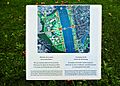 Kehl - Info Tafel an der Rheinpromenade - panoramio.jpg 1,280 × 917; 1.18 MB
-
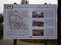
 Kehl - Landesgartenschau - 2004 - panoramio.jpg 1,280 × 899; 982 KB
-
 Kehl 100 Jahre Dorf und Stadt Vereinigungslinie Schaubild.JPG 3,648 × 2,736; 4.39 MB
-
 Kehl Bahnhof.jpg 3,664 × 2,748; 2.37 MB
-
 Kehl in Germany.png 140 × 175; 14 KB
-
 Kehl in OG.svg 733 × 752; 1,004 KB
-
 Kehl pont du Rhin Réseau Alliance plaque commémorative.jpg 2,277 × 3,416; 6.36 MB
-
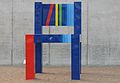 Kehl Stuhl.jpg 1,600 × 1,109; 158 KB
-
 Kehl, Germany, October 2017 05.jpg 4,128 × 3,096; 6.61 MB
-
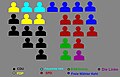
 Kehl-Population-Stats.png 1,075 × 650; 34 KB
-
 Kehlbrug tussen Kehl en Straatsburg, Duitsland, RP-F-F13855.jpg 4,458 × 2,180; 1.19 MB
-
 Kehler FV Logo.png 591 × 591; 201 KB
-
 Kehlerfv.JPG 591 × 591; 74 KB
-
 Kinzigallee KEHL - panoramio.jpg 2,703 × 2,027; 3.24 MB
-
 Kupferstich - Die Franzosen setzen am 24 Juni über den Rhein.png 428 × 675; 469 KB
-
 LASB K Hellwig 0952.jpg 2,733 × 2,046; 7.7 MB
-
 Le jardin des Deux Rives - Garten der zwei Ufer - The garden of Two Rivers photo2.jpg 3,456 × 2,304; 3.17 MB
-
 Le jardin des Deux Rives - Garten der zwei Ufer - The garden of Two Rivers photo3.jpg 3,456 × 2,304; 2.93 MB
-
 Le jardin des Deux Rives - Garten der zwei Ufer - The garden of Two Rivers photo4.jpg 3,456 × 2,304; 4.43 MB
-
 Le jardin des Deux Rives - Garten der zwei Ufer - The garden of Two Rivers photo5.jpg 3,456 × 2,304; 4.24 MB
-
 Le jardin des Deux Rives - Garten der zwei Ufer - The garden of Two Rivers photo6.jpg 3,456 × 2,304; 3.83 MB
-
 Le Tour du monde-03-p364.jpg 820 × 416; 112 KB
-
 Logo Kehl am Rhein.jpg 189 × 110; 3 KB
-
 McDonald's Strassburger Strasse - geo.hlipp.de - 40317.jpg 640 × 429; 57 KB
-
 Monument in Kehl - panoramio.jpg 1,920 × 2,560; 709 KB
-
 Multizelle über dem Schwarzwald.jpg 2,144 × 1,424; 634 KB
-
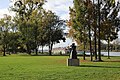
 Oberlaender denkmal.jpg 1,552 × 2,592; 1 MB
-
 October 2006, Cycling around Strasbourg 2.jpg 2,272 × 1,704; 1.2 MB
-
 Pont Beatus-Rhenanus - Beatus-Rhenanus-Brücke photo2.jpg 3,456 × 2,304; 3.68 MB
-
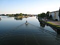
 Rheinbrücke - Straßburg - Kehl - panoramio.jpg 1,280 × 835; 766 KB
-
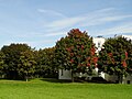
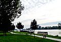
 Rheingarten Kehl (10688502396).jpg 4,912 × 2,760; 3.87 MB
-
 Rheinpromenade - Kehl - panoramio.jpg 1,280 × 960; 796 KB
-
 Rheinpromenade - panoramio (1).jpg 1,280 × 853; 945 KB
-
 Rheinpromenade - panoramio (2).jpg 4,608 × 3,456; 9.37 MB
-
 Rheinpromenade - panoramio (3).jpg 1,280 × 960; 826 KB
-
 Rheinpromenade - panoramio (4).jpg 2,560 × 1,920; 1.75 MB
-
 Rheinpromenade - panoramio.jpg 2,272 × 1,704; 953 KB
-
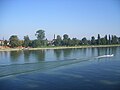
 Rheinufer - Kehl - panoramio.jpg 1,280 × 876; 671 KB
-
 Rhine @ Passerelle des Deux Rives @ Strasbourg (45565604881).jpg 5,472 × 3,648; 7.22 MB
-
 Rhine near Leutesheim, north of Strasbourg. - panoramio.jpg 1,600 × 1,169; 285 KB
-
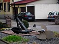 Schiffsschraube und Anker Kehl 2013.JPG 3,648 × 2,736; 4.15 MB
-
 Seabed aquarium motion lamps, for sale in Kehl.jpg 3,072 × 2,304; 1.85 MB
-
 Situation in 1796.gif 482 × 452; 95 KB
-
 Siège de Strasbourg, 1870, Kehl (batterie de mortiers).jpg 1,000 × 568; 220 KB
-
-

-

-
 Strasbourg and Vosges mountains seen from Ortenau.jpg 9,417 × 3,182; 18.96 MB
-
 Studentenwohnheim - Kinzigallee - panoramio.jpg 1,280 × 960; 982 KB
-
 Symbole Deutsch Französischer Freundschaft - panoramio.jpg 1,280 × 817; 875 KB
-
 Tribunal de Kehl.png 6,517 × 4,070; 35.54 MB
-
 Ufo - panoramio - georama.jpg 2,304 × 1,728; 1.35 MB
-
 University of Applied Sciences - panoramio.jpg 1,280 × 945; 1.1 MB
-
 Versöhnungsweg - panoramio (1).jpg 1,280 × 905; 683 KB
-
 Versöhnungsweg - panoramio.jpg 1,280 × 891; 786 KB
-
 Vue aérienne Kehl - Strasbourg.jpg 4,091 × 1,850; 4.72 MB
-
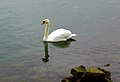
 Weiser Schwan - Sage Cygne - panoramio.jpg 1,280 × 899; 723 KB
-
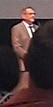 Wolfram Britz, Kehler Oberbürgermeister, bei Vereidigung.jpg 282 × 564; 20 KB
-
-
-

-
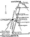
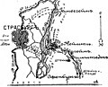
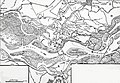 Карта к статье «Кель» № 3. Военная энциклопедия Сытина (Санкт-Петербург, 1911-1915).jpg 2,886 × 1,990; 1.05 MB


.jpg)


.jpg)


.jpg)

.jpg)
.jpg)
.jpg)
.jpg)


.jpg)


.jpg)


.jpg)


.jpg)
.jpg)
._%D0%92%D0%BE%D0%B5%D0%BD%D0%BD%D0%B0%D1%8F_%D1%8D%D0%BD%D1%86%D0%B8%D0%BA%D0%BB%D0%BE%D0%BF%D0%B5%D0%B4%D0%B8%D1%8F_%D0%A1%D1%8B%D1%82%D0%B8%D0%BD%D0%B0_(%D0%A1%D0%B0%D0%BD%D0%BA%D1%82-%D0%9F%D0%B5%D1%82%D0%B5%D1%80%D0%B1%D1%83%D1%80%D0%B3,_1911-1915).jpg)
.jpg)