Category:Kea Point Track
Jump to navigation
Jump to search
hiking track in New Zealand  | |||||
| Upload media | |||||
| Instance of | |||||
|---|---|---|---|---|---|
| Located in protected area | |||||
| Location | Canterbury Region, New Zealand | ||||
| Connects with | |||||
 | |||||
Media in category "Kea Point Track"
The following 13 files are in this category, out of 13 total.
-
 Forks to Kea Point and Hooker Valley - 2013.04 - panoramio.jpg 3,190 × 2,392; 2.5 MB
-
 Kea Point - 2013.04 - panoramio.jpg 4,262 × 3,197; 4.66 MB
-
 Kea Point Track - 2013.04 - panoramio (1).jpg 4,608 × 3,456; 5.85 MB
-
 Kea Point Track - 2013.04 - panoramio.jpg 4,608 × 3,456; 4.86 MB
-
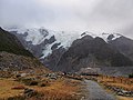
 Kea Point Track in Mount Cook National Park 01.jpg 4,127 × 2,680; 12.79 MB
-
 Kea Point Track in Mount Cook National Park 02.jpg 2,689 × 4,033; 8.74 MB
-
 Kea Point Track in Mount Cook National Park 03.jpg 4,034 × 2,689; 9.71 MB
-
 Kea Point Track in Mount Cook National Park 04.jpg 3,494 × 2,479; 8.73 MB
-
 Kea Point Track in Mount Cook National Park 05.jpg 3,696 × 2,464; 8.21 MB
-
 Kea Point Track in Mount Cook National Park 06.jpg 3,997 × 2,665; 8.17 MB
-
 Kea Point Track in Mount Cook National Park 07.jpg 3,722 × 2,050; 6.45 MB
-
 Southern Alps from Kea Point, Aoraki - Mount Cook National Park, New Zealand.jpg 6,734 × 3,788; 20.78 MB
-
 Valley seen from Kea Pt Track, Aoraki Mount Cook National Park (2).jpg 2,496 × 1,664; 2.16 MB


.jpg)


.jpg)