Category:Kata Tjuta

|
Legal disclaimer Someone has identified this image or film (or category of these items) as being captured within the boundaries of a Commonwealth reserve of Australia however they have not identified the specific Commonwealth reserve when using this template. Australian law states in section 12.38 of the Environment Protection and Biodiversity Conservation Regulations 2000 that images and film captured in a Commonwealth reserve cannot be used to derive commercial gain unless at least one of the exemptions listed in section 12.06 of the regulation is satisfied. Exemptions include capture and use of images and film as allowed by the management plan for the Commonwealth reserve, and requesting and being granted a permit. Section 18.04(b) of the regulation may exempt a permit fee from being payable if the activity contributes to the positive portrayal of the Commonwealth reserve and its values. Before using this content, please ensure that you have the right to use it under the laws which apply in the circumstances of your intended use. See our general disclaimer. |
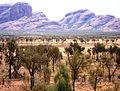
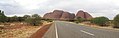
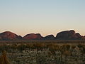
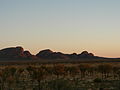
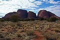
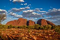
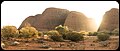
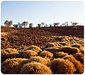
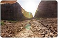
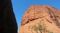
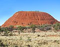
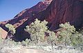
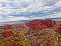
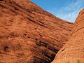
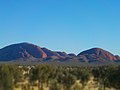
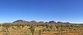
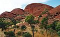
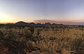
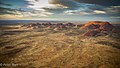
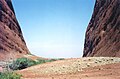
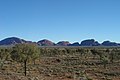
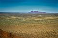
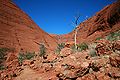
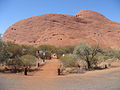
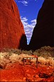
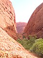
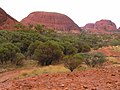
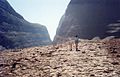
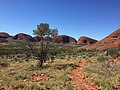
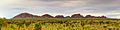
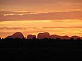
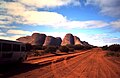
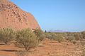
domed rock formation in the Northern Territory of Australia  | |||||
| Upload media | |||||
| Instance of | |||||
|---|---|---|---|---|---|
| Located in protected area | |||||
| Location | Northern Territory, AUS | ||||
| Area |
| ||||
| Elevation above sea level |
| ||||
 | |||||
Media in category "Kata Tjuta"
The following 200 files are in this category, out of 215 total.
(previous page) (next page)-
 01-valley-of-the-wind-walk-olgas-kata-tjuta-australia.JPG 1,920 × 1,080; 727 KB
-
 A stream and some glare.jpg 3,264 × 1,836; 3.29 MB
-

-
 Aerial Kata Tjuta olgas4799.jpg 500 × 324; 36 KB
-
 Aerial View of Kata Tjuta - 2013.04 - panoramio.jpg 3,252 × 2,437; 1.16 MB
-
 Allocasuarina decaisneana - desert oaks at Kata-Tjuta.jpg 649 × 492; 159 KB
-
 ApproachToKataJuta edit1.jpg 2,970 × 906; 2.22 MB
-
 ApproachToKataJuta.jpg 3,000 × 960; 2.13 MB
-
 AUS-Olga-panorama.jpg 2,956 × 1,029; 984 KB
-
 Australia alt banner.jpg 12,756 × 1,822; 21.8 MB
-
 Australian desert ESA345627.jpg 1,680 × 1,920; 4.7 MB
-
 Australian Outback - 2.jpg 5,568 × 3,712; 4.46 MB
-
 Australian Outback.jpg 5,568 × 3,712; 3.53 MB
-
 Australie 2 328.jpg 2,048 × 1,536; 820 KB
-
 Australie 2 372.jpg 1,536 × 2,048; 1.14 MB
-
 Australie 2 410.jpg 1,536 × 2,048; 1.5 MB
-
 Australie 2 416.jpg 2,048 × 1,536; 1.52 MB
-
 Australie Kata Tjuta 01.jpg 2,048 × 1,536; 1,011 KB
-
 Australie Kata Tjuta 02.jpg 2,048 × 1,536; 1,001 KB
-
 Australie Kata Tjuta 03.jpg 2,048 × 1,536; 958 KB
-
 Australie Red Center Kata Tjutas Olgas.JPG 1,800 × 1,200; 305 KB
-
 Autumn at Kata Tjuta.jpg 4,032 × 3,024; 5.54 MB
-
 Brush around Kata Tjuta.jpg 2,048 × 1,536; 2.95 MB
-
 Cata Tjuta (111544601).jpeg 1,080 × 580; 277 KB
-
 CSIRO ScienceImage 1259 Aerial view of Kata Tjuta Mount Olga.jpg 2,657 × 1,752; 5.67 MB
-
 CSIRO ScienceImage 1583 Sunset Sunrise.jpg 2,657 × 1,781; 4 MB
-
 CSIRO ScienceImage 1617 Sunset Sunrise.jpg 2,657 × 1,731; 2.47 MB
-
 Dawn (14990417150).jpg 5,760 × 3,840; 13.72 MB
-
 Desert14.jpg 3,008 × 2,008; 1.46 MB
-
 Dome Rocks - 2013.04 - panoramio.jpg 3,200 × 2,400; 2.77 MB
-
 Drinking Pool at Kata Tjuta.jpg 3,872 × 2,592; 1.72 MB
-
 DSC vbn.jpg 3,264 × 4,928; 6.24 MB
-
 Endless Stations 34 - Kata Tjuta.jpg 5,120 × 2,184; 8.34 MB
-
 Endless Stations 35 - Fluffy Desert.jpg 3,387 × 3,000; 9.1 MB
-
 Endless Stations 36 - On the Path to the Valley of the Winds.jpg 3,172 × 3,000; 9.01 MB
-
 Endless Stations 37 - Let The Flies Lead The Way.jpg 3,000 × 3,000; 6.88 MB
-
 Endless Stations 38 - And so did I find the home of sun.jpg 5,120 × 3,344; 14.23 MB
-
 Endless Stations 40 - Desert Skink!.jpg 3,000 × 3,000; 5.78 MB
-
 Giants in the waste.jpg 3,264 × 1,836; 2.58 MB
-
 Green Desert - 2013.04 - panoramio.jpg 4,503 × 3,377; 5.99 MB
-
 Huge Red Rock - 2013.04 - panoramio.jpg 4,608 × 3,456; 3.14 MB
-
 ISS-65 Kata Tjuta, Northern Territory.jpg 5,568 × 3,712; 5.75 MB
-
 Kajatuja.JPG 2,336 × 3,504; 2.11 MB
-
 Karingana Lookout (14990399747).jpg 5,760 × 3,840; 15.41 MB
-
 Karingana Lookout (15153945056).jpg 5,760 × 3,840; 15.19 MB
-
 Karingana Lookout - 2013.04 - panoramio.jpg 3,347 × 4,463; 2.99 MB
-
 Karu Lookout - 2013.04 - panoramio.jpg 3,200 × 2,400; 2.84 MB
-
 Kata Juta The Olgas.jpg 2,592 × 1,936; 1.97 MB
-
 Kata Tjuta (14990116629).jpg 4,896 × 3,264; 8.03 MB
-
 Kata Tjuta (14990182730).jpg 4,896 × 3,264; 10.95 MB
-
 Kata Tjuta (14990185130).jpg 4,896 × 3,264; 9.67 MB
-
 Kata Tjuta (14990302569).jpg 4,896 × 3,264; 9.99 MB
-
 Kata Tjuta (14990451110).jpg 4,896 × 3,264; 9.03 MB
-
 Kata Tjuta (15154074026).jpg 4,896 × 3,264; 7.13 MB
-
 Kata Tjuta (15174043521).jpg 4,896 × 3,264; 9.5 MB
-
 Kata Tjuta (15174150461).jpg 4,896 × 3,264; 8.8 MB
-
 Kata Tjuta (15177158615).jpg 4,896 × 3,264; 8.22 MB
-
 Kata Tjuta (2049622269).jpg 2,048 × 1,536; 391 KB
-
 Kata Tjuta (2049623795).jpg 2,048 × 1,536; 511 KB
-
 Kata Tjuta (2049624093).jpg 2,048 × 1,536; 1.19 MB
-
 Kata Tjuta (2049625669).jpg 2,048 × 1,536; 1.14 MB
-
 Kata Tjuta (2049627979).jpg 2,048 × 1,536; 825 KB
-
 Kata Tjuta (2050405938).jpg 2,048 × 1,536; 338 KB
-
 Kata Tjuta (2050406076).jpg 2,048 × 1,536; 416 KB
-
 Kata Tjuta (2050406296).jpg 2,048 × 1,536; 598 KB
-
 Kata Tjuta (2050408020).jpg 2,048 × 1,536; 1.06 MB
-
 Kata Tjuta (2050408662).jpg 2,048 × 1,536; 1.45 MB
-
 Kata Tjuta (2050408942).jpg 2,048 × 1,536; 727 KB
-
 Kata Tjuta (2050409692).jpg 2,048 × 1,536; 914 KB
-
 Kata Tjuta (2050409982).jpg 2,048 × 1,536; 1.32 MB
-
 Kata Tjuta (2050410512).jpg 2,048 × 1,536; 1.12 MB
-
 Kata Tjuta (2050410746).jpg 2,048 × 1,536; 715 KB
-
 Kata Tjuta (2050411004).jpg 2,048 × 1,536; 835 KB
-
 Kata Tjuta (2050411258).jpg 2,048 × 1,536; 726 KB
-
 Kata Tjuta (23214668970).jpg 2,513 × 1,651; 1.36 MB
-
 Kata Tjuta (50643954368).jpg 2,011 × 1,508; 1.19 MB
-
 Kata Tjuta (50644705526).jpg 3,864 × 3,000; 10.59 MB
-
 Kata Tjuta (6101053212) (2).jpg 1,500 × 707; 1,002 KB
-
 Kata Tjuta (6101053212).jpg 1,498 × 695; 874 KB
-
 Kata Tjuta (The Olgas) - panoramio - Frans-Banja Mulder.jpg 1,233 × 518; 520 KB
-
 Kata Tjuta (The Olgas) - panoramio.jpg 800 × 600; 330 KB
-
 Kata Tjuta (The Olgas) looking east.tif 2,440 × 940; 13.15 MB
-
 Kata Tjuta (The Olgas).tif 2,440 × 717; 10.04 MB
-
 Kata Tjuta - 2013.04 - panoramio (1).jpg 3,200 × 2,400; 3.16 MB
-
 Kata Tjuta - 2013.04 - panoramio.jpg 4,046 × 2,016; 3.21 MB
-
 Kata Tjuta - distant view at sunset.jpg 3,888 × 2,592; 4.79 MB
-
 Kata Tjuta - panoramio (1).jpg 2,592 × 1,944; 2.06 MB
-
 Kata Tjuta - Severní teritorium - panoramio.jpg 2,564 × 1,929; 3.41 MB
-
 Kata Tjuta - Valley of the Winds.jpg 4,032 × 3,024; 3.97 MB
-
 Kata Tjuta 1.jpg 917 × 502; 57 KB
-
 Kata Tjuta 2-2008.jpg 3,039 × 2,014; 9.01 MB
-
 Kata tjuta 2.jpg 800 × 475; 108 KB
-
 Kata Tjuta 2.jpg 924 × 602; 130 KB
-
 Kata Tjuta 321.jpg 4,032 × 3,024; 2.39 MB
-
 Kata Tjuta aerial photo (February 2004) 2.jpg 2,048 × 1,536; 1.47 MB
-
 Kata Tjuta aerial photo (February 2004).jpg 2,048 × 1,536; 2.42 MB
-
 Kata Tjuta Aerial.jpg 1,000 × 667; 861 KB
-
 Kata Tjuta also known as the Olgas from about 20km.jpg 4,032 × 1,467; 1.38 MB
-
 Kata Tjuta At Dusk.jpg 3,264 × 2,448; 1.48 MB
-
 Kata Tjuta at sunset (October 2009).jpg 1,024 × 739; 435 KB
-
 Kata Tjuta at sunset.jpg 3,456 × 2,304; 550 KB
-
 Kata Tjuta Australia.jpg 2,048 × 1,536; 373 KB
-
 Kata Tjuta before Sunrise - 2013.04 - panoramio.jpg 4,608 × 3,456; 2.88 MB
-
 Kata Tjuta by Kate Branch.jpg 3,072 × 3,120; 8.58 MB
-
 Kata Tjuta closeup Kim Dingwall.jpg 3,200 × 2,400; 6 MB
-
 Kata Tjuta dome with brush.jpg 1,536 × 2,048; 1.3 MB
-
 Kata Tjuta from a Helicopter.jpg 2,851 × 1,909; 2.08 MB
-
 Kata Tjuta from the distance.jpg 2,129 × 1,324; 1.22 MB
-
 Kata Tjuta from Uluru, NT, Australia.jpg 2,272 × 1,704; 929 KB
-
 Kata Tjuta from viewing deck.jpg 5,101 × 2,167; 1.32 MB
-
 Kata Tjuta gap between domes.jpg 1,536 × 2,048; 1.7 MB
-
 Kata Tjuta grass lands.jpg 3,600 × 1,805; 5.46 MB
-
 Kata Tjuta greenery Kim Dingwall.jpg 3,200 × 2,000; 4.66 MB
-
 Kata Tjuta hot weather closure point.jpg 3,745 × 2,738; 2.8 MB
-
 Kata Tjuta in Australia.jpg 3,072 × 3,120; 9.72 MB
-
 Kata Tjuta in evening light.jpg 2,048 × 1,536; 484 KB
-
 Kata Tjuta in the evening.jpg 4,973 × 3,216; 1.17 MB
-
 Kata tjuta inside.jpg 800 × 457; 109 KB
-
 Kata Tjuta looking west Cvbfgy.jpg 4,032 × 1,960; 2.37 MB
-
 Kata Tjuta Lookout.jpg 2,475 × 1,856; 1.38 MB
-
 Kata Tjuta National Park - The Olgas.jpg 6,680 × 3,758; 8.22 MB
-
 Kata Tjuta pan.jpg 14,788 × 1,836; 8.89 MB
-
 Kata tjuta panorama 3.jpg 2,496 × 639; 194 KB
-
 Kata tjuta panorama 4.jpg 4,225 × 669; 531 KB
-
 Kata Tjuta Panorama.jpg 10,279 × 1,632; 7.4 MB
-
 Kata tjuta panoramic.jpg 1,000 × 279; 61 KB
-
 Kata Tjuta reflected in puddle.jpg 3,264 × 2,258; 2.2 MB
-
 Kata Tjuta rock face.jpg 2,048 × 1,536; 1.95 MB
-
 Kata Tjuta sunset silhouettes.jpg 7,087 × 1,469; 3.34 MB
-
 Kata Tjuta sunset.jpg 5,616 × 3,744; 1.23 MB
-
 Kata Tjuta The Olgas 1227.jpg 4,608 × 3,456; 5.22 MB
-
 Kata Tjuta The Olgas1226.jpg 500 × 328; 28 KB
-
 Kata Tjuta Uluru (46838831161).jpg 5,874 × 8,763; 15.76 MB
-
 Kata Tjuta, Australia.jpg 1,200 × 786; 120 KB
-
 Kata Tjuta, Northern Territory, Australia.JPG 4,256 × 2,824; 11.65 MB
-
 Kata Tjuta, October 2017.jpg 2,048 × 1,361; 1.25 MB
-
 Kata Tjuta, Uluru-Kata Tjuta National Park, Australia.jpg 1,024 × 768; 147 KB
-
 Kata Tjuta.jpg 1,024 × 683; 323 KB
-
 Kata Tjuta.JPG 2,048 × 1,536; 630 KB
-
 Kata Tjuta1.jpg 596 × 396; 61 KB
-
 Kata Tjuta2008.jpg 3,039 × 2,014; 7.56 MB
-
 Kata Tjuṯa (24857640157).jpg 3,400 × 3,400; 9.52 MB
-
 Kata Tjuṯa (Olgas) - panoramio.jpg 2,592 × 1,296; 1.54 MB
-
 Kata Tjuṯa also known as the Olgas sunset.jpg 4,032 × 2,268; 3.08 MB
-
 Kata Tjuṯa also known as the Olgas.jpg 5,001 × 1,884; 7.68 MB
-
 Kata Tjuṯa, also known as the Olgas.jpg 7,482 × 1,979; 8.51 MB
-
 Kata Tjuṯa1.jpg 1,507 × 1,000; 1.83 MB
-
 Kata Tjuṯa2.jpg 1,528 × 1,000; 1.82 MB
-
 Kata-Tjuta at sunset.jpg 4,898 × 3,265; 250 KB
-
 Kata-Tjuta.jpg 3,468 × 2,505; 5.5 MB
-
 KataTjuta ValleyOfTheWinds.jpg 3,888 × 2,592; 6.68 MB
-
 KataTjuta-StitchedPanoramic.jpg 11,614 × 1,679; 4.95 MB
-
 KataTjutaDomes.jpg 3,172 × 2,379; 3.29 MB
-
 Lascar Kata Tjuta (The Olgas) (4563011892).jpg 2,592 × 1,944; 1.79 MB
-
 Lascar Kata Tjuta (The Olgas) (4563012964).jpg 2,592 × 1,944; 2.22 MB
-
 Lascar Kata Tjuta (The Olgas) (4563013918).jpg 2,592 × 1,944; 1.95 MB
-
 Lascar Kata Tjuta (The Olgas) - Walk between the large rocks (4563014782).jpg 2,592 × 1,944; 1.75 MB
-
 Les Olgas.jpg 1,536 × 1,024; 1.19 MB
-
 MC Olgas pano.jpg 4,765 × 1,500; 1.64 MB
-
 Morning Glow (15176669332).jpg 4,896 × 3,264; 8.68 MB
-
 Mount Olga, Central Australia(GN00965).jpg 3,264 × 2,448; 2.3 MB
-
 Olga australia 1990 - panoramio.jpg 2,030 × 3,098; 1.12 MB
-
 Olga Rocks, Australia - panoramio (1).jpg 1,536 × 2,048; 661 KB
-
 Olga Rocks, Australia - panoramio.jpg 2,048 × 1,536; 632 KB
-
 Olga Rocks, Australia, 2004 - panoramio (1).jpg 1,536 × 2,048; 666 KB
-
 Olga Rocks, Australia, 2004 - panoramio (2).jpg 2,048 × 1,536; 606 KB
-
 Olga Rocks, Australia, 2004 - panoramio (3).jpg 2,048 × 1,536; 684 KB
-
 Olga Rocks, Australia, 2004 - panoramio (4).jpg 2,048 × 1,536; 641 KB
-
 Olga Rocks, Australia, 2004 - panoramio.jpg 2,048 × 1,536; 686 KB
-
 Olgas - panoramio.jpg 3,456 × 2,592; 4.2 MB
-
 Olgas Australia.jpg 1,200 × 767; 158 KB
-
 Olgas IMG 2092 NT (39207746992).jpg 3,264 × 2,448; 3.11 MB
-
 Olgas in Northern Territory(GN03686).jpg 3,264 × 2,448; 997 KB
-
 Olgas schöner Himmel - panoramio.jpg 3,456 × 2,592; 3.39 MB
-
 Olgas.jpg 3,510 × 1,476; 1.64 MB
-
 OlgasFromUluruTop.JPG 2,048 × 1,280; 848 KB
-
 Panoramic view of Kata-Tjuta in the early morning.jpg 12,756 × 3,189; 33.18 MB
-
 Road heading to Kata Tjuta (Mount Olga) - Uluru-Kata Tjuta National Park.jpg 4,032 × 3,024; 4.79 MB
-
 Rock (14990237919).jpg 5,760 × 3,840; 15.47 MB
-
 Rocks (15153957096).jpg 5,760 × 3,840; 13.15 MB
-
 Rocks Of Kata-Tjuta.jpg 2,448 × 3,264; 2.73 MB
-
 Rocks olgas 2.jpg 3,153 × 2,364; 7.05 MB
-
 Rocks olgas.jpg 3,093 × 2,259; 8.25 MB
-
 Some brush between the walls.jpg 3,264 × 1,836; 2 MB
-
 Springtime at Kata Tjuta - panoramio.jpg 2,736 × 3,648; 2.91 MB
-
 Storm over Kata Tjuta.jpg 3,850 × 2,062; 2.91 MB
-
 Sunrise (15154010206).jpg 4,896 × 3,264; 8.16 MB
-
 The olgas 01.JPG 1,536 × 2,048; 512 KB
-
 The Olgas at noon, Uluru.jpg 4,032 × 3,024; 3.8 MB
-
 The Olgas at sunset, Uluru.jpg 4,032 × 3,024; 3.82 MB
-
 The Olgas.jpg 4,928 × 2,772; 7.16 MB
-
 The shade don't kill the heat.jpg 3,264 × 1,836; 1.45 MB
-

-
 The World Factbook - Australia - Flickr - The Central Intelligence Agency (24).jpg 1,500 × 1,125; 73 KB
-
 TjukaruruRoadAtKataTjuta1998.jpg 1,711 × 1,109; 381 KB
-
 Tree (14990310588).jpg 5,760 × 3,840; 16.49 MB
-
 Uluru - Kata Tjuta NP.jpg 3,039 × 2,014; 7.15 MB
-
 Uluru-Kata Tjuta banner Kata Tjuta.jpg 2,100 × 300; 229 KB
-
 UluruClip3ArtC1941.jpg 1,048 × 722; 292 KB
-
 Valley in Hiking Trail.jpg 4,256 × 2,832; 7.97 MB


.jpeg)


.jpg)


.jpg)
.jpg)


.jpg)
.jpg)
.jpg)
.jpg)
.jpg)
.jpg)
.jpg)
.jpg)
.jpg)
.jpg)
.jpg)
.jpg)
.jpg)
.jpg)
.jpg)
.jpg)
.jpg)
.jpg)
.jpg)
.jpg)
.jpg)
.jpg)
.jpg)
.jpg)
.jpg)
.jpg)
.jpg)
.jpg)
.jpg)
_(2).jpg)
.jpg)
_-_panoramio_-_Frans-Banja_Mulder.jpg)
_-_panoramio.jpg)
.jpg)


.jpg)


_2.jpg)
.jpg)


.jpg)


.jpg)


.jpg)
_-_panoramio.jpg)


_(4563011892).jpg)
_(4563012964).jpg)
_(4563013918).jpg)
_-_Walk_between_the_large_rocks_(4563014782).jpg)

.jpg)
.jpg)

.jpg)

.jpg)
.jpg)
.jpg)
.jpg)


.jpg)
.jpg)


_-_Uluru-Kata_Tjuta_National_Park.jpg)
.jpg)
.jpg)


.jpg)


.jpg)
.jpg)

.jpg)


