Category:Karla Marksa St., 25 (Simferopol)
Jump to navigation
Jump to search
| Object location | | View all coordinates using: OpenStreetMap |
|---|
 | |||||
| Upload media | |||||
| Instance of | |||||
|---|---|---|---|---|---|
| Part of | |||||
| Location | Simferopol, Simferopol municipality council, Autonomous Republic of Crimea, Ukraine | ||||
 | |||||
Media in category "Karla Marksa St., 25 (Simferopol)"
The following 8 files are in this category, out of 8 total.
-
 2015.09.26.1619.12.S3050046 Маркса25 сер.XIX-поч.XX буд.Арендта.JPG 2,816 × 1,584; 2.21 MB
-
 2015.09.26.1619.26.S3050047 Маркса25 сер.XIX-поч.XX буд.Арендта.JPG 2,816 × 1,584; 2.21 MB
-
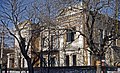
 2018.03.03.1532.51. Сімферополь будинок Арендта.jpg 4,608 × 3,456; 6.41 MB
-
 Arend home 1848.jpg 500 × 375; 95 KB
-
 Arendt home.jpg 500 × 375; 48 KB
-
 MG 2158w t.jpg 2,000 × 1,222; 833 KB
-
 Simferopol 04-14 img08 K-Marx-Street.jpg 4,206 × 2,804; 5.93 MB
-
 Комплекс споруд садиби Арендтів-Ребець.jpg 5,184 × 3,456; 8.86 MB


