Category:Kalverstraat 78, Amsterdam
Jump to navigation
Jump to search
| Object location | | View all coordinates using: OpenStreetMap |
|---|
 | |||||
| Upload media | |||||
| Instance of | |||||
|---|---|---|---|---|---|
| Location | Amsterdam, North Holland, Netherlands | ||||
| Street address |
| ||||
| Located on street | |||||
| Heritage designation |
| ||||
 | |||||
|
This is a category about rijksmonument number 2149
|
| Address |
|
Media in category "Kalverstraat 78, Amsterdam"
The following 9 files are in this category, out of 9 total.
-
 04-18-1952 10473 Sigarenwinkelier (8418717599).jpg 1,675 × 1,667; 288 KB
-
 Amsterdam (NL), Figur in der Kalverstraat -- 2015 -- 7198.jpg 3,054 × 5,121; 8.53 MB
-
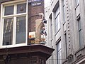
 Kalverstraat 78, 2011.JPG 1,024 × 685; 140 KB
-
 Kalverstraat 78.jpg 2,560 × 1,920; 454 KB
-
 Kalverstraat 90-78, overzicht - Amsterdam - 20014299 - RCE.jpg 953 × 1,200; 234 KB
-
 King Store, Amsterdam (2018).jpg 1,728 × 3,072; 1.73 MB
-
 Ontwerp tekening voor een winkelpui - Amsterdam - 20017838 - RCE.jpg 1,200 × 845; 266 KB
-
 RM2149 Kalverstraat 78.jpg 2,448 × 3,264; 1.52 MB
-
 Serie Juffrouw met briefje van duizend, Bestanddeelnr 908-2595.jpg 2,874 × 2,906; 965 KB
.jpg)
,_Figur_in_der_Kalverstraat_--_2015_--_7198.jpg)


.jpg)


