Category:Kalimpong
Jump to navigation
Jump to search
municipality in Kalimpong district, West Bengal  | |||||
| Upload media | |||||
| Instance of | |||||
|---|---|---|---|---|---|
| Location | Kalimpong subdivision, Kalimpong district, Jalpaiguri division, West Bengal, India | ||||
| Population |
| ||||
| Area |
| ||||
| Elevation above sea level |
| ||||
 | |||||
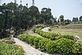
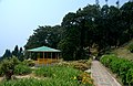
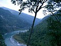
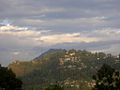
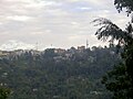
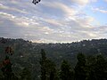
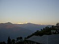
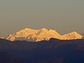
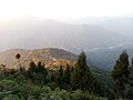
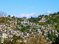
English: Kalimpong (Nepali: कालिम्पोङ) is a hill station nestled in the Shiwalik Hills (or Lower Himalaya) in the Indian state of West Bengal. It is located at an average elevation of 1,250 metres (4,101 ft). The town is the headquarters of the Kalimpong district. Kalimpong is known for its educational institutions many of which were established during the British Raj. It used to be a gateway in the trade between Tibet and India prior to China's annexation of Tibet and the Sino-Indian War. The Indian Army's 27 Mountain Division is located on the outskirts of the town. Kalimpong and neighbouring Darjeeling were major centres calling for a separate en:Gorkhaland state in the 1980s.
Subcategories
This category has the following 6 subcategories, out of 6 total.
!
- Quality images of Kalimpong (31 F)
B
N
- Nature of Kalimpong (31 F)
P
S
- Silver Oaks Kalimpong (3 F)
Media in category "Kalimpong"
The following 91 files are in this category, out of 91 total.
-
 LOUIS(1894) p042 KALIMPONG - MACFARLANE MEMORIAL CHURCH.jpg 1,887 × 1,439; 1.14 MB
-

-

-
 Bhakta bir singh fiat 1947.jpg 1,650 × 1,098; 555 KB
-
 Billboard in Kalimpong - panoramio.jpg 1,200 × 900; 271 KB
-
 Breather (5018552436).jpg 1,920 × 1,278; 3.51 MB
-
 Buddha Deola Hills kalimpong West Bengal.jpg 2,740 × 3,520; 2.06 MB
-
 Buddhist temple kalingpong.jpg 1,504 × 3,264; 1.06 MB
-
 Church (63655087).jpeg 2,048 × 1,536; 1.22 MB
-
 Clock tower in Kalimpong (cropped).jpg 5,144 × 735; 1.53 MB
-
 Clock tower in Kalimpong.jpg 5,144 × 3,429; 4.93 MB
-
 Cloudy kalimpong.jpg 4,320 × 3,240; 3.48 MB
-
 Cloudy kalimpong1.jpg 4,320 × 3,240; 3.54 MB
-
 Cloudy kalimpong2.jpg 4,320 × 3,240; 3.61 MB
-
 Cloudy kalimpong3.jpg 4,320 × 3,240; 2.73 MB
-
 Deolo, Kalimpong, West Bengal 734316, India - panoramio (1).jpg 4,288 × 2,848; 9.65 MB
-
 Deolo, Kalimpong, West Bengal 734316, India - panoramio.jpg 4,162 × 2,720; 5.63 MB
-
 Deolo.jpg 500 × 413; 59 KB
-
 DGH chapel windows.jpg 671 × 800; 137 KB
-
 Dorje Drolo.jpg 3,177 × 2,804; 5.14 MB
-
 Durpin Monastery Kalimpong.JPG 1,024 × 768; 380 KB
-
 Durpin2 (cropped).jpg 599 × 86; 20 KB
-
 Durpin2.jpg 600 × 267; 43 KB
-
 Hard Labour.jpg 5,616 × 3,744; 1.63 MB
-
 Icche Gaon, Kalimpong View 1.jpg 4,608 × 2,592; 3.5 MB
-
 Icche Gaon, Kalimpong View 2.jpg 4,608 × 2,592; 4.25 MB
-
 Icche Gaon, Kalimpong View 3.jpg 4,608 × 2,592; 2.22 MB
-
 Kalimpong (5736819285).jpg 1,920 × 1,279; 2.92 MB
-
 Kalimpong 03.jpg 1,024 × 768; 1.29 MB
-
 Kalimpong 05.jpg 1,024 × 768; 728 KB
-
 Kalimpong 06.jpg 768 × 1,024; 573 KB
-
 Kalimpong 13.jpg 1,024 × 768; 611 KB
-
 Kalimpong 14.jpg 1,024 × 768; 360 KB
-
 Kalimpong 15.jpg 1,024 × 768; 612 KB
-
 Kalimpong 18.jpg 768 × 1,024; 406 KB
-
 Kalimpong 19.jpg 1,024 × 768; 511 KB
-
 Kalimpong 20.jpg 1,024 × 768; 551 KB
-
 Kalimpong 24.jpg 1,024 × 768; 558 KB
-
 Kalimpong 25.jpg 1,024 × 768; 507 KB
-
 Kalimpong 26.jpg 1,024 × 768; 451 KB
-
 Kalimpong 28.jpg 1,024 × 768; 479 KB
-
 Kalimpong 29.jpg 1,024 × 768; 465 KB
-
 Kalimpong 34.jpg 1,024 × 768; 502 KB
-
 Kalimpong 35.jpg 768 × 1,024; 337 KB
-
 Kalimpong 37.jpg 1,024 × 768; 704 KB
-
 Kalimpong 38.jpg 1,024 × 768; 655 KB
-
 Kalimpong 39.jpg 1,024 × 768; 601 KB
-
 Kalimpong 40.jpg 1,024 × 768; 695 KB
-
 Kalimpong 41.jpg 1,024 × 768; 649 KB
-
 Kalimpong 46.jpg 768 × 1,024; 408 KB
-
 Kalimpong 51.jpg 1,024 × 768; 540 KB
-
 Kalimpong 52.jpg 1,024 × 768; 754 KB
-
 Kalimpong 55.jpg 1,024 × 768; 560 KB
-
 Kalimpong 58.jpg 1,024 × 768; 466 KB
-
 Kalimpong 59.jpg 1,024 × 768; 535 KB
-
 Kalimpong 60.jpg 1,024 × 768; 462 KB
-
 Kalimpong 61.jpg 1,024 × 768; 497 KB
-
 Kalimpong 62.jpg 1,024 × 768; 434 KB
-
 Kalimpong 63.jpg 1,024 × 768; 487 KB
-
 Kalimpong Army Golf Course watershed viewpoint plaq.jpg 6,016 × 4,000; 4.85 MB
-
 Kalimpong Clock Tower.jpg 2,592 × 4,608; 3 MB
-
 Kalimpong panorama.jpg 2,815 × 1,062; 346 KB
-
 Kalimpong town and nathula.jpg 1,024 × 768; 598 KB
-
 Kalimpong town nathu la.jpg 1,024 × 768; 701 KB
-
 Kalimpong town, view from Delo.jpg 894 × 604; 330 KB
-
 Kalimpong, India (28148928082).jpg 2,445 × 3,720; 948 KB
-
 Kalimpong, panoramic view of Kanchanjunga mountain.jpg 9,410 × 3,914; 7.25 MB
-
 Kalimpong.jpg 4,160 × 3,120; 2.69 MB
-
 Kalimponglocation.png 474 × 547; 192 KB
-
 Kalimpongtown.jpg 1,024 × 768; 1.08 MB
-
 Kpg motor stand.jpg 1,050 × 750; 317 KB
-
 Kpg pan 2.jpg 3,631 × 1,062; 746 KB
-
 Lamahatta.jpeg 4,096 × 2,304; 3.97 MB
-
 MacFarlane Memorial Church - panoramio.jpg 1,200 × 900; 551 KB
-
 Mangal Dham.jpg 1,600 × 1,200; 1.27 MB
-
 Monastery in Kalimpong.jpg 2,816 × 2,112; 796 KB
-
Pine View Nursery - Kalimpong.webm 50 s, 1,920 × 1,080; 241.42 MB
-
 Pramod tiwari.jpg 3,264 × 2,448; 1.46 MB
-
 Pramod Tiwari.jpg 3,264 × 2,448; 1.89 MB
-
 Rafting in Teesta River, Kalimpong 01.jpg 3,872 × 2,592; 1.05 MB
-
 Rafting in Teesta River, Kalimpong.jpg 3,872 × 2,592; 1.05 MB
-
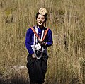 Rai Kirati girl in traditional dress.jpg 479 × 476; 209 KB
-
 Rainy-.jpg 3,264 × 2,448; 2.13 MB
-
 Red and Yellow (5528692156).jpg 1,280 × 1,920; 2.11 MB
-
 Shaheed Park - panoramio.jpg 1,200 × 900; 397 KB
-
 Soccer game in Kalimpong.jpg 1,920 × 1,079; 2.51 MB
-
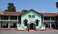 SUMI School, Kalimpong.jpg 3,648 × 2,144; 2.79 MB
-
 Teestavalley.jpg 1,024 × 768; 1.06 MB
-
 View of Kalimpong, India.jpg 3,217 × 2,145; 5.95 MB
-
 When the sun plays with colors.jpg 4,128 × 2,322; 2.53 MB
-
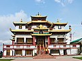 Zangdokpalri Monastery India.jpg 3,713 × 2,793; 5.29 MB
_p042_KALIMPONG_-_MACFARLANE_MEMORIAL_CHURCH.jpg)
%27_(11228003866).jpg)
_standing_on_the_steps_of_Wolseley_House,_Kalimpong_1914.jpg)


.jpg)


.jpeg)


.jpg)


.jpg)


.jpg)


.jpg)


.jpg)
.jpg)