Category:Kaiserberg (Duisburg)
Jump to navigation
Jump to search
| Object location | | View all coordinates using: OpenStreetMap |
|---|
mountain in Germany  | |||||
| Upload media | |||||
| Instance of | |||||
|---|---|---|---|---|---|
| Location | Duisburg, Düsseldorf Government Region, North Rhine-Westphalia, Germany | ||||
 | |||||
Subcategories
This category has the following 8 subcategories, out of 8 total.
*
B
- Botanischer Garten am Kaiserberg (17 F)
D
- Dietrich-Henning-Denkmal (5 F)
F
- Friedhof Kaiserberg (Duisburg) (29 F)
J
W
Media in category "Kaiserberg (Duisburg)"
The following 29 files are in this category, out of 29 total.
-
 Abb. 11 - Ankündigungsschild, Autobahn-Normalien 1958-.svg 976 × 689; 22 KB
-
 Aussicht kaiserberg.JPG 3,317 × 1,876; 809 KB
-
 Blick vom Kaiserberg in Duisburg.JPG 5,079 × 3,045; 3.8 MB
-
 Bänke auf dem Kaiserberg.JPG 3,648 × 2,736; 3.72 MB
-
 DB 2318 railway map.png 1,285 × 914; 890 KB
-
 Duisburg Kaiserberg Hoehenweg n 8370 201801.jpg 3,058 × 2,294; 2.32 MB
-
 Duisburg Kaiserberg Schnabelhuck Treppe NE 8369 201711.jpg 3,264 × 2,448; 2.55 MB
-
 Duisburg-Kaiserberg Richtung Duisburg-Nord.jpg 4,592 × 2,013; 2.72 MB
-
 DuisburgStadtansichtenHafenansichtenV.jpg 1,380 × 2,190; 428 KB
-
 Eingang zur Grünanlage Kaiserberg- Duisburg.jpg 1,440 × 900; 1.82 MB
-
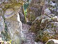
 Felsen Kaiserberg 3.JPG 3,648 × 2,736; 4.48 MB
-
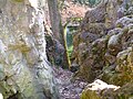
 Felsen Kaiserberg 4.JPG 3,648 × 2,736; 4.88 MB
-
 Felsen Kaiserberg 6.JPG 3,648 × 2,736; 3.83 MB
-
 Felsen Kaiserberg 7.JPG 3,648 × 2,736; 4.74 MB
-
 Felsen Kaiserberg 8.JPG 3,648 × 2,736; 4.69 MB
-
 Felsen Kaiserberg 9.JPG 3,648 × 2,736; 4.66 MB
-
 Felsen Kaiserberg Duisburg 10.JPG 3,648 × 2,736; 4.13 MB
-
 Felsen Kaiserberg.JPG 3,648 × 2,736; 4.4 MB
-
 Felsen- Kaiserberg- Duisburg.jpg 1,440 × 900; 2.17 MB
-
 Geocaching auf dem Kaiserberg - panoramio.jpg 800 × 600; 291 KB
-
 Kaiserberg in Duisburg.jpg 4,592 × 3,056; 3.63 MB
-
 Kaiserbergfest - Logo.gif 401 × 376; 32 KB
-
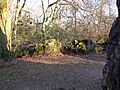
 Teich Kaiserberg 2.JPG 3,648 × 2,736; 4.48 MB
-
 Teich Kaiserberg 3.JPG 3,648 × 2,736; 4.5 MB
-
 Teich Kaiserberg.JPG 3,648 × 2,736; 4.47 MB
-
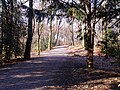
 Wanderweg- Kaiserberg- Duisburg.jpg 1,440 × 810; 1.68 MB
-
 Weg Kaiserberg 2.JPG 3,648 × 2,736; 4.14 MB
-
 Weg Kaiserberg.JPG 3,648 × 2,736; 4.04 MB
-
 Wegweiser zum Kaiserberg.JPG 3,648 × 2,736; 4.55 MB


