Category:Kabir Kuh
Jump to navigation
Jump to search
mountain in Ilam Province, Iran  | |||||
| Upload media | |||||
| Instance of |
| ||||
|---|---|---|---|---|---|
| Location | Ilam Province, Iran | ||||
| Length |
| ||||
| Mountain range | |||||
| Elevation above sea level |
| ||||
 | |||||
Subcategories
This category has the following 3 subcategories, out of 3 total.
Media in category "Kabir Kuh"
The following 19 files are in this category, out of 19 total.
-
 Darreh Shahr-Abdanan road.JPG 2,048 × 1,536; 508 KB
-
 Foothills of Kabir Kuh.JPG 1,311 × 1,920; 1.98 MB
-
 Kabir Kooh Mountains.jpg 2,432 × 648; 520 KB
-
 Kabir Kouh Topo 01.png 1,203 × 780; 1.72 MB
-
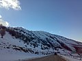
 Kabir Kuh in Winter.JPG 2,048 × 1,536; 483 KB
-
 KK Tunnel.svg 1,052 × 932; 3.32 MB
-
 Seymareh Landslide 01.png 2,748 × 2,480; 15.6 MB
-
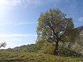
 Wheat fields near Sheikh Makan Village.jpg 1,536 × 2,048; 1.02 MB
-
 Zarangoosh (1).jpg 448 × 336; 46 KB
-
 Zarangoosh village(11).jpg 448 × 336; 61 KB
-
 Zarangush village (10).jpg 448 × 336; 57 KB
-
 Zarangush village (2).jpg 448 × 336; 80 KB
-
 Zarangush village (3).jpg 448 × 336; 62 KB
-
 Zarangush village (4).jpg 448 × 336; 58 KB
-
 Zarangush village (5).jpg 448 × 336; 56 KB
-
 Zarangush village (6).jpg 448 × 336; 58 KB
-
 Zarangush village (7).jpg 448 × 336; 63 KB
-
 Zarangush village.jpg 448 × 336; 77 KB
-
 کبیرکوه.jpg 1,600 × 1,176; 441 KB


.jpg)
.jpg)
.jpg)
.jpg)
.jpg)
.jpg)
.jpg)
.jpg)
.jpg)

