Category:Königsstuhl (Rügen)
Jump to navigation
Jump to search
| Object location | | View all coordinates using: OpenStreetMap |
|---|
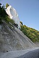
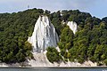
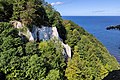
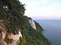
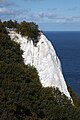
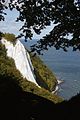
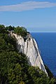
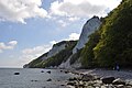
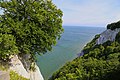
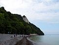
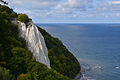
chalk cliff on the island of Rügen  | |||||
| Upload media | |||||
| Instance of | |||||
|---|---|---|---|---|---|
| Location | Vorpommern-Rügen District, Mecklenburg-Western Pomerania, Germany | ||||
| Elevation above sea level |
| ||||
| official website | |||||
 | |||||
Media in category "Königsstuhl (Rügen)"
The following 83 files are in this category, out of 83 total.
-
 00 6974 Steilküste vom Kap Arkona (Ostseeinsel Rügen).jpg 2,533 × 3,800; 9.34 MB
-
 01476-Rügen-1900-Königsstuhl-Brück & Sohn Kunstverlag.jpg 1,000 × 1,507; 423 KB
-
 04-10-07 -Königsstuhl-analog 05.jpg 3,522 × 2,364; 3.54 MB
-
 1024 Stubbenkammer, Blick auf den Königsstuhl-5727.jpg 1,024 × 670; 399 KB
-
 2016 Jasmund 13.jpg 3,317 × 2,211; 2.36 MB
-
 2016 Jasmund 14.jpg 2,246 × 3,234; 2.72 MB
-
 2022 Koenigsstuhl Ruegen 01.jpg 4,200 × 2,362; 5.01 MB
-
 2022 Koenigsstuhl Ruegen 02.jpg 3,543 × 2,657; 4.6 MB
-
 2022 Koenigsstuhl Ruegen 03.jpg 3,543 × 2,657; 4.63 MB
-
 2022 Koenigsstuhl Ruegen 04.jpg 2,953 × 2,953; 4.99 MB
-
 Binz 1935 Königsstuhl.jpg 1,979 × 1,310; 533 KB
-
 Blick aus dem Wald hin zum Königsstuhl.jpg 2,321 × 1,307; 963 KB
-
 Blick vom Königsstuhl 01.jpg 4,624 × 2,601; 9.47 MB
-
 Blick vom Königsstuhl 02.jpg 4,418 × 2,945; 9.61 MB
-
 Blick vom Königsstuhl 03.jpg 4,556 × 3,422; 11.43 MB
-
 Der Königsstuhl auf Rügen.jpg 4,608 × 3,072; 1.32 MB
-
 Die untere Treppe am Königsstuhl.jpg 4,608 × 3,072; 2.95 MB
-
 Fotothek df ps 0001526 Landschaften ^ Insellandschaften.jpg 800 × 817; 274 KB
-
 Fotothek df ps 0001527 Landschaften ^ Insellandschaften.jpg 791 × 820; 293 KB
-
 Fotothek df ps 0001605 Landschaften ^ Insellandschaften.jpg 547 × 820; 181 KB
-
 Fotothek-df ge 0000071-Königstuhl, Insel Rügen.jpg 800 × 494; 163 KB
-
 Koenigsstuhl 118 m.jpg 2,592 × 1,944; 1.25 MB
-
 Koenigsstuhl 1900.jpg 3,478 × 2,585; 3.57 MB
-
 Koenigsstuhl nach Sonnenaufgang.jpg 2,592 × 1,944; 1.07 MB
-
 Koenigsstuhl Ruegen.jpg 4,272 × 2,848; 4.98 MB
-
 Koenigsstuhl Stubbenkammer 1900.jpg 2,474 × 3,417; 3.54 MB
-
 Koenigsstuhl Stubbenkammer 2 1900.jpg 2,488 × 3,473; 3.33 MB
-
 Koenigsstuhl.jpg 4,752 × 3,168; 14.85 MB
-
 KoenigsstuhlRuegenPlatform.jpg 3,000 × 4,000; 5.39 MB
-
 Koenigstuhl von viktoriasicht.jpg 3,072 × 2,048; 860 KB
-
 Kreidefelsen - panoramio (1).jpg 2,816 × 2,112; 2.02 MB
-
 Kreidefelsen auf Rügen.jpg 1,232 × 1,632; 398 KB
-
 Kreidefelsen framed by trees.jpg 5,183 × 3,887; 4 MB
-
 Kreidefelsen Rügen in spring.jpg 5,184 × 3,888; 4.12 MB
-
 Kreidefelsen with the sea below.jpg 4,951 × 3,716; 2.96 MB
-
 Kreideküste Rügen 18.jpg 1,620 × 1,080; 698 KB
-
 Kreideküste Rügen 20.jpg 810 × 1,080; 629 KB
-
 Königsstuhl (Rügen).jpg 3,312 × 4,416; 5.94 MB
-
 Königsstuhl - Kreidefelsen auf Rügen (10569466755).jpg 1,000 × 1,500; 580 KB
-
 Königsstuhl - Kreidefelsen auf Rügen (10569542984).jpg 1,000 × 1,500; 714 KB
-
 Königsstuhl - Kreidefelsen auf Rügen (10569755423).jpg 1,000 × 1,500; 647 KB
-
 Königsstuhl chalk mountain- Jasmund National Park.jpg 6,000 × 4,000; 18.12 MB
-
 Königsstuhl Inspiration von Caspar David Friedrich.jpg 2,304 × 1,728; 1.51 MB
-
 Königsstuhl Jasmund.jpg 3,024 × 4,032; 4.19 MB
-
 Königsstuhl Rügen 2012.JPG 2,008 × 3,000; 4.29 MB
-
 Königsstuhl Rügen Jasmund.jpg 3,266 × 4,898; 3.27 MB
-
 Königsstuhl und Viktoria-Sicht.jpg 5,477 × 3,312; 12.51 MB
-
 Königsstuhl-P1190995.JPG 3,648 × 2,736; 5.78 MB
-
 Königsstuhl-Strand-110513-055.JPG 3,216 × 2,136; 1.7 MB
-
 Königsstuhl.JPG 2,304 × 1,728; 1.86 MB
-
 Königsstuhl.jpg 2,304 × 1,728; 1.87 MB
-
 Königsstuhltreppe-110513-030.JPG 3,216 × 2,136; 1.8 MB
-
 National Park Jasmund Winteranfang 2021.jpg 4,000 × 3,000; 5.02 MB
-
 Nationalpark Jasmund auf Rügen.jpg 2,592 × 1,944; 2.08 MB
-
 Nationalpark Jasmund Blick von der Victoria Sicht zum Koenigsstuhl.JPG 4,912 × 2,760; 5.78 MB
-
 Nationalpark Jasmund Blicke Koenigsstuhl 01.JPG 4,912 × 2,760; 6.63 MB
-
 Nationalpark Jasmund Blicke Koenigsstuhl 02.JPG 4,912 × 2,760; 6.19 MB
-
 Nationalpark Jasmund Blicke Koenigsstuhl 03.JPG 4,912 × 2,760; 5.22 MB
-
 Nationalpark Jasmund Koenigsstuhl 09.jpg 3,648 × 5,472; 11.04 MB
-
 Nationalpark Jasmund Koenigsstuhl Viktoriasicht 01.jpg 5,472 × 3,648; 15.53 MB
-
 Nationalpark Jasmund, Rügen, Königsstuhl von Victoria Sicht 1.JPG 3,456 × 4,608; 3.63 MB
-
 Nationalpark Jasmund, Rügen, Königsstuhl von Victoria Sicht 2.JPG 3,456 × 4,608; 4.97 MB
-
 NP Jasmund Rügen Königsstuhl.JPG 3,000 × 3,000; 2.63 MB
-
 NP Jasmund, Königstuhl, svah k pobřeží, schody.JPG 2,580 × 1,936; 2.31 MB
-
 Otto Geigenberger Stubbenkammer Königsstuhl.jpg 3,762 × 2,607; 1.05 MB
-
 Ruegen np jasmund koenigsstuhl vom strand ds wv 08 2010.jpg 1,546 × 1,166; 293 KB
-
 Ruegen np jasmund koenigsstuhl von der victoriasicht ds wv 08 2010.jpg 1,350 × 1,800; 341 KB
-
 Rügen blick königsstuhl von der victoriasicht ds wv 25 05 2012.jpg 1,500 × 1,125; 396 KB
-
 Rügen Königsstuhl 1.jpg 1,920 × 1,047; 821 KB
-
 Rügen Königsstuhl 2.jpg 1,600 × 885; 757 KB
-
 Rügen und seine Kreidefelsen.JPG 4,467 × 2,978; 6.89 MB
-
 Rügen.jpeg 2,736 × 3,648; 2.02 MB
-
 The Konigsstuhl, seen from north, Stubbenkammer, Isle of Rugen, Germany-LCCN2002720548.jpg 2,706 × 3,623; 3.21 MB
-
 The Konigsstuhl, seen from north, Stubbenkammer, Isle of Rugen, Germany-LCCN2002720548.tif 2,706 × 3,623; 28.08 MB
-
 The Konigsstuhl, seen from strand, Stubbenkammer, Isle of Rugen, Germany-LCCN2002720547.jpg 3,612 × 2,727; 2.74 MB
-
 The Konigsstuhl, seen from strand, Stubbenkammer, Isle of Rugen, Germany-LCCN2002720547.tif 3,612 × 2,727; 28.18 MB
-
 The Konigsstuhl, with fisher huts, Stubbenkammer, Isle of Rugen, Germany-LCCN2002720549.jpg 2,684 × 3,602; 3.46 MB
-
 The Konigsstuhl, with fisher huts, Stubbenkammer, Isle of Rugen, Germany-LCCN2002720549.tif 2,684 × 3,602; 27.69 MB
-
 The Wildflower.jpg 3,672 × 4,896; 10.59 MB
-
 Treppe am Königsstuhl im Nationalpark Jasmund.jpg 4,608 × 3,072; 2.94 MB
-
 Treppe zum unteren Königsstuhl.jpg 4,608 × 3,072; 3.34 MB
-
 Viktoriaaussicht.jpg 2,324 × 1,309; 726 KB
-
 Viktoriasicht.jpg 3,024 × 4,032; 6.9 MB
.jpg)


.jpg)


.jpg)
.jpg)
.jpg)
.jpg)


