Category:Juta (Hungary)
Jump to navigation
Jump to search
| Object location | | View all coordinates using: OpenStreetMap |
|---|
village in Hungary  Roman Catholic church with statue of Pietà  | |||||
| Upload media | |||||
| Instance of |
| ||||
|---|---|---|---|---|---|
| Location | Kaposvár District, Somogy County, Hungary | ||||
| Population |
| ||||
| Area |
| ||||
| official website | |||||
 | |||||
Subcategories
This category has the following 4 subcategories, out of 4 total.
Media in category "Juta (Hungary)"
The following 5 files are in this category, out of 5 total.
-
 Blason ville hu JUTA.svg 512 × 563; 59 KB
-
 HUN Juta COA.jpg 2,000 × 2,532; 500 KB
-
 HUN Juta COA.svg 600 × 760; 92 KB
-
 Juta rovastabla.png 81 × 40; 5 KB
-
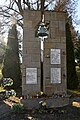 Juta, világháborús emlékmű 2022 01.jpg 1,600 × 2,400; 1.23 MB


