Category:June 2005 in Highland (council area)
Jump to navigation
Jump to search
Council areas (municipalities) of Scotland: Aberdeenshire · Angus · Argyll and Bute · Dundee · East Lothian · Edinburgh · Glasgow · Highland ·
Deutsch: Bilder, die im Juni 2005 in Highland (council area) aufgenommen worden sind. Bitte beachten Sie, dass dies weder das Datum des Uploads noch das Datum des Scannens eines Fotos ist.
English: Images/pictures taken in Highland (council area) during June 2005. Note this is not the date of the upload, nor the date a photo was scanned.
Español: Fotografías o imágenes tomadas en Highland (council area) durante junio 2005. No es la fecha de subida ni escaneo, sino la fecha en que las fotografías o imágenes se crearon.
Esperanto: Bildoj faritaj en Highland (council area) en junio 2005. Tio ne estas la dato, kiam la bildoj estis alŝutitaj aŭ skanitaj.
Français : Photographies ou images prises en Highland (council area) durant juin 2005. Ce n'est pas la date du téléchargement ou du scan.
Galego: Fotografías ou imaxes tomadas en Highland (council area) durante xuño 2005. Non é a data de subida nin escaneamento, senón a data na que se crearon as fotografías ou imaxes.
Italiano: Fotografie o immagini scattate a Highland (council area) nel giugno 2005. Nota bene: la data non si riferisce né a quella di upload né a quella in cui la foto è stata digitalizzata.
Norsk bokmål: Bilder tatt i Highland (council area) i løpet av juni 2005. Merk at dette ikke er datoen for opplasting, eller når et bilde har blitt skannet.
Norsk nynorsk: Bilete teke i Highland (council area) i løpet av juni 2005. Merk at dette ikkje er datoen for opplasting, eller når eit bilete har vorte skanna.
Русский: Изображения, сделанные в Highland (council area) в течение июнь 2005 (не дата загрузки изображения).
Українська: Зображення, зроблені в Highland (council area) протягом червень 2005. Зауважте, що це не дата завантаження чи дата сканування фотографії.
| June 2004 | ← | June 2005 | → | June 2006 | |||||||
| Jan | Feb | Mar | Apr | May | Jun | Jul | Aug | Sep | Oct | Nov | Dec |
| 7 | 3 | 29 | 21 | 24 | 44 | 45 | 51 | 30 | 48 | 29 | 2 |
|---|---|---|---|---|---|---|---|---|---|---|---|
Media in category "June 2005 in Highland (council area)"
The following 43 files are in this category, out of 43 total.
-
 A church in Scotland 02.jpg 3,264 × 2,448; 3.55 MB
-
 A830 near Corpach - geograph.org.uk - 15578.jpg 640 × 464; 151 KB
-
 Abandoned Land Rover on Raasay - geograph.org.uk - 112651.jpg 640 × 480; 59 KB
-

-
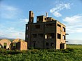
 Abandoned WW2 buildings at Loanhead - geograph.org.uk - 501591.jpg 640 × 480; 139 KB
-
-
 Abandoned WW2 tower at Fearn Airfield - geograph.org.uk - 501586.jpg 640 × 480; 105 KB
-

-
 Banavie swing bridge 01.jpg 960 × 1,280; 607 KB
-
 Dalwhinnie Distillery, Dalwhinnie.jpg 640 × 427; 66 KB
-
 Derelict WW2 buildings by Lochslin - geograph.org.uk - 501607.jpg 640 × 480; 97 KB
-
 Dunnet Bay - geograph.org.uk - 33160.jpg 640 × 480; 111 KB
-
 Dunvegan Castle - geograph.org.uk - 136781.jpg 592 × 400; 72 KB
-
-
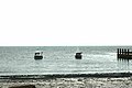 Fishing Boats by the Jetty - geograph.org.uk - 26358.jpg 640 × 427; 58 KB
-
 Highland cattle in Glen Dessarry - geograph.org.uk - 1423927.jpg 640 × 480; 58 KB
-
 Inverianvie River - geograph.org.uk - 24923.jpg 640 × 480; 117 KB
-

-
 Kaledonský kanál.jpg 448 × 298; 54 KB
-
 Kinlochbervie old harbour.jpg 640 × 479; 103 KB
-
 Kyle of Durness.jpg 640 × 480; 48 KB
-

-
 Loch Achtriochtan in Glencoe - geograph.org.uk - 107435.jpg 640 × 480; 140 KB
-
 Loch Eil Outward Bound1.jpg 640 × 325; 95 KB
-
 Loch Gairloch.jpg 640 × 480; 89 KB
-
 Loch na Cairidh - geograph.org.uk - 353310.jpg 640 × 469; 38 KB
-
 Lochan na h-Achlaise - geograph.org.uk - 107427.jpg 640 × 480; 142 KB
-
 Portree Harbour - geograph.org.uk - 134778.jpg 592 × 400; 98 KB
-
 Remnants of The Clearances - geograph.org.uk - 37662.jpg 640 × 480; 148 KB
-
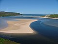
 Sand Dunes. - geograph.org.uk - 93757.jpg 640 × 479; 98 KB
-
 Sgeir Mhor - geograph.org.uk - 309555.jpg 640 × 480; 102 KB
-
 Talisker Distillery.jpg 640 × 427; 89 KB
-
 Tarskavaig Bay - geograph.org.uk - 353375.jpg 640 × 480; 133 KB
-
 The head of Gleann Leac na Muidhe - geograph.org.uk - 497771.jpg 640 × 480; 79 KB
-
 The Jacobite en route to Mallaig 12.jpg 1,280 × 960; 614 KB
-
 The Jacobite en route to Mallaig 18.jpg 1,280 × 960; 565 KB
-
 The Jacobite en route to Mallaig 19.jpg 1,280 × 960; 579 KB
-
 Towards Dingwall - geograph.org.uk - 34820.jpg 640 × 480; 143 KB
-

-
 Waterfall, Glen Golly, Sutherland - geograph.org.uk - 33493.jpg 480 × 640; 200 KB
-

-
 Fields and view to Tain Bombing range - geograph.org.uk - 501610.jpg 640 × 480; 82 KB
-
 Summit area, Beinn na Cloiche - geograph.org.uk - 18119.jpg 640 × 480; 87 KB


_-_geograph.org.uk_-_501588.jpg)


