Category:July 2009 in Utah
Jump to navigation
Jump to search
English: Images/pictures taken in Utah during July 2009. Note this is not the date of the upload, nor the date a photo was scanned.
States of the United States: Alabama · Alaska · Arizona · Arkansas · California · Colorado · Connecticut · Delaware · Florida · Georgia · Hawaii · Idaho · Illinois · Indiana · Iowa · Kansas · Kentucky · Louisiana · Maine · Maryland · Massachusetts · Michigan · Minnesota · Mississippi · Missouri · Montana · Nebraska · Nevada · New Jersey · New Mexico · New York · North Carolina · North Dakota · Ohio · Oregon · Pennsylvania · Rhode Island · South Carolina · South Dakota · Tennessee · Texas · Utah · Vermont · Virginia · Washington · West Virginia · Wisconsin · Wyoming – Washington, D.C.
Puerto Rico
Puerto Rico
| July 2008 | ← | July 2009 | → | July 2010 | |||||||||
| Jan | Feb | Mar | Apr | May | Jun | Jul | Aug | Sep | Oct | Nov | Dec | ||
| ← | 108 | 31 | 39 | 286 | 159 | 155 | 197 | 225 | 139 | 93 | 25 | 13 | → |
|---|---|---|---|---|---|---|---|---|---|---|---|---|---|
Media in category "July 2009 in Utah"
The following 197 files are in this category, out of 197 total.
-
 10550 S State St.jpg 3,264 × 2,448; 1.83 MB
-
 11800 S State St.jpg 3,264 × 2,448; 1.95 MB
-
 11950 S Factory Outlet Dr.jpg 3,264 × 2,448; 1.97 MB
-
 12200 S Factory Outlet Dr.jpg 3,264 × 2,448; 1.9 MB
-
 12300 S Factory Outlet Dr.jpg 3,264 × 2,448; 1.74 MB
-
 12600 S Redwood Rd.jpg 3,264 × 2,448; 1.89 MB
-
 2700 W Bangerter Hwy.jpg 2,310 × 1,792; 761 KB
-
 4500 S State St.jpg 3,264 × 2,344; 959 KB
-
 4600 S State St.jpg 3,264 × 2,195; 795 KB
-
 5100 S State St.jpg 3,264 × 2,120; 798 KB
-
 5300 S State St.jpg 3,264 × 2,448; 1.93 MB
-
 5900 S State St.jpg 3,264 × 2,448; 1.85 MB
-
 6200 S State St.jpg 3,264 × 2,325; 909 KB
-
 7900 S State St.jpg 3,264 × 2,448; 1.82 MB
-
 9050 S State St.jpg 3,264 × 2,448; 1.85 MB
-
 9400 S State St.jpg 3,264 × 2,448; 1.86 MB
-
 Abies concolor subsp. concolor needles.jpg 3,264 × 2,448; 3.2 MB
-
 Amos Ida Jensen Home.jpg 2,816 × 1,872; 1.64 MB
-
 Aquilegia caerulea 1.jpg 2,448 × 2,685; 3.73 MB
-
 Arches 2009-07-27 (3802265815).jpg 3,504 × 2,336; 4.16 MB
-
 Arches 2009-07-27 (3803073986).jpg 3,504 × 2,336; 2.25 MB
-
 Arthur Cushing Home.jpg 2,728 × 1,756; 1.84 MB
-
 Batiment Société de Secours 0.JPG 2,560 × 1,920; 977 KB
-
 Beehive house complex, Salt Lake City, Utah.jpg 2,811 × 1,869; 1.4 MB
-
 Bristlecone Loop Trail (3678784287).jpg 1,057 × 1,600; 275 KB
-
 Campus Walkway.jpg 2,448 × 3,264; 3.3 MB
-
 Canyonlands 2009-07-26 (3801689815).jpg 3,504 × 2,336; 4.19 MB
-
 Cassidy Arch, Capitol Reef National Park.JPG 3,648 × 2,736; 3.04 MB
-
 Castle Valley, Utah (6045125414).jpg 1,600 × 1,200; 558 KB
-
 Castle Valley, Utah (6045125838).jpg 1,600 × 1,200; 749 KB
-
 Cecret Lake Panorama Albion Basin Alta Utah July 2009.jpg 7,931 × 3,760; 23.78 MB
-
 Cecret Lake.jpg 3,600 × 2,400; 2.94 MB
-
 Cedar Breaks and Brian Head Peak.jpg 3,264 × 2,448; 4.23 MB
-
 Colorado River at Dead Horse Point (3786629319).jpg 3,504 × 2,336; 1.84 MB
-
 Colorado River Scenic Byway (3767138821).jpg 3,504 × 2,336; 2.11 MB
-
 Colorado River Scenic Byway (3767139921).jpg 3,504 × 2,336; 2.57 MB
-
 Colorado River Scenic Byway (3767935464).jpg 3,504 × 2,336; 2.02 MB
-
 Colorado River Scenic Byway (3767935734).jpg 3,504 × 2,336; 1.9 MB
-
 Colorado River Scenic Byway (3767939482).jpg 3,504 × 2,002; 1.51 MB
-
 Colorado River Scenic Byway (3767943766).jpg 3,504 × 2,336; 2.13 MB
-
 Colorado River Scenic Byway (3767945846).jpg 3,504 × 2,336; 2.18 MB
-
 Colorado River Scenic Byway (3767946786).jpg 2,336 × 3,504; 2.6 MB
-
 Colorado River Scenic Byway (3767948284).jpg 3,504 × 2,336; 4.59 MB
-
 Desert Juniper, Western Red Cedar, and Sagebrush - panoramio.jpg 3,264 × 2,448; 3.64 MB
-
 Devils Garden (3678754305).jpg 1,600 × 1,057; 490 KB
-
 Dirt Road Intersects Highway 36 - panoramio.jpg 3,264 × 2,448; 2.99 MB
-
 Downtown logan utah main street.jpg 1,000 × 750; 340 KB
-
 Eagle Crags.jpg 3,448 × 1,790; 1.45 MB
-
 Eagle Gate.jpg 1,872 × 2,816; 2.22 MB
-
 El Monte Golf Clubhouse Ogden Utah.jpeg 2,560 × 1,920; 1.1 MB
-
 Elizabeth Hall 2.jpg 2,440 × 3,258; 3.51 MB
-
 Elizabeth Hall.jpg 3,264 × 2,448; 3.26 MB
-
 Fiery Furnace (3803100090).jpg 3,504 × 2,336; 2.46 MB
-
 Flickr - brewbooks - Arenaria fendler (Fendler's sandwort) (1).jpg 3,264 × 2,448; 5.56 MB
-
 Flickr - brewbooks - Arenaria fendler (Fendler's sandwort) (2).jpg 3,172 × 2,239; 4.36 MB
-
 Flickr - brewbooks - Arenaria fendler (Fendler's sandwort).jpg 3,264 × 2,259; 4.71 MB
-
 Flickr - brewbooks - Blue Columbine - Cedar Breaks (1).jpg 2,511 × 2,173; 1.82 MB
-
 Flickr - brewbooks - Blue Columbine - Cedar Breaks.jpg 3,264 × 2,448; 3.35 MB
-
 Folkfest.JPG 3,888 × 2,592; 4.22 MB
-
 Frasera speciosa.jpg 2,025 × 2,188; 3 MB
-
 Giraffe at Hogle Zoo, Jul 09.jpg 2,816 × 2,112; 2.34 MB
-
 Great White Throne (3679607848).jpg 1,057 × 1,600; 372 KB
-
 Great White Throne benind The Organ (3679608128).jpg 1,600 × 1,057; 338 KB
-
 Heiner House Morgan Utah.jpeg 3,296 × 2,472; 1.84 MB
-
 Hickman Bridge (3678751753).jpg 1,600 × 1,057; 817 KB
-
 Highway 36 Northwest - panoramio (1).jpg 3,264 × 2,448; 3.19 MB
-
 Highway 36 Northwest - panoramio (2).jpg 3,264 × 2,448; 3.16 MB
-
 Highway 36 Northwest - panoramio.jpg 3,264 × 2,448; 3.34 MB
-
 Huntsville-St Florence Catholic Church.jpg 2,816 × 1,872; 5.23 MB
-
 Hurricane banner.jpg 2,816 × 402; 262 KB
-
 Hurricaneutah.jpg 2,816 × 2,120; 1.44 MB
-
 I-15NewHarmony.jpg 3,456 × 2,339; 2.31 MB
-
 Jackson Square Pillar, Detail, Salt Lake City.jpg 640 × 512; 132 KB
-
 Jackson Square Pillar, Salt Lake City.jpg 512 × 640; 151 KB
-
 James B Jensen Home.jpg 2,816 × 1,872; 2.5 MB
-
 Joel Johnson Home, Payson, Utah.jpg 2,816 × 1,872; 2.24 MB
-
 Joel Johnson Home.jpg 2,816 × 1,872; 5.78 MB
-
 John A Annie C Olsen Home.jpg 2,816 × 1,872; 1.62 MB
-
 JonMontanaTrip09 003.jpg 3,472 × 2,604; 2.08 MB
-
 JonMontanaTrip09 012.jpg 3,472 × 2,604; 2.22 MB
-
 JonMontanaTrip09 024.jpg 3,472 × 2,604; 1.99 MB
-
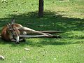 Kangaroo napping at Hogle Zoo, Jul 16.jpg 2,816 × 2,112; 2.71 MB
-
 Kimball Visual Arts Center.jpg 1,869 × 1,322; 1.15 MB
-
 Ledge on the way to Delicate Arch (3803067458).jpg 3,504 × 2,336; 1.29 MB
-
 Leopard at Hogle Zoo, Jul 09.jpg 2,816 × 2,112; 2.83 MB
-
 Lind Lecture Hall & Science Lab.jpg 2,439 × 2,722; 1.73 MB
-
 Logan17.jpg 1,000 × 750; 208 KB
-
 LoganUtahCourthouse.jpg 1,000 × 750; 212 KB
-
 Looking Down Dirt Road to Railroad Intersection (West Southwest) - panoramio.jpg 3,264 × 2,448; 2.99 MB
-
 Looking East Southeast (Mount Timpanogos Far Distant at Center) - panoramio.jpg 3,264 × 2,448; 3.36 MB
-
 Looking East Southeastward from side of Dirt Road - panoramio.jpg 3,264 × 2,448; 2.86 MB
-
 Looking Eastward - panoramio.jpg 3,264 × 2,448; 3.48 MB
-
 Looking Eastward from side of Dirt Road - panoramio.jpg 3,264 × 2,448; 2.99 MB
-
 Looking North - panoramio (1).jpg 3,264 × 2,448; 2.95 MB
-
 Looking North across Dirt Road and Highway 36 toward Ridge - panoramio.jpg 3,264 × 2,448; 3.25 MB
-
 Looking North from side of Highway 36 - panoramio.jpg 3,264 × 2,448; 3.28 MB
-
 Looking North Northeast Toward Oquirrh Mountains - panoramio.jpg 3,264 × 2,448; 3.4 MB
-
 Looking North Northeast Toward South End of Oquirrh Mountain Range - panoramio.jpg 3,264 × 2,448; 3.58 MB
-
 Looking North Northwest - panoramio.jpg 3,264 × 2,448; 3.02 MB
-
 Looking Northeast from side of Highway 36 - panoramio.jpg 3,264 × 2,448; 2.88 MB
-
 Looking Northeast Toward South End of Oquirrh Mountain Range - panoramio.jpg 3,264 × 2,448; 3.52 MB
-
 Looking northeast up Dirt Road - panoramio.jpg 3,264 × 2,448; 3.3 MB
-
 Looking Northwest across Dirt Road - panoramio.jpg 3,264 × 2,448; 3.31 MB
-
 Looking Northwest on Highway 36 - panoramio.jpg 3,264 × 2,448; 3.19 MB
-
 Looking South from side of Dirt Road - panoramio.jpg 3,264 × 2,448; 2.94 MB
-
 Looking South Southwest Across Sagebrush Toward Distant Mountains - panoramio.jpg 3,264 × 2,448; 2.82 MB
-
 Looking Southeastward from side of Dirt Road - panoramio.jpg 3,264 × 2,448; 2.97 MB
-
 Looking Southeastward on Road 36 - panoramio.jpg 3,264 × 2,448; 3.16 MB
-
 Looking Southwest from side of Dirt Road - panoramio.jpg 3,264 × 2,448; 3.08 MB
-
 Looking Southwestward from Highway 36 - panoramio.jpg 3,264 × 2,448; 3.15 MB
-
 Looking West across Dirt Road - panoramio.jpg 3,264 × 2,448; 3.14 MB
-
 Looking West from Highway 36 - panoramio.jpg 3,264 × 2,448; 3.31 MB
-
 Mountain of the Sun covering Twin Brothers.jpg 3,471 × 1,858; 1.32 MB
-
 My Public Lands Magazine, Summer 2014 (13972922785).jpg 1,600 × 1,200; 1.52 MB
-
 Nibley utah.jpg 3,648 × 2,736; 4.74 MB
-
 North Ogden Elementary School Utah.jpeg 2,560 × 1,920; 1.13 MB
-
 Old Gifford Homestead (3679559404).jpg 1,057 × 1,600; 635 KB
-
 Park Avenue (3802250825).jpg 2,336 × 3,504; 2.08 MB
-
 Payson commerical dist (7).jpg 2,816 × 1,872; 5.47 MB
-
 Payson Commerical District 2.jpg 2,639 × 1,755; 1.67 MB
-
 Payson Commerical District.jpg 2,816 × 1,872; 2.58 MB
-
 Payson Peteetneet School.jpg 2,816 × 1,872; 5.2 MB
-
 Peccary at Hogle Zoo, Jul 09.jpg 2,816 × 2,112; 2.6 MB
-
 Penguin at Hogle Zoo, Jul 09.jpg 2,816 × 2,112; 2.63 MB
-
 Penguin, Hogle Zoo, Jul 09.jpg 2,816 × 2,112; 2.45 MB
-
 Peteetneet Academy, Payson, UT.jpg 2,805 × 1,865; 2.07 MB
-
 Pine Tree Arch (3803089998).jpg 2,336 × 3,504; 3.1 MB
-
 Prairie dogs at Hogle Zoo, Jul 09 1.jpg 2,816 × 2,112; 2.66 MB
-
 Prairie dogs at Hogle Zoo, Jul 09 2.jpg 2,816 × 2,112; 2.64 MB
-
 Prarie dogs, Hogle Zoo 01.JPG 2,816 × 2,112; 2.59 MB
-
 Prarie dogs, Hogle Zoo 02.JPG 2,816 × 2,112; 2.54 MB
-
 Primula parryi 1.jpg 3,264 × 2,448; 3.14 MB
-
 Primula parryi.jpg 2,270 × 2,200; 2.88 MB
-
 Promontory Tower.jpg 3,264 × 2,448; 2.74 MB
-
 Redwood Rd at Bangerter Hwy2.jpg 3,264 × 2,448; 1.81 MB
-
 Redwood Rd at SR-73.jpg 3,264 × 2,303; 1.07 MB
-
 Rhinoceros, Hogle Zoo, Jul 09.jpg 2,816 × 2,112; 2.8 MB
-
 Sagebrush, Rabbitbrush, Utah West Desert - panoramio.jpg 3,264 × 2,448; 3.05 MB
-
 SEUtahStrat.JPG 3,161 × 1,794; 2.5 MB
-
 Shepherd Student Union.jpg 3,264 × 2,448; 3.05 MB
-
 Smithsonian Butte.jpg 3,872 × 1,233; 1.04 MB
-
 Social & Behavioral Sciences Building.jpg 2,448 × 3,264; 2.9 MB
-
 South Window (3803112948).jpg 3,504 × 2,336; 3.85 MB
-
 SR-173 eastern terminus.jpg 3,264 × 2,448; 2.06 MB
-
 St George, UT - Main Building of Dixie College (1).jpg 1,200 × 804; 331 KB
-
 St George, UT - Main Building of Dixie College (2).jpg 804 × 1,200; 340 KB
-
 St George, UT - Main Building of Dixie College (3).jpg 1,200 × 804; 337 KB
-
 St George, UT - Old Washington County Courthouse (1).jpg 804 × 1,200; 333 KB
-
 St George, UT - Old Washington County Courthouse (2).jpg 804 × 1,200; 345 KB
-
 St George, UT - Orson Pratt House.jpg 1,200 × 804; 332 KB
-
 St George, UT - St George Tabernacle (1).jpg 804 × 1,200; 318 KB
-
 St George, UT - St George Tabernacle (2).jpg 804 × 1,200; 316 KB
-
 St George, UT - St George Tabernacle (3).jpg 804 × 1,200; 304 KB
-
 St George, UT - St George Temple (1).jpg 804 × 1,200; 347 KB
-
 St George, UT - St George Temple (2).jpg 1,200 × 804; 291 KB
-
 St George, UT - St George Temple (3).jpg 1,200 × 801; 319 KB
-
 St George, UT - Woodward School.jpg 804 × 1,200; 338 KB
-
 Stevens House North Ogden Utah.jpeg 2,560 × 1,920; 1,021 KB
-
 Stewart Library 2.jpg 3,264 × 2,448; 2.87 MB
-
 Stewart Library.jpg 3,264 × 2,448; 2.8 MB
-
 Student Services Center.jpg 3,264 × 2,448; 3.65 MB
-
 Sunset in the Bryce Canyon.jpg 3,072 × 2,048; 2.96 MB
-
 Temple Salk lake city at night.JPG 3,000 × 4,000; 1.14 MB
-
 The Windows (3802300663).jpg 3,504 × 2,336; 4.09 MB
-
 Thomas Austin home in Lehi, Utah.jpg 2,816 × 1,872; 2.56 MB
-
 Thomas R Cutler home in Lehi, Utah, USA.jpg 2,613 × 1,737; 1.5 MB
-
 Trail - panoramio - rodrigodemarque.jpg 1,200 × 1,600; 630 KB
-
 Tunnel Arch (3802272619).jpg 3,504 × 2,336; 3.88 MB
-
 UintaTrail.jpg 3,456 × 2,592; 6.69 MB
-
 Union Pacific Northwestbound in Utah West Desert - panoramio.jpg 3,264 × 2,448; 3.2 MB
-
 Union Pacific Southeastbound in Utah West Desert - panoramio.jpg 3,264 × 2,448; 3.27 MB
-
 Utah West Desert - Distant Hill - panoramio.jpg 3,264 × 2,448; 3.52 MB
-
 Utah West Desert - panoramio.jpg 3,264 × 2,448; 2.95 MB
-
 Utah West Desert Hot July Day - panoramio.jpg 3,264 × 2,448; 2.76 MB
-
 Utah West Desert near Railroad - panoramio.jpg 3,264 × 2,448; 2.52 MB
-
 Various Flora in Utah West Desert on Hot July Day - panoramio.jpg 3,264 × 2,448; 3.16 MB
-
 Waterpocket Fold (3678749351).jpg 1,600 × 776; 381 KB
-
 Wattis Business Building.jpg 2,448 × 3,264; 3.98 MB
-
 Weber State Campus.jpg 2,428 × 3,250; 3.33 MB
-
 Weber State University Campus 2.jpg 3,260 × 2,442; 2.81 MB
-
 Weber State University Walkway.jpg 3,226 × 2,396; 2.89 MB
-
 William Tyler Vincent Home.jpg 2,816 × 1,872; 1.82 MB
-
 Zebras at Hogle Zoo, Jul 09.jpg 2,816 × 2,112; 2.7 MB
-
 Zion National Park, UT - Along the Zion-Mt Carmel Highway 07.jpg 1,200 × 804; 328 KB
-
 Zion National Park, UT - Along the Zion-Mt Carmel Highway 08.jpg 1,200 × 804; 334 KB
-
 Zion National Park, UT - Along the Zion-Mt Carmel Highway 09.jpg 1,200 × 804; 335 KB
-
 Zion National Park, UT - Along the Zion-Mt Carmel Highway 10.jpg 1,200 × 804; 317 KB
-
 Zion National Park, UT - Along the Zion-Mt Carmel Highway 11.jpg 804 × 1,200; 349 KB
-
 Zion National Park, UT - Along the Zion-Mt Carmel Highway 12.jpg 804 × 1,200; 313 KB
-
 Zion National Park, UT - Along the Zion-Mt Carmel Highway 13.jpg 1,200 × 804; 328 KB
-
 Zion National Park, UT - Along the Zion-Mt Carmel Highway 14.jpg 1,200 × 804; 357 KB
-
 Zion National Park, UT - Along the Zion-Mt Carmel Highway 15.jpg 1,200 × 804; 337 KB
-
 Zion National Park, UT - Along the Zion-Mt Carmel Highway 16.jpg 1,200 × 804; 308 KB
-
 Zion National Park, UT - Along the Zion-Mt Carmel Highway 17.jpg 804 × 1,200; 319 KB
-
 Zion National Park, UT - East Gate Sign - Entering Zion National Park.jpg 804 × 1,200; 318 KB
-
 Zion National Park, UT - East Gate Sign - Leaving Zion National Park.jpg 800 × 1,200; 299 KB
-
 Zion-Mount Carmel Highway (5015257437).jpg 2,448 × 3,264; 2.53 MB


.jpg)
.jpg)


.jpg)

.jpg)

.jpg)
.jpg)


.jpg)
.jpg)
.jpg)
.jpg)
.jpg)
.jpg)
.jpg)
.jpg)
.jpg)
.jpg)

.jpg)


.jpg)
_(1).jpg)
_(2).jpg)
.jpg)
.jpg)


.jpg)
.jpg)

.jpg)
.jpg)
.jpg)


.jpg)


_-_panoramio.jpg)
_-_panoramio.jpg)


.jpg)


.jpg)


.jpg)
.jpg)
.jpg)


.jpg)


.jpg)

.jpg)
.jpg)
.jpg)
.jpg)
.jpg)

.jpg)
.jpg)
.jpg)
.jpg)
.jpg)
.jpg)


.jpg)


.jpg)


.jpg)


.jpg)