Category:Joint Security Area, Korea
Jump to navigation
Jump to search
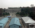
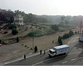
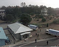
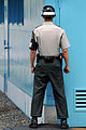
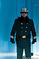
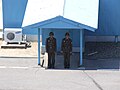
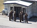
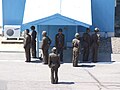
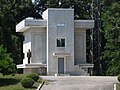
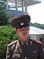
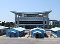
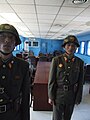
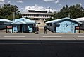
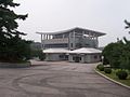
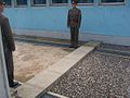
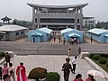
English: The Joint Security Area (JSA) is the only portion of the Korean Demilitarized Zone (DMZ) where South and North Korean forces stand face-to-face. The JSA is used by the two Koreas for diplomatic engagements and, until March 1991, was also the site of military negotiations between North Korea and the United Nations Command (UNC).
한국어: 공동경비구역(共同警備區域, Joint Security Area, JSA)은 대한민국과 조선민주주의인민공화국이 비무장지대에서 서로 대면하고 있는 지역이다. 때때로 대한민국과 북조선 간의 교섭이 있기도 하다.
portion of the Korean Demilitarized Zone (DMZ) where North and South Korean forces stand face-to-face   | |||||
| Upload media | |||||
| Pronunciation audio | |||||
|---|---|---|---|---|---|
| Instance of | |||||
| Part of |
| ||||
| Location | Korean Demilitarized Zone, DPRK | ||||
 | |||||
Subcategories
This category has the following 7 subcategories, out of 7 total.
2
A
- April 2018 inter-Korean summit (66 F)
B
- Bridge of No Return (26 F)
C
- Camp Bonifas (19 F)
I
- Inter-Korean House of Freedom (30 F)
N
Pages in category "Joint Security Area, Korea"
This category contains only the following page.
Media in category "Joint Security Area, Korea"
The following 200 files are in this category, out of 405 total.
(previous page) (next page)-
 (Barely) in North Korea (346118336).jpg 1,800 × 1,200; 422 KB
-
 070401 Panmunjeom3.jpg 3,008 × 2,000; 432 KB
-
 110429-A-LX984-054.jpg 2,297 × 3,452; 2.24 MB
-
 110429-A-LX984-072.jpg 3,174 × 2,112; 1.13 MB
-
 120726-D-TT977-269 (7654194990).jpg 2,100 × 1,398; 1.38 MB
-
 120726-D-TT977-328 (7654189154).jpg 2,100 × 1,398; 1.32 MB
-
 130724-A-ZZ999-6060.jpg 1,200 × 900; 808 KB
-
 151102-D-PB383-110.jpg 3,518 × 2,258; 389 KB
-
 151102-N-ZZ999-001.jpg 4,217 × 2,898; 1.65 MB
-
 151102-N-ZZ999-002.jpg 3,192 × 2,042; 1.51 MB
-
 1624 - Nordkorea 2015 - Panmunjon DMZ (22793479140).jpg 2,123 × 3,206; 1.6 MB
-
 1626 - Nordkorea 2015 - Panmunjon DMZ (22955478076).jpg 4,710 × 3,119; 3.1 MB
-
 1627 - Nordkorea 2015 - Panmunjon DMZ (22360321923).jpg 2,201 × 3,323; 1.83 MB
-
 1628 - Nordkorea 2015 - Panmunjon DMZ (22793457550).jpg 4,421 × 2,928; 3.03 MB
-
 180619-A-XN199-094 (43026656501).jpg 5,472 × 3,648; 7.06 MB
-
 1996 North Korea soldier + South Korea MP. Spielvogel.jpg 2,712 × 1,808; 483 KB
-
 1998년 제10기 소방간부후보생10.jpg 475 × 361; 33 KB
-

-

-
 32167175177 North Korean Guard, Joint Security Area December 2017.jpg 5,472 × 3,648; 11.91 MB
-
 38th Parallel.jpg 3,504 × 2,336; 3.47 MB
-

-
-

-
-
-

-

-
-

-

-

-

-

-

-

-

-

-

-

-

-

-

-
-

-

-

-
-

-

-

-

-

-
 Ashton B. Carter, Military Armistice Commission Building, Panmunjom, July 26, 2012.jpg 2,100 × 1,398; 1.37 MB
-
 At Panmunjom (11553114324).jpg 1,024 × 576; 93 KB
-
 At the DMZ (11419407394).jpg 576 × 1,024; 99 KB
-
 Attitude behind the line (8314759076).jpg 1,201 × 1,793; 186 KB
-
 Bldg Row-a.jpg 704 × 476; 126 KB
-
 Border guards (6647232701).jpg 3,456 × 2,304; 2.17 MB
-
 Border with North Korea (2459173056).jpg 3,264 × 2,448; 2.67 MB
-

-

-
 Defense.gov photo essay 120726-D-TT977-299.jpg 2,100 × 1,398; 2.14 MB
-
 Demarcation Line Korea 1956.jpg 4,856 × 3,236; 3.72 MB
-
 Demilitarised zone (Korea) banner Joint Security Area.jpg 2,100 × 300; 512 KB
-

-
 Demilitarized Zone of Korea 17.JPG 3,488 × 2,616; 2.23 MB
-
 Demilitarized Zone of Korea 18.JPG 2,616 × 3,488; 2.05 MB
-
 Demilitarized Zone of Korea 19.JPG 3,488 × 2,616; 2.21 MB
-
 Demilitarized Zone of Korea 20.JPG 3,488 × 2,616; 2.07 MB
-
 Demilitarized Zone of Korea 21.JPG 2,568 × 3,448; 1.81 MB
-
 Demilitarized Zone of Korea 22.JPG 3,488 × 2,616; 2.13 MB
-
 Demilitarized Zone of Korea 23.JPG 3,488 × 2,616; 2.17 MB
-
 Demilitarized Zone of Korea 24.JPG 3,488 × 2,616; 2.08 MB
-
 Demilitarized Zone of Korea 25.JPG 3,488 × 2,616; 2.2 MB
-
 Demilitarized Zone of Korea 26.JPG 3,488 × 2,616; 2.19 MB
-
 Demilitarized Zone of Korea 27.JPG 3,488 × 2,616; 2.19 MB
-
 Demilitarized Zone of Korea 28.JPG 3,465 × 2,591; 1.93 MB
-
 Demilitarized Zone of Korea 29.JPG 3,460 × 2,129; 1.59 MB
-
 Demilitarized Zone of Korea 30.JPG 2,616 × 3,488; 2.1 MB
-
 Demilitarized Zone of Korea 31.JPG 3,488 × 2,616; 2.23 MB
-
 Demilitarized Zone of Korea 32.JPG 3,426 × 2,529; 1.77 MB
-
 Demilitarized Zone of Korea 33.JPG 3,464 × 2,563; 1.89 MB
-
 Demilitarized Zone of Korea 34.JPG 3,488 × 2,616; 2.01 MB
-
 Demilitarized Zone of Korea 35.JPG 3,488 × 2,616; 2.22 MB
-
 Demilitarized Zone of Korea 36.JPG 3,488 × 2,616; 2.16 MB
-
 Demilitarized Zone of Korea 37.JPG 2,616 × 3,488; 2.1 MB
-
 DMZ (8375217511).jpg 5,841 × 3,894; 2.78 MB
-
 DMZ - Demilitarized zone.jpg 1,600 × 1,067; 1.76 MB
-
 DMZ - Freedom Building from side.jpg 2,048 × 1,536; 652 KB
-
 DMZ - Freedom Building.jpg 2,048 × 1,536; 566 KB
-
 DMZ - North Korean Soldiers marching along the defense line PS.jpg 1,203 × 1,774; 175 KB
-
 DMZ 015.JPG 1,000 × 750; 42 KB
-
 DMZ 08.JPG 600 × 450; 43 KB
-
 DMZ 09.JPG 600 × 450; 46 KB
-
 DMZ 10.JPG 600 × 450; 75 KB
-
 DMZ 11.JPG 600 × 450; 70 KB
-
 DMZ 12.JPG 600 × 450; 60 KB
-
 DMZ 13.JPG 600 × 450; 58 KB
-
 DMZ from North Korea side (14319646165).jpg 4,912 × 2,760; 4.31 MB
-
 DMZ from North Korea side (14319653255).jpg 4,912 × 2,760; 6.75 MB
-
 DMZ from North Korea side (14339836673).jpg 4,912 × 2,760; 4.53 MB
-
 DMZ seen from the north, 2005.jpg 640 × 478; 75 KB
-
 DMZ, North Korea. (2604186687).jpg 3,008 × 2,000; 4.06 MB
-
 DMZ, North Korea. (2604187997).jpg 3,008 × 2,000; 3.63 MB
-
 DMZ, North Korea. (2605014958).jpg 3,008 × 2,000; 3.42 MB
-
 Dmz-jsa-korea-4-4-2009.jpg 2,048 × 1,536; 535 KB
-
 DPRK - El guía serio en su trabajo (39118166480).png 4,272 × 2,848; 16.66 MB
-
 DPRK soldier.JPG 2,592 × 1,944; 1.96 MB
-
-
-
 Fahey DSCF3457 (6075658484).jpg 4,000 × 3,000; 8.01 MB
-
 Fahey DSCF3471 (6075665668).jpg 3,000 × 4,000; 6.19 MB
-
 Fahey DSCF3473 (6075130273).jpg 2,954 × 3,939; 7.71 MB
-
 Fahey DSCF3476 (6075671450).jpg 4,000 × 3,000; 7.56 MB
-
 Fahey DSCF3477 (6075674016).jpg 4,000 × 3,000; 6.76 MB
-
 Fahey DSCF3478 (6075139087).jpg 4,000 × 3,000; 8.42 MB
-
 Fahey DSCF3479 (6075678826).jpg 4,800 × 1,264; 4.09 MB
-
 Fahey DSCF3482 (6075143777).jpg 4,000 × 3,000; 8.21 MB
-
 Fahey DSCF3486 (6075147423).jpg 4,000 × 3,000; 10.02 MB
-
 Flag of the DPRK at Panmunjom Joint Security Area (13952141430).jpg 4,608 × 2,592; 3.01 MB
-
 Foreign Office Minister Jeremy Browne visits the Republic of Korea (5926118452).jpg 1,825 × 1,221; 873 KB
-
 Foreign Secretary at Korean Demilitarized Zone (20476077332).jpg 1,709 × 1,140; 715 KB
-

-
 GEN Sharp visits JSA-28MAY2010-Photo by SSG Nicholas Salcido - 167.jpg 3,060 × 2,032; 855 KB
-
 GEN Sharp visits JSA-28MAY2010-Photo by SSG Nicholas Salcido - 260.jpg 3,002 × 2,072; 612 KB
-
 GEN Sharp visits JSA-28MAY2010-Photo by SSG Nicholas Salcido - 33.jpg 3,118 × 1,994; 945 KB
-
 GEN Sharp visits JSA-28MAY2010-Photo by SSG Nicholas Salcido - 608.jpg 3,040 × 2,046; 1.07 MB
-
 GEN Sharp visits JSA-28MAY2010-Photo by SSG Nicholas Salcido - 610.jpg 3,423 × 1,817; 1.01 MB
-
 GEN Sharp visits JSA-28MAY2010-Photo by SSG Nicholas Salcido - 642.jpg 2,032 × 3,060; 865 KB
-
 GEN Sharp visits JSA-28MAY2010-Photo by SSG Nicholas Salcido - 646.jpg 2,032 × 3,060; 816 KB
-
 General Officer Talks at Panmunjom (4).jpg 3,648 × 2,736; 7.11 MB
-
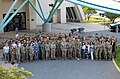 Group photograph in Korea - 20230614-A-LEESH-3002.jpg 6,290 × 4,152; 3.83 MB
-
 Group photograph in Korea - 20230614-A-LEESH-3003.jpg 6,720 × 4,480; 11.79 MB
-
 Gsa-dmz-2-buiobuione.jpg 1,600 × 1,067; 1.92 MB
-
 Gsa-dmz-4-buiobuione.jpg 1,600 × 1,067; 2.77 MB
-
 Guardians (8747508670).jpg 4,272 × 2,848; 7.7 MB
-
 Halfman (8747507414).jpg 4,272 × 2,848; 8.33 MB
-
 HQ UN Command Security Battalion. 1996. Spielvogel.JPG 3,900 × 2,600; 1.62 MB
-
-
-
-
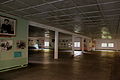
 InsideTheJointSecurityArea1.jpg 2,738 × 3,571; 1.82 MB
-
 Intelligence Officer Michele H. Bredenkamp promoted to Major General 210602-A-CI827-9632.jpg 4,907 × 3,329; 1.93 MB
-
 Intelligence Officer Michele H. Bredenkamp promoted to Major General 210602-A-CI827-9642.jpg 5,184 × 3,456; 2.25 MB
-
 Intelligence Officer Michele H. Bredenkamp promoted to Major General 210602-A-CI827-9656.jpg 5,184 × 3,088; 2.22 MB
-

-

-
 Joint Security Area - Panorama.jpg 2,000 × 570; 850 KB
-
 Joint Security Area - view.jpg 1,024 × 768; 540 KB
-
 Joint Security Area 1956.jpg 4,852 × 3,240; 2.8 MB
-
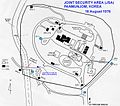 Joint Security Area 1976 map.jpg 758 × 672; 96 KB
-
 Joint Security Area 2008.jpg 3,648 × 2,736; 2.04 MB
-
 Joint Security Area Guards in UN Buildings.jpg 589 × 442; 46 KB
-
 Joint Security Area observation tower.jpg 2,868 × 1,922; 955 KB
-
 Joint Security Area panorama.jpg 2,459 × 1,040; 490 KB
-
 Joint Security Area view from NK, Flag of South Korea.jpg 800 × 600; 178 KB
-
 Joint Security Area view from North Korea 01.jpg 1,700 × 846; 423 KB
-
 Joint Security Area view from North Korea.jpg 800 × 600; 262 KB
-
 Joint Security Area, Demilitarized Zone, Korea (3162743334).jpg 2,304 × 3,072; 1.61 MB
-
 Joint Security Area, North Korea-South Korea border (15200953216).jpg 960 × 720; 324 KB
-
 Joint Security Area, North Korea-South Korea border (15223977745).jpg 960 × 701; 352 KB
-
 Joint Security Area, Panmunjeom.jpg 2,048 × 1,536; 502 KB
-
 Joint Security Area-Military.jpg 2,201 × 2,935; 2.04 MB
-
 Joint Security Area.jpg 3,047 × 2,285; 2.2 MB
-
 JointSecurityAreaKoreaDMZ (cropped).jpg 3,902 × 2,216; 2.84 MB
-
 JointSecurityAreaKoreaDMZ.jpg 4,288 × 2,848; 3.74 MB
-
 JointSecurityAreaNorthKoreans.jpg 1,287 × 958; 591 KB
-
 Journalists visit the DMZ before the 2018 Winter Olympics (4127041).jpeg 5,735 × 4,096; 18.73 MB
-
 JSA (159241962).jpg 800 × 600; 77 KB
-
 JSA AngolanTour1.jpg 1,172 × 786; 344 KB
-
 JSA AngolanTour2.jpg 1,183 × 796; 468 KB
-
 JSA conference room (2459172548).jpg 3,264 × 2,448; 2.32 MB
-
 JSA ConferenceRooms.JPG 800 × 532; 65 KB
-
 JSA Face Off (159241949).jpg 800 × 600; 76 KB
-
 JSA soldier.jpg 1,512 × 2,016; 1.3 MB
-
 JSA south korea military police.jpg 2,533 × 2,733; 447 KB
-
 Korean Demilitarized Zone (DMZ) from the South Korean side.jpg 4,608 × 3,072; 3.73 MB
-
 Korean DMZ Border 2009.jpg 3,264 × 1,832; 1.94 MB
-
 Korean DMZ Soldier Arm Band.jpg 1,512 × 2,016; 1.3 MB
-

-

-
 KPA3-1a.jpg 1,068 × 694; 242 KB
-
 KPA3-2a.jpg 832 × 519; 117 KB
-
 KPA7-CP3a.jpg 874 × 590; 299 KB
-
-

-

-
 Laika ac DMZ (6900024739).jpg 2,936 × 3,904; 4.97 MB
-
 Laika ac DMZ (7993709889).jpg 5,063 × 3,377; 8.1 MB
-
 Laika ac DMZ (7993710332).jpg 5,184 × 3,456; 4.74 MB
-
 MAC building during a JDO meeting.jpg 1,104 × 746; 212 KB
-
 Map JSA.jpg 702 × 546; 52 KB
-
 Map of Joint Security Area.svg 1,983 × 1,471; 577 KB
-
 MDL Korea 1.jpg 589 × 442; 35 KB
-
 Me at the border (2458337945).jpg 3,264 × 2,448; 2.66 MB
-
 Me on the North Korean side of the conference room (2458337671).jpg 3,264 × 2,448; 2.29 MB
-
-

-
_in_North_Korea_(346118336).jpg)


.jpg)
.jpg)


.jpg)
.jpg)
.jpg)
.jpg)
.jpg)


_on_981106-F-AF179-514.jpg)


_officials_pay_their_respects_to_what_is_believed_to_be_one_of_five_U.S._soldiers_killed_in_the_Korean_War_who_were_repatriated_during_981009-F-FC975-501.jpg)

.jpg)

_on_981106-F-AF179-015.jpg)


_prior_to_a_repatriation_ceremony_at_the_Panmunjom_Freedom_House_for_what_is_981009-F-FC975-507.jpg)


_guard_stands_at_his_post_providing_protection_for_a_group_of_visitors_touring_Joint_Security_Area_(JSA)_981008-F-CP197-506.jpg)
_stands_guard_at_Pan_Mun_Jom_in_Korea%27s_Demilitarized_Zone_Sept_020912-F-IZ313-223.jpg)


.jpg)
.jpg)

.jpg)
.jpg)
.jpg)

.jpg)
.jpg)


_Joint_Security_Area_(JSA)_Looking_Into_North_Korea_(28819154694).jpg)


.jpg)


.jpg)
.jpg)
.jpg)

.jpg)
.jpg)
.jpg)

.png)


.jpg)
.jpg)
.jpg)
.jpg)
.jpg)
.jpg)
.jpg)
.jpg)
.jpg)
.jpg)
.jpg)


.jpg)


.jpg)
.jpg)

.jpg)
.jpg)
.jpg)


.jpg)
.jpg)
.jpg)


.jpg)


.jpeg)
.jpg)


.jpg)

.jpg)


_from_the_South_Korean_side.jpg)


.jpg)
.jpg)
.jpg)


.jpg)
.jpg)


_officials_look_on_as_the_UNCMAC_Honor_Guard_drapes_the_United_Nations_flag_over_the_transfer_case_of_what_is_believed_to_be_one_981009-F-FC975-502.jpg)
_banner_Joint_Security_Area.jpg)
.jpg)