Category:Jasło-Sanok Pits (Depression)
Jump to navigation
Jump to search
 | |||||
| Upload media | |||||
| Instance of | |||||
|---|---|---|---|---|---|
| Location |
| ||||
| Length |
| ||||
| Area |
| ||||
| Elevation above sea level |
| ||||
 | |||||
English: The Jasło — Sanok Pits and Doły Jasielsko-Sanockie Mountain range, a vast Northern Outer Carpathian depression, located between the Beskid Niski Mountains and the Ciężkowice foothills in the Subcarpathian Voivodeship, southeastern Poland.The mountain range rises to 250—350 m, 825—1150 ft.
Polski: Doły Jasielsko-Sanockie
Deutsch: Sanoker Flachland
Subcategories
This category has the following 9 subcategories, out of 9 total.
Media in category "Jasło-Sanok Pits (Depression)"
The following 9 files are in this category, out of 9 total.
-
 Besko.tartak2.P1010148.JPG 2,816 × 2,112; 2.66 MB
-
 Grybowski Dział - DK28.JPG 1,024 × 768; 729 KB
-
 Nadolany 2009.jpg 1,013 × 723; 540 KB
-
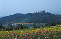 Odrzykon2 (js).jpg 1,182 × 763; 240 KB
-
 Pogórze Bukowskie i Jasielskie 2015.08.24 p.jpg 3,424 × 1,588; 4.35 MB
-
 Pogórze Rymanowskie.JPG 1,728 × 1,296; 578 KB
-
 San river (Międzybrodzie near Sanok).jpg 1,280 × 960; 107 KB
-
 Wisłoka.JPG 2,304 × 1,728; 696 KB
-
 Ściana Olzy - Olza Wall.jpg 1,280 × 960; 197 KB


.jpg)


.jpg)


Categories:
- Northern Outer Carpathian depressions
- Eastern Beskids
- Mountain ranges of Poland
- Geography of Subcarpathian Voivodeship
- Powiat sanocki
- Powiat krośnieński, Subcarpathian Voivodeship
- Powiat jasielski
- Pogórze Środkowobeskidzkie
- East Carpathian Biosphere Reserve
- Outer Eastern Carpathians
- Przeworsk culture area in the San river basin