Category:January 2018 in the East Riding of Yorkshire
Jump to navigation
Jump to search
Ceremonial counties of England: Berkshire · Buckinghamshire · Cambridgeshire · Cheshire · Cornwall · Derbyshire · Devon · Dorset · Durham · East Riding of Yorkshire · Essex · Gloucestershire · Greater London · Greater Manchester · Hertfordshire · Kent · Lancashire · Lincolnshire · Merseyside · Norfolk · North Yorkshire · Northamptonshire · Nottinghamshire · Oxfordshire · Shropshire · Somerset · South Yorkshire · Staffordshire · Suffolk · Surrey · Tyne and Wear · Warwickshire · West Midlands · West Sussex · West Yorkshire · Worcestershire
City-counties: Bristol ·
Former historic counties:
Other former counties:
City-counties: Bristol ·
Former historic counties:
Other former counties:
Deutsch: Bilder, die im Januar 2018 in the East Riding of Yorkshire aufgenommen worden sind. Bitte beachten Sie, dass dies weder das Datum des Uploads noch das Datum des Scannens eines Fotos ist.
English: Images/pictures taken in the East Riding of Yorkshire during January 2018. Note this is not the date of the upload, nor the date a photo was scanned.
Español: Fotografías o imágenes tomadas en the East Riding of Yorkshire durante enero 2018. No es la fecha de subida ni escaneo, sino la fecha en que las fotografías o imágenes se crearon.
Esperanto: Bildoj faritaj en the East Riding of Yorkshire en januaro 2018. Tio ne estas la dato, kiam la bildoj estis alŝutitaj aŭ skanitaj.
Français : Photographies ou images prises en the East Riding of Yorkshire durant janvier 2018. Ce n'est pas la date du téléchargement ou du scan.
Galego: Fotografías ou imaxes tomadas en the East Riding of Yorkshire durante xaneiro 2018. Non é a data de subida nin escaneamento, senón a data na que se crearon as fotografías ou imaxes.
Italiano: Fotografie o immagini scattate a the East Riding of Yorkshire nel gennaio 2018. Nota bene: la data non si riferisce né a quella di upload né a quella in cui la foto è stata digitalizzata.
Norsk bokmål: Bilder tatt i the East Riding of Yorkshire i løpet av januar 2018. Merk at dette ikke er datoen for opplasting, eller når et bilde har blitt skannet.
Norsk nynorsk: Bilete teke i the East Riding of Yorkshire i løpet av januar 2018. Merk at dette ikkje er datoen for opplasting, eller når eit bilete har vorte skanna.
Русский: Изображения, сделанные в the East Riding of Yorkshire в течение январь 2018 (не дата загрузки изображения).
Українська: Зображення, зроблені в the East Riding of Yorkshire протягом січень 2018. Зауважте, що це не дата завантаження чи дата сканування фотографії.
| January 2017 | ← | January 2018 | → | January 2019 | |||||||
| Jan | Feb | Mar | Apr | May | Jun | Jul | Aug | Sep | Oct | Nov | Dec |
| 95 | 47 | 36 | 62 | 47 | 47 | 38 | 24 | 42 | 100 | 23 | 51 |
|---|---|---|---|---|---|---|---|---|---|---|---|
Subcategories
This category has only the following subcategory.
Media in category "January 2018 in the East Riding of Yorkshire"
The following 94 files are in this category, out of 94 total.
-
 A63 westbound (geograph 5658077).jpg 640 × 480; 46 KB
-
 Access track to Shiptondale Farm (geograph 5643295).jpg 1,024 × 768; 377 KB
-
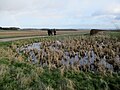 After a storm water in the dew pond (geograph 5643222).jpg 1,024 × 768; 533 KB
-
 All Saints Parish Church, North Ferriby (geograph 5659817).jpg 480 × 640; 45 KB
-
 All Saints Parish Hall, North Ferriby (geograph 5659811).jpg 640 × 480; 80 KB
-
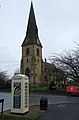 All Saints' Parish Church, North Ferriby (geograph 5658006).jpg 422 × 640; 50 KB
-
 Bridleway near Little Wauldby (geograph 5656055).jpg 640 × 480; 81 KB
-
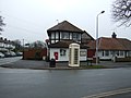
 Bus stop and former Post Office on Church Street, Welton (geograph 5664013).jpg 2,848 × 2,136; 1.41 MB
-
 Bus stop on Church Road, North Ferriby (geograph 5659806).jpg 640 × 480; 73 KB
-
 Church Street, Welton (geograph 5664015).jpg 640 × 480; 62 KB
-
 Close up, Elizabeth II postbox on Stanley Jackson Way, Welton (geograph 5663644).jpg 1,073 × 2,156; 546 KB
-
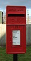 Close up, Elizabeth II postbox on Wiske Avenue, Brough (geograph 5664058).jpg 975 × 1,890; 400 KB
-
 Close up, George V postbox on Gibson Lane North, Melton (geograph 5658787).jpg 1,129 × 2,000; 545 KB
-
 Elizabeth II postbox and telephone box, North Ferriby Post Office (geograph 5658811).jpg 2,848 × 2,136; 1.46 MB
-
 Elizabeth II postbox on Plantation Drive, North Ferriby (geograph 5658824).jpg 1,555 × 2,581; 869 KB
-

-
 Elizabeth II postbox on Welton Low Road, Elloughton (geograph 5664599).jpg 1,322 × 2,727; 757 KB
-
 Elizabeth II postbox on Welton Low Road, Elloughton (geograph 5664600).jpg 2,848 × 2,136; 1.41 MB
-
 Elizabeth II postbox on Wiske Avenue, Brough (geograph 5664056).jpg 2,848 × 2,136; 1.46 MB
-
 Elizabeth II postbox, North Ferriby Post Office (geograph 5658809).jpg 1,464 × 2,051; 731 KB
-
 Ellie Rose Bus depot buses.jpg 5,184 × 3,456; 4.92 MB
-
 Entering Warter from the east (geograph 5643131).jpg 1,024 × 758; 413 KB
-
 Farmland towards the River Humber (geograph 5658042).jpg 640 × 480; 68 KB
-
 Field near Melton (geograph 5665967).jpg 640 × 480; 60 KB
-
 Foot bridge over the A63, Melton (geograph 5658071).jpg 640 × 480; 52 KB
-
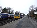
 Footbridge, Ferriby Railway Station (geograph 5658799).jpg 640 × 480; 54 KB
-
 Footpath toward Middleton Grange Farm (geograph 5643324).jpg 1,024 × 767; 429 KB
-

-
 Former Post Office on Church Street, Welton (geograph 5664014).jpg 2,136 × 2,848; 1.14 MB
-
 George V Ludlow postbox on Church Street, Welton (geograph 5664012).jpg 952 × 1,509; 380 KB
-
 George V postbox on Gibson Lane North, Melton (geograph 5658786).jpg 2,848 × 2,136; 1.23 MB
-
 George V postbox on Marine Drive, North Ferriby (geograph 5658769).jpg 1,332 × 2,804; 787 KB
-
 Gibson Lane North, Melton (geograph 5658789).jpg 2,848 × 2,136; 1.19 MB
-
 Hedon Racecourse railway Halt (site), Yorkshire (geograph 5658332).jpg 1,600 × 1,200; 548 KB
-
 Hedon Racecourse railway Halt (site), Yorkshire (geograph 5658663).jpg 1,600 × 1,200; 734 KB
-
 Hedon railway station (site), Yorkshire (geograph 5658240).jpg 1,600 × 1,200; 498 KB
-
 Hedon Road, Kingston upon Hull (geograph 5651730).jpg 2,304 × 1,296; 1.41 MB
-
 Hedon Road, Kingston upon Hull (geograph 5651733).jpg 2,592 × 1,296; 1.62 MB
-
 Hedon Road, Kingston upon Hull (geograph 5651737).jpg 2,592 × 1,315; 1.93 MB
-
 Hedon Road, Kingston upon Hull (geograph 5651742).jpg 2,588 × 1,386; 1.69 MB
-
 Hollym Gate railway station(site), Yorkshire (geograph 5657820).jpg 1,600 × 1,200; 399 KB
-
 House of Townend Wine Merchants, Melton (geograph 5658060).jpg 640 × 449; 45 KB
-
 House on Church Road, North Ferriby (geograph 5659809).jpg 640 × 480; 99 KB
-
 Houses on Church Road, North Ferriby (geograph 5659816).jpg 640 × 480; 49 KB
-
 Houses on Gibson Lane South, Melton (geograph 5658063).jpg 640 × 480; 71 KB
-
 Houses on Marine Drive, North Ferriby (geograph 5658770).jpg 2,641 × 1,925; 1.01 MB
-
 Humber foreshore near North Ferriby (geograph 5665955).jpg 640 × 480; 98 KB
-
 Humber Foreshore, North Ferriby (geograph 5665973).jpg 640 × 480; 71 KB
-
 Humber Road, North Ferriby (geograph 5658012).jpg 640 × 480; 65 KB
-
 Keyingham railway station (site), Yorkshire (geograph 5657955).jpg 1,600 × 1,200; 564 KB
-
 Kilnsea Beach.jpg 4,905 × 3,679; 4.91 MB
-
 Kiplingcotes Station (geograph 5651921).jpg 640 × 480; 53 KB
-
 Little Weighton railway station (site), Yorkshire (geograph 5658796).jpg 1,600 × 1,200; 628 KB
-
 Lobster Pot, Kilnsea Beach.jpg 4,680 × 3,509; 5.23 MB
-
 M62 towards Hull (geograph 5664126).jpg 640 × 480; 46 KB
-
 Marine Drive, North Ferriby (geograph 5658772).jpg 2,532 × 1,799; 954 KB
-
 Market Weighton railway station (site), Yorkshire (geograph 5659085).jpg 1,600 × 1,200; 463 KB
-
 Minor road toward Middleton-on-the-Wolds (geograph 5643231).jpg 1,024 × 760; 501 KB
-
 Muddy path across the fields (geograph 5660658).jpg 640 × 553; 57 KB
-
 National Cycle Route 65, Melton (geograph 5658053).jpg 640 × 480; 57 KB
-
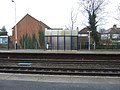
 North Ferriby Library (geograph 5659808).jpg 640 × 480; 99 KB
-
 North Ferriby Post Office (geograph 5658812).jpg 2,752 × 1,942; 1.2 MB
-
 North Ferriby Post Office (geograph 5658814).jpg 2,848 × 2,136; 1.45 MB
-
 North Ferriby Village Hall (geograph 5658018).jpg 640 × 480; 53 KB
-
 Nut Wood (geograph 5656058).jpg 640 × 480; 143 KB
-
 Ottringham railway station (site), Yorkshire (geograph 5657867).jpg 1,600 × 1,200; 639 KB
-
 Patrington railway station (site), Yorkshire (geograph 5657846).jpg 1,600 × 1,200; 335 KB
-
 Plantation Drive, North Ferriby (geograph 5658825).jpg 2,848 × 2,136; 1.34 MB
-
 Plantation Drive, North Ferriby (geograph 5658827).jpg 2,848 × 2,136; 1.13 MB
-
 Platform 1, Ferriby Railway Station (geograph 5658802).jpg 2,848 × 2,136; 1.23 MB
-
 Platform 1, Ferriby Railway Station (geograph 5658803).jpg 640 × 480; 66 KB
-
 Platform 2, Ferriby Railway Station (geograph 5658804).jpg 640 × 480; 81 KB
-
 Railway bridge over Church Road (geograph 5658020).jpg 640 × 480; 80 KB
-
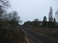 Railway towards York and Doncaster (geograph 5658026).jpg 640 × 480; 63 KB
-
 Raywell House (geograph 5656052).jpg 640 × 480; 62 KB
-
 River Humber near Melton (geograph 5665961).jpg 640 × 480; 88 KB
-
 Ryehill & Burstwick railway station (site), Yorkshire (geograph 5657967).jpg 1,600 × 1,200; 476 KB
-
 Scrub on the side of Great Dug Dale (geograph 5644173).jpg 1,024 × 756; 384 KB
-
 Scrub trees on the southern side of Great Dug Dale (geograph 5644180).jpg 1,024 × 768; 468 KB
-
 Shelter, Platform 2, Ferriby Railway Station (geograph 5658800).jpg 640 × 480; 84 KB
-
-
 Springhead Pumping Station (geograph 5660644).jpg 640 × 480; 75 KB
-
 Stanley Jackson Way, Welton (geograph 5663645).jpg 2,848 × 2,136; 1.44 MB
-
 Tenfoot leading to Wolfreton Road (geograph 5660637).jpg 640 × 480; 82 KB
-
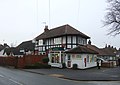
 The Spread Eagle, Withernsea (geograph 5657788).jpg 1,600 × 1,200; 336 KB
-
 Underpass beneath Monks Way, Melton (geograph 5658058).jpg 640 × 480; 62 KB
-
 View towards Wilberfoss (geograph 5640474).jpg 1,024 × 768; 149 KB
-
 Warter village pond alongside the B1246 (geograph 5643140).jpg 1,024 × 737; 516 KB
-
 Welton Low Road, Elloughton (geograph 5664601).jpg 2,848 × 2,136; 1.25 MB
-
 Wide open Yorkshire Wolds view (geograph 5643322).jpg 1,024 × 765; 467 KB
-
 Winestead railway station (site), Yorkshire (geograph 5657857).jpg 1,600 × 1,200; 407 KB
-
 Wiske Avenue, Brough (geograph 5664060).jpg 2,848 × 2,136; 1.42 MB
-
 Withernsea railway station (site), Yorkshire (geograph 5657768).jpg 1,600 × 1,200; 401 KB
-
 Wood Drive, North Ferriby (geograph 5658034).jpg 640 × 480; 49 KB
.jpg)
.jpg)
.jpg)
.jpg)
.jpg)
.jpg)
.jpg)
.jpg)
.jpg)
.jpg)
.jpg)
.jpg)
.jpg)
.jpg)
.jpg)
.jpg)
.jpg)
.jpg)
.jpg)
.jpg)

.jpg)
.jpg)
.jpg)
.jpg)
.jpg)
.jpg)
.jpg)
.jpg)
.jpg)
.jpg)
.jpg)
.jpg)
,_Yorkshire_(geograph_5658332).jpg)
,_Yorkshire_(geograph_5658663).jpg)
,_Yorkshire_(geograph_5658240).jpg)
.jpg)
.jpg)
.jpg)
.jpg)
,_Yorkshire_(geograph_5657820).jpg)
.jpg)
.jpg)
.jpg)
.jpg)
.jpg)
.jpg)
.jpg)
.jpg)
,_Yorkshire_(geograph_5657955).jpg)

.jpg)
,_Yorkshire_(geograph_5658796).jpg)

.jpg)
.jpg)
,_Yorkshire_(geograph_5659085).jpg)
.jpg)
.jpg)
.jpg)
.jpg)
.jpg)
.jpg)
.jpg)
.jpg)
,_Yorkshire_(geograph_5657867).jpg)
,_Yorkshire_(geograph_5657846).jpg)
.jpg)
.jpg)
.jpg)
.jpg)
.jpg)
.jpg)
.jpg)
.jpg)
.jpg)
,_Yorkshire_(geograph_5657967).jpg)
.jpg)
.jpg)
.jpg)
.jpg)
.jpg)
.jpg)
.jpg)
.jpg)
.jpg)
.jpg)
.jpg)
.jpg)
.jpg)
,_Yorkshire_(geograph_5657857).jpg)
.jpg)
,_Yorkshire_(geograph_5657768).jpg)
.jpg)