Category:January 2009 in Nottinghamshire
Jump to navigation
Jump to search
Deutsch: Bilder, die im Januar 2009 in Nottinghamshire aufgenommen worden sind. Bitte beachten Sie, dass dies weder das Datum des Uploads noch das Datum des Scannens eines Fotos ist.
English: Images/pictures taken in Nottinghamshire during January 2009. Note this is not the date of the upload, nor the date a photo was scanned.
Español: Fotografías o imágenes tomadas en Nottinghamshire durante enero 2009. No es la fecha de subida ni escaneo, sino la fecha en que las fotografías o imágenes se crearon.
Esperanto: Bildoj faritaj en Nottinghamshire en januaro 2009. Tio ne estas la dato, kiam la bildoj estis alŝutitaj aŭ skanitaj.
Français : Photographies ou images prises en Nottinghamshire durant janvier 2009. Ce n'est pas la date du téléchargement ou du scan.
Galego: Fotografías ou imaxes tomadas en Nottinghamshire durante xaneiro 2009. Non é a data de subida nin escaneamento, senón a data na que se crearon as fotografías ou imaxes.
Italiano: Fotografie o immagini scattate a Nottinghamshire nel gennaio 2009. Nota bene: la data non si riferisce né a quella di upload né a quella in cui la foto è stata digitalizzata.
Norsk bokmål: Bilder tatt i Nottinghamshire i løpet av januar 2009. Merk at dette ikke er datoen for opplasting, eller når et bilde har blitt skannet.
Norsk nynorsk: Bilete teke i Nottinghamshire i løpet av januar 2009. Merk at dette ikkje er datoen for opplasting, eller når eit bilete har vorte skanna.
Русский: Изображения, сделанные в Nottinghamshire в течение январь 2009 (не дата загрузки изображения).
Українська: Зображення, зроблені в Nottinghamshire протягом січень 2009. Зауважте, що це не дата завантаження чи дата сканування фотографії.
| January 2008 | ← | January 2009 | → | January 2010 | |||||||
| Jan | Feb | Mar | Apr | May | Jun | Jul | Aug | Sep | Oct | Nov | Dec |
| 56 | 43 | 24 | 38 | 54 | 29 | 26 | 37 | 29 | 61 | 19 | 18 |
|---|---|---|---|---|---|---|---|---|---|---|---|
Media in category "January 2009 in Nottinghamshire"
The following 55 files are in this category, out of 55 total.
-
 Wigsley Road sunset - geograph.org.uk - 1114031.jpg 640 × 427; 47 KB
-
 43084 Flyfish Crossing (3241400626).jpg 3,629 × 2,531; 5.92 MB
-
 67001 Flyfish Crossing (3241396268).jpg 3,417 × 2,379; 4.93 MB
-
 92012 Flyfish Crossing 2.jpg 2,290 × 1,623; 1.76 MB
-
 92012 Flyfish Crossing 3.jpg 2,961 × 2,263; 3.07 MB
-
 92012 Flyfish Crossing.jpg 3,477 × 2,418; 4.47 MB
-
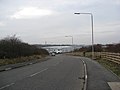
 A453 Flyover - geograph.org.uk - 1130416.jpg 426 × 640; 91 KB
-

-
 B6420 Mansfield Road - geograph.org.uk - 1132214.jpg 640 × 480; 41 KB
-
 Brailsford Way Chilwell - geograph.org.uk - 1126793.jpg 640 × 480; 164 KB
-
 Bridge over the River Maun at Eaton - geograph.org.uk - 1132071.jpg 640 × 448; 55 KB
-
 Cycles to the right - geograph.org.uk - 1122297.jpg 640 × 480; 96 KB
-
 DVT 82205 (3241799300).jpg 2,514 × 1,676; 1.68 MB
-
 Entrance to Kings Marina - geograph.org.uk - 1117432.jpg 640 × 480; 73 KB
-
 Fiddlers Elbow Bridge - geograph.org.uk - 1117497.jpg 640 × 480; 77 KB
-
 Field near Wood Farm - geograph.org.uk - 1127220.jpg 640 × 479; 182 KB
-
 Field near Wood Farm - geograph.org.uk - 1127230.jpg 640 × 479; 155 KB
-
 Fields near Lambley - geograph.org.uk - 1127243.jpg 640 × 479; 153 KB
-
 Fisherman's car park north of Holme - geograph.org.uk - 1120304.jpg 640 × 480; 59 KB
-
 Footpath from Lambley - geograph.org.uk - 1127341.jpg 640 × 479; 206 KB
-
 Footpath near Crimea Farm - geograph.org.uk - 1127255.jpg 640 × 479; 281 KB
-

-
 Footpath to Lambley - geograph.org.uk - 1127186.jpg 479 × 640; 197 KB
-
 Footpath to Lambley - geograph.org.uk - 1127187.jpg 640 × 479; 139 KB
-
 Footpath to Lambley - geograph.org.uk - 1127192.jpg 479 × 640; 150 KB
-
 Footpath to Lambley - geograph.org.uk - 1127195.jpg 640 × 479; 178 KB
-
 Footpath to Lambley - geograph.org.uk - 1127282.jpg 640 × 479; 354 KB
-
 Footpath to Lambley - geograph.org.uk - 1127339.jpg 479 × 640; 198 KB
-
 Footpath to Top Dumble - geograph.org.uk - 1127274.jpg 640 × 479; 164 KB
-
 Footpath to Wood Lane - geograph.org.uk - 1127180.jpg 640 × 479; 335 KB
-
 Grand Central HST heading North (3240967337).jpg 2,052 × 1,368; 1.2 MB
-
-
 Huthwaite - Common Road (B6027) - geograph.org.uk - 1140316.jpg 640 × 480; 50 KB
-

-
 Under repair - geograph.org.uk - 1141200.jpg 640 × 427; 66 KB
-
 Level Crossing at Whitehouse Lane - geograph.org.uk - 1117560.jpg 640 × 479; 66 KB
-
 Newark Castle Station Building - geograph.org.uk - 1146814.jpg 426 × 640; 106 KB
-
 River Idle - geograph.org.uk - 1116251.jpg 640 × 427; 98 KB
-
 Road junction and old buildings - geograph.org.uk - 1143814.jpg 640 × 427; 67 KB
-
 Saracens Head Hotel - geograph.org.uk - 1144152.jpg 640 × 427; 68 KB
-
 Sluice bridge over Slough Dyke - geograph.org.uk - 1120336.jpg 640 × 480; 116 KB
-
 Sunshine and Shade on the Minster - geograph.org.uk - 1144138.jpg 640 × 427; 91 KB
-

-

-

-
 The Feathers Tavern - geograph.org.uk - 1116083.jpg 640 × 468; 90 KB
-
 Train 43309 (3240616579).jpg 3,888 × 2,592; 3.87 MB
-

-

-
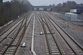 Trowell Junction - geograph.org.uk - 1109970.jpg 640 × 428; 106 KB
-
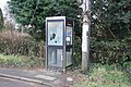 Wigsley phone box - geograph.org.uk - 1115691.jpg 640 × 427; 121 KB
-
 Winter Sunlight on the Minster - geograph.org.uk - 1141316.jpg 640 × 427; 67 KB
-
 Winthorpe Crossing - geograph.org.uk - 1117676.jpg 640 × 508; 61 KB
-
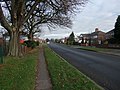 Winthorpe Road, Newark - geograph.org.uk - 1117573.jpg 640 × 480; 96 KB
-
 Allotments off Cottage Lane, Collingham - geograph.org.uk - 1122269.jpg 640 × 480; 111 KB

.jpg)
.jpg)


.jpg)


.jpg)

_-_geograph.org.uk_-_1140316.jpg)


.jpg)


