Category:James Cook (maps relating to)
Jump to navigation
Jump to search
English: Many maps are associated directly with James Cook. He made detailed maps of Newfoundland (1758-1767) prior to mapping the island groups of the Pacific during his three famous voyages (1768-1780).
Deutsch: Viele Landkarten können direkt James Cook zugeordnet werden. Nach der Kartografierung von Neufundland (1758-1767) zeichnete er bei seinen drei Südseereisen (1768-1780) eine Vielzahl von Karten von den Inselgruppen des Pazifik.
Subcategories
This category has only the following subcategory.
Media in category "James Cook (maps relating to)"
The following 97 files are in this category, out of 97 total.
-

-

-

-
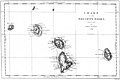
 1769 Cook Map of the Society Islands - Geographicus - SoecityIsland-cook-1769.jpg 4,000 × 2,708; 2.29 MB
-
 Pitcairn map by Robert Benard 1774.jpg 3,248 × 2,423; 8.63 MB
-
 1777 Cook Map of the Friendly Islands or Tonga - Geographicus - FriendlyIsles-cook-1777.jpg 3,000 × 1,970; 1.54 MB
-
 1780 Cook - Hogg Map of Tahiti ( Society Islands ) - Geographicus - Tahiti-hogg-1780.jpg 4,000 × 2,138; 912 KB
-
 Kerg map.jpg 1,000 × 897; 156 KB
-
 Kerguel map.jpg 4,060 × 3,582; 7.03 MB
-
 1785 Cook - Bligh Map of Hawaii - Geographicus - Hawaii-cook-1785.jpg 4,000 × 2,435; 1.64 MB
-
-
 1798 Cassini Map of Alaska and the Bering Strait - Geographicus - Alaska-cassini-1798.jpg 4,000 × 2,897; 3.09 MB
-

-

-

-

-

-

-
-
-

-

-

-

-

-

-

-

-

-
 Admiralty Chart No 1093 Shouraka Gulf, Published 1836.jpg 6,125 × 7,854; 6.02 MB
-

-
 Admiralty Chart No 232b Newfoundland - Northern Portion, Published 1870.jpg 14,763 × 7,986; 14.88 MB
-
 Admiralty Chart No 2516 Gulf of St Lawrence and the River to Quebec, Published 1857.jpg 12,359 × 8,107; 13.66 MB
-
 Admiralty Chart No 2666 St Johns Newfoundland to Halifax with the Outer Banks, Published 1861.jpg 11,911 × 8,074; 12.46 MB
-
 Amerika.jpg 9,917 × 6,963; 18.24 MB
-
 Approximate route of third voyage of Captain Cook (animated).gif 800 × 401; 44 KB
-

-

-
 Bay of Islands New Zealand (by Captain James Cook, 1773).jpg 1,412 × 1,452; 1.41 MB
-
 Carte Générale De L'Europe.jpg 10,572 × 7,781; 12.48 MB
-
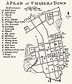 Cook, James — 1773 Map of Charles Town.jpg 1,366 × 1,600; 670 KB
-

-

-
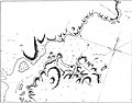 Chart of Mercury Bay by Richard Pickersgill (1769).jpg 908 × 709; 121 KB
-
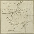 Chart of Tolaga Bay New Zealand (by Captain James Cook, 1773).jpg 1,416 × 1,412; 1.36 MB
-
 Cook 1.gif 800 × 401; 46 KB
-
 Cook 2.gif 800 × 401; 47 KB
-
 Cook chart of New Zealand.jpg 1,093 × 1,508; 301 KB
-
 Cook chart of the Society Isles.jpg 1,886 × 1,250; 761 KB
-
 Cook mapa.jpg 4,291 × 5,915; 1.48 MB
-
 Cook New Zealand South Cape.jpg 800 × 618; 127 KB
-
 Cook new zealand.jpg 861 × 1,024; 307 KB
-
 Cook Three Voyages 59.png 800 × 401; 273 KB
-

-
 Cook'sFirstVoyage54.png 800 × 401; 236 KB
-

-
 Cook-1777.jpg 1,269 × 888; 539 KB
-
 Cook-1777.PNG 3,807 × 2,664; 3.33 MB
-
 Cook-map.jpg 630 × 288; 24 KB
-
 CookANZ.JPG 237 × 154; 10 KB
-
 Cookroutes.png 643 × 430; 113 KB
-
 Cooks erste Reise.png 1,263 × 632; 66 KB
-
 Cooks Karte von Neufundland.jpg 1,500 × 1,462; 521 KB
-
 Entrance of Endeavour River and Botany Bay in New South Wales.jpeg 1,400 × 873; 909 KB
-

-
 Itinerario del primo viaggio di James Cook.svg 2,754 × 1,397; 1.59 MB
-
 Jacques Cook - Carte de l'Hemisphere Austral (1778).jpg 6,251 × 6,425; 6.93 MB
-
 James Cook - A Chart of the Southern Hemisphere (1776).jpg 6,494 × 6,810; 8.07 MB
-
 James Cook NF Belle Isle.jpg 1,766 × 962; 312 KB
-
 James Cook NF Placentia.jpg 1,000 × 876; 178 KB
-
 James Cook NF South coast.jpg 1,279 × 1,304; 247 KB
-
 James Cook NF St marys.jpg 816 × 1,000; 134 KB
-
 James Cook NF Trepassey.jpg 1,597 × 1,049; 285 KB
-
 James Cook NF West coast.jpg 1,368 × 1,199; 348 KB
-
 James Cook York harbour labrador.jpg 1,534 × 1,062; 279 KB
-
 Karte Cook Seereise nr1.png 1,263 × 632; 97 KB
-
 Malay Archipelago map with track of the Endeavour.jpg 1,286 × 681; 426 KB
-
 Map of 'New Holland' - 1798(GN00278).jpg 2,313 × 1,783; 685 KB
-
 Mapa del océano Pacífico Sur mostrando la ruta del HMB Endeavour (1769-1770).jpg 6,885 × 2,867; 11.3 MB
-
 Melanesia map with track of the Endeavour.jpg 1,277 × 726; 313 KB
-
 Mercury Bay New Zealand (by Captain James Cook, 1773).jpg 1,441 × 951; 946 KB
-
 Nautical Chart Belle Isle Cook 1766 nla.obj-231254777.jpg 9,410 × 7,168; 7.48 MB
-
 Poverty Bay, Nueva Zelanda, octubre de 1769. Según W.L. Williams, (1888).jpg 1,246 × 1,138; 761 KB
-
 Cook, James — Map of the Province of South Carolina 1773.jpg 9,968 × 9,824; 22.85 MB
-

-
 River Thames and Mercury Bay New Zealand (by Captain James Cook, 1773).jpg 2,976 × 2,896; 5.55 MB
-

-
 Ruta del HMB Endeavour feb-marzo - 1770 NZ.jpg 719 × 532; 254 KB
-
 Ruta del HMB Endeavour parte norte Isla Sur NZ.jpg 587 × 386; 185 KB
-
 Ruta del HMB Endeavour. dic- 1769 NZ.jpg 995 × 944; 465 KB
-
 SeaSurveys Edgell 1965 0029 12.jpg 2,796 × 3,764; 2.94 MB
-
 SeaSurveys Edgell 1965 0030 13.jpg 2,796 × 3,764; 2.37 MB
-
 Tahiti and New Zealand map with track of the Endeavour.jpg 738 × 1,283; 332 KB
-
 The world at the treaty of Paris, 1763.jpg 2,946 × 1,534; 1.32 MB
-
 Track of Endeavour.jpg 1,300 × 694; 247 KB
-
 World map with track of the Endeavour.jpg 1,340 × 793; 893 KB
-
 Nouvel atlas portatif 1806 (138990082).jpg 6,074 × 5,193; 29.26 MB
%27_(11093772166).jpg)
%27_(11094964023).jpg)


_-_Geographicus_-_Tahiti-hogg-1780.jpg)


_-_Geographicus_-_NorthwestPassage-schraembl-1788.jpg)


.jpg)

t_Hen(r)y_Roberts..._;_W._Palmer_sculp._-_btv1b5970605q.jpg)

.jpg)
.jpg)


.gif)
_auch_Polynesien_oder_Inselwelt,_insgemein_der_f%C3%BCnfte_Welttheil_genannt_-_UvA-BC_OTM_HB-KZL_69_11_05.jpg)
_auch_Polynesien_oder_Inselwelt,_insgemein_der_f%C3%BCnfte_Welttheil_genannt_-_UvA-BC_OTM_HB-KZL_101.20.02.jpg)
.jpg)


.jpg)
.jpg)


.jpg)
.jpg)


.jpg)
.jpg)

.jpg)

.jpg)

.jpg)
.jpg)
.jpg)


.jpg)
.jpg)