Category:Jakobsweg Graubünden
Jump to navigation
Jump to search

  | |||||
| Upload media | |||||
| Instance of |
| ||||
|---|---|---|---|---|---|
| Location | Grisons, Switzerland | ||||
| Maintained by |
| ||||
| Part of the series |
| ||||
| Length |
| ||||
| official website | |||||
| |||||
![]() Switzerland -
Switzerland - ![]() Graubünden &
Graubünden & ![]() Uri / Route 43: Via son Giachen
Uri / Route 43: Via son Giachen
Media in category "Jakobsweg Graubünden"
The following 21 files are in this category, out of 21 total.
-
 43-85-L.jpg 1,600 × 1,067; 154 KB
-
 43-Wegsymbol.jpg 140 × 140; 20 KB
-
 43-Wegweiser.jpg 275 × 220; 34 KB
-
 43-Zeichen-UR.jpg 123 × 123; 13 KB
-
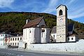 Benediktinerkloster St. Johann.JPG 2,160 × 1,446; 823 KB
-
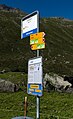 Dürrboden bus stop.jpg 1,896 × 3,089; 1.95 MB
-
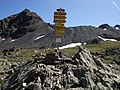
 Fingerpost Chrüzlipass.jpg 1,944 × 2,592; 1.2 MB
-
 Fingerpost near Etzlihütte.jpg 2,591 × 1,942; 480 KB
-
 Fingerpost on Scalettapass.jpg 3,456 × 4,608; 6.94 MB
-
 Fingerpost on Strelapass 1.jpg 3,456 × 4,608; 7.96 MB
-
 Fingerpost on Strelapass 2.jpg 3,456 × 4,608; 8.13 MB
-
 Hike signs in Davos.jpg 3,649 × 3,153; 2.69 MB
-
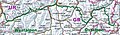 Karte-43.jpg 1,459 × 431; 327 KB
-
 Lavin Wegweiser.jpg 3,000 × 4,000; 4.97 MB
-
 Mittelplatten-WW.jpg 856 × 526; 300 KB
-
 Panixersee - Lag da Pigniu - GR - 8.jpg 7,952 × 5,304; 7.59 MB
-
 Punt Ota bei Brail 2.jpg 1,536 × 2,048; 1,017 KB
-
 Scalettapass01.jpg 1,600 × 1,200; 497 KB
-
 St. Hilarienbrüggli über die Plessur, Chur GR 20190825-jag9889.jpg 4,608 × 3,456; 11.22 MB
-
 Val S-charl Wegweiser.jpg 4,000 × 3,000; 4.94 MB
-
 Wegweiser Senda.jpg 2,512 × 1,817; 1.09 MB


