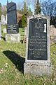
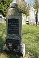
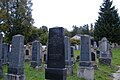
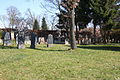
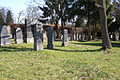
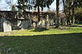
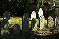
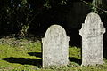
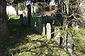
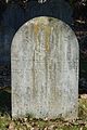
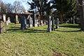
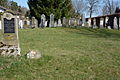
Category:Jüdischer Friedhof Buttenwiesen
Jump to navigation
Jump to search
| Object location | | View all coordinates using: OpenStreetMap |
|---|
| Upload media | |||||
| Instance of | |||||
|---|---|---|---|---|---|
| Location | Buttenwiesen, Dillingen, Swabia, Bavaria, Germany | ||||
| Street address |
| ||||
| Heritage designation | |||||
 | |||||
This is the category of the Bavarian Baudenkmal (cultural heritage monument) with the ID D-7-73-122-9 (Wikidata)
|
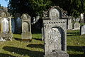
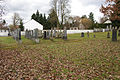
Media in category "Jüdischer Friedhof Buttenwiesen"
The following 44 files are in this category, out of 44 total.
-
 Buttenwiesen jüdischer Friedhof HugoLammfromm249.JPG 2,520 × 3,776; 4.31 MB
-
 Buttenwiesen jüdischer Friedhof JakobLammfromm257.JPG 2,520 × 3,776; 4.27 MB
-
 Buttenwiesen jüdischer Friedhof SophieNeuburger241.JPG 2,520 × 3,776; 4.45 MB
-
 Buttenwiesen Jüdischer Friedhof.jpg 2,304 × 1,536; 855 KB
-
 Buttenwiesen jüdischer Friedhof235.JPG 3,776 × 2,520; 6.15 MB
-
 Buttenwiesen jüdischer Friedhof236.JPG 3,776 × 2,520; 5.99 MB
-
 Buttenwiesen jüdischer Friedhof237.JPG 3,776 × 2,520; 5.8 MB
-
 Buttenwiesen jüdischer Friedhof238.JPG 3,776 × 2,520; 6.11 MB
-
 Buttenwiesen jüdischer Friedhof239.JPG 3,776 × 2,520; 5.92 MB
-
 Buttenwiesen jüdischer Friedhof242.JPG 3,776 × 2,520; 5.51 MB
-
 Buttenwiesen jüdischer Friedhof244.JPG 3,776 × 2,520; 5.67 MB
-
 Buttenwiesen jüdischer Friedhof246.JPG 3,776 × 2,520; 5.8 MB
-
 Buttenwiesen jüdischer Friedhof248.JPG 2,520 × 3,776; 4.3 MB
-
 Buttenwiesen jüdischer Friedhof251.JPG 3,776 × 2,520; 5.97 MB
-
 Buttenwiesen jüdischer Friedhof252.JPG 3,776 × 2,520; 5.85 MB
-
 Buttenwiesen jüdischer Friedhof254.JPG 3,776 × 2,520; 5.98 MB
-
 Buttenwiesen jüdischer Friedhof255.JPG 3,776 × 2,520; 5.92 MB
-
 Buttenwiesen jüdischer Friedhof259.JPG 3,776 × 2,520; 6.02 MB
-
 Buttenwiesen jüdischer Friedhof260.JPG 3,776 × 2,520; 6.26 MB
-
 Buttenwiesen jüdischer Friedhof261.JPG 3,776 × 2,520; 5.74 MB
-
 D-7-73-122-9 Buttenwiesen Juedischer-Friedhof 001.jpg 4,765 × 3,176; 2.42 MB
-
 D-7-73-122-9 Buttenwiesen Juedischer-Friedhof 002.jpg 4,869 × 3,225; 2.75 MB
-
 D-7-73-122-9 Buttenwiesen Juedischer-Friedhof 003.jpg 4,917 × 3,257; 2.86 MB
-
 D-7-73-122-9 Buttenwiesen Juedischer-Friedhof 004.jpg 2,705 × 3,908; 1.3 MB
-
 D-7-73-122-9 Buttenwiesen Juedischer-Friedhof 005.jpg 4,811 × 2,913; 2.15 MB
-
 D-7-73-122-9 Buttenwiesen Juedischer-Friedhof 006.jpg 4,928 × 3,264; 2.59 MB
-
 D-7-73-122-9 Buttenwiesen Juedischer-Friedhof 007.jpg 4,866 × 3,223; 2.45 MB
-
 D-7-73-122-9 Buttenwiesen Juedischer-Friedhof 008.jpg 4,758 × 3,059; 2.43 MB
-
 D-7-73-122-9 Buttenwiesen Juedischer-Friedhof 009.jpg 4,855 × 3,216; 2.69 MB
-
 D-7-73-122-9 Buttenwiesen Juedischer-Friedhof 010.jpg 4,890 × 3,239; 2.57 MB
-
 D-7-73-122-9 Buttenwiesen Juedischer-Friedhof 011.jpg 3,128 × 4,722; 1.54 MB
-
 D-7-73-122-9 Buttenwiesen Juedischer-Friedhof 012.jpg 4,896 × 3,243; 1.9 MB
-
 D-7-73-122-9 Buttenwiesen Juedischer-Friedhof 013.jpg 4,866 × 3,223; 2.14 MB
-
 D-7-73-122-9 Buttenwiesen Juedischer-Friedhof 014.jpg 3,238 × 4,888; 1.79 MB
-
 D-7-73-122-9 Buttenwiesen Juedischer-Friedhof 016.jpg 3,264 × 4,928; 2.58 MB
-
 D-7-73-122-9 Buttenwiesen Juedischer-Friedhof 017.jpg 4,902 × 3,247; 2.52 MB
-
 D-7-73-122-9 Buttenwiesen Juedischer-Friedhof 018.jpg 4,908 × 3,251; 2.49 MB
-
 D-7-73-122-9 Buttenwiesen Juedischer-Friedhof 019.jpg 4,928 × 3,264; 2.63 MB
-
 D-7-73-122-9 Buttenwiesen Juedischer-Friedhof 02.jpg 3,226 × 4,870; 2.31 MB
-
 D-7-73-122-9 Buttenwiesen Juedischer-Friedhof 020.jpg 4,821 × 3,193; 2.87 MB
-
 D-7-73-122-9 Buttenwiesen Juedischer-Friedhof 021.jpg 3,251 × 4,908; 2.3 MB
-
 D-7-73-122-9 Buttenwiesen Juedischer-Friedhof 022.jpg 3,044 × 4,781; 893 KB
-
 D-7-73-122-9 Buttenwiesen Juedischer-Friedhof 023.jpg 3,102 × 4,770; 1.27 MB
-
 Jüdische Friedhof Buttenwiesen.jpg 2,304 × 1,536; 847 KB


