Category:Itcha Range
Jump to navigation
Jump to search
mountain range in British Columbia, Canada  | |||||
| Upload media | |||||
| Instance of | |||||
|---|---|---|---|---|---|
| Part of |
| ||||
| Location | British Columbia, Canada | ||||
| Highest point |
| ||||
| Elevation above sea level |
| ||||
 | |||||
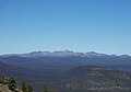
English: The Itcha Range is a mountain range located entirely within Itcha Ilgachuz Provincial Park in British Columbia, Canada. It is part of the Anahim Volcanic Belt.
Subcategories
This category has only the following subcategory.
M
- Maps of Anahim Volcanic Belt (6 F)
Media in category "Itcha Range"
The following 8 files are in this category, out of 8 total.
-
 Itcha Range .jpg 475 × 334; 11 KB
-
 Itcha Range geology.png 571 × 370; 66 KB
-
 Itcha Range northern.jpg 990 × 378; 70 KB
-
 Itcha Range southern.jpg 985 × 327; 56 KB
-
 Itcha Range western.jpg 967 × 405; 62 KB
-
 Itcha Range.jpg 672 × 586; 270 KB
-
 Mount Downton 3D.gif 618 × 434; 9.82 MB
-
 RainbowIlgachuzItcha.jpg 510 × 207; 17 KB


