Category:Islip, Oxfordshire
Jump to navigation
Jump to search
village and civil parish in Cherwell district, Oxfordshire, England  | |||||
| Upload media | |||||
| Instance of | |||||
|---|---|---|---|---|---|
| Location | Cherwell, Oxfordshire, South East England, England | ||||
| Population |
| ||||
| Area |
| ||||
| official website | |||||
 | |||||
English: Islip ( north of Oxford.
Esperanto: Islip [Ajslip] estas vilaĝo en Oxfordshire proksime al Kidlington kaj ĉirkaŭ dek kilometrojn sudoriente de Bicester.
Subcategories
This category has the following 4 subcategories, out of 4 total.
I
- Islip railway station (38 F)
S
- The Swan Inn, Islip (5 F)
Media in category "Islip, Oxfordshire"
The following 175 files are in this category, out of 175 total.
-
 A field of wheat at Noke - geograph.org.uk - 2492878.jpg 1,500 × 969; 280 KB
-
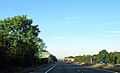
 A34 approaches the B4027 interchange - geograph.org.uk - 3395202.jpg 3,648 × 2,736; 1.29 MB
-
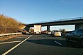
 A34 bridge carrying B4027 - geograph.org.uk - 2534930.jpg 3,648 × 2,736; 1.77 MB
-
 A34 northbound - geograph.org.uk - 5637933.jpg 640 × 428; 79 KB
-
 A34 northbound - geograph.org.uk - 5637942.jpg 640 × 428; 84 KB
-
 A34 slip road for B4027 - geograph.org.uk - 2534932.jpg 3,648 × 2,736; 1.2 MB
-
 A34 Southbound - geograph.org.uk - 6075863.jpg 640 × 480; 62 KB
-
 A34, half a mile to Kidlington turn - geograph.org.uk - 6261331.jpg 640 × 393; 42 KB
-
 A34, northbound - geograph.org.uk - 5648465.jpg 640 × 371; 45 KB
-
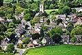 Aerial view of Islip, Oxfordshire - geograph.org.uk - 3892474.jpg 4,288 × 2,848; 6.67 MB
-
 Aerial view of Islip, Oxfordshire - geograph.org.uk - 3892478 (cropped).jpg 2,848 × 2,848; 4.59 MB
-
 Aerial view of Islip, Oxfordshire - geograph.org.uk - 3892478.jpg 4,288 × 2,848; 6.84 MB
-
 Apples at Manor Farm - geograph.org.uk - 5936451.jpg 4,738 × 3,103; 2.95 MB
-
 Approaching B4027 turn off the A34 - geograph.org.uk - 6260340.jpg 640 × 389; 46 KB
-

-
 Arable field near Islip - geograph.org.uk - 3693105.jpg 1,500 × 999; 232 KB
-
 Arable field on the edge of Islip - geograph.org.uk - 1767556.jpg 640 × 480; 96 KB
-
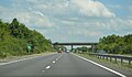
 B4027 approaching flyover above A34 - geograph.org.uk - 4462645.jpg 3,008 × 2,000; 4.45 MB
-
 B4027 bridge over A34 in rush hour - geograph.org.uk - 5528812.jpg 1,600 × 962; 584 KB
-
 Benchmark behind gate of Hillside Cottages - geograph.org.uk - 3266122.jpg 683 × 1,024; 230 KB
-
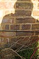 Benchmark in my shadow on ^2 Mill Street - geograph.org.uk - 3266093.jpg 683 × 1,024; 202 KB
-
 Benchmark on St Nicholas Church tower - geograph.org.uk - 3261717.jpg 683 × 1,024; 290 KB
-
 Benchmark on ^10 Mill Street - geograph.org.uk - 3263417.jpg 683 × 1,024; 244 KB
-
 Bletchingdon Road bridge in Islip - geograph.org.uk - 1502998.jpg 640 × 427; 109 KB
-
 Bletchingdon Road to Islip - geograph.org.uk - 3693104.jpg 999 × 1,500; 240 KB
-
 Bletchingdon Road to the A34 and Bletchingdon - geograph.org.uk - 3693107.jpg 1,500 × 999; 218 KB
-
 Bridge carrying B4027 over A34 - geograph.org.uk - 6371421.jpg 1,024 × 768; 97 KB
-
 Bridge over a ditch near Islip - geograph.org.uk - 1504808.jpg 640 × 403; 73 KB
-
 Cherwell , The A34 - geograph.org.uk - 6113509.jpg 6,000 × 4,000; 7.2 MB
-

-

-

-

-

-

-

-

-
 AlexanderDennis Enviro400 HW63 FHE Islip.jpg 1,280 × 1,023; 675 KB
-
 Church of St Nicholas, Islip - geograph.org.uk - 4066232.jpg 882 × 1,280; 227 KB
-
 Commemoration frieze on Islip Village Hall - geograph.org.uk - 1853880.jpg 1,200 × 1,600; 385 KB
-
 Cottages in Collice Street - geograph.org.uk - 4738500.jpg 1,500 × 1,125; 257 KB
-
 Cottages in Collice Street - geograph.org.uk - 4738505.jpg 1,500 × 1,125; 250 KB
-
 Cottages in High Street, Islip - geograph.org.uk - 1967806.jpg 640 × 427; 90 KB
-
 End Of The Track - geograph.org.uk - 428340.jpg 640 × 480; 95 KB
-

-
 Entrance to Islip - geograph.org.uk - 4170397.jpg 640 × 480; 95 KB
-
 Entrance to Manor Farm - geograph.org.uk - 5936472.jpg 3,456 × 4,534; 3.66 MB
-
 Entrance to reservoir - geograph.org.uk - 1917450.jpg 640 × 480; 111 KB
-

-
 Farmland near Islip - geograph.org.uk - 5939110.jpg 1,600 × 846; 294 KB
-
 Fingerpost , Mill Street, Islip - geograph.org.uk - 4066274.jpg 960 × 1,280; 518 KB
-
 Fingerpost and Cross Tree, Islip - geograph.org.uk - 4066253.jpg 1,280 × 960; 425 KB
-
 Fingerpost and Islip Bridge in Wheatley Road - geograph.org.uk - 5627085.jpg 770 × 1,024; 376 KB
-
 Fingerpost by Islip Bridge - geograph.org.uk - 4066287.jpg 960 × 1,280; 398 KB
-
 Fingerpost in Mill Street, Islip - geograph.org.uk - 5627093.jpg 768 × 1,024; 322 KB
-
 Fingerpost in Wheatley Road, Islip - geograph.org.uk - 5627083.jpg 768 × 1,024; 376 KB
-
 Flooded fields near Islip - geograph.org.uk - 3828204.jpg 640 × 480; 52 KB
-

-
 Former Wooster Arms, Islip - geograph.org.uk - 4066260.jpg 1,280 × 936; 351 KB
-
 Gate on the Oxfordshire Way - geograph.org.uk - 5941767.jpg 1,600 × 1,217; 821 KB
-
 Graveyard and church at Islip, Oxfordshire.jpg 3,096 × 4,128; 4.27 MB
-
 Handling Pen, Islip - geograph.org.uk - 1377980.jpg 640 × 480; 118 KB
-
 Harrowed field near Islip - geograph.org.uk - 3693106.jpg 1,500 × 999; 184 KB
-
 Hillside Cottages, Wheatley Road - geograph.org.uk - 3266129.jpg 1,024 × 683; 195 KB
-
 Hillside Farm entrance - geograph.org.uk - 3265881.jpg 1,024 × 683; 168 KB
-
 House at Brick Kiln Farm - geograph.org.uk - 5667543.jpg 1,024 × 683; 224 KB
-
 Houses at the west end of Mill Street - geograph.org.uk - 3266108.jpg 1,024 × 683; 195 KB
-
 Houses on High Street, Islip - geograph.org.uk - 6374766.jpg 1,840 × 1,148; 1.22 MB
-
 Houses on the south side of Mill Street - geograph.org.uk - 3263432.jpg 1,024 × 683; 141 KB
-
 Houses on the walk, Islip - geograph.org.uk - 6376810.jpg 1,886 × 1,228; 1.36 MB
-
 D I Y Level Crossing - geograph.org.uk - 92033.jpg 640 × 481; 51 KB
-
 Entering the cutting at Islip - geograph.org.uk - 1502989.jpg 640 × 427; 101 KB
-
-
 Level Crossing (Mill Street), Islip - geograph.org.uk - 1472126.jpg 640 × 480; 100 KB
-
 Level Crossing (Mill Street), Islip - geograph.org.uk - 1472132.jpg 640 × 480; 70 KB
-
 Islip - geograph.org.uk - 2003019.jpg 480 × 640; 75 KB
-
 Islip and St Nicholas' church - geograph.org.uk - 5882611.jpg 859 × 644; 164 KB
-
 Islip Church of England parish church, Oxfordshire, England.jpg 3,096 × 4,128; 3.02 MB
-

-
 Islip High Street - geograph.org.uk - 5936460.jpg 4,037 × 3,456; 2.39 MB
-
 Islip map.JPG 1,680 × 2,240; 1.46 MB
-
 Islip Millennium Wood - geograph.org.uk - 5936584.jpg 1,024 × 761; 363 KB
-
 Islip MonksCottage rear.jpg 2,955 × 1,970; 2.12 MB
-
 Islip Railway Station - geograph.org.uk - 4718651.jpg 1,600 × 1,064; 392 KB
-
 Islip railway station, Oxfordshire - geograph.org.uk - 3386275.jpg 1,024 × 731; 223 KB
-
 Islip railway station, Oxfordshire - geograph.org.uk - 4788328.jpg 1,600 × 1,200; 397 KB
-
 Islip station entrance - geograph.org.uk - 6373039.jpg 1,858 × 1,180; 1.03 MB
-
 Islip Village Hall - geograph.org.uk - 5192375.jpg 640 × 428; 105 KB
-
 Islip`1.jpg 869 × 589; 357 KB
-
 Kidlington Road out of Islip - geograph.org.uk - 3981571.jpg 1,500 × 999; 152 KB
-
 Kings Head House, Islip - geograph.org.uk - 4066290.jpg 935 × 1,280; 350 KB
-
 Kings Head Lane in Islip - geograph.org.uk - 4738472.jpg 1,500 × 1,165; 186 KB
-
 Kings Head Street, Islip - geograph.org.uk - 1967814.jpg 640 × 577; 128 KB
-
 Lane east of Islip - geograph.org.uk - 4271326.jpg 1,600 × 1,064; 300 KB
-
 Layby at Hampton Gorse - geograph.org.uk - 3296817.jpg 640 × 480; 400 KB
-
 Leisure time, Islip - geograph.org.uk - 1377981.jpg 640 × 480; 94 KB
-
 Level Crossing Closed - geograph.org.uk - 5936500.jpg 5,184 × 3,456; 3.68 MB
-
 Looking south from the lane east of Islip - geograph.org.uk - 4271328.jpg 1,600 × 1,064; 348 KB
-
 Lower Street from the corner of Wheatley Road - geograph.org.uk - 6374765.jpg 1,896 × 1,244; 1.44 MB
-
 Lower Street, Islip - geograph.org.uk - 1472143.jpg 640 × 480; 97 KB
-
 Lunch at the Pub - geograph.org.uk - 5936435.jpg 3,456 × 5,184; 2.27 MB
-

-
 Memorial Bench by the Path - geograph.org.uk - 5936541.jpg 4,464 × 3,281; 3.07 MB
-
 Middle Road - geograph.org.uk - 6400944.jpg 1,200 × 803; 1.36 MB
-
 Middle Street in Islip - geograph.org.uk - 4738469.jpg 1,500 × 1,125; 219 KB
-
 Mill Farm, Islip - geograph.org.uk - 5192359.jpg 640 × 480; 220 KB
-
 Mill Lane Farm (entrance of) - geograph.org.uk - 1472190.jpg 640 × 480; 55 KB
-
 Mill Lane near Islip - geograph.org.uk - 3981573.jpg 1,500 × 999; 194 KB
-
 Moor End, North Street, Islip, Oxfordshire.jpg 2,587 × 1,940; 1.65 MB
-
 New station at Islip - geograph.org.uk - 4824876.jpg 640 × 480; 89 KB
-
 North Street, Islip - geograph.org.uk - 4066250.jpg 1,280 × 960; 315 KB
-
 Northbound A34, Hampton Gorse - geograph.org.uk - 3296814.jpg 640 × 480; 393 KB
-
 Northbound A34, Turnoff for Islip - geograph.org.uk - 3296820.jpg 640 × 480; 387 KB
-

-

-
-
 Old Roadsign, Islip - geograph.org.uk - 1472204.jpg 640 × 480; 145 KB
-
 Ordnance Survey Sheet SP 51 Islip, Published 1951.jpg 7,409 × 7,499; 4.08 MB
-
 Outbuilding at Brick Kiln Farm - geograph.org.uk - 5667567.jpg 1,024 × 764; 274 KB
-
 Oxfordshire Way - geograph.org.uk - 4787192.jpg 640 × 480; 114 KB
-
 Oxfordshire Way - geograph.org.uk - 4787210.jpg 640 × 480; 90 KB
-
 Path across field - geograph.org.uk - 6075629.jpg 640 × 480; 90 KB
-
 Path to River Cherwell - geograph.org.uk - 6075530.jpg 640 × 480; 98 KB
-
 Pump, Collice Street, Islip - geograph.org.uk - 5192338.jpg 640 × 480; 323 KB
-
 Railway bridge near Mill Farm - geograph.org.uk - 1502981.jpg 640 × 412; 109 KB
-
 Railway bridge over the River Cherwell - geograph.org.uk - 1502976.jpg 640 × 410; 115 KB
-
 Railway line into Islip, Oxfordshire - geograph.org.uk - 3892469.jpg 2,848 × 4,288; 5.48 MB
-
 River Cherwell - geograph.org.uk - 2003023.jpg 640 × 480; 82 KB
-
 River Ray at Islip - geograph.org.uk - 673377.jpg 640 × 480; 105 KB
-
 River View, The Walk, Islip - geograph.org.uk - 4066259.jpg 1,280 × 1,280; 417 KB
-
 Road junction in the centre of Islip - geograph.org.uk - 1767542.jpg 640 × 480; 73 KB
-
 Road to Noke - geograph.org.uk - 5192286.jpg 640 × 428; 174 KB
-
 Road to the reservoir - geograph.org.uk - 2492879.jpg 1,500 × 1,000; 338 KB
-
 Roadbridge Over River Ray, Islip - geograph.org.uk - 1472163.jpg 640 × 480; 105 KB
-

-
 Roadside Field near Islip - geograph.org.uk - 1040407.jpg 640 × 480; 83 KB
-
 Robert Graves plaque.jpg 2,547 × 2,547; 358 KB
-
 Slip road from A34 to B4027 - geograph.org.uk - 5528815.jpg 1,600 × 1,200; 683 KB
-
 St Nicholas Church - geograph.org.uk - 3261741.jpg 683 × 1,024; 131 KB
-
 St Nicholas Church in Islip - geograph.org.uk - 4738457.jpg 1,130 × 1,500; 156 KB
-
 St Nicholas church, Islip - geograph.org.uk - 5494446.jpg 2,592 × 1,944; 1.25 MB
-
 Stocks in Islip - geograph.org.uk - 4735526.jpg 1,500 × 1,125; 265 KB
-
 Stubble field - geograph.org.uk - 5192383.jpg 640 × 480; 172 KB
-
 Thames Water Service Hut, Islip - geograph.org.uk - 1472152.jpg 640 × 480; 120 KB
-
 Thatched Cottage, Mill Street, Islip - geograph.org.uk - 1472140.jpg 640 × 480; 70 KB
-
 The A34 by Hampton Gorse - geograph.org.uk - 1743767.jpg 1,500 × 1,000; 154 KB
-
 The B4027 to Wheatley - geograph.org.uk - 4738514.jpg 1,500 × 1,102; 171 KB
-
 The B4027 to Wheatley - geograph.org.uk - 4738516.jpg 1,500 × 1,098; 143 KB
-
 The B4027 to Wheatley - geograph.org.uk - 4738519.jpg 1,500 × 1,115; 123 KB
-
 The B4027 to Wheatley - geograph.org.uk - 4738524.jpg 1,500 × 1,114; 152 KB
-
 The B4027, Noke - geograph.org.uk - 6376019.jpg 1,920 × 1,280; 1.23 MB
-
 The B4027, Noke - geograph.org.uk - 6376020.jpg 1,920 × 1,280; 1.9 MB
-
 The Green, Islip - geograph.org.uk - 4066240.jpg 1,280 × 960; 376 KB
-
 The Old Fox, Islip - geograph.org.uk - 4066247.jpg 1,280 × 926; 225 KB
-
 The Old Rectory, Islip-geograph-4066281.jpg 1,280 × 960; 459 KB
-
 The Oxfordshire Way near Islip - geograph.org.uk - 5936523.jpg 5,184 × 3,456; 3.03 MB
-
 The pump in Collice Street - geograph.org.uk - 4738492.jpg 1,500 × 1,125; 262 KB
-
 The Red Lion on High Street - geograph.org.uk - 4738461.jpg 1,500 × 1,125; 235 KB
-
 The Red Lion, Islip - geograph.org.uk - 4066244.jpg 1,280 × 992; 300 KB
-
 The River Ray in Islip - geograph.org.uk - 4738483.jpg 1,500 × 1,125; 385 KB
-
 The River Ray in Islip - geograph.org.uk - 4738486.jpg 1,500 × 1,125; 335 KB
-
 Tithe barn, Islip - geograph.org.uk - 4066294.jpg 1,280 × 960; 387 KB
-
 Tree by the B4027, Noke - geograph.org.uk - 6376794.jpg 1,920 × 1,280; 1.43 MB
-
 Trees by The B4027, Noke - geograph.org.uk - 6376021.jpg 1,920 × 1,280; 2.64 MB
-
 View from Oxfordshire Way at Noke - geograph.org.uk - 5941836.jpg 1,600 × 1,067; 617 KB
-
 View Of Islip From The South Bank Of River Ray Early 1800's.jpg 818 × 558; 165 KB
-
 West Islip. (Village); North Babylon. (Village); Deer Park. (Village) NYPL1602995.tiff 5,428 × 7,230; 112.28 MB
-
 Across the fields - geograph.org.uk - 327350.jpg 640 × 480; 126 KB
-
 Bridge over a brook near Oddington - geograph.org.uk - 1506839.jpg 640 × 427; 93 KB
-
 Flooded footpath - geograph.org.uk - 352704.jpg 640 × 480; 250 KB
-
 Footpath to Noke - geograph.org.uk - 92035.jpg 640 × 481; 75 KB
-
 Prattle Wood - geograph.org.uk - 327349.jpg 640 × 480; 123 KB
-
 Track Near Home Farm - geograph.org.uk - 428332.jpg 640 × 480; 98 KB
-
 Track to Brookfurlong Farm - geograph.org.uk - 66761.jpg 640 × 480; 121 KB
-
 Tree-lined track - geograph.org.uk - 351033.jpg 640 × 480; 144 KB


.jpg)


_-_geograph.org.uk_-_6355157.jpg)
_-_geograph.org.uk_-_6355162.jpg)
_-_geograph.org.uk_-_6355167.jpg)
_-_geograph.org.uk_-_6355173.jpg)
_-_geograph.org.uk_-_6355182.jpg)
_-_geograph.org.uk_-_6355185.jpg)
_-_geograph.org.uk_-_6355187.jpg)
_-_geograph.org.uk_-_6355191.jpg)


,_Islip_-_geograph.org.uk_-_1472126.jpg)
,_Islip_-_geograph.org.uk_-_1472132.jpg)


_-_geograph.org.uk_-_1472190.jpg)


