Category:Isle of Whithorn
Jump to navigation
Jump to search
village in Dumfries and Galloway, Scotland, UK  | |||||
| Upload media | |||||
| Instance of | |||||
|---|---|---|---|---|---|
| Location |
| ||||
 | |||||
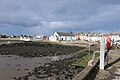
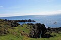
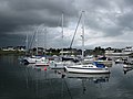
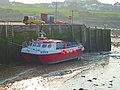
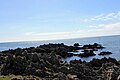
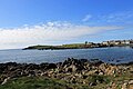
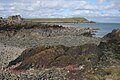
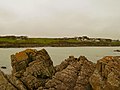
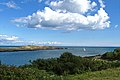
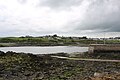
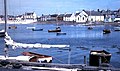
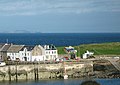
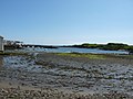
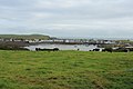
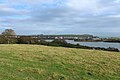
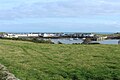
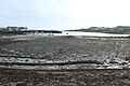
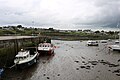
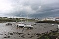
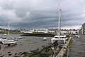
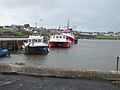
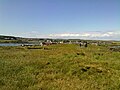
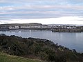
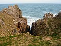
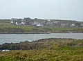
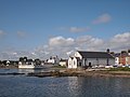
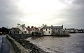
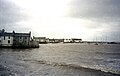
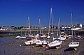
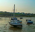
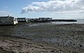
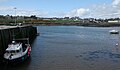
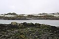
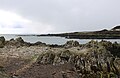
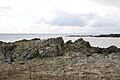
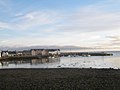
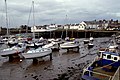
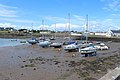
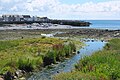
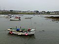
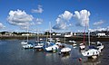
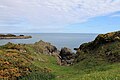
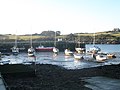
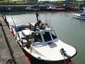
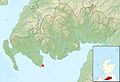
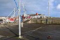
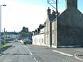
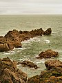
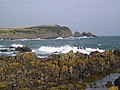
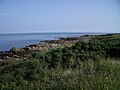
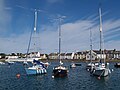
English: Isle of Whithorn is one of the most southerly villages and seaports in Scotland, lying on the coast, north east of Burrow Head, about three miles from Whithorn. Whithorn, (Taigh Mhàrtainn in Gaelic), is a former royal burgh in Dumfries and Galloway, with which the Isle of Whithorn is frequently incorrectly amalgamated or confused. It lies about thirteen miles south of Wigtown. The village is the location of the long ruined 13th century Saint Ninian's Chapel, previously a chapel linked to Whithorn Priory and a stopping off point for pilgrims landing on Isle Head and making their way to Whithorn. No longer a true island, John Ainslie's maps as late as 1782 and 1821 do show the Isle as an island. The main street was originally a causeway, with the harbour located on what was then the true Isle.
Subcategories
This category has the following 6 subcategories, out of 6 total.
I
- Isle of Whithorn Bay (6 F)
- Isle of Whithorn Castle (2 F)
- Isle of Whithorn harbour (13 F)
P
- Portyerrock Bay (11 F)
S
Media in category "Isle of Whithorn"
The following 200 files are in this category, out of 240 total.
(previous page) (next page)-
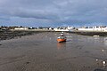
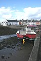
 "The Isle" at low tide - geograph.org.uk - 1537829.jpg 640 × 480; 79 KB
-
 'Beetle' Concrete Pontoon - geograph.org.uk - 1901106.jpg 3,648 × 2,736; 4.7 MB
-
 Across Stinking Port - geograph.org.uk - 5234103.jpg 4,608 × 3,456; 4.53 MB
-
 Approaching Isle on the Whithorn Road - geograph.org.uk - 738715.jpg 640 × 384; 58 KB
-
 At Rest - geograph.org.uk - 5525350.jpg 4,272 × 2,848; 1.96 MB
-
 Black Rock - geograph.org.uk - 5694304.jpg 2,976 × 1,984; 2.18 MB
-
 Black Rock - geograph.org.uk - 5694331.jpg 2,976 × 1,984; 2.63 MB
-
 Boat Rock - geograph.org.uk - 5530019.jpg 4,272 × 2,848; 2.27 MB
-
 Boats at anchor, Isle of Whithorn - geograph.org.uk - 2538947.jpg 3,648 × 2,736; 2.63 MB
-
 Boats in Isle of Whithorn Bay - geograph.org.uk - 5928428.jpg 637 × 478; 203 KB
-
 Boats under a threatening Sky - geograph.org.uk - 2538968.jpg 3,648 × 2,736; 2.3 MB
-
 Bright Horizon - geograph.org.uk - 2370574.jpg 640 × 480; 78 KB
-
 Brightly painted cottages - geograph.org.uk - 1539254.jpg 640 × 428; 68 KB
-
 By the Stinking Port - geograph.org.uk - 5529983.jpg 4,272 × 2,848; 2.21 MB
-
 Chapel Port and Bay - geograph.org.uk - 5529960.jpg 4,272 × 2,848; 2.59 MB
-
 Chapel Port East - geograph.org.uk - 4897817.jpg 3,504 × 2,336; 4.28 MB
-
 Chapel Port West - geograph.org.uk - 2825173.jpg 640 × 480; 67 KB
-
 Church of Scotland Isle of Whithorn - geograph.org.uk - 2197912.jpg 3,648 × 2,736; 2.25 MB
-

-
 Cliffs by Stein - geograph.org.uk - 5530111.jpg 4,272 × 2,848; 5.31 MB
-
 Cliffs, Isle of Whithorn - geograph.org.uk - 2825081.jpg 1,024 × 597; 192 KB
-
 Coast at Isle Head - geograph.org.uk - 2825279.jpg 480 × 640; 81 KB
-
 Coastal rocks on the Isle of Whithorn - geograph.org.uk - 4503994.jpg 640 × 480; 503 KB
-
 Coastline - geograph.org.uk - 2825170.jpg 480 × 640; 123 KB
-
 Coastline at Stinking Port - geograph.org.uk - 5694265.jpg 2,976 × 1,984; 2.87 MB
-
 Coming in to the Isle of Whithorn - geograph.org.uk - 2267466.jpg 2,500 × 1,660; 1.61 MB
-
 Crossroads on the Isle of Whithorn road - geograph.org.uk - 1450851.jpg 640 × 480; 117 KB
-
 Drummoral Wigtownshire Cup and Ring Rubbing Anderson 1927 Figure 5.jpg 2,838 × 2,331; 1.07 MB
-
-
 Entering the Isle of Whithorn - geograph.org.uk - 1537843.jpg 640 × 459; 72 KB
-
 Entrance to the harbour at the Isle of Whithorn - geograph.org.uk - 4360560.jpg 1,024 × 776; 203 KB
-
 Fishing from the pier - geograph.org.uk - 3161710.jpg 640 × 480; 99 KB
-
 Flowers at Monaghan - geograph.org.uk - 5525343.jpg 4,272 × 2,848; 5.48 MB
-
 Folded rocks - geograph.org.uk - 3161735.jpg 640 × 480; 92 KB
-
 Foreshore at Isle of Whithorn - geograph.org.uk - 878725.jpg 640 × 431; 93 KB
-
 Granite seat - geograph.org.uk - 1537857.jpg 640 × 452; 96 KB
-
 Harbour - geograph.org.uk - 3192255.jpg 1,024 × 768; 176 KB
-
 Harbour Entrance, Isle of Whithorn - geograph.org.uk - 5694320.jpg 2,976 × 1,984; 2.38 MB
-
 Harbour Entrance, Isle of Whithorn - geograph.org.uk - 6182738.jpg 2,976 × 1,984; 2.45 MB
-
 Harbour Rocks - geograph.org.uk - 5525326.jpg 4,272 × 2,848; 2.66 MB
-
 Harbour Row, Isle of Whithorn - geograph.org.uk - 4897471.jpg 3,504 × 2,336; 3.19 MB
-
 Harbour view at Isle of Whithorn 1972 - geograph.org.uk - 2396785.jpg 2,240 × 1,327; 1.15 MB
-
 Harbour wall - geograph.org.uk - 1537841.jpg 640 × 452; 62 KB
-
 Harbour, Isle of Whithorn - geograph.org.uk - 2978444.jpg 2,048 × 1,536; 1.31 MB
-
 Harbour, Isle of Whithorn - geograph.org.uk - 2978584.jpg 2,048 × 1,536; 1.24 MB
-
 Harbour, Isle of Whithorn - geograph.org.uk - 4690396.jpg 1,920 × 1,280; 1.11 MB
-
 Harbour, Isle of Whithorn - geograph.org.uk - 4690415.jpg 1,920 × 1,280; 1.25 MB
-
 Harbour, Isle of Whithorn - geograph.org.uk - 4690427.jpg 1,920 × 1,280; 1.45 MB
-
 Harbour, Isle of Whithorn - geograph.org.uk - 4690892.jpg 1,920 × 1,280; 1.48 MB
-
 Harbour, Isle of Whithorn - geograph.org.uk - 4690901.jpg 1,920 × 1,280; 1.72 MB
-
 Harbour, Isle of Whithorn - geograph.org.uk - 4690903.jpg 1,920 × 1,280; 1.79 MB
-
 Harbour, Isle of Whithorn - geograph.org.uk - 5694288.jpg 2,976 × 1,984; 2.16 MB
-
 Harbour, Isle of Whithorn - geograph.org.uk - 5694289.jpg 2,976 × 1,984; 2.19 MB
-
 Harbour, Isle of Whithorn - geograph.org.uk - 5694290.jpg 2,976 × 1,984; 3.41 MB
-
 Harbour, Isle of Whithorn - geograph.org.uk - 5694316.jpg 2,976 × 1,984; 2.26 MB
-
 Harbour, Isle of Whithorn - geograph.org.uk - 5694337.jpg 2,976 × 1,984; 2.39 MB
-
 Harbour, Isle of Whithorn - geograph.org.uk - 6182747.jpg 2,976 × 1,984; 2.35 MB
-
 Harbour, Isle of Whithorn - geograph.org.uk - 6182751.jpg 2,976 × 1,984; 2.33 MB
-
 Harbour, Isle of Whithorn - geograph.org.uk - 6182752.jpg 2,976 × 1,984; 2.31 MB
-
 Harbour, Isle of Whithorn - geograph.org.uk - 6182774.jpg 2,894 × 1,875; 811 KB
-
 Harbour, Isle of Whithorn - geograph.org.uk - 952221.jpg 640 × 436; 70 KB
-
 Harbourfront cottages - geograph.org.uk - 1455086.jpg 640 × 480; 111 KB
-
 Herring Gull - geograph.org.uk - 3011409.jpg 640 × 480; 73 KB
-
 High Tide - geograph.org.uk - 6054741.jpg 4,608 × 3,456; 3.71 MB
-
 Isle Farm - geograph.org.uk - 736999.jpg 640 × 384; 58 KB
-
 Isle Farm - geograph.org.uk - 738720.jpg 640 × 384; 71 KB
-
 Isle Farm from the south - geograph.org.uk - 1450978.jpg 640 × 480; 95 KB
-
 Isle Harbour - geograph.org.uk - 5560548.jpg 4,272 × 2,848; 1.88 MB
-
 Isle Head - geograph.org.uk - 2355613.jpg 640 × 480; 70 KB
-
 Isle Head - geograph.org.uk - 2825080.jpg 640 × 480; 94 KB
-
 Isle Head - geograph.org.uk - 2825136.jpg 640 × 480; 69 KB
-
 Isle Head - geograph.org.uk - 2825144.jpg 480 × 640; 95 KB
-
 Isle Head - geograph.org.uk - 2825296.jpg 640 × 480; 63 KB
-
 Isle Head to Mare Rock - geograph.org.uk - 2825163.jpg 640 × 480; 71 KB
-
 Isle Head, Isle of Whithorn - geograph.org.uk - 3086879.jpg 1,600 × 1,200; 642 KB
-
 Isle Kirk - geograph.org.uk - 3011417.jpg 478 × 640; 104 KB
-
 Isle of Whithorn - geograph.org.uk - 1377820.jpg 640 × 480; 92 KB
-
 Isle of Whithorn - geograph.org.uk - 1537823.jpg 640 × 480; 88 KB
-
 Isle of Whithorn - geograph.org.uk - 1537838.jpg 640 × 480; 72 KB
-
 Isle of Whithorn - geograph.org.uk - 2199019.jpg 3,648 × 2,736; 2 MB
-
 Isle of Whithorn - geograph.org.uk - 2338076.jpg 640 × 480; 96 KB
-
 Isle of Whithorn - geograph.org.uk - 2355555.jpg 640 × 469; 58 KB
-
 Isle of Whithorn - geograph.org.uk - 2355579.jpg 640 × 472; 60 KB
-
 Isle of Whithorn - geograph.org.uk - 2355588.jpg 640 × 480; 77 KB
-
 Isle of Whithorn - geograph.org.uk - 2355600.jpg 640 × 480; 86 KB
-
 Isle of Whithorn - geograph.org.uk - 2355685.jpg 640 × 480; 82 KB
-
 Isle of Whithorn - geograph.org.uk - 2632683.jpg 640 × 490; 49 KB
-
 Isle of Whithorn - geograph.org.uk - 2825293.jpg 480 × 640; 106 KB
-
 Isle of Whithorn - geograph.org.uk - 2825303.jpg 640 × 480; 55 KB
-
 Isle of Whithorn - geograph.org.uk - 3086873.jpg 1,600 × 1,200; 326 KB
-
 Isle of Whithorn - geograph.org.uk - 316830.jpg 480 × 640; 99 KB
-
 Isle of Whithorn - geograph.org.uk - 3302850.jpg 2,304 × 1,728; 1.49 MB
-
 Isle of Whithorn - geograph.org.uk - 3810020.jpg 640 × 507; 102 KB
-
 Isle of Whithorn - geograph.org.uk - 4060402.jpg 5,184 × 3,456; 7.19 MB
-
 Isle of Whithorn - geograph.org.uk - 738706.jpg 640 × 384; 65 KB
-
 Isle of Whithorn - geograph.org.uk - 813139.jpg 640 × 403; 63 KB
-
 Isle of Whithorn - geograph.org.uk - 813141.jpg 640 × 403; 59 KB
-
 Isle of Whithorn at low tide - geograph.org.uk - 670527.jpg 640 × 420; 85 KB
-
 Isle of Whithorn Bay - geograph.org.uk - 2014780.jpg 3,648 × 2,736; 4.58 MB
-
 Isle of Whithorn Bay - geograph.org.uk - 2370567.jpg 640 × 574; 77 KB
-
 Isle of Whithorn Bay - geograph.org.uk - 2370880.jpg 640 × 404; 56 KB
-
 Isle of Whithorn Bay - geograph.org.uk - 2562611.jpg 521 × 640; 78 KB
-
 Isle of Whithorn Bay - geograph.org.uk - 2978485.jpg 2,048 × 1,536; 1.28 MB
-
 Isle of Whithorn Bay - geograph.org.uk - 2978496.jpg 2,048 × 1,536; 1.28 MB
-
 Isle of Whithorn Bay - geograph.org.uk - 2978514.jpg 2,048 × 1,536; 1.44 MB
-
 Isle of Whithorn Bay - geograph.org.uk - 2978573.jpg 2,048 × 1,536; 1.32 MB
-
 Isle of Whithorn Bay - geograph.org.uk - 3810095.jpg 640 × 452; 119 KB
-
 Isle of Whithorn Bay - geograph.org.uk - 4061474.jpg 1,920 × 1,280; 1.9 MB
-
 Isle of Whithorn Bay - geograph.org.uk - 4690434.jpg 1,920 × 1,280; 1.41 MB
-
 Isle of Whithorn Bay - geograph.org.uk - 4690440.jpg 1,920 × 1,280; 1.43 MB
-
 Isle of Whithorn Bay - geograph.org.uk - 4690455.jpg 1,920 × 1,280; 1.25 MB
-
 Isle of Whithorn Bay - geograph.org.uk - 4690486.jpg 1,920 × 1,280; 1.29 MB
-
 Isle of Whithorn Bay - geograph.org.uk - 4690507.jpg 1,920 × 1,280; 1.38 MB
-
 Isle of Whithorn Bay - geograph.org.uk - 4896989.jpg 3,432 × 2,186; 3.08 MB
-
 Isle of Whithorn Bay - geograph.org.uk - 4897457.jpg 3,436 × 2,214; 2.56 MB
-
 Isle of Whithorn Bay - geograph.org.uk - 4897474.jpg 3,376 × 1,964; 2.22 MB
-
 Isle of Whithorn Bay - geograph.org.uk - 5694157.jpg 2,976 × 1,984; 2.65 MB
-
 Isle of Whithorn Bay - geograph.org.uk - 5694158.jpg 2,915 × 1,906; 1 MB
-
 Isle of Whithorn Bay - geograph.org.uk - 5694162.jpg 2,976 × 1,984; 2.99 MB
-
 Isle of Whithorn Bay - geograph.org.uk - 5694230.jpg 2,976 × 1,984; 2.94 MB
-
 Isle of Whithorn Bay - geograph.org.uk - 5694297.jpg 2,976 × 1,984; 2.61 MB
-
 Isle of Whithorn Bay - geograph.org.uk - 5694299.jpg 2,976 × 1,984; 2.78 MB
-
 Isle of Whithorn Bay - geograph.org.uk - 5694315.jpg 2,976 × 1,984; 3.31 MB
-
 Isle of Whithorn Bay - geograph.org.uk - 5694322.jpg 2,976 × 1,984; 2.65 MB
-
 Isle of Whithorn Bowling Club - geograph.org.uk - 1455166.jpg 640 × 480; 69 KB
-
 Isle of Whithorn Church - geograph.org.uk - 5525360.jpg 3,103 × 2,069; 1.02 MB
-
 Isle of Whithorn Church - geograph.org.uk - 738714.jpg 640 × 384; 58 KB
-
 Isle of Whithorn Community Hall - geograph.org.uk - 1454900.jpg 640 × 480; 100 KB
-
 Isle of Whithorn Harbour - geograph.org.uk - 1116019.jpg 640 × 427; 55 KB
-
 Isle of Whithorn harbour - geograph.org.uk - 1450700.jpg 640 × 480; 117 KB
-
 Isle of Whithorn Harbour - geograph.org.uk - 2014865.jpg 3,648 × 2,736; 4.71 MB
-
 Isle of Whithorn harbour - geograph.org.uk - 2199000.jpg 3,648 × 2,736; 2.17 MB
-
 Isle of Whithorn harbour - geograph.org.uk - 2940396.jpg 1,600 × 1,067; 561 KB
-
 Isle of Whithorn Harbour - geograph.org.uk - 4061465.jpg 1,920 × 1,280; 1.43 MB
-
 Isle of Whithorn Harbour - geograph.org.uk - 4061472.jpg 1,920 × 1,280; 1.71 MB
-
 Isle of Whithorn harbour - geograph.org.uk - 5039394.jpg 1,024 × 682; 181 KB
-
 Isle of Whithorn harbour - geograph.org.uk - 5039406.jpg 1,024 × 682; 233 KB
-
 Isle of Whithorn Harbour - geograph.org.uk - 5470679.jpg 640 × 480; 94 KB
-
 Isle of Whithorn Harbour - geograph.org.uk - 5694145.jpg 2,976 × 1,984; 2.59 MB
-
 Isle of Whithorn Harbour - geograph.org.uk - 5694160.jpg 2,976 × 1,984; 2.78 MB
-
 Isle of Whithorn Harbour - geograph.org.uk - 5694302.jpg 2,976 × 1,984; 2.37 MB
-
 Isle of Whithorn Harbour at Low Tide - geograph.org.uk - 6182771.jpg 2,976 × 1,984; 2.86 MB
-
 Isle of Whithorn harbour, 1 - geograph.org.uk - 3745286.jpg 800 × 498; 202 KB
-
 Isle of Whithorn harbour, 2 - geograph.org.uk - 3745290.jpg 800 × 600; 231 KB
-
 Isle of Whithorn Parish Church - geograph.org.uk - 4060395.jpg 5,184 × 3,456; 7.76 MB
-
 Isle of Whithorn Pier - geograph.org.uk - 2978579.jpg 2,048 × 1,536; 1.34 MB
-
 Isle of Whithorn Post Office - geograph.org.uk - 949292.jpg 640 × 479; 292 KB
-
 Isle of Whithorn Post Office planter - geograph.org.uk - 949293.jpg 640 × 480; 343 KB
-
 Isle of Whithorn war memorial - geograph.org.uk - 1455172.jpg 480 × 640; 92 KB
-
 Isle of Whithorn, low tide - geograph.org.uk - 2258975.jpg 2,500 × 1,502; 2.37 MB
-

-
 Isle Sailing Club - geograph.org.uk - 5525365.jpg 4,272 × 2,848; 2.05 MB
-
 Knockanharrie Inlet - geograph.org.uk - 5531243.jpg 4,272 × 2,848; 2.32 MB
-
 Low Tide - geograph.org.uk - 5530146.jpg 4,272 × 2,848; 2.81 MB
-
 Low tide at the Isle of Whithorn harbour - geograph.org.uk - 2197919.jpg 3,648 × 2,736; 2.1 MB
-
 Lowena Mor - geograph.org.uk - 2562624.jpg 640 × 480; 89 KB
-
 Lowena Mor - geograph.org.uk - 2562631.jpg 640 × 480; 102 KB
-
 Maintaining the Bright Horizon - geograph.org.uk - 4898412.jpg 2,074 × 3,071; 2.11 MB
-
 Mapa Phuirt Rosnait ann an DG.jpg 2,004 × 1,363; 599 KB
-
 Mare Rock - geograph.org.uk - 2825166.jpg 480 × 640; 96 KB
-
 Mare Rock - geograph.org.uk - 2825287.jpg 640 × 480; 61 KB
-
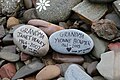 Memory Stones - Isle of Whithorn, Scotland.jpg 5,472 × 3,648; 2.95 MB
-
 Mid Islet - geograph.org.uk - 5530100.jpg 4,272 × 2,848; 3.93 MB
-
 Offshore Islet - geograph.org.uk - 5530096.jpg 4,272 × 2,848; 2.97 MB
-
 Offshore to the Isle - geograph.org.uk - 5530116.jpg 4,272 × 2,848; 2.91 MB
-
 Parish of Glasserton ^ Isle of Whithorn Church - geograph.org.uk - 5694317.jpg 2,976 × 1,984; 2.23 MB
-
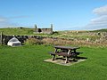 Picnic area in the Isle of Whithorn - geograph.org.uk - 1537850.jpg 640 × 480; 75 KB
-
 Pier at the Isle of Whithorn - geograph.org.uk - 3810032.jpg 640 × 448; 74 KB
-
 Pier at the Isle of Whithorn - geograph.org.uk - 3810084.jpg 640 × 441; 110 KB
-
 Pier through - geograph.org.uk - 2825067.jpg 480 × 640; 76 KB
-
 Pier, Isle of Whithorn - geograph.org.uk - 5694282.jpg 2,976 × 1,984; 2.94 MB
-
 Pier, Isle of Whithorn - geograph.org.uk - 5694325.jpg 2,976 × 1,984; 2.53 MB
-
 Pipe and slipway, Isle of Whithorn - geograph.org.uk - 4897480.jpg 3,504 × 2,086; 3.1 MB
-
 Port Rosnait.jpg 2,623 × 1,745; 1,003 KB
-
 Queens Arms Hotel - geograph.org.uk - 1537846.jpg 640 × 413; 62 KB
-
 Rileys on Harbour Row - geograph.org.uk - 5525321.jpg 4,272 × 2,848; 2.08 MB
-
 Road junction - geograph.org.uk - 1539257.jpg 640 × 480; 57 KB
-
 Rocks at Ramsey - geograph.org.uk - 5694231.jpg 2,976 × 1,984; 2.46 MB
-
 Rocks at the tip of Isle Head. Isle of Whithorn - geograph.org.uk - 5830487.jpg 3,888 × 4,943; 5.61 MB
-
 Rocks, Isle Head - geograph.org.uk - 4897519.jpg 3,440 × 2,195; 2.98 MB
-
 Rocky Coast - geograph.org.uk - 2825149.jpg 480 × 640; 96 KB
-
 Rocky Coast at the Isle of Whithorn - geograph.org.uk - 5470723.jpg 640 × 480; 87 KB
-
 Rocky coast-line - geograph.org.uk - 567684.jpg 640 × 479; 99 KB
-
-
 Ropey Roof - geograph.org.uk - 865661.jpg 640 × 303; 70 KB
-
 Sailing Boats in Isle of Whithorn Harbour - geograph.org.uk - 1731099.jpg 1,600 × 1,200; 352 KB
-
 Schooner off Isle Head - geograph.org.uk - 3517823.jpg 640 × 480; 83 KB
-
 Sea Breeze, Isle of Whithorn.jpg 3,456 × 2,304; 2.95 MB
-
 Sea Inlet - geograph.org.uk - 5530025.jpg 4,272 × 2,848; 4.1 MB
-
 Seabreeze and Rosnay - geograph.org.uk - 4897016.jpg 3,427 × 2,186; 2.74 MB
-
 Shangri-La, Isle of Whithorn - geograph.org.uk - 899881.jpg 640 × 480; 45 KB
-
 Shoreline to Screen - geograph.org.uk - 5531254.jpg 4,272 × 2,848; 2.62 MB
-
 Sileadh agus Teothachd ann am Port Rosnait.jpg 574 × 336; 35 KB
-
 Slipway at Isle of Whithorn - geograph.org.uk - 4061463.jpg 1,920 × 1,280; 1.51 MB
-
 Slipway at the Isle of Whithorn - geograph.org.uk - 3011421.jpg 640 × 436; 95 KB
-
 Slipway, Isle of Whithorn - geograph.org.uk - 5694277.jpg 2,976 × 1,984; 4.3 MB
-
 Sloping field - geograph.org.uk - 1539249.jpg 640 × 480; 76 KB
-
 Small bit of land in NX4835 - geograph.org.uk - 89028.jpg 640 × 427; 101 KB
-
 Snowing at Isle of Whithorn Harbour - geograph.org.uk - 5694144.jpg 2,976 × 1,984; 2.17 MB
-
 Solitaire - geograph.org.uk - 2632738.jpg 640 × 471; 93 KB


