Category:Islands of Papua New Guinea
Jump to navigation
Jump to search
Wikimedia category | |||||
| Upload media | |||||
| Instance of | |||||
|---|---|---|---|---|---|
| Category combines topics | |||||
 | |||||

Subcategories
This category has the following 58 subcategories, out of 58 total.
*
+
A
- Ambitle (6 F)
B
- Bagabag (Papua New Guinea) (1 F)
- Baluan Island (3 F)
- Bam Island (3 F)
- Blup Blup Island (4 F)
- Boisa (1 F)
- Bristow Island (2 F)
D
- Duke of York Islands (1 P, 21 F)
E
F
- Fergusson Island (10 F)
G
- Garove (Papua New Guinea) (6 F)
- Garua Island (2 F)
- Green Islands (23 F)
K
L
- Lambom Island (3 F)
M
- Mussau (2 F)
N
- Narage (Papua New Guinea) (1 F)
- New Hanover (11 F)
P
- Parama Island (2 F)
R
- Rossel Island (5 F)
S
- Sakar (Papua New Guinea) (3 F)
- Samarai (25 F)
T
- Tami Islands (1 F)
- Tolokiwa Island (1 F)
U
- Unea Island (3 F)
V
- Vokeo Island (4 F)
W
- Wingoru Island (1 F)
- Woodlark Island (9 F)
Y
- Yule Island (4 F)
Media in category "Islands of Papua New Guinea"
The following 35 files are in this category, out of 35 total.
-

-
 Bagabag (Landsat).JPG 446 × 426; 41 KB
-
 Bagabag.jpg 1,200 × 838; 180 KB
-
 Bat Islands Landsat.jpg 165 × 129; 5 KB
-
 Black Island 4654.jpg 1,720 × 1,349; 681 KB
-
 Doini Island Papua New Guinea Oceania Airport Sign.jpg 5,184 × 3,888; 6.15 MB
-
 Dyaul reef zone.png 992 × 527; 65 KB
-
 FishingCanoeWuvuluNewGuinea1910.jpg 652 × 1,000; 48 KB
-
 Garove Island.jpg 640 × 422; 40 KB
-
 Gonubalabala Island beach view Mary Muszynski.jpg 3,456 × 3,456; 1.73 MB
-
 ISS012-E-12990 - View of Papua New Guinea.jpg 1,520 × 1,008; 58 KB
-
 ISS034-E-5507 - View of Papua New Guinea.jpg 4,288 × 2,848; 1.01 MB
-
 ISS034-E-5548 - View of Papua New Guinea.jpg 4,288 × 2,848; 904 KB
-
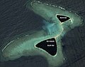
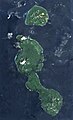
 Lihir Islands,Papua New Guinea, Sentinel-2.jpg 199 × 372; 37 KB
-
 Lolobau.jpg 640 × 421; 35 KB
-
 Malai Island, Papua New Guinea, Landsat.png 512 × 256; 224 KB
-
 Misima Island.jpg 792 × 275; 66 KB
-
 NortheastNG Vitiaz Dampier.png 1,024 × 697; 457 KB
-
 Parama Island-NASA World Wind-143.41528E 9.00250S.png 1,022 × 690; 954 KB
-
 Picturesque New Guinea Plate VII (a) - Lakatoi, Near Elevala Island.jpg 1,954 × 1,392; 939 KB
-
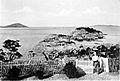 Picturesque New Guinea Plate VII (b) - Elevala Island, from Mission Station.jpg 2,053 × 1,389; 1.16 MB
-
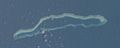 Pocklington Reef ISD highres STS092 STS092-711-82 3.JPG 1,282 × 509; 186 KB
-
 Ponamisland.jpg 594 × 875; 129 KB
-
 Ritter island.jpg 508 × 348; 24 KB
-
 Sakar island.jpg 1,200 × 826; 275 KB
-
 Schouten Islands (Papua New Guinea) txu-oclc-6552576-sa55-13.jpg 5,000 × 3,769; 2.67 MB
-
 Siassi Islands Relief.jpg 450 × 477; 26 KB
-
 Tabar Islands, Papua New Guinea, Sentinel-2.jpg 395 × 650; 62 KB
-
 Tabar south.jpg 1,000 × 610; 109 KB
-
 Tanga Islands nla.obj-233138948-1 (cropped).jpg 1,186 × 976; 692 KB
-
 Tanga Islands nla.obj-233138948-1.jpg 5,000 × 4,148; 10.61 MB
-
 Tolokiwa, Papua New Guinea, Landsat.png 411 × 341; 79 KB
-
 Tuam Island, Papua New Guinea, Landsat.png 234 × 180; 78 KB
-
 Vitu.jpg 508 × 348; 26 KB
-
 Vokeo Island (ISS).jpg 471 × 354; 23 KB
.jpg)
.JPG)


_-_Lakatoi,_Near_Elevala_Island.jpg)
_-_Elevala_Island,_from_Mission_Station.jpg)


_txu-oclc-6552576-sa55-13.jpg)


.jpg)


.jpg)