Category:Islandmagee
Jump to navigation
Jump to search
human settlement in Northern Ireland  | |||||
| Upload media | |||||
| Instance of | |||||
|---|---|---|---|---|---|
| Location | County Antrim, Northern Ireland | ||||
 | |||||
Subcategories
This category has the following 8 subcategories, out of 8 total.
B
- Ballystrudder (28 F)
C
- Carnspindle (16 F)
I
- Isle of Muck, County Antrim (5 F)
M
- Mill Bay, Northern Ireland (13 F)
- Mullaghboy, County Antrim (30 F)
P
- Portmuck (12 F)
T
- The Gobbins (34 F)
Media in category "Islandmagee"
The following 102 files are in this category, out of 102 total.
-
 "Stop" sign, Millbay Road, Islandmagee - geograph.org.uk - 173888.jpg 640 × 426; 188 KB
-
 20180406 164158 Islandmagee.jpg 2,880 × 2,160; 4.16 MB
-
 20180406 164333 Islandmagee.jpg 3,200 × 2,400; 2.73 MB
-
 20180406 164336 Islandmagee.jpg 3,200 × 2,400; 2.79 MB
-
 20180406 164342 Islandmagee.jpg 3,200 × 2,400; 2.42 MB
-
 20180406 164349 Islandmagee.jpg 3,200 × 2,400; 2.83 MB
-
 20180406 164353 Islandmagee.jpg 3,200 × 2,400; 2.75 MB
-
 20180406 170940 Islandmagee.jpg 2,880 × 2,160; 2.22 MB
-
 20180406 170944 Islandmagee.jpg 3,200 × 2,400; 2.69 MB
-
 20180406 171219 Islandmagee.jpg 3,200 × 2,400; 2.38 MB
-
 Ballylum 1.jpg 1,600 × 1,200; 262 KB
-
 Ballylumford.jpg 640 × 310; 141 KB
-
 Ballytober Road, Islandmagee - geograph.org.uk - 173785.jpg 640 × 426; 165 KB
-
 Brown's Bay Road, Islandmagee - geograph.org.uk - 218537.jpg 640 × 426; 147 KB
-
 Brown's Bay, Islandmagee (2) - geograph.org.uk - 2657887.jpg 640 × 332; 58 KB
-
 Brown's Bay, Islandmagee (3) - geograph.org.uk - 2659206.jpg 640 × 391; 86 KB
-
 Browns Bay, Islandmagee - geograph.org.uk - 209605.jpg 640 × 426; 148 KB
-
 Browns Bay, Islandmagee - geograph.org.uk - 312943.jpg 640 × 426; 131 KB
-
 Browns Bay, Islandmagee - geograph.org.uk - 312962.jpg 640 × 426; 147 KB
-
 Browns Bay, Islandmagee - geograph.org.uk - 355958.jpg 640 × 426; 106 KB
-
 Browns Bay, Islandmagee - geograph.org.uk - 355982.jpg 640 × 426; 115 KB
-
 Coastal path, Portmuck, Islandmagee (6) - geograph.org.uk - 1959161.jpg 625 × 371; 108 KB
-
 Coastline, Islandmagee - geograph.org.uk - 1940477.jpg 640 × 427; 99 KB
-

-
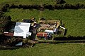 Farmhouse and Yard, Islandmagee - geograph.org.uk - 345993.jpg 640 × 426; 140 KB
-
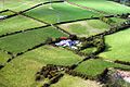 Farmhouse Islandmagee - geograph.org.uk - 345936.jpg 640 × 426; 159 KB
-
 Forsythe's Lane - geograph.org.uk - 346336.jpg 640 × 426; 127 KB
-
 Gobbins Brae, Islandmagee (2) - geograph.org.uk - 292898.jpg 640 × 426; 122 KB
-
 Gobbins Brae, Islandmagee - geograph.org.uk - 225631.jpg 640 × 426; 137 KB
-
 Gransha Brae, Islandmagee - geograph.org.uk - 226586.jpg 640 × 426; 126 KB
-
 Islandmagee.jpg 1,536 × 864; 104 KB
-
 Knowehead Brae, Islandmagee - geograph.org.uk - 221290.jpg 640 × 426; 143 KB
-
 Lane near Brown's Bay, Islandmagee - geograph.org.uk - 225626.jpg 640 × 426; 168 KB
-
 Larne lifeboat off Islandmagee - geograph.org.uk - 3383121.jpg 640 × 393; 53 KB
-
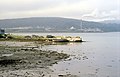
 Larne Lough - geograph.org.uk - 149006.jpg 640 × 479; 137 KB
-
 Middle Road, Islandmagee - geograph.org.uk - 797726.jpg 640 × 486; 366 KB
-

-
 Millbay Quay - geograph.org.uk - 345889.jpg 640 × 413; 74 KB
-
 Near Browns Bay, Islandmagee - geograph.org.uk - 172680.jpg 640 × 426; 169 KB
-
 On the Gobbins Cliff Path, Islandmagee - geograph.org.uk - 6328859.jpg 5,184 × 2,920; 6.1 MB
-
 Path to Skernaghan Point, Islandmagee (1) - geograph.org.uk - 209611.jpg 640 × 426; 178 KB
-
 Path to Skernaghan Point, Islandmagee (2) - geograph.org.uk - 209622.jpg 640 × 426; 168 KB
-
 Port Narrow, Browns Bay - geograph.org.uk - 355973.jpg 640 × 426; 159 KB
-
 Port Narrow, Browns Bay - geograph.org.uk - 355980.jpg 640 × 426; 90 KB
-
 Portmuck harbour, Islandmagee (6) - geograph.org.uk - 2156894.jpg 738 × 438; 125 KB
-
 Portmuck Road, Islandmagee (1) - geograph.org.uk - 221265.jpg 640 × 426; 130 KB
-
 Portmuck Road, Islandmagee (2) - geograph.org.uk - 237655.jpg 640 × 426; 155 KB
-
 Portmuck Road, Islandmagee (3) - geograph.org.uk - 237657.jpg 640 × 426; 172 KB
-
 Portmuck Road, Islandmagee (4) - geograph.org.uk - 237660.jpg 640 × 426; 131 KB
-

-

-
 Rocky coast, Islandmagee - geograph.org.uk - 209628.jpg 640 × 426; 177 KB
-
 Ruined farm buildings, Islandmagee - geograph.org.uk - 470574.jpg 640 × 426; 82 KB
-
 Rural settlement at Ballykeel on Islandmagee - geograph.org.uk - 3716256.jpg 1,024 × 768; 80 KB
-
 Sailing on the North Channel - geograph.org.uk - 312647.jpg 640 × 410; 49 KB
-
 Snow ^ who needs it^ (1) - geograph.org.uk - 346321.jpg 640 × 432; 105 KB
-
 Snow ^ who needs it^ (2) - geograph.org.uk - 346324.jpg 640 × 426; 129 KB
-
 Sound, Isle of Muck, Islandmagee - geograph.org.uk - 1959077.jpg 673 × 393; 85 KB
-
 St John's Church, Islandmagee - geograph.org.uk - 167343.jpg 640 × 426; 171 KB
-

-

-
 The Ballylumford Road, Islandmagee (1) - geograph.org.uk - 218519.jpg 640 × 426; 141 KB
-
 The Ballylumford Road, Islandmagee (3) - geograph.org.uk - 233738.jpg 640 × 426; 117 KB
-

-
 The coast beyond the Rocking Stone - geograph.org.uk - 209614.jpg 640 × 426; 149 KB
-
 The coast of Islandmagee (1) - geograph.org.uk - 636554.jpg 640 × 391; 89 KB
-
 The coast of Islandmagee (2) - geograph.org.uk - 636566.jpg 640 × 429; 109 KB
-
 The coast of Islandmagee (3) - geograph.org.uk - 636584.jpg 640 × 429; 110 KB
-
 The Ferris Bay Road, Islandmagee (5) - geograph.org.uk - 2042900.jpg 640 × 333; 91 KB
-
 The Gobbins Brae, Islandmagee (1) - geograph.org.uk - 221283.jpg 640 × 426; 154 KB
-
 The Gobbins Path, Islandmagee - geograph.org.uk - 233684.jpg 640 × 426; 145 KB
-
 The Gobbins Road, Islandmagee (1) - geograph.org.uk - 226577.jpg 640 × 426; 142 KB
-
 The Gobbins Road, Islandmagee (2) - geograph.org.uk - 233717.jpg 640 × 426; 148 KB
-
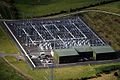 The Interconnector Islandmagee - geograph.org.uk - 345944.jpg 640 × 426; 152 KB
-
 The Islandmagee ferry - geograph.org.uk - 237681.jpg 640 × 426; 140 KB
-
 The Lunnon Road, Islandmagee - geograph.org.uk - 233731.jpg 640 × 426; 145 KB
-
 The Middle Road, Islandmagee - geograph.org.uk - 237674.jpg 640 × 426; 117 KB
-
 The Moyle Interconnector - geograph.org.uk - 205643.jpg 640 × 426; 154 KB
-
 The rocky shore at Portmuck, Islandmagee - geograph.org.uk - 2156928.jpg 800 × 466; 133 KB
-

-

-

-
 Whitehead to Blackhead (16) - geograph.org.uk - 700595.jpg 640 × 429; 78 KB
-
 'The Rinkha', Islandmagee - geograph.org.uk - 797719.jpg 640 × 480; 261 KB
-
 Blackhead Lighthouse - geograph.org.uk - 326462.jpg 640 × 426; 80 KB
-
 Disused Road looking towards Islandmagee - geograph.org.uk - 312292.jpg 426 × 640; 146 KB
-
 Hairpin bend, Millbay Road, Islandmagee - geograph.org.uk - 278629.jpg 640 × 426; 133 KB
-
 House Island Road Lower - geograph.org.uk - 312295.jpg 640 × 426; 155 KB
-
 Low Road, Islandmagee - geograph.org.uk - 345659.jpg 640 × 426; 135 KB
-
 The Blackhead path, Whitehead (2) - geograph.org.uk - 398617.jpg 640 × 426; 140 KB
-
 The Blackhead path, Whitehead - geograph.org.uk - 398612.jpg 640 × 426; 150 KB
-
 The Gobbins Road, Islandmagee (3) - geograph.org.uk - 292899.jpg 640 × 426; 130 KB
-
 The shore at Portdavy near Whitehead - geograph.org.uk - 398625.jpg 640 × 426; 161 KB
-
 Whitehead to Blackhead (10) - geograph.org.uk - 700393.jpg 640 × 424; 99 KB
-
 Whitehead to Blackhead (11) - geograph.org.uk - 700417.jpg 616 × 443; 96 KB
-
 Whitehead to Blackhead (12) - geograph.org.uk - 700533.jpg 640 × 401; 100 KB
-
 Whitehead to Blackhead (13) - geograph.org.uk - 700550.jpg 640 × 396; 83 KB
-
 Whitehead to Blackhead (14) - geograph.org.uk - 700561.jpg 640 × 428; 107 KB
-
 Whitehead to Blackhead (15) - geograph.org.uk - 700581.jpg 640 × 429; 60 KB
-
 Whitehead to Blackhead (17) - geograph.org.uk - 700625.jpg 640 × 429; 96 KB
-
 Whitehead to Blackhead (8) - geograph.org.uk - 700293.jpg 640 × 392; 76 KB
-
 Whitehead to Blackhead (9) - geograph.org.uk - 700322.jpg 640 × 425; 85 KB


_-_geograph.org.uk_-_2657887.jpg)
_-_geograph.org.uk_-_2659206.jpg)


_-_geograph.org.uk_-_1959161.jpg)


_-_geograph.org.uk_-_292898.jpg)


_-_geograph.org.uk_-_209611.jpg)
_-_geograph.org.uk_-_209622.jpg)


_-_geograph.org.uk_-_2156894.jpg)
_-_geograph.org.uk_-_221265.jpg)
_-_geograph.org.uk_-_237655.jpg)
_-_geograph.org.uk_-_237657.jpg)
_-_geograph.org.uk_-_237660.jpg)

.jpg)


_-_geograph.org.uk_-_346321.jpg)
_-_geograph.org.uk_-_346324.jpg)


_-_geograph.org.uk_-_5385128.jpg)

_-_geograph.org.uk_-_218519.jpg)
_-_geograph.org.uk_-_233738.jpg)
_-_geograph.org.uk_-_1894900.jpg)

_-_geograph.org.uk_-_636554.jpg)
_-_geograph.org.uk_-_636566.jpg)
_-_geograph.org.uk_-_636584.jpg)
_-_geograph.org.uk_-_2042900.jpg)
_-_geograph.org.uk_-_221283.jpg)

_-_geograph.org.uk_-_226577.jpg)
_-_geograph.org.uk_-_233717.jpg)


_-_geograph.org.uk_-_5385007.jpg)


_-_geograph.org.uk_-_700595.jpg)


_-_geograph.org.uk_-_398617.jpg)

_-_geograph.org.uk_-_292899.jpg)

_-_geograph.org.uk_-_700393.jpg)
_-_geograph.org.uk_-_700417.jpg)
_-_geograph.org.uk_-_700533.jpg)
_-_geograph.org.uk_-_700550.jpg)
_-_geograph.org.uk_-_700561.jpg)
_-_geograph.org.uk_-_700581.jpg)
_-_geograph.org.uk_-_700625.jpg)
_-_geograph.org.uk_-_700293.jpg)
_-_geograph.org.uk_-_700322.jpg)