Category:Island of Stroma
Jump to navigation
Jump to search
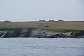
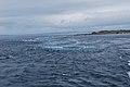
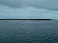
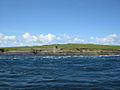
The Island of Stroma is an island off the north of Scotland. Although it is close to the Orkney Islands, it is administratively part of Caithness - the cat Orkney Islands is here, because it is commonly associated with them.
island off the northern coast of the mainland of Scotland, UK  | |||||
| Upload media | |||||
| Instance of | |||||
|---|---|---|---|---|---|
| Part of | |||||
| Location |
| ||||
| Located in or next to body of water | |||||
| Width |
| ||||
| Length |
| ||||
| Highest point |
| ||||
| Population |
| ||||
| Area |
| ||||
 | |||||
Subcategories
This category has the following 3 subcategories, out of 3 total.
Media in category "Island of Stroma"
The following 79 files are in this category, out of 79 total.
-
 Abandon Croft North Of Tree Geo - geograph.org.uk - 4633074.jpg 2,560 × 1,920; 2.95 MB
-
 Abandoned Dwellings on Stroma - geograph.org.uk - 3493389.jpg 640 × 492; 49 KB
-
 Abandoned houses on the Isle of Stroma - geograph.org.uk - 4474648.jpg 640 × 480; 440 KB
-
 Abandoned houses on the Isle of Stroma - geograph.org.uk - 4474680.jpg 640 × 480; 388 KB
-
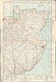
 Admiralty Chart No 2162 Scotland Pentland Firth, Published 1858.jpg 8,326 × 6,052; 5.48 MB
-
 Admiralty Chart No 2180b Southern portion of the Orkney Islands, Scotland, Published 1886.jpg 11,787 × 8,260; 11.67 MB
-
-
 Buoy - Stroma - geograph.org.uk - 894650.jpg 640 × 427; 62 KB
-
 Cairn Hill (Stroma) - geograph.org.uk - 4632799.jpg 2,560 × 1,920; 2.98 MB
-
 Cemetery on Scarton Point - geograph.org.uk - 3592894.jpg 3,872 × 2,592; 2.57 MB
-
 Cliffs on north west Stroma coast - geograph.org.uk - 5806734.jpg 1,024 × 575; 115 KB
-
 Coast of Stroma - geograph.org.uk - 894128.jpg 640 × 427; 55 KB
-
 Coastal View Near Langaton Point - geograph.org.uk - 4629266.jpg 2,484 × 1,814; 2.13 MB
-
 Ewes and lambs on Stroma - geograph.org.uk - 4632813.jpg 2,524 × 1,413; 2.04 MB
-
 Geo, on west of Stroma - geograph.org.uk - 895899.jpg 640 × 427; 76 KB
-
 House on Stroma - geograph.org.uk - 3592871.jpg 3,665 × 2,444; 2.08 MB
-
 Island dwelling - geograph.org.uk - 2222931.jpg 640 × 482; 107 KB
-
 Island harbour - geograph.org.uk - 2222933.jpg 640 × 482; 126 KB
-
 Island of Stroma - geograph.org.uk - 2146582.jpg 3,872 × 2,592; 4.9 MB
-
 Island of Stroma whirlpool - geograph.org.uk - 2146591.jpg 3,872 × 2,592; 4.15 MB
-
 Langaton Point - geograph.org.uk - 3470339.jpg 640 × 480; 53 KB
-
 Mell Head - geograph.org.uk - 3470310.jpg 640 × 480; 50 KB
-
 Mell Head - geograph.org.uk - 819501.jpg 640 × 480; 39 KB
-
 North end of Stroma - geograph.org.uk - 5901566.jpg 1,024 × 576; 69 KB
-
 Ordnance Survey One-Inch Sheet 12 Wick, Published 1947.jpg 8,808 × 12,871; 10 MB
-
 Ordnance Survey One-Inch Sheet 7 Pentland Firth, Published 1959.jpg 8,236 × 9,868; 6.93 MB
-
 Pentalina passing Stroma.jpg 4,692 × 1,565; 990 KB
-
 Pier At Nethertown - geograph.org.uk - 4633216.jpg 2,454 × 1,770; 1.73 MB
-
 Rammie Geo As Seen From Red Head - geograph.org.uk - 4633065.jpg 2,560 × 1,920; 2.91 MB
-
 Red Head - geograph.org.uk - 3470318.jpg 640 × 480; 53 KB
-
 Red Head, Stroma - geograph.org.uk - 5901524.jpg 1,024 × 1,024; 198 KB
-
 Rocky Coastline Near Mell Head - geograph.org.uk - 4632838.jpg 2,468 × 1,792; 1.69 MB
-
 Ruined Croft Near Rocky Shore - geograph.org.uk - 4633075.jpg 2,560 × 1,920; 2.81 MB
-
 Ruined houses - geograph.org.uk - 2222923.jpg 640 × 482; 130 KB
-
 Scarton Point - geograph.org.uk - 3491426.jpg 640 × 480; 64 KB
-
 Skerry Geo - geograph.org.uk - 3493414.jpg 640 × 480; 51 KB
-
 Stroma 1a.JPG 640 × 480; 84 KB
-
 Stroma 2007, aerial - geograph.org.uk - 3147700.jpg 640 × 427; 40 KB
-
 Stroma 2a.JPG 640 × 480; 96 KB
-
 Stroma bed.jpg 4,288 × 2,848; 2.97 MB
-
 Stroma cemetery - geograph.org.uk - 2222909.jpg 640 × 482; 112 KB
-
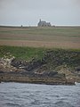
 Stroma church.jpg 2,848 × 4,288; 2.95 MB
-
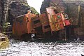
 Stroma cliffs and shipwreck - geograph.org.uk - 894074.jpg 640 × 427; 71 KB
-
 Stroma from Mey Hill - geograph.org.uk - 3512604.jpg 640 × 480; 51 KB
-
 Stroma from the Pentland Firth.jpg 5,440 × 1,704; 2.35 MB
-
 Stroma from the sea - geograph.org.uk - 824600.jpg 640 × 480; 54 KB
-
 Stroma harbour - geograph.org.uk - 2222895.jpg 640 × 482; 120 KB
-
 Stroma Harbour.jpg 4,288 × 2,848; 3.03 MB
-
 Stroma house interior.jpg 4,288 × 2,848; 2.97 MB
-
 Stroma Island -shipwreck of Bettina Danica-4Aug2008.jpg 3,872 × 2,592; 1.16 MB
-
 Stroma looking northwards.jpg 3,264 × 1,412; 890 KB
-
 Stroma mausoleum and houses.jpg 2,592 × 1,728; 1.66 MB
-
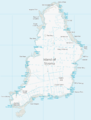 Stroma OS map.png 1,174 × 1,550; 151 KB
-
 Stroma pier and beach July 1904.jpg 4,538 × 3,266; 8.02 MB
-
 Stroma puffin.jpg 1,128 × 1,608; 560 KB
-
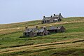 Stroma ruined houses.jpg 1,786 × 1,184; 860 KB
-
 Stroma shore line - geograph.org.uk - 2222917.jpg 640 × 482; 117 KB
-
 Stroma, cliffs and deserted village - geograph.org.uk - 2580496.jpg 640 × 480; 54 KB
-
 Stroma, Old church.jpg 4,288 × 3,216; 6.43 MB
-
-
 Stroma, the lighthouse - geograph.org.uk - 596866.jpg 640 × 338; 24 KB
-
 Stromafromcaithness.jpg 640 × 145; 24 KB
-
 StromaTheGloup.JPG 1,704 × 2,272; 2.26 MB
-
 Stromavault.jpg 640 × 480; 102 KB
-
 Telephone box (disused), Stroma - geograph.org.uk - 958516.jpg 640 × 427; 108 KB
-
 The Gloup - geograph.org.uk - 4633206.jpg 2,560 × 1,920; 2.43 MB
-
 Tree Geo, Island of Stroma - geograph.org.uk - 3493404.jpg 640 × 480; 68 KB
-
 Tree Geo, Stroma - geograph.org.uk - 3592879.jpg 3,872 × 2,592; 2.63 MB
-
 Unnamed geo on Stroma - geograph.org.uk - 3592887.jpg 3,872 × 2,592; 2.94 MB
-
 Uppertown - geograph.org.uk - 5893488.jpg 640 × 427; 249 KB
-
 View From Above The Subterranean Passage - geograph.org.uk - 4633223.jpg 2,556 × 1,914; 2.56 MB
-
 View towards Stroma island - geograph.org.uk - 479758.jpg 551 × 384; 55 KB
-
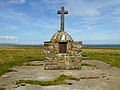
 War Memorial Close Up - geograph.org.uk - 4633057.jpg 2,560 × 1,920; 2.51 MB
-
 War Memorial On Stroma - geograph.org.uk - 4633055.jpg 2,560 × 1,920; 2.4 MB
-
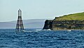 Warning Beacon And Mell Head - geograph.org.uk - 4632830.jpg 2,217 × 1,248; 1.24 MB
-
 Warning Beacon off Mell Head - geograph.org.uk - 5893500.jpg 640 × 427; 206 KB
-
 West coast of Stroma - geograph.org.uk - 5901534.jpg 1,024 × 576; 128 KB
-
 Western coast of the Isle of Stroma - geograph.org.uk - 4465060.jpg 640 × 480; 353 KB
-
 X hypoxylon.jpg 1,536 × 2,023; 327 KB


_-_geograph.org.uk_-_4632799.jpg)


,_Stroma_-_geograph.org.uk_-_958516.jpg)


