Category:Invalid SVG created with Other tools:Pennsylvania county locator maps
Jump to navigation
Jump to search
Media in category "Invalid SVG created with Other tools:Pennsylvania county locator maps"
The following 70 files are in this category, out of 70 total.
-
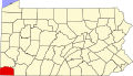
 Map of Pennsylvania highlighting Adams County.svg 4,950 × 2,846; 106 KB
-
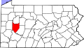
 Map of Pennsylvania highlighting Allegheny County.svg 4,950 × 2,846; 106 KB
-
 Map of Pennsylvania highlighting Armstrong County.svg 4,950 × 2,846; 106 KB
-
 Map of Pennsylvania highlighting Beaver County.svg 4,950 × 2,846; 106 KB
-
 Map of Pennsylvania highlighting Bedford County.svg 4,950 × 2,846; 106 KB
-
 Map of Pennsylvania highlighting Berks County.svg 4,950 × 2,846; 106 KB
-
 Map of Pennsylvania highlighting Blair County.svg 4,950 × 2,846; 106 KB
-
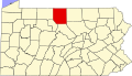
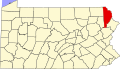
 Map of Pennsylvania highlighting Bradford County.svg 4,950 × 2,846; 106 KB
-
 Map of Pennsylvania highlighting Bucks County.svg 4,950 × 2,846; 106 KB
-
 Map of Pennsylvania highlighting Butler County.svg 4,950 × 2,846; 106 KB
-
 Map of Pennsylvania highlighting Cambria County.svg 4,950 × 2,846; 106 KB
-
 Map of Pennsylvania highlighting Cameron County.svg 4,950 × 2,846; 106 KB
-
 Map of Pennsylvania highlighting Carbon County.svg 4,950 × 2,846; 106 KB
-
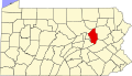
 Map of Pennsylvania highlighting Centre County.svg 4,950 × 2,846; 106 KB
-
 Map of Pennsylvania highlighting Chester County.svg 4,950 × 2,846; 106 KB
-
 Map of Pennsylvania highlighting Clarion County.svg 4,950 × 2,846; 106 KB
-
 Map of Pennsylvania highlighting Clearfield County.svg 4,950 × 2,846; 106 KB
-
 Map of Pennsylvania highlighting Clinton County.svg 4,950 × 2,846; 106 KB
-
 Map of Pennsylvania highlighting Columbia County.svg 4,950 × 2,846; 106 KB
-
 Map of Pennsylvania highlighting Crawford County.svg 4,950 × 2,846; 106 KB
-
 Map of Pennsylvania highlighting Cumberland County.svg 4,950 × 2,846; 106 KB
-
 Map of Pennsylvania highlighting Dauphin County.svg 4,950 × 2,846; 106 KB
-
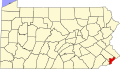
 Map of Pennsylvania highlighting Delaware County.svg 4,950 × 2,846; 106 KB
-
 Map of Pennsylvania highlighting Elk County.svg 4,950 × 2,846; 106 KB
-
 Map of Pennsylvania highlighting Erie County.svg 4,950 × 2,846; 106 KB
-
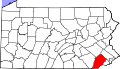
 Map of Pennsylvania highlighting Fayette County.svg 4,950 × 2,846; 106 KB
-
 Map of Pennsylvania highlighting Forest County.svg 4,950 × 2,846; 106 KB
-
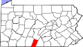
 Map of Pennsylvania highlighting Franklin County.svg 4,950 × 2,846; 106 KB
-
 Map of Pennsylvania highlighting Fulton County.svg 4,950 × 2,846; 106 KB
-
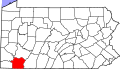
 Map of Pennsylvania highlighting Greene County.svg 4,950 × 2,846; 106 KB
-
 Map of Pennsylvania highlighting Huntingdon County.svg 4,950 × 2,846; 106 KB
-
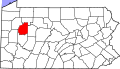
 Map of Pennsylvania highlighting Indiana County.svg 4,950 × 2,846; 106 KB
-
 Map of Pennsylvania highlighting Jefferson County.svg 4,950 × 2,846; 106 KB
-
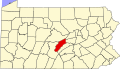
 Map of Pennsylvania highlighting Johnstown and Somerset.svg 4,950 × 2,846; 110 KB
-
 Map of Pennsylvania highlighting Juniata County.svg 4,950 × 2,846; 106 KB
-
 Map of Pennsylvania highlighting Lackawanna County.svg 4,950 × 2,846; 106 KB
-
 Map of Pennsylvania highlighting Lancaster County.svg 4,950 × 2,846; 106 KB
-
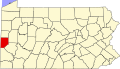
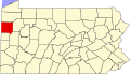
 Map of Pennsylvania highlighting Lawrence County.svg 4,950 × 2,846; 106 KB
-
 Map of Pennsylvania highlighting Lebanon County.svg 4,950 × 2,846; 106 KB
-
 Map of Pennsylvania highlighting Lehigh County.svg 4,950 × 2,846; 106 KB
-
 Map of Pennsylvania highlighting Luzerne County.svg 4,950 × 2,846; 106 KB
-
 Map of Pennsylvania highlighting Lycoming County.svg 4,950 × 2,846; 106 KB
-
 Map of Pennsylvania highlighting McKean County.svg 4,950 × 2,846; 106 KB
-
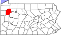
 Map of Pennsylvania highlighting Mercer County.svg 4,950 × 2,846; 106 KB
-
 Map of Pennsylvania highlighting Mifflin County.svg 4,950 × 2,846; 106 KB
-
 Map of Pennsylvania highlighting Monroe County.svg 4,950 × 2,846; 106 KB
-
 Map of Pennsylvania highlighting Montgomery County.svg 4,950 × 2,846; 106 KB
-
 Map of Pennsylvania highlighting Montour County.svg 4,950 × 2,846; 106 KB
-
 Map of Pennsylvania highlighting Northampton County.svg 4,950 × 2,846; 106 KB
-
 Map of Pennsylvania highlighting Northumberland County.svg 4,950 × 2,846; 106 KB
-
 Map of Pennsylvania highlighting Perry County.svg 4,950 × 2,846; 106 KB
-
 Map of Pennsylvania highlighting Philadelphia County.svg 4,950 × 2,846; 106 KB
-
 Map of Pennsylvania highlighting Pike County.svg 4,950 × 2,846; 106 KB
-
 Map of Pennsylvania highlighting Potter County.svg 4,950 × 2,846; 106 KB
-
 Map of Pennsylvania highlighting Schuylkill County.svg 4,950 × 2,846; 106 KB
-
 Map of Pennsylvania highlighting Snyder County.svg 4,950 × 2,846; 106 KB
-
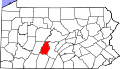
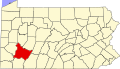
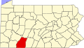 Map of Pennsylvania highlighting Somerset County.svg 4,950 × 2,846; 106 KB
-
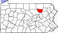 Map of Pennsylvania highlighting Sullivan County.svg 4,950 × 2,846; 106 KB
-
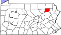
 Map of Pennsylvania highlighting Susquehanna County.svg 4,950 × 2,846; 106 KB
-
 Map of Pennsylvania highlighting Tioga County.svg 4,950 × 2,846; 106 KB
-
 Map of Pennsylvania highlighting Union County.svg 4,950 × 2,846; 106 KB
-
 Map of Pennsylvania highlighting Venango County.svg 4,950 × 2,846; 106 KB
-
 Map of Pennsylvania highlighting Warren County.svg 4,950 × 2,846; 106 KB
-
 Map of Pennsylvania highlighting Washington County.svg 4,950 × 2,846; 106 KB
-
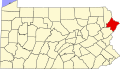
 Map of Pennsylvania highlighting Wayne County.svg 4,950 × 2,846; 106 KB
-
 Map of Pennsylvania highlighting Wyoming County.svg 4,950 × 2,846; 106 KB
-
 Map of Pennsylvania highlighting York County.svg 4,950 × 2,846; 106 KB
-
 Presbytery of Redstone counties map.svg 4,950 × 2,846; 106 KB
-
 Map of Pennsylvania highlighting Westmoreland County.svg 4,950 × 2,846; 106 KB
-
 Presbytery of Washington map.svg 4,950 × 2,846; 106 KB


