Category:Inner German border
Jump to navigation
Jump to search

border which separated the territories of the FRG and the GDR  .jpg)  | |||||
| Upload media | |||||
| Instance of | |||||
|---|---|---|---|---|---|
| Part of |
| ||||
| Made from material | |||||
| Location |
| ||||
| Applies to jurisdiction | |||||
| Start time |
| ||||
| Inception |
| ||||
| End time |
| ||||
| Dissolved, abolished or demolished date |
| ||||
 | |||||
Deutsch: Die Innerdeutsche Grenze oder deutsch-deutsche Grenze war 1949–1990 die Grenze zwischen der Deutsche Demokratische Republik und der Bundesrepublik Deutschland bzw. Westberlin. 1961–1989 war sie durch „Mauer und Stacheldraht“ befestigt.
English: The Inner German Border was the border between the German Democratic Republic (East Germany) and the Federal Republic of Germany (West Germany) respectively West Berlin 1949–1990. It was part of the iron curtain.
Subcategories
This category has the following 40 subcategories, out of 40 total.
*
A
- Aktion Ungeziefer (6 F)
B
- Berlin Air Safety Center (6 F)
C
D
- Demarcation line (Germany) (6 F)
- Deutsch-deutsche Grenzkommission (10 F)
G
- GDR propaganda; border (17 F)
K
- Kleiner Grenzverkehr (7 F)
L
M
N
O
P
R
S
- Schießbefehl (8 F)
- SM-70 (12 F)
U
V
W
- Inner German border in winter (18 F)
Z
Media in category "Inner German border"
The following 154 files are in this category, out of 154 total.
-
 1969 DDR Grenzschutzanlagen.pdf 637 × 877, 2 pages; 7.21 MB
-
 1989u1990 Stempel DDR-Grenzabfertigungen im westdeutschen Reisepass.jpg 1,005 × 1,237; 1.41 MB
-
 2021-08-13 Calau - Mobile Welt des Ostens 21.jpg 3,648 × 2,736; 2.16 MB
-
 2021-08-13 Calau - Mobile Welt des Ostens 23.jpg 3,648 × 2,736; 1.98 MB
-
-
 AIMG 0391 Grenzreste bei Mellrichstadt.jpg 5,184 × 3,888; 7.94 MB
-
Annita Strutz Grenzöffnung.ogg 4 min 37 s; 1.84 MB
-
 AttachesEastGermanBorder1981.jpg 1,818 × 1,228; 814 KB
-
 Aue-Fallstein, Germany - panoramio - drahtfunker (1).jpg 640 × 480; 141 KB
-
 Aue-Fallstein, Germany - panoramio - drahtfunker (2).jpg 480 × 640; 156 KB
-
 Aue-Fallstein, Germany - panoramio - drahtfunker.jpg 640 × 480; 101 KB
-
 Aue-Fallstein, Germany - panoramio.jpg 640 × 480; 100 KB
-
 Berechtigung Visum.jpg 694 × 500; 158 KB
-
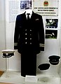 Bfs uniform.jpg 870 × 1,200; 264 KB
-
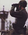
 BGS Puma inner German border.jpg 2,754 × 1,883; 2.79 MB
-
 Bild-LuftkorridoreBerlin1989.jpg 2,790 × 1,860; 1.5 MB
-
 Biosphärenreservat Rhön nahe Frankenheim (21).jpg 2,592 × 3,888; 4.64 MB
-
 Biosphärenreservat Rhön nahe Frankenheim (22).jpg 3,888 × 2,592; 4.15 MB
-
 Birx, ehemalige Staatsgrenze.jpg 2,048 × 1,536; 726 KB
-
 Blackhorse trooper.jpg 416 × 508; 31 KB
-
 Border satellite view.jpg 742 × 793; 191 KB
-
 Boundary marker of East Germany.svg 99 × 770; 107 KB
-

-

-

-
 Bundesarchiv Bild 146-1977-124-06, Zonengrenze, Grenzgänger.jpg 800 × 487; 64 KB
-

-

-
-

-
-

-

-

-

-

-
-

-
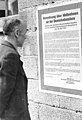
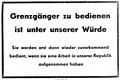 Bundesarchiv Bild 183-65208-0001, Plakat gegen Grenzgänger.jpg 784 × 522; 42 KB
-

-

-

-

-

-

-
 Bundesarchiv Bild 183-N0415-363, Mödlareuth, Zonengrenze.jpg 800 × 504; 91 KB
-
 Bundesarchiv Bild 183-N0415-364, Mödlareuth, Zonengrenze.jpg 800 × 490; 72 KB
-

-

-
 Bundesarchiv Bild 183-S88411, Marienborn, Illegale Grenzgänger.jpg 800 × 493; 57 KB
-
 Büstedt Tafel.jpg 4,896 × 3,672; 2.12 MB
-
 CDU Wahlkampfplakat - kaspl009.JPG 1,206 × 1,708; 218 KB
-
 Control strip hoetensleben.jpg 1,200 × 900; 440 KB
-
 Curtain germany.jpg 1,564 × 1,060; 319 KB
-

-
 DDR Einreise Berechtigungsschein.jpg 1,742 × 2,269; 2.16 MB
-
 DDR Grenzordnung 1982.jpg 2,655 × 1,673; 254 KB
-
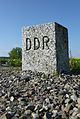
 DDR Grenzpfahl 02.jpg 2,336 × 3,504; 1.45 MB
-
 DDR Transit041.jpg 2,164 × 2,318; 1.07 MB
-
 Deutsches Panzermusem Munster (48892195403).jpg 5,184 × 3,456; 7.1 MB
-
 DF-ST-88-01263 Crossing border Wartha-Herleshausen between East and West Germany.jpeg 2,840 × 1,890; 1.57 MB
-
-
-
 DOWA 81 selfmade East German escape plane.jpg 2,048 × 1,536; 725 KB
-
 DSS-Arbeitspapiere-2011-ap-103-Uva.jpg 812 × 1,194; 101 KB
-
 Döhren - Looking toward East Germany (6826957505).jpg 1,120 × 788; 350 KB
-
 Döhren, East Germany (3010868696).jpg 1,000 × 648; 185 KB
-
 East German border 1962 full.jpg 3,018 × 1,929; 1.97 MB
-
 East German Border 1962 Macht Das Tor Auf.jpg 824 × 604; 351 KB
-
 East German Border Fence - panoramio.jpg 5,184 × 3,456; 7.02 MB
-
 East German Border near Grasleben 19890727.jpg 923 × 600; 285 KB
-
 East german propaganda leaflet.jpg 1,200 × 880; 548 KB
-
 East german propaganda mortar.jpg 1,137 × 576; 210 KB
-
 East German Soldiers at the inner German border.JPEG 2,847 × 1,882; 1.25 MB
-
 Ecklingerode ehem. Grenzkompanie.JPG 4,320 × 3,240; 4.77 MB
-
 Elektrifizierter Zaun - geo-en.hlipp.de - 13687.jpg 640 × 480; 80 KB
-
 Equipment Room (49997792751).jpg 2,400 × 1,568; 1.27 MB
-
 Former DDR BRD Border, Mecklenburg-Vorpommern, Oct 1994 (4257730056).jpg 3,598 × 2,399; 264 KB
-
 Frontière entre la RFA et la RDA en 1982.jpg 1,074 × 735; 221 KB
-

-
 Gdr border outer strip.jpg 769 × 626; 99 KB
-
 GDR Border scout.jpg 1,864 × 2,820; 926 KB
-
 Gedenkkreuz Grenzoeffnung.jpg 3,000 × 3,806; 4.28 MB
-

-
 GraphyArchy - Wikipedia 00392.jpg 6,000 × 4,000; 13.82 MB
-
 Grasleben - Looking to East Germany (3010868816).jpg 1,150 × 744; 341 KB
-
 Grenzanlage 9650.jpg 1,181 × 799; 427 KB
-
 Grenzanlage Stresow Erdbunker 01.jpg 784 × 578; 141 KB
-
 Grenzanlage Stresow Zaun.jpg 788 × 584; 110 KB
-
 Grenzdurchbruche en.png 1,962 × 1,788; 263 KB
-
 Grenzenueberwinden.JPG 768 × 1,024; 295 KB
-
 Grenznaher Verkehr040.jpg 1,160 × 2,243; 652 KB
-
 Grenzoeffnung bei heinersdorf.jpg 1,024 × 559; 498 KB
-
 Grenztruppen der DDR auf Patrouille (1979).jpg 2,835 × 1,882; 821 KB
-
Grenzöffnung November 1989 - Selmsdorf (DDR) - Lübeck-Schlutup.webm 8 min 10 s, 1,280 × 720; 72.74 MB
-
 Grenzübergang Horst 2011.jpg 3,230 × 2,265; 1.41 MB
-
 Gruenes band deutschland.jpg 877 × 1,200; 411 KB
-
 Gruenes-Band-01.jpg 3,216 × 2,136; 3.71 MB
-
 Grünes Band Tiefenbrunn 02.jpg 5,804 × 3,869; 12.62 MB
-
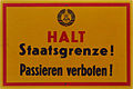 Halt Staatsgrenze - Flickr - KlausNahr.jpg 2,729 × 1,813; 580 KB
-
 Halt! Hier Grenze (Stop! Border Here) - geo.hlipp.de - 25047.jpg 640 × 427; 71 KB
-
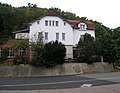 Haus hossfeld.jpg 1,200 × 929; 391 KB
-
 Haßberge-ehemaliges-DDR-Grenztor-P8145355.jpg 4,608 × 3,456; 10.47 MB
-
 Heinersdorf Mauerrest.jpg 3,829 × 2,341; 5.12 MB
-
 Helmstedt Reichsstrasse1.jpg 705 × 471; 80 KB
-
 Herleshausen border crossing.jpg 2,840 × 1,900; 1.55 MB
-
 Hessische Rhön-Point Alpha 041.jpg 7,632 × 5,088; 2.82 MB
-
 Hier ist deutschland.jpg 1,200 × 1,443; 663 KB
-
 Hinweis Zonengrenze.jpg 769 × 626; 264 KB
-
 Hohegeiss grænse.JPG 2,592 × 1,944; 1.87 MB
-
 Infotafel Mödlareuth 20201003 DSC4717.jpg 4,940 × 3,660; 8.39 MB
-
Ingrid Vulturius Grenze in Rhoden.ogg 11 min 29 s; 5.78 MB
-
 Inner German Border shown in Germany Pavilion, Expo 2019 (20191005181712).jpg 4,000 × 3,000; 5.9 MB
-
 Innerdeutsche Grenze bei Helmstedt.jpg 875 × 1,170; 612 KB
-
 Innerdeutsche Grenze nahe Ratzeburg-0020.jpg 4,251 × 4,074; 15.18 MB
-
 Innerdeutsche Grenze Oebisfelde 1970.jpg 566 × 337; 127 KB
-
 Innerdeutsche Grenze zwischen Zasenbeck und Hanum.jpg 2,020 × 1,420; 607 KB
-
 Innerdeutscher Grenzzaun.jpg 600 × 902; 195 KB
-
 Junge Fruende der Grenzsoldaten.jpg 420 × 576; 91 KB
-
 Kolonnenweg-Rimbach-01.jpg 2,048 × 1,536; 3.6 MB
-
 Mahnmal deutsche Teilung.jpg 4,320 × 2,880; 5.86 MB
-
 Moedlareuth Museum 2002.jpg 1,600 × 1,200; 566 KB
-
 Original Frontlader H.-J. Großes im Grenzmuseum Schifflersgrund.jpg 3,456 × 2,304; 2.56 MB
-
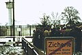 Ost-West Grenze Zicherie.jpg 1,553 × 1,033; 761 KB
-
 Ostrach - Grenzsteinmuseum Burgweiler, DDR-Stein.jpg 1,919 × 2,863; 875 KB
-
 Panorama vom Heldrastein.jpg 15,195 × 3,000; 33.23 MB
-
 Panzersperre hoetensleben.jpg 1,200 × 900; 611 KB
-
 PMN-2 mine.jpg 1,200 × 976; 327 KB
-
 Postaustausch an der Sektorengrenze 1949.jpg 2,924 × 1,784; 545 KB
-
 Postaustausch an der Sektorengrenze 1949.PNG 1,232 × 753; 791 KB
-
 Powerline Helmstedt Wolmirstedt crosses former border.JPG 1,000 × 750; 174 KB
-
 Railroad tracks through East Germany in 1977.jpg 1,805 × 1,200; 476 KB
-
 SchaeferhundZoll1984.jpg 2,830 × 1,880; 4.08 MB
-
 Schwedische Besuchergruppe an der „Zonengrenze“ 1964.jpg 2,748 × 1,800; 1.16 MB
-
 Schwickershausen 1990-08-21 06.jpg 2,008 × 1,318; 563 KB
-
 Selbstschussanlagen Obersuhl.jpg 3,456 × 2,304; 1.81 MB
-
 Sorge Harzen Dokumentationscenter 02.JPG 3,456 × 2,592; 1.76 MB
-
 Sparnberg 1980s.jpg 1,000 × 648; 477 KB
-

-
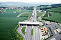
 Straßenlandschaft in Deutschland 06102018 002.jpg 6,000 × 4,000; 6.25 MB
-
 Streckmetallzaun 9641.jpg 945 × 1,417; 434 KB
-
 System of gdr border fortification.jpg 2,853 × 2,096; 2 MB
-
 Teilungsdenkmal in Staaken.jpg 994 × 1,925; 537 KB
-
 The Cold War -East West German Border (3318001856).jpg 2,053 × 1,463; 1.04 MB
-
 The Cold War-East-West German Border -British Army Patrol (3318001860).jpg 2,056 × 1,471; 1.15 MB
-
 The Wall - part of the old DDR - BRD inner German border, 1995 (3179604873).jpg 2,762 × 4,064; 475 KB
-
 VockfeyMemorial.jpg 2,000 × 1,333; 2.36 MB
-
 Wappen Grenzpfahl DDR PA.JPG 1,200 × 1,600; 398 KB
-
 Warenbegleitschein DDR Transit.jpg 1,558 × 2,285; 628 KB
-
 Weferlingen Gedenkstein an Teilung-01.jpg 4,884 × 3,663; 17.66 MB
-
 Weferlingen Gedenkstein an Teilung-02.jpg 5,108 × 3,831; 13.04 MB
-
-
 Zaehlkarte.jpg 868 × 596; 99 KB
-
 Zicherie Stein.JPG 2,592 × 1,944; 2.26 MB


_computer_screen_depicting_a_map_of_Berlin_air_space_DF-ST-91-10417.jpg)


.jpg)
.jpg)


.jpg)
.jpg)


_-_geo.hlipp.de_-_25046.jpg)


.jpg)


.jpg)
.jpg)


.jpg)
.jpg)

_-_geo.hlipp.de_-_38736.jpg)


.jpg)


.jpg)


_-_geo.hlipp.de_-_25047.jpg)


.jpg)


.jpg)
.jpg)
.jpg)


