Category:Ingoldsby
Jump to navigation
Jump to search
village in South Kesteven, Lincolnshire, England  | |||||
| Upload media | |||||
| Instance of | |||||
|---|---|---|---|---|---|
| Location | Ingoldsby, South Kesteven, Lincolnshire, East Midlands, England | ||||
 | |||||
English: Ingoldsby is a small village of approximately 121 households, located seven miles south east of Grantham, in South Kesteven, Lincolnshire.
Subcategories
This category has the following 2 subcategories, out of 2 total.
B
S
- Scotland, Lincolnshire (2 F)
Media in category "Ingoldsby"
The following 154 files are in this category, out of 154 total.
-
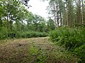
 A frame of trees - geograph.org.uk - 3728263.jpg 4,896 × 3,264; 5.71 MB
-
 Across the field - geograph.org.uk - 3728094.jpg 4,896 × 3,264; 6.23 MB
-
 Across the fields to Keisby - geograph.org.uk - 3727914.jpg 4,896 × 3,264; 6.34 MB
-
 At the end of the day - geograph.org.uk - 5968914.jpg 4,014 × 6,032; 5.77 MB
-
 Athelstan Hall Gates - geograph.org.uk - 3584122.jpg 4,320 × 3,240; 5.7 MB
-
 Barn in the middle of a field - geograph.org.uk - 399736.jpg 640 × 480; 70 KB
-
 Bridge and stile over the East Glen River - geograph.org.uk - 600139.jpg 640 × 427; 127 KB
-
 Bungalows - geograph.org.uk - 3584181.jpg 4,320 × 3,240; 5.83 MB
-
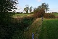
 Country road to Ingoldsby - geograph.org.uk - 328273.jpg 640 × 427; 114 KB
-
 Crop Field near Osgoodby - geograph.org.uk - 3457121.jpg 2,256 × 1,504; 1.81 MB
-
 Early Sunday morning in Main Street Ingoldsby, Lincolnshire - geograph.org.uk - 6261110.jpg 4,608 × 3,072; 1.71 MB
-
 Earthworks Landscape - geograph.org.uk - 3583662.jpg 4,188 × 2,122; 1.84 MB
-
 East end of Ingoldsby - geograph.org.uk - 3727876.jpg 4,896 × 3,264; 6.25 MB
-
 Entering Ingoldsby - geograph.org.uk - 4021087.jpg 3,088 × 2,056; 4.36 MB
-
 Entrance gates to Ingoldsby Manor House - geograph.org.uk - 5129430.jpg 1,024 × 768; 258 KB
-
 Farm buildings near Sunnyside Farm - geograph.org.uk - 3042073.jpg 640 × 427; 101 KB
-
 Farm track near Ingoldsby - geograph.org.uk - 600088.jpg 640 × 427; 104 KB
-
 Farmland at Sunnyside Farm - geograph.org.uk - 328271.jpg 640 × 427; 108 KB
-
 Farmland near Ingoldsby - geograph.org.uk - 600079.jpg 640 × 427; 111 KB
-
 Field of linseed - geograph.org.uk - 6202305.jpg 1,024 × 768; 196 KB
-
 Fields - geograph.org.uk - 4752880.jpg 4,320 × 3,240; 5.36 MB
-
 Fields behind the houses - geograph.org.uk - 3728071.jpg 4,896 × 3,264; 6.03 MB
-
 Fields near Ingoldsby - geograph.org.uk - 3456979.jpg 2,256 × 1,504; 1.68 MB
-
 Flocking Rooks - geograph.org.uk - 3727859.jpg 4,896 × 3,264; 5.59 MB
-
 Footbridge over a drain - geograph.org.uk - 5281706.jpg 1,024 × 768; 315 KB
-
 Footpath near Ingoldsby - geograph.org.uk - 3456973.jpg 2,256 × 1,504; 1.83 MB
-
 Footpath near Ingoldsby - geograph.org.uk - 600110.jpg 640 × 427; 112 KB
-
 Footpath to Ingoldsby - geograph.org.uk - 5129438.jpg 1,024 × 768; 222 KB
-
 Footpath to Ingoldsby crossing a drain - geograph.org.uk - 5281696.jpg 1,024 × 768; 200 KB
-
 Grange farm cottages - geograph.org.uk - 4470291.jpg 4,320 × 3,240; 5.65 MB
-
 Grantham Road - geograph.org.uk - 1059860.jpg 640 × 495; 115 KB
-
 Hailstorm (geograph 3728279).jpg 4,896 × 3,264; 6.25 MB
-
 Hills, school, and church - geograph.org.uk - 3727934.jpg 4,896 × 3,264; 5.73 MB
-
 House in Ingoldsby - geograph.org.uk - 5968917.jpg 6,032 × 4,014; 3.44 MB
-
 How old is this alignment^ - geograph.org.uk - 3727571.jpg 4,896 × 3,672; 6.8 MB
-
 Ingoldsby lane - geograph.org.uk - 1566235.jpg 640 × 426; 131 KB
-
 Ingoldsby primary school (geograph 3727592).jpg 4,896 × 3,264; 6.04 MB
-
 Ingoldsby Road - geograph.org.uk - 2869709.jpg 1,280 × 853; 400 KB
-
 Ingoldsby Round Hills. - geograph.org.uk - 87051.jpg 640 × 480; 123 KB
-
 Ingoldsby Village Hall - geograph.org.uk - 5129556.jpg 1,024 × 768; 270 KB
-
 Labelled on the pole. - geograph.org.uk - 3727543.jpg 3,264 × 4,896; 3.26 MB
-
 Leaving Ingoldsby on unnamed lane - geograph.org.uk - 4023794.jpg 3,088 × 2,056; 4.02 MB
-
 Looking towards Lenton - geograph.org.uk - 600097.jpg 640 × 427; 79 KB
-
 Maize stalks - geograph.org.uk - 3728232.jpg 4,896 × 3,264; 5.62 MB
-
 Never big enough - geograph.org.uk - 3727613.jpg 4,896 × 3,264; 6.14 MB
-
 Oak Apple Farm - geograph.org.uk - 4470775.jpg 3,813 × 2,065; 1.44 MB
-

-
 Ordnance Survey Cut Mark - geograph.org.uk - 4111608.jpg 4,000 × 3,000; 4.76 MB
-
 Picturesque Ingoldsby - geograph.org.uk - 3584163.jpg 4,320 × 3,240; 6.15 MB
-
 Pole transformer - geograph.org.uk - 3727538.jpg 4,896 × 3,264; 6.2 MB
-

-
 Public Footpath over Red Hill - geograph.org.uk - 4021212.jpg 3,088 × 2,056; 3.79 MB
-
 Rainy front passing through Ingoldsby - geograph.org.uk - 3727848.jpg 4,896 × 3,264; 6.39 MB
-
 Red Hill track - geograph.org.uk - 1566209.jpg 640 × 426; 71 KB
-
 Road junction and grass triangle - geograph.org.uk - 5324680.jpg 3,648 × 2,736; 2.57 MB
-
 Roadside sales - geograph.org.uk - 4470765.jpg 4,320 × 3,240; 5.49 MB
-
 Round Hills - geograph.org.uk - 1566144.jpg 640 × 426; 79 KB
-
 Round Hills earthwork - geograph.org.uk - 3583657.jpg 4,320 × 3,240; 5.6 MB
-

-
 Scotland House, Scotland Lane, Scotland (geograph 6966214).jpg 3,776 × 2,520; 1.96 MB
-
 Sky over Osgodby - geograph.org.uk - 3728268.jpg 4,896 × 3,264; 5.25 MB
-
 Skyline - geograph.org.uk - 3728118.jpg 4,896 × 3,264; 6.04 MB
-
 Social club and playing field - geograph.org.uk - 3584132.jpg 4,320 × 3,240; 5.76 MB
-
 Storm light - geograph.org.uk - 3728107.jpg 4,896 × 3,264; 6.09 MB
-
 Stormlight - geograph.org.uk - 3728152.jpg 4,896 × 3,264; 5.91 MB
-
 Stormlight - geograph.org.uk - 3728212.jpg 4,896 × 3,264; 6.29 MB
-
 Streambed - geograph.org.uk - 3728141.jpg 4,896 × 3,264; 5.52 MB
-
 Stubble field, footpath and strawstack - geograph.org.uk - 5281690.jpg 1,024 × 718; 160 KB
-
 Sunlight on the hill - geograph.org.uk - 3728245.jpg 4,896 × 3,264; 5.75 MB
-
 Sunnyside Farm - geograph.org.uk - 328270.jpg 640 × 427; 118 KB
-
 Sunnyside Farm - geograph.org.uk - 4331332.jpg 1,024 × 768; 173 KB
-
 Supplying the village - geograph.org.uk - 3727535.jpg 3,264 × 4,896; 2.7 MB
-
 Telephone exchange near Ingoldsby - geograph.org.uk - 6214647.jpg 1,024 × 768; 301 KB
-

-
 The Church of St Bartholomew - geograph.org.uk - 5946681.jpg 6,632 × 6,558; 7.44 MB
-
 The Church of St Bartholomew, A wooden lintel - geograph.org.uk - 5966695.jpg 5,390 × 3,752; 4.62 MB
-
 The Church of St Bartholomew, Arches - geograph.org.uk - 5960070.jpg 6,032 × 4,014; 3.53 MB
-
 The Church of St Bartholomew, Autumn in the porch - geograph.org.uk - 5966859.jpg 6,032 × 4,014; 3.59 MB
-
 The Church of St Bartholomew, Carved Chair - geograph.org.uk - 5960060.jpg 4,014 × 6,032; 5.15 MB
-
 The Church of St Bartholomew, Chancel Arch - geograph.org.uk - 5966819.jpg 4,014 × 6,032; 3.26 MB
-
 The Church of St Bartholomew, Choir and Altar - geograph.org.uk - 5966850.jpg 6,032 × 4,014; 5.43 MB
-
 The Church of St Bartholomew, Churchyard plan - geograph.org.uk - 5966728.jpg 4,492 × 3,399; 3.54 MB
-
 The Church of St Bartholomew, coursed stonework - geograph.org.uk - 5960100.jpg 6,032 × 4,014; 4.6 MB
-
 The Church of St Bartholomew, Fire Escape - geograph.org.uk - 5947787.jpg 3,401 × 5,419; 2.99 MB
-
 The Church of St Bartholomew, Interior view - geograph.org.uk - 5947794.jpg 6,032 × 4,014; 3.56 MB
-
 The Church of St Bartholomew, Leaves in the churchyard - geograph.org.uk - 5968902.jpg 6,032 × 4,014; 6.51 MB
-
 The Church of St Bartholomew, Millennium kneeler - geograph.org.uk - 5960067.jpg 6,032 × 4,014; 5.08 MB
-
 The Church of St Bartholomew, Modern improvements - geograph.org.uk - 5966758.jpg 6,032 × 4,014; 4.29 MB
-
 The Church of St Bartholomew, Modern precautions - geograph.org.uk - 5966750.jpg 4,014 × 6,032; 5.09 MB
-
 The Church of St Bartholomew, Nave and Chancel - geograph.org.uk - 5966824.jpg 4,014 × 6,032; 3.61 MB
-
 The Church of St Bartholomew, North aisle window - geograph.org.uk - 5966869.jpg 4,014 × 6,032; 5.44 MB
-
 The Church of St Bartholomew, North Arcade - geograph.org.uk - 5946684.jpg 8,241 × 6,500; 7.5 MB
-
 The Church of St Bartholomew, Old oak and New oak - geograph.org.uk - 5954874.jpg 6,032 × 4,014; 3.76 MB
-
 The Church of St Bartholomew, Pillar Capital - geograph.org.uk - 5966800.jpg 6,032 × 4,014; 3.16 MB
-
 The Church of St Bartholomew, Piscina - geograph.org.uk - 5966844.jpg 4,014 × 6,032; 5.18 MB
-
 The Church of St Bartholomew, Priest's porch - geograph.org.uk - 5960095.jpg 4,014 × 6,032; 4.54 MB
-
 The Church of St Bartholomew, Roll of Honour - geograph.org.uk - 5964018.jpg 2,818 × 4,446; 3.36 MB
-
 The Church of St Bartholomew, Roof and Clerestory - geograph.org.uk - 5966833.jpg 6,032 × 4,014; 3.88 MB
-
 The Church of St Bartholomew, Roof and Clerestory - geograph.org.uk - 5966840.jpg 6,032 × 4,014; 3.93 MB
-
 The Church of St Bartholomew, Several arches - geograph.org.uk - 5966837.jpg 6,032 × 4,014; 3.21 MB
-
 The Church of St Bartholomew, Stained glass - geograph.org.uk - 5960114.jpg 3,201 × 4,499; 4.24 MB
-
 The Church of St Bartholomew, Stone Graffiti - geograph.org.uk - 5946866.jpg 4,014 × 6,032; 2.91 MB
-
 The Church of St Bartholomew, Stone Graffiti - geograph.org.uk - 5946875.jpg 4,014 × 6,032; 3.53 MB
-
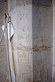 The Church of St Bartholomew, Stone Graffiti - geograph.org.uk - 5947773.jpg 4,014 × 6,032; 3.26 MB
-
 The Church of St Bartholomew, Stone Graffiti - geograph.org.uk - 5947779.jpg 4,014 × 6,032; 4.77 MB
-
 The Church of St Bartholomew, Stone Graffiti - geograph.org.uk - 5947783.jpg 4,014 × 6,032; 2.99 MB
-
 The Church of St Bartholomew, Stone Graffiti - geograph.org.uk - 5966812.jpg 6,032 × 4,014; 3.59 MB
-
 The Church of St Bartholomew, The bell record - geograph.org.uk - 5966711.jpg 3,647 × 5,507; 3.15 MB
-
 The Church of St Bartholomew, The Bier - geograph.org.uk - 5964050.jpg 6,032 × 4,014; 4.06 MB
-
 The Church of St Bartholomew, The celebrant's view - geograph.org.uk - 5966857.jpg 6,032 × 4,014; 3.55 MB
-
 The Church of St Bartholomew, the Door - geograph.org.uk - 5954862.jpg 4,014 × 6,032; 6.08 MB
-
 The Church of St Bartholomew, the East End - geograph.org.uk - 5954880.jpg 6,032 × 4,014; 2.78 MB
-
 The Church of St Bartholomew, the Font - geograph.org.uk - 5949919.jpg 4,014 × 6,032; 3.3 MB
-
 The Church of St Bartholomew, the main door - geograph.org.uk - 5954854.jpg 4,014 × 6,032; 4.43 MB
-
 The Church of St Bartholomew, the North Door - geograph.org.uk - 5960089.jpg 6,032 × 4,014; 6.02 MB
-
 The Church of St Bartholomew, the South Arcade - geograph.org.uk - 5954889.jpg 6,032 × 4,014; 4.11 MB
-
 The Church of St Bartholomew, The tower root - geograph.org.uk - 5966783.jpg 4,014 × 6,032; 3.45 MB
-
 The Church of St Bartholomew, The view from the door - geograph.org.uk - 5966774.jpg 6,032 × 4,014; 3.51 MB
-
 The Church of St Bartholomew, War memorial - geograph.org.uk - 5964016.jpg 2,925 × 5,183; 4.06 MB
-
 The Church of St Bartholomew, Window fragments - geograph.org.uk - 5960080.jpg 1,718 × 3,198; 1.19 MB
-
 The East Glen River - geograph.org.uk - 600162.jpg 640 × 427; 97 KB
-
 The Old Manor House, Main Street, Ingoldsby (geograph 5330663).jpg 3,217 × 4,824; 7.68 MB
-
 The track to Scotland - geograph.org.uk - 3583604.jpg 4,320 × 3,240; 5.54 MB
-
 Timber house - geograph.org.uk - 5968907.jpg 6,032 × 4,014; 4.13 MB
-
 To The Ark - geograph.org.uk - 1566203.jpg 640 × 426; 95 KB
-
 Toward Ingoldsby Grange - geograph.org.uk - 4470782.jpg 4,320 × 3,240; 5.48 MB
-
 Toward Osgodby - geograph.org.uk - 3727576.jpg 4,896 × 3,672; 7.1 MB
-
 Towards Irnham - geograph.org.uk - 1059861.jpg 640 × 452; 97 KB
-
 Towards Lenton - geograph.org.uk - 1059862.jpg 640 × 480; 81 KB
-
 Track near Sunnyside Farm - geograph.org.uk - 2869732.jpg 682 × 1,024; 219 KB
-
 Track off Grantham Road - geograph.org.uk - 2869363.jpg 1,280 × 853; 423 KB
-
 Track to Mount Farm - geograph.org.uk - 2869177.jpg 1,280 × 853; 359 KB
-
 View along Humby Road - geograph.org.uk - 3728029.jpg 4,896 × 3,264; 6.42 MB
-
 View from the corner of the grid square - geograph.org.uk - 6215187.jpg 1,024 × 768; 172 KB
-
 View from the hill - geograph.org.uk - 3728089.jpg 4,896 × 3,264; 6.19 MB
-
 View through the Willows - geograph.org.uk - 3728017.jpg 4,896 × 3,264; 6.06 MB
-
 View towards Lenton - geograph.org.uk - 3042091.jpg 640 × 427; 88 KB
-
 View towards Osgodby - geograph.org.uk - 5292079.jpg 1,024 × 768; 211 KB
-
 Visited by Rooks - geograph.org.uk - 3727855.jpg 4,896 × 3,264; 5.7 MB
-
 Wooden bungalow - geograph.org.uk - 3584169.jpg 4,320 × 3,240; 5.64 MB
-
 Working on a Sunday - geograph.org.uk - 3727840.jpg 4,896 × 3,264; 6.6 MB
-
 Bridge and building - geograph.org.uk - 399727.jpg 640 × 480; 72 KB
-
 Buildings at Ingoldsby Grange - geograph.org.uk - 399682.jpg 640 × 480; 58 KB
-

-
 Farmland between Ingoldsby and Hamby - geograph.org.uk - 600133.jpg 640 × 427; 120 KB
-
 Farmland between Ingoldsby and Hamby - geograph.org.uk - 600658.jpg 640 × 427; 100 KB
-
 Farmland near Humby, Lincolnshire - geograph.org.uk - 155354.jpg 640 × 427; 89 KB
-
 Footpath - geograph.org.uk - 399706.jpg 640 × 480; 68 KB
-
 Footpath across a field - geograph.org.uk - 599866.jpg 640 × 427; 114 KB
-
 Footpath across field - geograph.org.uk - 399712.jpg 640 × 480; 73 KB
-
 Footpath to Ropsley - geograph.org.uk - 399690.jpg 640 × 480; 74 KB
-
 Humby Telephone Exchange - geograph.org.uk - 155352.jpg 640 × 427; 95 KB
-
 Path and Track - geograph.org.uk - 399742.jpg 640 × 480; 70 KB
-
 Road to Ingoldsby - geograph.org.uk - 399687.jpg 640 × 480; 105 KB


.jpg)


.jpg)


.jpg)


.jpg)


